Category:Fenland District
Направо към навигацията
Направо към търсенето
local government district in Cambridgeshire, England  Localisation de Fenland dans le Cambridgeshire | |||||
| Качване на файл | |||||
| Екземпляр на | |||||
|---|---|---|---|---|---|
| Местоположение | Cambridgeshire, Кеймбриджшър, Източна Англия, Англия | ||||
| Столица | |||||
| Законодателен орган |
| ||||
| Дата на създаване |
| ||||
| Население |
| ||||
| Площ |
| ||||
| Различно от | |||||
| официален уебсайт | |||||
 | |||||
Подкатегории
Показани са 18 от общо 18 подкатегории на тази категория.
- Maps of Fenland District (0 К, 0 С, 8 Ф)
B
C
- Christchurch, Cambridgeshire (0 К, 0 С, 213 Ф)
D
E
F
- Fenland Hall, March (0 К, 0 С, 2 Ф)
G
- Gorefield (0 К, 0 С, 101 Ф)
L
M
N
P
T
W
Файлове в категория „Fenland District“
Показани са 16 от общо 16 файла в тази категория.
-
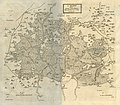 "A Map of the Great Levell, representing it as it lay drowned." (1662).jpg 4671 × 4086; 13,09 МБ
-
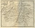 "The Map of the Great Levell drained" (1662).jpg 4666 × 3648; 12,37 МБ
-
 Aircraft at Chatteris Airfield on Block Fen Road - geograph.org.uk - 3571325.jpg 4320 × 3240; 5,21 МБ
-
 Banff Fenland.jpg 2816 × 2112; 2,33 МБ
-
 Elgood's Brewery.jpg 2448 × 3264; 1,05 МБ
-
 Fenland in Banff.jpg 900 × 675; 92 КБ
-
 Fenland UK ward map 2015.svg 535 × 716; 181 КБ
-
 Fenland UK ward map 2019.svg 535 × 716; 180 КБ
-
 Flood barrier between Whittlesey and Eldernell - panoramio.jpg 3264 × 2448; 2,25 МБ
-
 Level Crossing East of March - geograph.org.uk - 1930112.jpg 800 × 531; 100 КБ
-
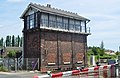 March East Signal Box - geograph.org.uk - 1929696.jpg 800 × 522; 115 КБ
-
 March South Junction Signal Box - geograph.org.uk - 1930163.jpg 800 × 531; 123 КБ
-
 March South Junction Signal Box - geograph.org.uk - 1930493.jpg 800 × 531; 98 КБ
-

-

-
 UK Fenland Council 2019.svg 360 × 185; 2 КБ
.jpg)
.jpg)


