Category:Fenny Compton
Aller à la navigation
Aller à la recherche
village britannique  La salle commune de Fenny Compton en 2009.  | |||||
| Téléverser des médias | |||||
| Prononciation (fichier son) | |||||
|---|---|---|---|---|---|
| Nature de l’élément | |||||
| Lieu | Stratford-on-Avon, Warwickshire, Midlands de l'Ouest, Angleterre | ||||
| Population |
| ||||
| Superficie |
| ||||
 | |||||
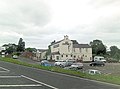
English: Fenny Compton is a village and parish in Warwickshire, England, about eight miles north of Banbury. In the 2001 census the parish had a population of 797. Its church of St. Peter and St. Clare was built in the 14th century. Fenny Compton is small but had two stations, one on the Great Western Railway route from Oxford to Birmingham, the other being on the [1]Stratford-upon-Avon and Midland Junction Railway route from Bicester to Broom. The GWR station and SMJ station were built alongside each other controlled by a joint signal box. The village has a doctor's consulting-room, a small general store, and two pubs. The old part of the village has many notable buildings including Knotts Cottage.
Sous-catégories
Cette catégorie comprend seulement la sous-catégorie ci-dessous.
F
- Saint Clare, Fenny Compton (3 F)
Média dans la catégorie « Fenny Compton »
Cette catégorie comprend 180 fichiers, dont les 180 ci-dessous.
-
 06.03.93 Fenny Compton 60072 (6332109621).jpg 1 532 × 949 ; 213 kio
-

-
 A new use for an old stone quarry - geograph.org.uk - 5193916.jpg 640 × 480 ; 171 kio
-
 A423 at Fenny Compton Wharf - geograph.org.uk - 2838027.jpg 640 × 482 ; 51 kio
-
 A423 north of Fenny Compton Wharf - geograph.org.uk - 3122717.jpg 3 477 × 2 479 ; 1,08 Mio
-
 A423 north of Home Farm - geograph.org.uk - 3123880.jpg 3 242 × 2 345 ; 1,3 Mio
-
 Across the ditch - geograph.org.uk - 3350373.jpg 640 × 482 ; 116 kio
-
 An Uplifting Experience - geograph.org.uk - 1440999.jpg 640 × 480 ; 79 kio
-
 Approaching the token box at Fenny Compton - geograph.org.uk - 1332659.jpg 640 × 427 ; 94 kio
-
 Arable land - geograph.org.uk - 3360306.jpg 640 × 430 ; 48 kio
-
 Arable land north of Fenny Compton - geograph.org.uk - 2732659.jpg 3 648 × 2 736 ; 4,08 Mio
-
 Avon Dassett Road - geograph.org.uk - 1991088.jpg 1 500 × 1 000 ; 485 kio
-
 Avon Dassett Road to Fenny Compton - geograph.org.uk - 1991093.jpg 1 500 × 1 000 ; 173 kio
-
 Barn by Northend Lane - geograph.org.uk - 142179.jpg 640 × 480 ; 264 kio
-
 Bridge 136 - geograph.org.uk - 6601491.jpg 4 032 × 3 024 ; 4,18 Mio
-
 Bridge 136 crosses the Oxford Canal - geograph.org.uk - 4502946.jpg 1 296 × 972 ; 248 kio
-
 Bridge 136A carries the A423 over the Oxford Canal - geograph.org.uk - 1972210.jpg 1 500 × 1 000 ; 217 kio
-
 Bridge over the main road at Fenny Compton - geograph.org.uk - 1332653.jpg 640 × 416 ; 88 kio
-
 Building in a field - geograph.org.uk - 3350349.jpg 640 × 478 ; 74 kio
-
 Burton Dassett Hills - geograph.org.uk - 3482033.jpg 640 × 479 ; 52 kio
-
 Class 47 Wormleighton Crossing 1976 (29095432502).jpg 4 045 × 2 487 ; 2 Mio
-
 Deep cutting along the Oxford Canal - geograph.org.uk - 4606914.jpg 800 × 600 ; 204 kio
-
 Drain into the Oxford Canal - geograph.org.uk - 6601478.jpg 4 032 × 3 024 ; 6,04 Mio
-
 Eastwards - geograph.org.uk - 3350350.jpg 640 × 473 ; 54 kio
-
 Equinox at Fenny Compton - geograph.org.uk - 6601488.jpg 4 032 × 3 024 ; 4,42 Mio
-
 Farm track north of Fenny Compton - geograph.org.uk - 2732644.jpg 3 648 × 2 736 ; 3,25 Mio
-
 Farmland by the railway line - geograph.org.uk - 3360312.jpg 640 × 455 ; 62 kio
-
 Fenny Compton - geograph.org.uk - 1443918.jpg 640 × 480 ; 60 kio
-
 Fenny Compton - St Peter ^ St Clare's Church - geograph.org.uk - 6506399.jpg 1 800 × 1 200 ; 253 kio
-
 Fenny Compton Bridge No 136 - geograph.org.uk - 4606469.jpg 800 × 600 ; 121 kio
-
 Fenny Compton Bridge No 138 - geograph.org.uk - 4606926.jpg 800 × 694 ; 172 kio
-
 Fenny Compton Cutting - geograph.org.uk - 1452174.jpg 640 × 480 ; 68 kio
-
 Fenny Compton cutting - geograph.org.uk - 31581.jpg 600 × 450 ; 87 kio
-
Fenny compton en gb.ogg 1,9 s ; 51 kio
-
 Fenny Compton fire station - geograph.org.uk - 288313.jpg 640 × 427 ; 195 kio
-
 Fenny Compton High Street - geograph.org.uk - 1432150.jpg 640 × 480 ; 82 kio
-
 Fenny Compton High Street - geograph.org.uk - 1972225.jpg 1 500 × 1 000 ; 190 kio
-
 Fenny Compton Hill - geograph.org.uk - 6108388.jpg 1 600 × 1 200 ; 614 kio
-
 Fenny Compton Hill - geograph.org.uk - 6108392.jpg 1 600 × 1 200 ; 524 kio
-
 Fenny Compton Marina along the Oxford Canal - geograph.org.uk - 4606501.jpg 800 × 600 ; 140 kio
-
 Fenny Compton Signal Box - geograph.org.uk - 142331.jpg 640 × 480 ; 237 kio
-
 Fenny Compton signalling installation - geograph.org.uk - 142332.jpg 640 × 480 ; 247 kio
-
 Fenny Compton taken from Hertfordshire Railtours, The Sword & Pen on 10 June 2000.jpg 4 785 × 3 013 ; 4,85 Mio
-
 Fenny Compton Tunnel, Oxford Canal - geograph.org.uk - 6141261.jpg 1 280 × 851 ; 441 kio
-
 Fenny Compton Turnover Bridge No 137A - geograph.org.uk - 4606921.jpg 800 × 641 ; 198 kio
-
 Fenny Compton Village Hall - geograph.org.uk - 1440991.jpg 640 × 480 ; 79 kio
-
 Fenny Compton war memorial - geograph.org.uk - 1972222.jpg 1 000 × 1 500 ; 308 kio
-
 Fenny Compton Wharf - geograph.org.uk - 1432136.jpg 640 × 480 ; 83 kio
-
 Fenny Compton Wharf - geograph.org.uk - 1441008.jpg 640 × 480 ; 66 kio
-
 Fenny Compton Wharf - geograph.org.uk - 3944171.jpg 640 × 427 ; 75 kio
-
 Fenny Compton Wharf - geograph.org.uk - 4111792.jpg 640 × 480 ; 86 kio
-
 Fenny Compton wharf - geograph.org.uk - 6601493.jpg 3 648 × 2 432 ; 3,58 Mio
-
 Fenny Compton-Church Street - geograph.org.uk - 1440985.jpg 640 × 480 ; 94 kio
-
 Fenny Compton-Mill Lane - geograph.org.uk - 1440874.jpg 640 × 480 ; 61 kio
-
 Fenny Compton-Oxford Canal - geograph.org.uk - 1440869.jpg 640 × 480 ; 61 kio
-
 Fenny Compton-The Tunnel - geograph.org.uk - 1441022.jpg 640 × 480 ; 105 kio
-
 Fenny Compton-The Tunnel - geograph.org.uk - 1441039.jpg 480 × 640 ; 87 kio
-
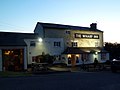
 Fenny Compton-The Wharf Inn - geograph.org.uk - 1441876.jpg 640 × 480 ; 68 kio
-
 Fenny Marina - geograph.org.uk - 6141198.jpg 1 280 × 851 ; 359 kio
-
 Field adjacent to former quarry - geograph.org.uk - 3350351.jpg 640 × 461 ; 58 kio
-
 Field edge south of The Slade - geograph.org.uk - 3350374.jpg 640 × 475 ; 58 kio
-
 Field margin - geograph.org.uk - 3930025.jpg 2 000 × 1 432 ; 746 kio
-
 Fields south of The Slade - geograph.org.uk - 3350375.jpg 640 × 492 ; 53 kio
-
 Footpath towards Avon Dassett - geograph.org.uk - 3350376.jpg 640 × 474 ; 66 kio
-
 Footpaths cross the ditch - geograph.org.uk - 3350377.jpg 458 × 640 ; 104 kio
-
 Gate to a field on Northend Road - geograph.org.uk - 1972234.jpg 1 500 × 1 000 ; 289 kio
-
 Gredenton Hill - geograph.org.uk - 6302946.jpg 1 024 × 595 ; 132 kio
-
 Gredenton Hill from Avon Dassett Road - geograph.org.uk - 1991086.jpg 1 500 × 1 000 ; 320 kio
-
 Hedge near Hammonds Barn - geograph.org.uk - 3360310.jpg 640 × 430 ; 51 kio
-
 Hedgeline in arable field - geograph.org.uk - 3360335.jpg 640 × 430 ; 52 kio
-
 High Street - geograph.org.uk - 6387413.jpg 800 × 533 ; 115 kio
-
-
 Lambs at Windmill Hill - geograph.org.uk - 142194.jpg 640 × 480 ; 347 kio
-
 Level crossing near Hammonds Barn - geograph.org.uk - 1332679.jpg 640 × 427 ; 98 kio
-
 Looking across a field to Fenny Compton - geograph.org.uk - 1334836.jpg 640 × 418 ; 82 kio
-
 Looking over a field towards the Burton Hills - geograph.org.uk - 1972232.jpg 1 500 × 1 000 ; 205 kio
-
 Memorial Road in Fenny Compton - geograph.org.uk - 1972220.jpg 1 500 × 1 000 ; 197 kio
-
 Merrie Lion, Fenny Compton.jpg 3 456 × 2 304 ; 3,3 Mio
-
 Minor road north of Avon Dassett - geograph.org.uk - 2616300.jpg 763 × 1 024 ; 255 kio
-
 Narrowboat moored along the Oxford Canal - geograph.org.uk - 4606497.jpg 800 × 608 ; 117 kio
-
 Northend Road Fenny Compton - geograph.org.uk - 3482027.jpg 640 × 480 ; 54 kio
-
 Northend Road to Fenny Compton - geograph.org.uk - 1972229.jpg 1 500 × 1 000 ; 178 kio
-
 Old Fenny Compton fingerpost - geograph.org.uk - 2171023.jpg 462 × 640 ; 59 kio
-
 Old stone quarry workings - geograph.org.uk - 5193926.jpg 640 × 480 ; 229 kio
-
 On Tunnel Bridge No 137 - geograph.org.uk - 4606519.jpg 800 × 600 ; 197 kio
-
 Ordnance Survey Sheet SP 45 Priors Marston, Published 1957.jpg 7 390 × 7 536 ; 3,82 Mio
-
 Oxford Canal - Bridge No. 136 - geograph.org.uk - 6537928.jpg 640 × 480 ; 88 kio
-
 Oxford Canal - Bridge No. 136A - geograph.org.uk - 6537933.jpg 640 × 480 ; 89 kio
-
 Oxford Canal - Fenny Compton Wharf - geograph.org.uk - 6537920.jpg 640 × 480 ; 56 kio
-
 Oxford Canal - geograph.org.uk - 5206007.jpg 640 × 480 ; 145 kio
-
 Oxford Canal - geograph.org.uk - 6601480.jpg 4 032 × 3 024 ; 5,67 Mio
-
 Oxford Canal at Fenny Compton Wharf - geograph.org.uk - 4606490.jpg 800 × 600 ; 144 kio
-
 Oxford Canal by the railway line - geograph.org.uk - 3360317.jpg 640 × 430 ; 55 kio
-
 Oxford Canal Walk - geograph.org.uk - 5206012.jpg 640 × 480 ; 100 kio
-
 Oxford Canal Walk - geograph.org.uk - 5206018.jpg 640 × 480 ; 106 kio
-
 Oxford Canal Walk - geograph.org.uk - 5206023.jpg 640 × 480 ; 79 kio
-
 Oxford Canal, Bridge Number 137 - geograph.org.uk - 6101711.jpg 1 024 × 785 ; 244 kio
-
 Oxford Canal, Bridge Number 137A - geograph.org.uk - 6101732.jpg 1 024 × 768 ; 217 kio
-
 Oxford Canal, Entrance to Fenny Marina - geograph.org.uk - 6101681.jpg 1 024 × 768 ; 221 kio
-
 Oxford Canal, Fenny Compton - geograph.org.uk - 6141234.jpg 1 280 × 851 ; 474 kio
-
 Oxford Canal, Mooring at Fenny Compton - geograph.org.uk - 6186993.jpg 1 024 × 768 ; 150 kio
-
 Oxford Canal, Site of the former Fenny Compton Tunnel - geograph.org.uk - 6101786.jpg 1 024 × 768 ; 202 kio
-
 Oxford Canal, Site of the former Fenny Compton Tunnel - geograph.org.uk - 6101799.jpg 1 024 × 756 ; 266 kio
-
 Plaque under Fenny Compton Bridge No 138 - geograph.org.uk - 4606931.jpg 800 × 526 ; 162 kio
-

-
 Quiet Country road - geograph.org.uk - 1532011.jpg 640 × 419 ; 77 kio
-
 Railway crossing near Knightcote - geograph.org.uk - 1332689.jpg 640 × 427 ; 115 kio
-
 Railway junction at Fenny Compton - geograph.org.uk - 1267952.jpg 640 × 427 ; 62 kio
-
 Railway junction at Fenny Compton - geograph.org.uk - 1332642.jpg 640 × 415 ; 99 kio
-
 Railway line from bridge DCL95 - geograph.org.uk - 4502945.jpg 1 296 × 972 ; 290 kio
-
 Ridge and furrow field at Fenny Compton - geograph.org.uk - 1332669.jpg 640 × 447 ; 79 kio
-
 Ruined building, near old stone quarries - geograph.org.uk - 5193942.jpg 640 × 428 ; 190 kio
-
 Sheep near Farnborough - geograph.org.uk - 143585.jpg 640 × 480 ; 299 kio
-
 Sheep Pasture Near Fenny Compton. - geograph.org.uk - 3482019.jpg 640 × 480 ; 67 kio
-
 Siding at Fenny Compton - geograph.org.uk - 1332651.jpg 640 × 419 ; 94 kio
-
 Storage trailers - geograph.org.uk - 3350378.jpg 640 × 476 ; 76 kio
-
 Thatched Cottages, Fenny Compton - geograph.org.uk - 142305.jpg 640 × 480 ; 299 kio
-
 The Croft, Fenny Compton.jpg 3 456 × 2 304 ; 3,07 Mio
-
 The Goods Loop in the cutting at Fenny Compton - geograph.org.uk - 1332637.jpg 640 × 427 ; 100 kio
-
 The junction at Fenny Compton - geograph.org.uk - 1267982.jpg 640 × 416 ; 45 kio
-
 The old signal box at Fenny Compton - geograph.org.uk - 1267957.jpg 640 × 460 ; 62 kio
-
 The Oxford Canal at Fenny Compton Marina - geograph.org.uk - 2429720.jpg 1 024 × 768 ; 276 kio
-
 The Oxford Canal at Fenny Compton Wharf - geograph.org.uk - 2429724.jpg 1 024 × 768 ; 148 kio
-
 The Rambler at Fenny Compton - geograph.org.uk - 6601487.jpg 4 032 × 3 024 ; 4,69 Mio
-
 The Slade towards Farnborough - geograph.org.uk - 3350379.jpg 640 × 465 ; 67 kio
-
 The Slade towards Fenny Compton - geograph.org.uk - 3350380.jpg 640 × 470 ; 61 kio
-
 The token box at Fenny Compton - geograph.org.uk - 1332666.jpg 640 × 427 ; 84 kio
-
 The Wharf at Fenny Compton - geograph.org.uk - 2574689.jpg 3 264 × 2 448 ; 1,59 Mio
-
 The Wharf Inn - geograph.org.uk - 2431646.jpg 1 024 × 768 ; 102 kio
-
 The Wharf Inn - geograph.org.uk - 3122693.jpg 3 268 × 2 411 ; 1,05 Mio
-
 The Wharf Inn - geograph.org.uk - 6387386.jpg 800 × 533 ; 93 kio
-
 The Wharf Inn - geograph.org.uk - 6600061.jpg 4 032 × 3 024 ; 3,56 Mio
-
 The Wharf Inn - geograph.org.uk - 6601495.jpg 4 032 × 3 024 ; 4,29 Mio
-
 The Wharf Inn at Fenny Compton - geograph.org.uk - 1972212.jpg 1 500 × 1 000 ; 262 kio
-
 The Wharf Inn at Fenny Compton - geograph.org.uk - 1972215.jpg 1 500 × 1 000 ; 192 kio
-
 The Wharf Inn, Fenny Compton - engine - geograph.org.uk - 6537861.jpg 480 × 640 ; 120 kio
-
 The Wharf Inn, Fenny Compton - geograph.org.uk - 6537852.jpg 640 × 480 ; 58 kio
-
 The Wharf Inn, Fenny Compton - geograph.org.uk - 6537855.jpg 480 × 640 ; 59 kio
-
 The winding hole at Fenny Compton on the Oxford Canal - geograph.org.uk - 2431637.jpg 1 024 × 768 ; 175 kio
-
 Towards Avon Dassett - geograph.org.uk - 3350360.jpg 640 × 464 ; 77 kio
-
 Towards Fenny Compton - geograph.org.uk - 3350361.jpg 640 × 479 ; 72 kio
-
 Towards Gredenton Hill - geograph.org.uk - 3350362.jpg 640 × 474 ; 67 kio
-
 Towpath along the Oxford Canal - geograph.org.uk - 4606944.jpg 800 × 611 ; 216 kio
-
 Train in Fenny Compton cutting - geograph.org.uk - 1369608.jpg 640 × 533 ; 139 kio
-
 Tree lined towpath along the Oxford Canal - geograph.org.uk - 4606934.jpg 800 × 600 ; 232 kio
-
 Tunnel Bridge - geograph.org.uk - 6601483.jpg 4 032 × 3 024 ; 5,67 Mio
-
 Tunnel Bridge No 137 - geograph.org.uk - 4606512.jpg 600 × 800 ; 146 kio
-
 Turning basin on the Oxford Canal - geograph.org.uk - 1972207.jpg 1 500 × 1 000 ; 194 kio
-
 Turnover Bridge - geograph.org.uk - 6601481.jpg 4 032 × 3 024 ; 6,62 Mio
-
 Wayland Farm - geograph.org.uk - 3360315.jpg 640 × 430 ; 43 kio
-
 Westwards - geograph.org.uk - 3350355.jpg 640 × 475 ; 47 kio
-
 Bayards, Fenny Compton - geograph.org.uk - 142187.jpg 639 × 513 ; 234 kio
-
 Burton Dassett - geograph.org.uk - 3995.jpg 640 × 480 ; 56 kio
-
 Farm yard by The Slade - geograph.org.uk - 143590.jpg 640 × 480 ; 266 kio
-
 Fenny Compton - geograph.org.uk - 142183.jpg 640 × 480 ; 285 kio
-
 Fenny Compton - geograph.org.uk - 142303.jpg 640 × 480 ; 280 kio
-
 Fenny Compton Hill - geograph.org.uk - 3998.jpg 640 × 480 ; 83 kio
-
 Fenny Compton Marina - geograph.org.uk - 1432145.jpg 640 × 480 ; 61 kio
-
 Fenny Compton Sign Post - geograph.org.uk - 142301.jpg 480 × 640 ; 319 kio
-
 Fenny Compton Telephone Exchange - geograph.org.uk - 142309.jpg 640 × 480 ; 280 kio
-
 Fenny Compton-The Tunnel - geograph.org.uk - 1433139.jpg 640 × 480 ; 119 kio
-

-
 Gated Road, Farnborough - geograph.org.uk - 142191.jpg 640 × 480 ; 285 kio
-
 Gredenton Hill - geograph.org.uk - 125115.jpg 640 × 480 ; 84 kio
-
 Holbech Hill, Farnborough - geograph.org.uk - 143579.jpg 640 × 480 ; 244 kio
-
 Old quarry, Burton Dassett Country Park - geograph.org.uk - 162843.jpg 640 × 480 ; 267 kio
-
 Rectory Farm, Fenny Compton - geograph.org.uk - 143575.jpg 640 × 480 ; 257 kio
-
 Remains of farm building - geograph.org.uk - 142197.jpg 640 × 480 ; 288 kio
-
 SandMJR towards Fenny Compton - geograph.org.uk - 148203.jpg 640 × 480 ; 320 kio
-
 Sheep at Shooter's Hill - geograph.org.uk - 143578.jpg 640 × 480 ; 241 kio
-
 Sourland Pool and Ice flow - geograph.org.uk - 117216.jpg 640 × 481 ; 60 kio
-
 Stratford and Midland Junction Railway - geograph.org.uk - 147312.jpg 639 × 479 ; 269 kio
-
 The Merrie Lion, Fenny Compton - geograph.org.uk - 142310.jpg 640 × 480 ; 264 kio
-
 The Slade - geograph.org.uk - 142198.jpg 640 × 480 ; 301 kio
-
 The Slade - geograph.org.uk - 143593.jpg 640 × 480 ; 380 kio
-
 Timber yard near Claydon - geograph.org.uk - 143565.jpg 640 × 480 ; 298 kio
-
 View from Shooter's Hill - geograph.org.uk - 142188.jpg 640 × 480 ; 229 kio
-
 View from The Slade - geograph.org.uk - 143587.jpg 640 × 480 ; 245 kio
-
 View of the Burton Hills from Northend Lane - geograph.org.uk - 142182.jpg 640 × 480 ; 222 kio
-
 Works at Fenny Compton - geograph.org.uk - 142200.jpg 640 × 480 ; 240 kio
.jpg)


.jpg)


