Category:Fenton, West Lindsey
Aller à la navigation
Aller à la recherche
English: Fenton is a village and civil parish in the district of West Lindsey, in Lincolnshire, England. It is on the A156 Lincoln to Gainsborough road, and is notable for the Fenton Motel, and fishing spot, by virtue of it being a short distance from the River Trent. Its coordinates are . There is also a cask ale pub called the 'Carpenters Arms', and Fenton is a centre for the breeding of the Fenton Herd Lincoln Reds local cattle variety.
localité britannique du comté anglais de Lincolnshire  | |||||
| Téléverser des médias | |||||
| Nature de l’élément | |||||
|---|---|---|---|---|---|
| Lieu | West Lindsey, Lincolnshire, Midlands de l'Est, Angleterre | ||||
| À ne pas confondre avec | |||||
| Réputé identique à | Fenton (page en doublon, paroisse civile) | ||||
 | |||||
Sous-catégories
Cette catégorie comprend seulement la sous-catégorie ci-dessous.
T
- Torksey Lock (31 F)
Média dans la catégorie « Fenton, West Lindsey »
Cette catégorie comprend 98 fichiers, dont les 98 ci-dessous.
-
 A bend in the Fossdyke Canal - geograph.org.uk - 4930643.jpg 800 × 555 ; 119 kio
-
 A bend in the River Trent - geograph.org.uk - 5474089.jpg 800 × 600 ; 118 kio
-
 A glimpse of Lincoln Cathedral - geograph.org.uk - 4930687.jpg 800 × 612 ; 100 kio
-
 A156 heading north - geograph.org.uk - 3535025.jpg 640 × 480 ; 73 kio
-
 A156 towards Gainsborough - geograph.org.uk - 3535023.jpg 640 × 480 ; 94 kio
-
 Approaching Torksey Lock by Fossdyke Navigation - geograph.org.uk - 5931389.jpg 5 376 × 3 024 ; 4,65 Mio
-
 Bend in the A156 Lincoln Road - geograph.org.uk - 3492370.jpg 1 600 × 1 067 ; 506 kio
-
 Boats moored along the Fossdyke Canal - geograph.org.uk - 4930552.jpg 800 × 553 ; 141 kio
-
 Boats moored along the Fossdyke Canal - geograph.org.uk - 4930561.jpg 800 × 600 ; 118 kio
-
 Boats moored along the Fossdyke Canal - geograph.org.uk - 4930569.jpg 800 × 563 ; 113 kio
-

-
 Cuba of Ryeford on the Fossdyke Navigation - geograph.org.uk - 5931444.jpg 5 376 × 3 024 ; 4,26 Mio
-
 Dandelions on the bank of the Fossdyke Canal - geograph.org.uk - 4930845.jpg 800 × 600 ; 136 kio
-
 Danger sunken island keep left - geograph.org.uk - 3160492.jpg 640 × 454 ; 178 kio
-
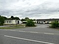
 Deserted car-boot sale site - geograph.org.uk - 6181461.jpg 1 024 × 768 ; 128 kio
-
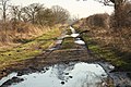
 Drain by Sykes Lane - geograph.org.uk - 845056.jpg 640 × 480 ; 100 kio
-
 Extreme angling - geograph.org.uk - 2802067.jpg 640 × 427 ; 93 kio
-
 Farmland next to the Fossdyke Canal - geograph.org.uk - 4930608.jpg 800 × 548 ; 140 kio
-
 Farmland next to the Fossdyke Canal - geograph.org.uk - 4930872.jpg 800 × 600 ; 173 kio
-
 Farmland next to the Fossdyke Canal - geograph.org.uk - 4930970.jpg 800 × 534 ; 117 kio
-
 Farmland off the A156 - geograph.org.uk - 3535022.jpg 640 × 480 ; 86 kio
-
 Farmland, Torksey Lock - geograph.org.uk - 3535026.jpg 640 × 480 ; 70 kio
-
 Field track near Hargerze - geograph.org.uk - 1337176.jpg 640 × 480 ; 68 kio
-
 Flotsam by Torksey Lock - geograph.org.uk - 5931365.jpg 5 376 × 3 024 ; 3,75 Mio
-
 Former motel on the A156 - geograph.org.uk - 5883905.jpg 640 × 480 ; 61 kio
-
 Foss Dyke exit to the River Trent - geograph.org.uk - 5558850.jpg 960 × 1 280 ; 237 kio
-
 Fossdyke Canal near Fenton - geograph.org.uk - 4930913.jpg 800 × 548 ; 127 kio
-
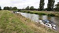
 Fossdyke Navigation (2) - geograph.org.uk - 2192725.jpg 1 024 × 768 ; 134 kio
-
 Fossdyke Navigation - geograph.org.uk - 2192714.jpg 1 024 × 768 ; 145 kio
-
 Fossdyke Navigation - geograph.org.uk - 5931434.jpg 5 376 × 3 024 ; 4,47 Mio
-
 Fossdyke Navigation at Torksey Lock - geograph.org.uk - 5931375.jpg 5 376 × 3 024 ; 3,64 Mio
-
 Junction of A156 and A1133 - geograph.org.uk - 3492374.jpg 2 256 × 1 504 ; 1,23 Mio
-
 Junction of the A1133 and A156 - geograph.org.uk - 5780747.jpg 1 600 × 1 065 ; 368 kio
-
 Kettlethorpe Lane, Fenton - geograph.org.uk - 5780750.jpg 1 600 × 1 072 ; 619 kio
-
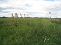 Km 71 and Cottam Power Station - geograph.org.uk - 2576119.jpg 1 024 × 768 ; 181 kio
-
 Lincoln Road ( A156) - geograph.org.uk - 3535019.jpg 640 × 480 ; 94 kio
-
 Maltkiln Road, Fenton - geograph.org.uk - 3071306.jpg 2 256 × 1 504 ; 1,83 Mio
-
 Maltkiln Road, Fenton - geograph.org.uk - 3535021.jpg 640 × 480 ; 72 kio
-
 Marsh Lane drain - geograph.org.uk - 1330892.jpg 640 × 426 ; 105 kio
-
 Monkey Puzzle Tree on A1133 - geograph.org.uk - 3745913.jpg 1 504 × 2 256 ; 1,84 Mio
-
 Moorings at Torksey Lock - geograph.org.uk - 4930535.jpg 800 × 515 ; 117 kio
-
 Newark Road (A1133) - geograph.org.uk - 3535027.jpg 640 × 480 ; 65 kio
-
 Newark Road (A1133) - geograph.org.uk - 3535030.jpg 640 × 480 ; 80 kio
-
 Oilseed rape near Fenton - geograph.org.uk - 1337182.jpg 640 × 480 ; 61 kio
-
 Path along the bank of the Fossdyke Canal - geograph.org.uk - 4930592.jpg 800 × 633 ; 128 kio
-
 Path along the bank of the Fossdyke Canal - geograph.org.uk - 4930631.jpg 800 × 540 ; 142 kio
-
 Ploughed farmland next to the Fossdyke Canal - geograph.org.uk - 4930657.jpg 800 × 600 ; 141 kio
-
 Potato crop off Newark Road - geograph.org.uk - 3535028.jpg 640 × 480 ; 76 kio
-
 Pumping station next to the Fossdyke Canal - geograph.org.uk - 4930979.jpg 800 × 582 ; 132 kio
-
 Ramper Lane, near Fenton - geograph.org.uk - 3067711.jpg 1 504 × 2 256 ; 2,24 Mio
-
 Reach below Torksey Lock - geograph.org.uk - 3159971.jpg 640 × 427 ; 186 kio
-
 Remote stretch of the Fossdyke Canal - geograph.org.uk - 4930863.jpg 800 × 600 ; 148 kio
-

-

-
 River Cruisers on the Fossdyke Navigation - geograph.org.uk - 5883877.jpg 640 × 480 ; 103 kio
-
 River Trent - geograph.org.uk - 3268210.jpg 640 × 427 ; 27 kio
-
 River Trent - geograph.org.uk - 4870401.jpg 1 024 × 683 ; 140 kio
-
 Sand Lane - geograph.org.uk - 1333947.jpg 640 × 426 ; 98 kio
-
 Sand Lane - geograph.org.uk - 1333952.jpg 640 × 426 ; 128 kio
-
 Sand Lane - geograph.org.uk - 3335455.jpg 640 × 427 ; 125 kio
-
 Sewer Drain at Torksey Lock - geograph.org.uk - 5883897.jpg 640 × 480 ; 99 kio
-
 Sewer Drain, Torksey Lock - geograph.org.uk - 2192717.jpg 1 024 × 768 ; 118 kio
-
 Sluice at Cottam power station - geograph.org.uk - 3160489.jpg 640 × 427 ; 164 kio
-
 Sunken island - geograph.org.uk - 3160498.jpg 640 × 427 ; 163 kio
-
 Teapots on a lock gate at Torksey Lock - geograph.org.uk - 5558854.jpg 960 × 1 280 ; 321 kio
-
 Teapots outside Torksey Lock Tea Room - geograph.org.uk - 4930519.jpg 800 × 600 ; 163 kio
-
 The Carpenter's Arms, Fenton - geograph.org.uk - 3535020.jpg 640 × 480 ; 65 kio
-
 The Fossdyke Canal at The Elms - geograph.org.uk - 5883881.jpg 640 × 480 ; 126 kio
-
 The Fossdyke Navigation at Torksey Lock - geograph.org.uk - 5883894.jpg 640 × 480 ; 90 kio
-
 The Fossdyke Navigation near Fenton - geograph.org.uk - 5883874.jpg 640 × 480 ; 100 kio
-
 The Fossdyke Navigation near Torksey Lock - geograph.org.uk - 5883885.jpg 640 × 480 ; 80 kio
-
 The view from Torksey Lock - geograph.org.uk - 5558846.jpg 1 280 × 887 ; 235 kio
-
 The Wheelhouse - geograph.org.uk - 2802075.jpg 427 × 640 ; 86 kio
-
 The White Swan - geograph.org.uk - 5883901.jpg 640 × 480 ; 116 kio
-
 Time for a drink - geograph.org.uk - 1297077.jpg 640 × 426 ; 88 kio
-
 Torksey Basin - geograph.org.uk - 2802063.jpg 640 × 427 ; 48 kio
-
 Torksey Lock - geograph.org.uk - 5558833.jpg 1 280 × 960 ; 322 kio
-
 Torksey Lock - geograph.org.uk - 5558835.jpg 1 280 × 960 ; 413 kio
-
 Torksey Lock - geograph.org.uk - 5558838.jpg 1 280 × 960 ; 423 kio
-
 Torksey Lock - geograph.org.uk - 5558840.jpg 1 280 × 941 ; 364 kio
-
 Torksey Lock - geograph.org.uk - 5558860.jpg 1 280 × 960 ; 401 kio
-
 Torksey Lock basin - geograph.org.uk - 5558843.jpg 1 280 × 1 280 ; 436 kio
-
 Torksey Lock basin - geograph.org.uk - 5558857.jpg 1 280 × 960 ; 376 kio
-
 Torksey Lock on the Fossdyke - geograph.org.uk - 5435751.jpg 4 032 × 3 024 ; 3,77 Mio
-
 Torksey Lock on the Fossdyke - geograph.org.uk - 5435770.jpg 3 024 × 4 032 ; 2,03 Mio
-
 Torksey Lock reach - geograph.org.uk - 3268194.jpg 640 × 427 ; 19 kio
-
 Torksey Lock reach - geograph.org.uk - 3268217.jpg 640 × 427 ; 36 kio
-
 Torksey Lock reach - geograph.org.uk - 3335524.jpg 640 × 427 ; 39 kio
-
 Torksey Lock reach - geograph.org.uk - 4865283.jpg 1 024 × 683 ; 263 kio
-
 Torksey Lock reach - geograph.org.uk - 4865306.jpg 1 024 × 683 ; 149 kio
-
 Torksey Lock village sign - geograph.org.uk - 5883899.jpg 640 × 480 ; 66 kio
-
 Torksey meadow - geograph.org.uk - 4870414.jpg 1 024 × 683 ; 191 kio
-
 Torksey pumps - geograph.org.uk - 1718141.jpg 640 × 426 ; 98 kio
-
 Trent Bank - geograph.org.uk - 2577434.jpg 1 024 × 768 ; 178 kio
-
 Trent floods - geograph.org.uk - 3268200.jpg 640 × 427 ; 73 kio
-
 Trenton Motel, Fenton, West Lindsey, in 1967 (geograph 3132510).jpg 1 160 × 647 ; 161 kio
-
 View from the Trent bank - geograph.org.uk - 2576130.jpg 1 024 × 768 ; 203 kio
-
 White Swan, Torksey Lock - geograph.org.uk - 5931353.jpg 5 376 × 3 024 ; 4,39 Mio


_-_geograph.org.uk_-_2192725.jpg)


_-_geograph.org.uk_-_3535019.jpg)


_-_geograph.org.uk_-_3535027.jpg)
_-_geograph.org.uk_-_3535030.jpg)


.jpg)

