Category:Ferndown
Vai alla navigazione
Vai alla ricerca
town in Dorset, England, UK  | |||||
| Carica un file multimediale | |||||
| Istanza di | |||||
|---|---|---|---|---|---|
| Luogo | Ferndown Town, Dorset, Sud Ovest dell'Inghilterra, Inghilterra | ||||
| Popolazione |
| ||||
| sito web ufficiale | |||||
 | |||||

Deutsch: Ferndown ist eine Kleinstadt in Dorset, England, nördlich von Bournemouth und östlich von Wimborne Minster. Sie hat 16.890 Einwohner (Stand 2005) und gehört zum Distrikt East Dorset.
English: Ferndown is a town and civil parish in the East Dorset district of Dorset in southern England, situated immediately to the north of unitary authorities of Poole and Bournemouth. The parish, which until 1972 was called Hampreston, includes the communities of Hampreston, Longham, Stapehill and Trickett's Cross. The latest population figure (2006 mid year estimate) for the parish is 17,200.
Polski: Ferndown - miasto w Wielkiej Brytanii, w Anglii, w regionie South West England, w hrabstwie Dorset. W 2001r. miasto to zamieszkiwało 17 650 osób.
Română: Ferndown este un oraş în comitatul Dorset, regiunea South West, Anglia. Oraşul se află în districtul East Dorset.
Sottocategorie
Questa categoria contiene le 3 sottocategorie indicate di seguito, su un totale di 3.
File nella categoria "Ferndown"
Questa categoria contiene 142 file, indicati di seguito, su un totale di 142.
-

-
 A31 Underpass, Ferndown - geograph.org.uk - 1750031.jpg 800 × 600; 204 KB
-
 A31 Underpass, Ferndown - geograph.org.uk - 1750042.jpg 800 × 600; 178 KB
-
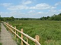
 Ameysford, footbridge - geograph.org.uk - 2296300.jpg 1 024 × 768; 384 KB
-
 Ameysford, police headquarters (geograph 2293303).jpg 1 024 × 768; 141 KB
-
 Ameysford, subway - geograph.org.uk - 2293285.jpg 1 024 × 768; 324 KB
-
 Ameysford, trailway - geograph.org.uk - 2296290.jpg 768 × 1 024; 303 KB
-
 Ameysford, Uddens Water - geograph.org.uk - 2296321.jpg 1 024 × 768; 396 KB
-
 Apartment Block at Tricketts Cross - geograph.org.uk - 2146410.jpg 640 × 480; 81 KB
-
 BCPBUA.png 1 618 × 850; 1,41 MB
-
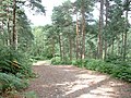
 Castleman Trailway in Ferndown Forest - geograph.org.uk - 29592.jpg 640 × 480; 183 KB
-
 Castleman Trailway in Uddens Plantation - geograph.org.uk - 29748.jpg 640 × 480; 168 KB
-
 Crossroads Ferndown - geograph.org.uk - 1295134.jpg 640 × 480; 116 KB
-
 Curry Cottage - geograph.org.uk - 1858062.jpg 640 × 480; 70 KB
-
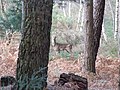 Deer on Ferndown Common - geograph.org.uk - 1779216.jpg 800 × 600; 155 KB
-
 Dorset Search and Rescue van 2.jpg 4 032 × 2 268; 4,45 MB
-
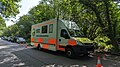 Dorset Search and Rescue van.jpg 4 032 × 2 268; 4,39 MB
-
 Dudsbury Weirs - geograph.org.uk - 469112.jpg 640 × 480; 140 KB
-
 Election Day - Thur 6th May 2010 - geograph.org.uk - 1858043.jpg 640 × 480; 64 KB
-
 Entrance to the waterworks at Longham - geograph.org.uk - 2082209.jpg 1 024 × 627; 173 KB
-
 Ferndown Common - geograph.org.uk - 2030831.jpg 768 × 1 024; 190 KB
-
 Ferndown Common - geograph.org.uk - 2037018.jpg 1 024 × 768; 181 KB
-
 Ferndown Common - geograph.org.uk - 2037500.jpg 1 024 × 768; 194 KB
-
 Ferndown Common Public Footpath.jpg 1 795 × 1 205; 332 KB
-
 Ferndown Common, bridleway - geograph.org.uk - 2037095.jpg 768 × 1 024; 187 KB
-
 Ferndown Common, footpath - geograph.org.uk - 2030862.jpg 768 × 1 024; 374 KB
-
 Ferndown Common, footpath - geograph.org.uk - 2037078.jpg 1 024 × 768; 221 KB
-
 Ferndown Common, tumulus - geograph.org.uk - 2037139.jpg 1 024 × 768; 245 KB
-
 Ferndown Fire Station - geograph.org.uk - 251171.jpg 640 × 427; 178 KB
-
 Ferndown Industrial Estate - geograph.org.uk - 2030650.jpg 1 024 × 768; 154 KB
-
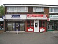
 Ferndown Shopping Precinct.jpg 459 × 344; 44 KB
-
 Ferndown Upper School (geograph 1666313).jpg 640 × 480; 60 KB
-
 Ferndown, Ameysford Road - geograph.org.uk - 2030788.jpg 1 024 × 768; 179 KB
-
 Ferndown, Brabourne Avenue - geograph.org.uk - 2037484.jpg 1 024 × 754; 169 KB
-
 Ferndown, car dealers - geograph.org.uk - 2037836.jpg 1 024 × 740; 168 KB
-
 Ferndown, Cats Protection - geograph.org.uk - 2030638.jpg 1 024 × 768; 152 KB
-
 Ferndown, dancing school - geograph.org.uk - 2030775.jpg 1 024 × 768; 114 KB
-
 Ferndown, Ferndown Common - geograph.org.uk - 1352729.jpg 480 × 640; 65 KB
-
 Ferndown, Fernside Park - geograph.org.uk - 2030664.jpg 1 024 × 768; 160 KB
-
 Ferndown, footpath - geograph.org.uk - 2030688.jpg 768 × 1 024; 345 KB
-
 Ferndown, footpath - geograph.org.uk - 2030802.jpg 768 × 1 024; 250 KB
-
 Ferndown, Forest View Drive - geograph.org.uk - 2030888.jpg 1 024 × 739; 136 KB
-
 Ferndown, larger pond on Ferndown Common - geograph.org.uk - 1352722.jpg 640 × 480; 115 KB
-
 Ferndown, Leeson Drive - geograph.org.uk - 2030718.jpg 1 024 × 768; 168 KB
-
 Ferndown, Longacre Drive - geograph.org.uk - 2037452.jpg 1 024 × 768; 193 KB
-
 Ferndown, old sign on the A347 - geograph.org.uk - 1091616.jpg 640 × 480; 112 KB
-
 Ferndown, paddocks - geograph.org.uk - 2037030.jpg 1 024 × 768; 203 KB
-
 Ferndown, Penny's Walk - geograph.org.uk - 1356661.jpg 640 × 480; 65 KB
-
 Ferndown, plan - geograph.org.uk - 2030763.jpg 1 024 × 768; 126 KB
-
 Ferndown, Pompey's Lane - geograph.org.uk - 1352714.jpg 640 × 480; 105 KB
-
 Ferndown, pond - geograph.org.uk - 2037049.jpg 1 024 × 768; 335 KB
-
-
-
-

-
-
-
-

-
-

-
-

-

-

-
-

-

-
-

-

-

-
 Ferndown, power lines - geograph.org.uk - 2030704.jpg 768 × 1 024; 137 KB
-
 Ferndown, pylon on the common - geograph.org.uk - 1352733.jpg 640 × 480; 56 KB
-
 Ferndown, roundabout - geograph.org.uk - 2030738.jpg 1 024 × 768; 115 KB
-
 Ferndown, small pond on Ferndown Common - geograph.org.uk - 1352717.jpg 640 × 480; 126 KB
-
 Ferndown, the post office - geograph.org.uk - 1356666.jpg 640 × 480; 68 KB
-
 Ferndown, three unwanted houses - geograph.org.uk - 1091610.jpg 640 × 460; 45 KB
-
 Ferndown, trig point and tree - geograph.org.uk - 1352738.jpg 480 × 640; 82 KB
-
 Ferndown, veterinary practice - geograph.org.uk - 2037829.jpg 1 024 × 743; 161 KB
-
 Ferndown, Wimborne Road Post Office - geograph.org.uk - 1030414.jpg 640 × 480; 50 KB
-

-
 Good size cycleway - Ferndown - geograph.org.uk - 1858053.jpg 640 × 480; 89 KB
-
 Great Barrow, Ferndown Common - geograph.org.uk - 1778583.jpg 800 × 600; 182 KB
-
 Horse in field - geograph.org.uk - 1132764.jpg 640 × 427; 101 KB
-
 Kings Arms public house - geograph.org.uk - 367679.jpg 640 × 480; 93 KB
-
 Longham, Angel Lane - geograph.org.uk - 2036951.jpg 1 024 × 768; 247 KB
-
 Longham, Coneygar Farm - geograph.org.uk - 2036987.jpg 1 024 × 768; 141 KB
-
 Longham, farm road - geograph.org.uk - 2036996.jpg 1 024 × 768; 189 KB
-
 Longham, Pompey's Lane - geograph.org.uk - 2037008.jpg 768 × 1 024; 376 KB
-
 Longham, power lines - geograph.org.uk - 2036967.jpg 768 × 1 024; 166 KB
-
 Longham, The Angel - geograph.org.uk - 2037190.jpg 1 024 × 768; 111 KB
-
 Longham, The Angel, sign - geograph.org.uk - 2037219.jpg 803 × 1 024; 135 KB
-
 Old Cottage on Ringwood Road - geograph.org.uk - 367671.jpg 640 × 480; 92 KB
-
 Paddocks to the north of East Parley - geograph.org.uk - 388043.jpg 640 × 419; 85 KB
-
 Palmer's Ford, footpath - geograph.org.uk - 1151989.jpg 640 × 480; 160 KB
-
 Palmer's Ford, junction - geograph.org.uk - 1151969.jpg 480 × 640; 98 KB
-
 Palmer's Ford, water meadows - geograph.org.uk - 1152004.jpg 640 × 454; 80 KB
-
-
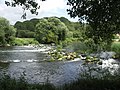
 River Stour - geograph.org.uk - 2082284.jpg 1 024 × 683; 185 KB
-
 River Stour - geograph.org.uk - 5205360.jpg 640 × 480; 155 KB
-
 River Stour at Longham Bridge - geograph.org.uk - 1857585.jpg 640 × 425; 46 KB
-
 River Stour Ford, Dudsbury - geograph.org.uk - 2420417.jpg 800 × 600; 173 KB
-

-
 Shops in Ferndown - geograph.org.uk - 2146382.jpg 640 × 480; 85 KB
-
-
 Slop Bog Nature Reserve - geograph.org.uk - 27402.jpg 640 × 480; 109 KB
-
 Stapehill, nursery beds - geograph.org.uk - 2037065.jpg 1 024 × 768; 159 KB
-
 Stapehill, paddocks - geograph.org.uk - 2036934.jpg 1 024 × 768; 161 KB
-
 The Angel - geograph.org.uk - 1816637.jpg 1 024 × 683; 146 KB
-
 The Angel, Longham, Ferndown - geograph.org.uk - 1778660.jpg 800 × 600; 132 KB
-
 The Angel, Longham. Ferndown - geograph.org.uk - 1778621.jpg 800 × 600; 106 KB
-
 The Barrington Centre, Ferndown - geograph.org.uk - 1120991.jpg 640 × 480; 187 KB
-
 The sign for The Angel - geograph.org.uk - 1816559.jpg 683 × 1 024; 244 KB
-
 Trickett's Cross Roundabout - geograph.org.uk - 2176961.jpg 1 024 × 768; 146 KB
-
 Trickett's Cross, motel - geograph.org.uk - 2177003.jpg 1 024 × 768; 182 KB
-
 Trickett's Cross, recreation ground - geograph.org.uk - 2177059.jpg 1 024 × 768; 134 KB
-
 Trickett's Cross, roundabout - geograph.org.uk - 2177070.jpg 1 024 × 768; 93 KB
-
 Trickett's Cross, Smugglers Haunt - geograph.org.uk - 2176993.jpg 1 024 × 739; 113 KB
-
 Trickett's Cross, supermarket - geograph.org.uk - 2177048.jpg 1 024 × 761; 121 KB
-
 Trickett's Cross, superstore - geograph.org.uk - 2176979.jpg 1 024 × 787; 147 KB
-
 Tumulus, Ferndown Common - geograph.org.uk - 1778896.jpg 800 × 600; 257 KB
-
 Tumulus, Ferndown Common - geograph.org.uk - 1778910.jpg 800 × 600; 120 KB
-
 Uddens Plantation, bridge - geograph.org.uk - 2296356.jpg 1 024 × 768; 322 KB
-
 Uddens Plantation, catkins - geograph.org.uk - 2296342.jpg 1 024 × 768; 344 KB
-
 Uddens Plantation, footbridge - geograph.org.uk - 2297341.jpg 1 024 × 768; 370 KB
-
 Uddens Plantation, forestry road - geograph.org.uk - 2296369.jpg 768 × 1 024; 240 KB
-
 Uddens Plantation, trail - geograph.org.uk - 2297348.jpg 768 × 1 024; 289 KB
-
 Uddens Plantation, trailway - geograph.org.uk - 2296381.jpg 768 × 1 024; 279 KB
-
 Uddens Plantation, Uddens Water - geograph.org.uk - 2297336.jpg 768 × 1 024; 336 KB
-
 Uddens, cattle grazing - geograph.org.uk - 2297362.jpg 1 024 × 768; 178 KB
-
 Uddens, horse grazing - geograph.org.uk - 2297358.jpg 1 024 × 768; 327 KB
-
 Victoria Road, Ferndown - geograph.org.uk - 1295101.jpg 640 × 480; 113 KB
-
 Weir on the River Stour - geograph.org.uk - 2082154.jpg 1 024 × 677; 319 KB
-
 Wimborne Minster - geograph.org.uk - 251.jpg 640 × 427; 32 KB
-
 Wooded area of Ferndown Common - geograph.org.uk - 1132762.jpg 640 × 480; 123 KB
-
 Cannon Hill - geograph.org.uk - 31160.jpg 640 × 480; 135 KB
-
 Cannon Hill Plantation - geograph.org.uk - 31165.jpg 640 × 480; 172 KB
-
 Ferndown Industrial Estate, Dorset - geograph.org.uk - 139057.jpg 640 × 481; 79 KB
-
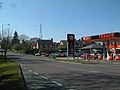 Petrol Station, Stapehill, Dorset - geograph.org.uk - 139054.jpg 640 × 481; 73 KB
-
 The Bridge House Hotel - geograph.org.uk - 367686.jpg 640 × 392; 56 KB
-
 Track leading to Pompey's Corner - geograph.org.uk - 436583.jpg 430 × 640; 185 KB


.jpg)


.jpg)


_(Rear_Hall_-_Reema_Construction_Hall).JPG)


