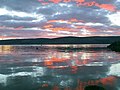
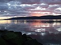
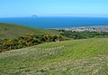
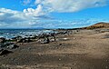
Category:Firth of Clyde
Vai alla navigazione
Vai alla ricerca


insenatura situata nella costa occidentale della Scozia   | |||||
| Carica un file multimediale | |||||
| Istanza di | |||||
|---|---|---|---|---|---|
| Luogo | Scozia | ||||
| Immissario |
| ||||
| Nazione rivierasca | |||||
 | |||||
Sottocategorie
Questa categoria contiene le 14 sottocategorie indicate di seguito, su un totale di 14.
C
- Cloch Point Lighthouse (83 F)
F
- Fairlie Roads, Firth of Clyde (13 F)
G
H
- Hunterston Terminal (98 F)
I
L
- Lappock Rock (4 F)
M
- Maps of the Firth of Clyde (29 F)
N
R
T
- Tail of the Bank (53 F)
W
- Firth of Clyde at Wemyss Bay (11 F)
File nella categoria "Firth of Clyde"
Questa categoria contiene 200 file, indicati di seguito, su un totale di 399.
(pagina precedente) (pagina successiva)-
 "DUMA" Scottish Junk - panoramio.jpg 1 280 × 960; 867 KB
-
 "Mo Mhairi" off Cumbrae (19305842148).jpg 4 467 × 2 978; 3,54 MB
-
 060725-Lunderston-Bay.jpg 2 272 × 1 704; 687 KB
-
 130708 Clyde from Greenock Esplanade.jpg 3 264 × 2 448; 1,58 MB
-
 130909 Granny Balcary Irvine Carrick Ipad 032.jpg 2 592 × 1 936; 1,64 MB
-
 131022a Cembay+pilot boat.jpg 3 783 × 1 664; 545 KB
-
 230711 Greenock.jpg 2 549 × 1 665; 486 KB
-
 A grey Firth of Clyde - geograph.org.uk - 5607690.jpg 1 024 × 768; 87 KB
-

-

-
 Aerial view of Erskine Bridge, 2009-02-01.jpg 3 888 × 2 592; 7,13 MB
-
 Aida Blu passing Bullwood - geograph.org.uk - 2589363.jpg 640 × 330; 105 KB
-
 Ailsa Craig, Clyde, 1840s..jpg 2 144 × 1 280; 621 KB
-
 Alba Explorer in the Firth of Clyde - geograph.org.uk - 3455337.jpg 640 × 404; 119 KB
-
 Alfred Nobel explosives factory, Ardeer from the air - geograph.org.uk - 2138819.jpg 2 592 × 1 944; 3,59 MB
-
 Ali Cat and MSC Mailn off Gourock - geograph.org.uk - 5907067.jpg 1 024 × 528; 151 KB
-
 Ali Cat on the Firth of Clyde - geograph.org.uk - 3092806.jpg 640 × 324; 109 KB
-
 Ali Cat on the Firth of Clyde - geograph.org.uk - 3092808.jpg 640 × 342; 104 KB
-
 Ali Cat on the Firth of Clyde - geograph.org.uk - 3092860.jpg 640 × 429; 150 KB
-

-
 Ardneil Bay and Hill - panoramio.jpg 1 280 × 898; 678 KB
-
 Ardneil Bay from Jacks View West Kilbride - panoramio.jpg 1 280 × 960; 468 KB
-
 Ardneil Beach - panoramio.jpg 1 280 × 960; 783 KB
-
 Ardrossan from the air (geograph 4677934).jpg 640 × 497; 152 KB
-
 Ardrossan from the air - geograph.org.uk - 2138777.jpg 2 592 × 1 944; 3 MB
-
 Arran - geograph.org.uk - 372073.jpg 640 × 480; 61 KB
-
 Arran and the Cumbraes - panoramio.jpg 1 280 × 843; 495 KB
-
 Arran and the Firth of Clyde - geograph.org.uk - 4456714.jpg 640 × 480; 65 KB
-
 Arran from ferry - panoramio.jpg 1 280 × 960; 825 KB
-
 Arran Summer Sunset - panoramio.jpg 1 280 × 960; 600 KB
-
 Arran Summer Sunset 2 - panoramio.jpg 1 280 × 960; 438 KB
-
 Ashton Buoy Firth of Clyde - geograph.org.uk - 3639927.jpg 4 000 × 3 000; 2,3 MB
-
 Ashton Buoy Firth of Clyde - geograph.org.uk - 3641624.jpg 4 000 × 3 000; 2,27 MB
-
 Baker Street - geograph.org.uk - 609149.jpg 640 × 480; 83 KB
-
 Bank Street - geograph.org.uk - 1164473.jpg 640 × 480; 82 KB
-
 Battery park and Kilcreggan - geograph.org.uk - 4783797.jpg 640 × 480; 112 KB
-
 Battery Park and the Firth of Clyde - geograph.org.uk - 3095495.jpg 640 × 429; 128 KB
-
 BBC Marmara (IMO 9454228).jpg 5 000 × 3 323; 4,86 MB
-
 Ben Bowie and the Firth of Clyde - geograph.org.uk - 5187659.jpg 640 × 407; 104 KB
-
 BG Antwerp passing Cloch Point - geograph.org.uk - 838205.jpg 640 × 480; 99 KB
-
 BG Antwerp passing Inverkip - geograph.org.uk - 838199.jpg 640 × 480; 86 KB
-
 Big Eagle - geograph.org.uk - 3685773.jpg 640 × 480; 253 KB
-
 Bro Nordby in the Firth of Clyde - geograph.org.uk - 6306025.jpg 1 024 × 768; 268 KB
-
 Bro Nordby in the Firth of Clyde - geograph.org.uk - 6306028.jpg 1 024 × 768; 286 KB
-
 Bro Nordby in the Firth of Clyde - geograph.org.uk - 6306029.jpg 1 024 × 438; 111 KB
-
 Buoy off Victoria Harbour - geograph.org.uk - 1569655.jpg 590 × 322; 37 KB
-
 Burgia passing Port Glasgow - geograph.org.uk - 4834377.jpg 640 × 480; 84 KB
-
 Car ferry approaching McInroy's Point, Gourock, Firth of Clyde.jpg 1 920 × 1 080; 612 KB
-
 Car ferry at McInroy's Point, Gourock, Firth of Clyde.jpg 1 920 × 1 080; 783 KB
-
 Car ferry from Hunter's Quay passing Strone Point, Firth of Clyde, Scotland.jpg 1 920 × 1 080; 828 KB
-
 Cardwell Bay - geograph.org.uk - 1384328.jpg 640 × 480; 44 KB
-
 Castleisland.jpg 640 × 424; 79 KB
-
 HMS-Cavina-WW2-1941-requisitioned-Elder&Fyffes-Banana-Boat.jpg 900 × 663; 249 KB
-
 Cemsea (1993).jpg 3 072 × 2 048; 2,75 MB
-
 Channel marker buoy - geograph.org.uk - 6266129.jpg 1 024 × 768; 226 KB
-
 Cioch na h-Oige - geograph.org.uk - 664199.jpg 640 × 437; 97 KB
-
 Cloch Point - geograph.org.uk - 1000924.jpg 640 × 480; 38 KB
-
 Clyde and Inverkip power station site from Berfern.jpg 3 944 × 2 218; 1,22 MB
-
 Clyde at Port Glasgow.jpg 2 154 × 1 406; 176 KB
-
 Clyde channel, Greenock Ocean Terminal and Tail of the Bank.jpg 2 786 × 1 567; 859 KB
-
 Clyde pilot boat July06.jpg 1 428 × 947; 63 KB
-
 Clyde shipping.jpg 935 × 798; 44 KB
-
 Clyde sunset - geograph.org.uk - 728480.jpg 640 × 480; 64 KB
-
 Clyde sunset - geograph.org.uk - 728484.jpg 640 × 480; 87 KB
-
 Clyde View - geograph.org.uk - 808101.jpg 450 × 600; 59 KB
-
 Clyde View - geograph.org.uk - 808141.jpg 640 × 444; 78 KB
-
 Clyde View - geograph.org.uk - 848453.jpg 640 × 406; 57 KB
-
 Clyde Winter Panorama - geograph.org.uk - 2724841.jpg 5 812 × 2 659; 4,81 MB
-
 Crocodile Rock Millport - panoramio.jpg 1 280 × 960; 794 KB
-
 Crossing the firth of Clyde from Gourock to Cowal Dunoon Scotland (4939007243).jpg 2 592 × 1 944; 361 KB
-
 Crossing the firth of Clyde from Gourock to Cowal Dunoon Scotland (4939008301).jpg 2 583 × 1 722; 284 KB
-
 Crossing the Firth of Clyde from Gourock to Cowal Dunoon Scotland (4939594624).jpg 2 586 × 1 740; 396 KB
-
 Crossing the firth of Clyde from Gourock to Cowal Dunoon Scotland (4939595362).jpg 2 589 × 1 806; 459 KB
-
 Crossing the firth of Clyde from Gourock to Cowal Dunoon Scotland (4939596024).jpg 2 589 × 1 689; 308 KB
-
 Crossing the firth of Clyde from Gourock to Cowal Dunoon Scotland (4939596550).jpg 2 589 × 1 740; 251 KB
-
 Crossing the Firth of Clyde from Gourock to Cowal Dunoon Scotland (4939596950).jpg 2 586 × 1 662; 252 KB
-
 Crossing to Arran - Flickr - Graham Grinner Lewis.jpg 2 048 × 1 536; 621 KB
-
 Crown Princess off Ardgowan Point - geograph.org.uk - 1422834.jpg 640 × 480; 60 KB
-
 Cruise ship and windsurfer - geograph.org.uk - 535536.jpg 640 × 424; 49 KB
-
 Culzean Bay - geograph.org.uk - 5723361.jpg 640 × 405; 96 KB
-
 Culzean View - geograph.org.uk - 3660238.jpg 640 × 432; 64 KB
-
 Drumry from the air (geograph 5186896).jpg 640 × 410; 135 KB
-

-
 Dunoon and the Clyde - geograph.org.uk - 325197.jpg 640 × 386; 147 KB
-
 Dunoon and the Clyde - geograph.org.uk - 581441.jpg 640 × 480; 66 KB
-
 Dunoon and the Clyde from Everton - geograph.org.uk - 1425229.jpg 640 × 480; 62 KB
-
 Dunoon pier from Dunoon Castle Hill, Argyll and Bute.jpg 1 920 × 978; 656 KB
-
 Dunoon Pier, Firth of Clyde, Argyll and Bute - north side.jpg 1 920 × 953; 567 KB
-
 Dunoon Pier, Firth of Clyde, Argyll and Bute - south side detail.jpg 1 920 × 1 080; 569 KB
-
 Dunure Bay and Castle - panoramio.jpg 1 280 × 960; 189 KB
-
 Dunure viewed from the Castle - panoramio.jpg 1 280 × 960; 489 KB
-
 East Cardinal Buoy Number 34 - geograph.org.uk - 5925701.jpg 1 600 × 947; 181 KB
-
 East cardinal mark - geograph.org.uk - 4234324.jpg 1 600 × 1 200; 446 KB
-
 Easter Snowfall on Arran - panoramio.jpg 1 280 × 960; 466 KB
-

-
 Edward Gennys Fanshawe, Looking across the Clyde from Gourock, 1843 (Scotland).jpg 1 280 × 981; 1,31 MB
-
 F207 Bremen , Clyde 26 2 06.jpg 1 244 × 896; 73 KB
-
 F207 Bremen, Clyde 26 2 06a.jpg 1 185 × 824; 58 KB
-
 F207 Bremen, Clyde 26 2 06b.jpg 1 054 × 563; 41 KB
-
 Fairlie bay & hills beyond - panoramio.jpg 1 280 × 960; 965 KB
-
 Fairlie bay and beach - panoramio.jpg 1 280 × 960; 847 KB
-
 Fairlie Castle, Clyde, 1840s..jpg 3 664 × 2 112; 1,81 MB
-
 Fairlie Prom - panoramio.jpg 1 280 × 960; 884 KB
-
 Fairlie, Clyde, 1840s..jpg 3 840 × 2 256; 1,97 MB
-
 Farland Head - panoramio.jpg 1 280 × 960; 1,05 MB
-
 Ferry in the Firth of Clyde - geograph.org.uk - 5469646.jpg 640 × 228; 32 KB
-
 Ferry Loch Shira in the Firth of Clyde - geograph.org.uk - 5818444.jpg 1 024 × 768; 215 KB
-
 Ferry Loch Shira in the Firth of Clyde - geograph.org.uk - 5819624.jpg 1 024 × 360; 116 KB
-
 Ferry Loch Shira in the Firth of Clyde - geograph.org.uk - 5819629.jpg 1 024 × 585; 149 KB
-
 Ferry MV Lochinvar in the Firth of Clyde - geograph.org.uk - 6108167.jpg 1 024 × 565; 254 KB
-
 Firth of Clyde - geograph.org.uk - 1152994.jpg 640 × 389; 83 KB
-
 Firth Of Clyde - geograph.org.uk - 239933.jpg 640 × 311; 39 KB
-
 Firth of Clyde - geograph.org.uk - 3493366.jpg 1 920 × 1 280; 1,28 MB
-
 Firth of Clyde - geograph.org.uk - 3493403.jpg 1 920 × 1 280; 1,8 MB
-
 Firth of Clyde - geograph.org.uk - 3493421.jpg 1 920 × 1 280; 1,03 MB
-
 Firth of Clyde - geograph.org.uk - 3493604.jpg 1 920 × 1 280; 1,48 MB
-
 Firth of Clyde - geograph.org.uk - 3493611.jpg 1 920 × 1 280; 1,27 MB
-
 Firth of Clyde - geograph.org.uk - 3493614.jpg 1 920 × 1 280; 1,28 MB
-
 Firth of Clyde - geograph.org.uk - 3580903.jpg 1 920 × 1 280; 1,38 MB
-
 Firth of Clyde - geograph.org.uk - 3581149.jpg 1 920 × 1 280; 1,44 MB
-
 Firth of Clyde - geograph.org.uk - 3581169.jpg 1 920 × 1 280; 1,95 MB
-
 Firth of Clyde - geograph.org.uk - 4663145.jpg 1 920 × 1 280; 1 MB
-
 Firth of Clyde - geograph.org.uk - 4663151.jpg 1 280 × 1 920; 797 KB
-
 Firth of Clyde - geograph.org.uk - 4663762.jpg 1 920 × 1 280; 1,71 MB
-
 Firth of Clyde - geograph.org.uk - 4780369.jpg 1 920 × 1 280; 1,37 MB
-
 Firth of Clyde - geograph.org.uk - 4917954.jpg 1 880 × 1 219; 209 KB
-
 Firth of Clyde - geograph.org.uk - 4917960.jpg 1 920 × 1 280; 950 KB
-
 Firth of Clyde - geograph.org.uk - 5089033.jpg 1 886 × 1 235; 200 KB
-
 Firth of Clyde - geograph.org.uk - 5089037.jpg 1 889 × 1 237; 213 KB
-
 Firth of Clyde - geograph.org.uk - 6192794.jpg 2 976 × 1 984; 1,86 MB
-
 Firth of Clyde - geograph.org.uk - 6200888.jpg 1 600 × 1 200; 255 KB
-
 Firth of Clyde and Argyll Hills - geograph.org.uk - 1165853.jpg 640 × 480; 45 KB
-
 Firth of Clyde and Arran from Ayrshire Coastal Path, Dunure, South Ayrshire.jpg 4 896 × 2 752; 3,34 MB
-

-
 Firth of Clyde at Kilcreggan, with Waverley passing Loch Long.jpg 3 988 × 2 243; 1,29 MB
-
 Firth of Clyde farm.jpg 2 272 × 1 704; 165 KB
-
 Firth of Clyde from Ayrshire Coastal Path, Dunure, South Ayrshire.jpg 4 896 × 2 752; 4,62 MB
-

-
 Firth of Clyde from Berfern - geograph.org.uk - 1075434.jpg 640 × 480; 57 KB
-
 Firth of Clyde from Berfern - geograph.org.uk - 1075439.jpg 640 × 480; 75 KB
-
 Firth of Clyde from Berfern - geograph.org.uk - 1075443.jpg 640 × 480; 59 KB
-
 Firth of Clyde from Kilpatrick Hills - geograph.org.uk - 830289.jpg 640 × 480; 50 KB
-

-

-
 Firth of Clyde sunset - geograph.org.uk - 6263860.jpg 1 024 × 497; 243 KB
-
 Firth of Clyde sunset - geograph.org.uk - 6263862.jpg 1 024 × 456; 135 KB
-
 Firth of Clyde sunset - geograph.org.uk - 6263863.jpg 1 024 × 501; 150 KB
-
 Firth of Clyde View - geograph.org.uk - 3134351.jpg 640 × 447; 101 KB
-
 Firth of Clyde View - geograph.org.uk - 5176802.jpg 640 × 401; 92 KB
-
 Firth of Clyde, from West Bay, Dunoon, Cowal, Argyll and Bute.jpg 3 262 × 1 392; 1,42 MB
-
 Firth Of Clyde, North Ayrshire - geograph.org.uk - 6369811.jpg 1 600 × 1 200; 281 KB
-
 Firth of Clyde. - geograph.org.uk - 61334.jpg 640 × 480; 65 KB
-
 Flotilla of swans at Fairlie - panoramio.jpg 1 280 × 960; 482 KB
-
 Forestry and the Firth of Clyde - Flickr - Graham Grinner Lewis.jpg 2 048 × 1 536; 585 KB
-
 Fort Matilda.jpg 2 263 × 1 270; 254 KB
-
 FPV Norna.jpg 1 536 × 780; 96 KB
-
 Free French Memorial Greenock.jpg 2 163 × 1 318; 209 KB
-
 Free French Memorial, Lyle Hill - geograph.org.uk - 417332.jpg 640 × 480; 38 KB
-
 Free French War Memorial - geograph.org.uk - 1384330.jpg 640 × 435; 35 KB
-
 Freeway (ship, 2014) 01.jpg 3 182 × 2 386; 2,19 MB
-
 Freeway (ship, 2014) 02.jpg 3 001 × 2 251; 2,28 MB
-
 Freeway (ship, 2014) 03.jpg 3 264 × 2 448; 1,98 MB
-
 Frigates in the Firth of Clyde - geograph.org.uk - 994061.jpg 640 × 480; 102 KB
-
 Glowing Adrossan (5456172407).jpg 4 928 × 3 264; 887 KB
-
 Golden Princess 3806 1140.jpg 1 728 × 1 320; 225 KB
-
 Golden Princess 4906 651.jpg 2 272 × 1 704; 694 KB
-
 Golden Princess 4906 655.jpg 2 188 × 1 186; 453 KB
-
 Golden Princess at Clydeport.jpg 1 855 × 1 267; 236 KB
-
 Golden Princess at Clydeport2.jpg 2 077 × 1 463; 260 KB
-
 Golden sunset at Ardrossan North Shore - panoramio.jpg 1 280 × 960; 452 KB
-
 Gourock - Flickr - Graham Grinner Lewis.jpg 2 048 × 1 536; 588 KB
-
 Gourock and cartoon photographer 2007.jpg 1 594 × 1 111; 303 KB
-

-
 Gourock from Lyle Hill widw.jpg 2 272 × 1 704; 1,37 MB
-
 Gourock from Lyle Hill.jpg 1 716 × 1 190; 156 KB
-
 Gourock from McInroy's Point, Firth of Clyde.jpg 1 920 × 965; 427 KB
-
 Gourock from west 2004.jpg 863 × 631; 101 KB
-
 Gourock Pier from Darroch park - geograph.org.uk - 372238.jpg 640 × 480; 71 KB
-
 Gourock pierhead.jpg 2 272 × 1 249; 628 KB
-
 Gourock sunset.jpg 1 280 × 844; 205 KB
-
 Gourock swimming pool.jpg 2 122 × 1 514; 248 KB
-
 Gourock to Dunoon passenger ferry, Firth of Clyde, Argyll and Bute.jpg 1 920 × 864; 461 KB
-

-
 Greenock + Golden Princess.jpg 2 178 × 1 198; 213 KB
-
 Greenock and Gourock, panorama taken from Lyle Hill.jpg 16 856 × 2 276; 10,58 MB
-
 Greenock and the Clyde - geograph.org.uk - 1438531.jpg 640 × 480; 94 KB
-
 Greenock and the Clyde from Overton - geograph.org.uk - 1438490.jpg 640 × 480; 97 KB
-
 Greenock banner panorama from Lyle Hill.jpg 9 800 × 1 400; 4,18 MB
-
 Greenock from Lyle Park - geograph.org.uk - 944344.jpg 640 × 480; 87 KB
-
 Greenock Prison and the River Clyde - geograph.org.uk - 1438522.jpg 640 × 480; 73 KB
-
 Greenock, Inverclyde. - geograph.org.uk - 50609.jpg 550 × 413; 35 KB
-
 Greenock, the Clyde and a Coo - geograph.org.uk - 58620.jpg 640 × 419; 50 KB
-
 Greenock2307gp.jpg 2 589 × 1 885; 499 KB
-
 Greenockwest2011.JPG 3 872 × 2 592; 3,39 MB
-
 GTS Constellation at Greenock 20706.jpg 1 416 × 1 480; 126 KB
-
 Hammerhead crane at James Watt Dock - geograph.org.uk - 1601960.jpg 640 × 480; 72 KB
-
 Hilltop Road - geograph.org.uk - 371367.jpg 640 × 480; 98 KB
-
 HMS Brocklesby sails from HMNB Clyde for the final time. MOD 45146488.jpg 3 000 × 2 616; 799 KB
-
 HMS Daring Enroute to Portsmouth MOD 45149793.jpg 1 942 × 2 935; 1,11 MB
-
 HMS Dragon Leaves the Clyde MOD 45153100.jpg 1 837 × 2 664; 1,91 MB

.jpg)


.jpg)


.jpg)


.jpg)


.jpg)
.jpg)
.jpg)
.jpg)
.jpg)
.jpg)
.jpg)


.jpg)


.jpg)
.jpg)


_01.jpg)
_02.jpg)
_03.jpg)

.jpg)


