Category:Flamborough
Vai alla navigazione
Vai alla ricerca

village and civil parish in the East Riding of Yorkshire, England  | |||||
| Carica un file multimediale | |||||
| Istanza di | |||||
|---|---|---|---|---|---|
| Luogo | East Riding of Yorkshire, Yorkshire e Humber, Inghilterra | ||||
 | |||||
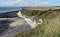
English: Flamborough is a village and civil parish in the East Riding of Yorkshire, England. It is situated approximately 4 miles (6.4 km) north east of Bridlington town centre on the prominent coastal feature of Flamborough Head.
Sottocategorie
Questa categoria contiene le 31 sottocategorie indicate di seguito, su un totale di 31.
B
- Breil Nook, Flamborough (18 F)
C
- Chatterthrow, Flamborough (5 F)
- Cradle Head, Flamborough (9 F)
D
E
F
- Flamborough Sword Dancers (3 F)
- Flamborough War Memorial (4 F)
H
L
N
P
- Public footpaths in Flamborough (80 F)
R
S
- Sanwick Brig, Flamborough (7 F)
- Sculptures in Flamborough (17 F)
- Selwicks Bay, Flamborough (69 F)
- Signs in Flamborough (58 F)
- Sport in Flamborough (7 F)
- Streets in Flamborough (20 F)
T
- Thornwick Bay, Flamborough (112 F)
V
- Views of Flamborough (15 F)
File nella categoria "Flamborough"
Questa categoria contiene 200 file, indicati di seguito, su un totale di 1 891.
(pagina precedente) (pagina successiva)-
 "Springflower" at North Landing - geograph.org.uk - 6114235.jpg 5 015 × 3 538; 2,78 MB
-
 20 pence for a close-up view - geograph.org.uk - 2894558.jpg 1 504 × 2 256; 1,18 MB
-
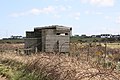
 2nd World War Pillbox - geograph.org.uk - 3243446.jpg 1 600 × 1 200; 598 KB
-
 A 'thrifty' spot on the cliff top - geograph.org.uk - 2989181.jpg 2 818 × 3 870; 2,47 MB
-

-
 A headland strip - geograph.org.uk - 5383132.jpg 640 × 426; 63 KB
-
 A lake near Thornwick Farm - geograph.org.uk - 5402800.jpg 640 × 426; 76 KB
-
 A large wheat field - geograph.org.uk - 1913684.jpg 640 × 430; 152 KB
-
 A line of trees - geograph.org.uk - 1914646.jpg 640 × 430; 125 KB
-
 A little band of puffins - geograph.org.uk - 3541196.jpg 778 × 1 024; 394 KB
-
 A path from Flamborough to the cliffs - geograph.org.uk - 2133648.jpg 800 × 600; 224 KB
-

-
 A prairie sized wheat field^ - geograph.org.uk - 1913694.jpg 640 × 430; 142 KB
-

-
 A robust pair of Northern marsh orchids - geograph.org.uk - 4022261.jpg 1 138 × 1 600; 997 KB
-
 A sea of caravans - geograph.org.uk - 2989169.jpg 3 990 × 2 000; 1,49 MB
-

-

-
 A very large wheat field - geograph.org.uk - 1914652.jpg 640 × 430; 137 KB
-
 A wave battered crab-lobster pot beached in Molk Hole - geograph.org.uk - 5065328.jpg 4 608 × 3 456; 7,35 MB
-
 Above the Arches - geograph.org.uk - 4506789.jpg 1 024 × 768; 183 KB
-
 Access Rd to Dane's Dyke Country Park - geograph.org.uk - 1914688.jpg 640 × 430; 182 KB
-
 Access road, Thornwick Holiday Centre - geograph.org.uk - 2608076.jpg 1 600 × 1 200; 247 KB
-
 Across Selwicks Bay to Molk Hole - geograph.org.uk - 5065422.jpg 4 604 × 3 450; 6,8 MB
-
 Air-Sea Rescue helicopter at work near Flamborough Head - geograph.org.uk - 3143463.jpg 4 320 × 3 240; 5,27 MB
-
 Allotments, Flamborough - geograph.org.uk - 3045812.jpg 640 × 480; 67 KB
-
 Along cliff tops at Breil Nook - geograph.org.uk - 2636014.jpg 1 306 × 979; 303 KB
-
 Along North Cliff from Thornwick Nab - geograph.org.uk - 2631526.jpg 1 306 × 979; 314 KB
-
 Along the cliff path at Stottle Bank Nook - geograph.org.uk - 2634674.jpg 1 306 × 979; 400 KB
-
 Along the Headland Way at East Nook - geograph.org.uk - 2600396.jpg 1 306 × 979; 400 KB
-
 An Inhospitable Beach - geograph.org.uk - 6116054.jpg 5 472 × 3 648; 3,41 MB
-
 Ankle breakers - geograph.org.uk - 3032377.jpg 1 024 × 706; 289 KB
-
 Antiques, Flamborough - geograph.org.uk - 5408783.jpg 640 × 426; 48 KB
-
 Antiques, Tower St - geograph.org.uk - 5391393.jpg 640 × 425; 64 KB
-
 Approaching Danes Dyke - geograph.org.uk - 5418459.jpg 640 × 426; 68 KB
-
 Approaching Flamborough Head - geograph.org.uk - 3159549.jpg 640 × 480; 46 KB
-
 Approaching fog-signal station, Flamborough Head, 1992 - geograph.org.uk - 4430855.jpg 2 369 × 1 408; 3,21 MB
-
 Approaching South Landing from the east - geograph.org.uk - 3742729.jpg 3 970 × 2 194; 5,65 MB
-
 Arable field at Brigg Bottom - geograph.org.uk - 5473388.jpg 2 000 × 1 500; 603 KB
-
 Arable field, North Moor - geograph.org.uk - 2214927.jpg 2 000 × 1 479; 675 KB
-
 Arable land, Beacon Hill - geograph.org.uk - 5409391.jpg 640 × 426; 68 KB
-
 Arch from High Stacks - geograph.org.uk - 3541186.jpg 1 600 × 1 071; 607 KB
-
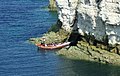
 Arch in the chalk sea cliffs at Selwicks Bay - geograph.org.uk - 4628206.jpg 2 872 × 3 906; 2,8 MB
-
 Arch on Flamborough Head - geograph.org.uk - 5137362.jpg 640 × 519; 117 KB
-
 Art^ East Nook - geograph.org.uk - 5386039.jpg 640 × 426; 95 KB
-
 At the crossroads, Flamborough - geograph.org.uk - 4632524.jpg 640 × 480; 74 KB
-
 Autumn sown crop and New Fall Plantation - geograph.org.uk - 5964665.jpg 1 024 × 768; 233 KB
-
 Avenue of Trees - geograph.org.uk - 424145.jpg 640 × 480; 150 KB
-
 B1255 - B1259 junction - geograph.org.uk - 5391391.jpg 640 × 426; 84 KB
-
 B1255 - geograph.org.uk - 5402812.jpg 640 × 426; 64 KB
-
 B1255 - geograph.org.uk - 5402814.jpg 640 × 426; 50 KB
-
 B1255 and B1259 junction - geograph.org.uk - 1914530.jpg 640 × 430; 161 KB
-
 B1255 Bridlington Road - geograph.org.uk - 5324729.jpg 2 864 × 1 744; 1,12 MB
-
 B1255 near Danes Dyke - geograph.org.uk - 4822404.jpg 640 × 480; 109 KB
-
 B1255 towards Bridlington - geograph.org.uk - 2619160.jpg 1 600 × 1 200; 223 KB
-
 B1255 towards Flamborough - geograph.org.uk - 2678114.jpg 1 024 × 565; 63 KB
-
 B1255, Flamborough - geograph.org.uk - 5402825.jpg 640 × 426; 67 KB
-
 B1255, Flamborough - geograph.org.uk - 5402828.jpg 640 × 426; 64 KB
-
 B1259 - geograph.org.uk - 5391458.jpg 640 × 426; 51 KB
-
 B1259 towards Flamborough Lighthouse - geograph.org.uk - 2678133.jpg 800 × 600; 96 KB
-
 Back on dry land - geograph.org.uk - 3412568.jpg 640 × 558; 143 KB
-
 Barley Field, South Cliff, Flamborough - geograph.org.uk - 4014547.jpg 1 400 × 1 050; 1,7 MB
-
 Barley, Headland Way, Yorkshire - geograph.org.uk - 4062720.jpg 800 × 534; 206 KB
-
 Barley, Headland Way, Yorkshire - geograph.org.uk - 4062722.jpg 1 024 × 683; 462 KB
-
 Barley, Headland Way, Yorkshire - geograph.org.uk - 4062725.jpg 1 024 × 683; 574 KB
-
 Barn off Bempton Lane (B1229) - geograph.org.uk - 6115805.jpg 800 × 600; 83 KB
-
 Barn on the edge of Flamborough - geograph.org.uk - 1914617.jpg 640 × 430; 145 KB
-
 Beach and cliffs at High Stacks - geograph.org.uk - 5966751.jpg 640 × 455; 80 KB
-
 Beach and cliffs east of Dykes End - geograph.org.uk - 5746405.jpg 1 024 × 768; 111 KB
-
 Beach at Dykes End - geograph.org.uk - 4051279.jpg 640 × 459; 78 KB
-
 Beach at low tide, South Landing - geograph.org.uk - 4681614.jpg 640 × 480; 48 KB
-
 Beach at South Landing - geograph.org.uk - 5383152.jpg 640 × 426; 83 KB
-
 Beach at South Landing - geograph.org.uk - 5473397.jpg 2 000 × 1 500; 472 KB
-
 Beach at Thornwick Bay - geograph.org.uk - 5968199.jpg 640 × 479; 77 KB
-
 Beach near Danes Dyke, E Yorks - geograph.org.uk - 4494741.jpg 640 × 458; 213 KB
-
 Beach, North Landing - geograph.org.uk - 6509212.jpg 768 × 1 024; 243 KB
-
 Beach, South Landing - geograph.org.uk - 5386042.jpg 640 × 426; 43 KB
-
 Beacon and lighthouse at Flamborough Head - geograph.org.uk - 6461383.jpg 1 199 × 1 799; 260 KB
-
 Beacon at Flamborough Head - geograph.org.uk - 5967059.jpg 640 × 400; 60 KB
-
 Beacon Farm - geograph.org.uk - 4100512.jpg 1 600 × 1 074; 525 KB
-
 Beacon Farm - geograph.org.uk - 5409383.jpg 640 × 426; 76 KB
-
 Beacon Farm, Flamborough - geograph.org.uk - 2213984.jpg 2 000 × 1 500; 711 KB
-
 Beacon Farmhouse - geograph.org.uk - 5409380.jpg 640 × 426; 105 KB
-
 Beacon Hill - geograph.org.uk - 1387692.jpg 640 × 480; 57 KB
-
 Beacon Hill - geograph.org.uk - 5409441.jpg 640 × 426; 59 KB
-
 Beacon Hill cliffs - geograph.org.uk - 5056458.jpg 1 298 × 877; 188 KB
-
 Beacon Hill, Flamborough - geograph.org.uk - 4021585.jpg 2 290 × 1 192; 598 KB
-
 Beacon, Flamborough - geograph.org.uk - 5391414.jpg 426 × 640; 36 KB
-
 Beacon, Flamborough Head - geograph.org.uk - 3159632.jpg 640 × 457; 28 KB
-
 Beacon, Flamborough Head - geograph.org.uk - 5373911.jpg 426 × 640; 43 KB
-
 Beacon, Flamborough Head, Yorkshire - geograph.org.uk - 4064624.jpg 1 024 × 683; 761 KB
-
 Beacon, Flamborough Head, Yorkshire - geograph.org.uk - 4064704.jpg 683 × 1 024; 621 KB
-
 Bee on Knapweed - geograph.org.uk - 4141955.jpg 773 × 1 024; 355 KB
-
 Beech Avenue - geograph.org.uk - 1913891.jpg 640 × 430; 129 KB
-
 Beech Avenue, Flamborough - geograph.org.uk - 2214853.jpg 2 000 × 1 500; 489 KB
-
 Bempton Cliffs at Dykes End - geograph.org.uk - 5969129.jpg 640 × 466; 99 KB
-
 Bempton Cliffs at Flamborough Head - geograph.org.uk - 5785508.jpg 800 × 679; 162 KB
-

-

-

-

-

-

-
 Bempton Lane cutting through Danes' Dyke - geograph.org.uk - 4507698.jpg 1 024 × 768; 188 KB
-
 Bempton Lane near Flamborough - geograph.org.uk - 5325334.jpg 1 600 × 1 064; 275 KB
-
 Bempton Road - geograph.org.uk - 5375586.jpg 640 × 427; 94 KB
-
 Bempton Road, Flamborough - geograph.org.uk - 2214002.jpg 2 000 × 1 403; 482 KB
-
 Bempton Road, Flamborough - geograph.org.uk - 2214012.jpg 2 000 × 1 500; 670 KB
-
 Bench and sculpture - geograph.org.uk - 5964740.jpg 1 024 × 768; 335 KB
-
 Bench mark alongside Lighthouse Road - geograph.org.uk - 2559245.jpg 480 × 640; 201 KB
-
 Bench mark on St Oswald's, Flamborough - geograph.org.uk - 2558457.jpg 480 × 640; 169 KB
-
 Bench with a view - geograph.org.uk - 2629107.jpg 1 600 × 1 132; 413 KB
-
 Bird hide, North Moor - geograph.org.uk - 3435514.jpg 800 × 533; 128 KB
-
 Bird watchers at Flamborough Head - geograph.org.uk - 5785386.jpg 800 × 710; 113 KB
-

-

-
 Boat entering caves, Thornwick Bay - geograph.org.uk - 4115344.jpg 1 190 × 754; 283 KB
-
 Boats, North Landing - geograph.org.uk - 5362461.jpg 640 × 426; 90 KB
-

-
 Boundary stone at Flamborough Head - geograph.org.uk - 2149378.jpg 1 627 × 2 000; 645 KB
-
 Breil Nook - geograph.org.uk - 5244720.jpg 640 × 480; 103 KB
-
 Breil Nook - geograph.org.uk - 5362522.jpg 640 × 426; 86 KB
-
 Breil Nook - geograph.org.uk - 5362533.jpg 640 × 426; 81 KB
-
 Breil Nook - geograph.org.uk - 5362629.jpg 640 × 426; 71 KB
-
 Breil Nook - geograph.org.uk - 5367095.jpg 640 × 426; 72 KB
-
 Breil Nook - geograph.org.uk - 6116009.jpg 5 079 × 3 150; 2,33 MB
-
 Breil Nook View, Flamborough - geograph.org.uk - 4010461.jpg 1 400 × 1 050; 1,45 MB
-
 Breil Nook Views, Flamborough - geograph.org.uk - 4010438.jpg 1 330 × 977; 1,4 MB
-
 Brick barn for sale, Tower St - geograph.org.uk - 1914527.jpg 640 × 430; 145 KB
-
 Bridge of whales^ - geograph.org.uk - 3744031.jpg 4 000 × 2 248; 7,77 MB
-
 Bridlington and Flamborough Head - geograph.org.uk - 860941.jpg 412 × 640; 65 KB
-
 Bridlington Bay - geograph.org.uk - 4141893.jpg 2 000 × 1 255; 772 KB
-
 Bridlington Road (B1255) - geograph.org.uk - 4455829.jpg 640 × 480; 106 KB
-
 Bridlington Road (B1255) towards Flamborough - geograph.org.uk - 2678119.jpg 1 600 × 930; 183 KB
-
 Bridlington Road Flamborough - geograph.org.uk - 4497669.jpg 1 024 × 770; 163 KB
-
 Bridlington Road, Flamborough - geograph.org.uk - 5618144.jpg 1 600 × 1 064; 516 KB
-
 Briel Nook - geograph.org.uk - 2204034.jpg 480 × 640; 73 KB
-
 Brig Bottom - geograph.org.uk - 5408096.jpg 640 × 427; 137 KB
-

-
 Bungalow on Lighthouse Road - geograph.org.uk - 3159602.jpg 640 × 439; 51 KB
-
 Bungalow on Lighthouse Road - geograph.org.uk - 3159630.jpg 640 × 418; 45 KB
-
 Bungalow on Lily Lane, Flamborough - geograph.org.uk - 4632484.jpg 640 × 480; 52 KB
-
 Bungalows with a view of Thornwick Bay - geograph.org.uk - 2133610.jpg 800 × 600; 199 KB
-
 Burned out cafe - geograph.org.uk - 2599262.jpg 1 600 × 1 200; 393 KB
-
 Bus Shelter on Crofts Hill - geograph.org.uk - 4325040.jpg 640 × 443; 93 KB
-
 Bus stop and pub signs, Flamborough - geograph.org.uk - 4632441.jpg 640 × 480; 68 KB
-

-

-
 Bus stop on Flamborough Road - geograph.org.uk - 4325039.jpg 640 × 480; 93 KB
-

-

-
 Bush by South Seas Rd - geograph.org.uk - 5386067.jpg 640 × 426; 95 KB
-
 Bushes in a sea of wheat - geograph.org.uk - 1913706.jpg 640 × 430; 143 KB
-
 Cafe and Bar, North Landing - geograph.org.uk - 2618961.jpg 1 600 × 948; 183 KB
-
 Cafe and car park at Thornwick - geograph.org.uk - 5485279.jpg 2 000 × 1 500; 267 KB
-
 Cafe and car park at Thornwick Bay - geograph.org.uk - 5485270.jpg 2 000 × 1 500; 339 KB
-
 Cafe and car park entrance, South Landing, Flamborough - geograph.org.uk - 5473394.jpg 2 000 × 1 500; 456 KB
-
 Café at Thornwick Bay - geograph.org.uk - 5968270.jpg 640 × 435; 96 KB
-

-
 Car park, South Landing - geograph.org.uk - 5386053.jpg 640 × 426; 61 KB
-
 Car park, Thornwick Bay - geograph.org.uk - 5362426.jpg 640 × 426; 51 KB
-
 Caravan park at Thornwick - geograph.org.uk - 5499675.jpg 2 000 × 1 500; 365 KB
-
 Caravan park near Danes Dyke - geograph.org.uk - 4455834.jpg 640 × 382; 72 KB
-
 Caravan site - geograph.org.uk - 3159392.jpg 640 × 480; 61 KB
-
 Caravan Site and Thornwick Farm - geograph.org.uk - 2761241.jpg 3 264 × 2 448; 1,37 MB
-
 Caravan site at Flamborough, East Riding of Yorkshire, England.jpg 640 × 480; 84 KB
-
 Caravan site at Thornwick Bay, Flamborough - geograph.org.uk - 5617457.jpg 1 600 × 1 064; 806 KB
-
 Caravan site, Beacon Farm, Flamborough - geograph.org.uk - 2580135.jpg 1 600 × 1 200; 331 KB
-
 Caravans, Thornwick Holiday Park - geograph.org.uk - 1913700.jpg 640 × 430; 111 KB
-
 Carol Sandra and North Wind Memorial - geograph.org.uk - 5391432.jpg 640 × 426; 94 KB
-
 Carr Farmhouse - geograph.org.uk - 5408859.jpg 640 × 426; 46 KB
-
 Carter Lane - geograph.org.uk - 5391429.jpg 640 × 426; 58 KB
-
 Carter Lane, Flamborough - geograph.org.uk - 2891375.jpg 1 024 × 633; 241 KB
-
 Castle ruins, Flamborough - geograph.org.uk - 4100501.jpg 1 024 × 728; 247 KB
-
 Caterpillar of a Garden Tiger Moth - geograph.org.uk - 3031094.jpg 828 × 1 024; 220 KB
-
 Cattlemere Scar - geograph.org.uk - 5377428.jpg 640 × 426; 128 KB
-
 Cave forming - geograph.org.uk - 3030723.jpg 1 024 × 768; 410 KB
-
 Caves and cliffs - geograph.org.uk - 2989174.jpg 4 000 × 3 000; 2,31 MB
-
 Caves at the base of the chalk cliffs - geograph.org.uk - 3031198.jpg 1 024 × 651; 328 KB
-
 Caves on Thornwick Nab - geograph.org.uk - 5244691.jpg 640 × 480; 73 KB
-
 Caves ^ Cliffs - geograph.org.uk - 3868299.jpg 1 188 × 1 400; 1,78 MB
-

-
 Centre of Flamborough - geograph.org.uk - 5391408.jpg 640 × 426; 105 KB
-
 Chalk cliff - geograph.org.uk - 5367100.jpg 640 × 426; 75 KB
-
 Chalk cliff topped with boulder clay - geograph.org.uk - 3031172.jpg 1 024 × 759; 333 KB
-
 Chalk cliff, Cough Hole - geograph.org.uk - 3541208.jpg 1 600 × 1 204; 788 KB
-
 Chalk cliff, North Landing - geograph.org.uk - 4509712.jpg 1 024 × 768; 268 KB
-
 Chalk Cliffs - geograph.org.uk - 5022017.jpg 640 × 427; 358 KB
-
 Chalk cliffs - geograph.org.uk - 5362432.jpg 640 × 426; 61 KB
-
 Chalk cliffs - geograph.org.uk - 5362440.jpg 640 × 426; 57 KB
-
 Chalk cliffs - geograph.org.uk - 5362500.jpg 640 × 426; 84 KB
-
 Chalk cliffs - geograph.org.uk - 5362503.jpg 426 × 640; 85 KB
-
 Chalk cliffs - geograph.org.uk - 5362508.jpg 640 × 426; 70 KB
-
 Chalk cliffs - geograph.org.uk - 5362510.jpg 426 × 640; 104 KB
-
 Chalk cliffs - geograph.org.uk - 5362512.jpg 640 × 426; 84 KB
-
 Chalk cliffs - geograph.org.uk - 5362515.jpg 640 × 426; 90 KB
-
 Chalk cliffs - geograph.org.uk - 5362517.jpg 640 × 426; 94 KB
-
 Chalk cliffs - geograph.org.uk - 5400562.jpg 426 × 640; 75 KB
-
 Chalk cliffs - geograph.org.uk - 5402738.jpg 426 × 640; 73 KB
-
 Chalk cliffs at Flamborough Head - geograph.org.uk - 2894580.jpg 1 128 × 752; 329 KB


_-_geograph.org.uk_-_6115805.jpg)


_approaching_crest_-_geograph.org.uk_-_3045781.jpg)
_towards_Flamborough_-_geograph.org.uk_-_3045774.jpg)
_towards_Flamborough_-_geograph.org.uk_-_3045775.jpg)
_towards_Flamborough_-_geograph.org.uk_-_3045777.jpg)
_towards_Flamborough_-_geograph.org.uk_-_3045778.jpg)
_towards_Flamborough_-_geograph.org.uk_-_3045782.jpg)


_-_geograph.org.uk_-_4455829.jpg)
_towards_Flamborough_-_geograph.org.uk_-_2678119.jpg)


