Category:Floodplains
Vai alla navigazione
Vai alla ricerca
spazio piano compreso tra la riva di un corso d'acqua ed il suo argine | |||||
| Carica un file multimediale | |||||
| Audio della pronuncia | |||||
|---|---|---|---|---|---|
| Sottoclasse di |
| ||||
| Distinto da | |||||
| |||||
Deutsch: Aue, Flussaue oder Flussniederung, auch Überschwemmungsebene. Hingegen versteht man unter Überschwemmungsgebiet normalerweise ein akut unter Wasser stehendes Gebiet.
English: Floodplain or flood plain
Español: Terreno inundable
Nederlands: Riviervlakten
Sottocategorie
Questa categoria contiene le 14 sottocategorie indicate di seguito, su un totale di 14.
File nella categoria "Floodplains"
Questa categoria contiene 97 file, indicati di seguito, su un totale di 97.
-
A series of paired river terraces plainsvg.svg 1 904 × 2 165; 75 KB
-
A series of paired river terraces.jpg 2 456 × 2 344; 639 KB
-
Aerial photography of river in green hills.jpg 2 100 × 1 397; 387 KB
-
Angzam tmo 2010117 lrg 01.jpg 6 144 × 6 372; 7,52 MB
-
Angzam tmo 2010117 lrg 02.jpg 720 × 480; 235 KB
-
Avon valley floodplain north of Downton - geograph.org.uk - 160422.jpg 640 × 480; 133 KB
-
Breggia (Hochwasser)-2.webm 3,9 s, 1 080 × 1 920; 9,52 MB
-
Breggia (Hochwasser).webm 8,1 s, 1 920 × 1 080; 31,86 MB
-
Conon floodplain - geograph.org.uk - 227803.jpg 640 × 350; 56 KB
-
Cyclone Nargis flooding before-and-after.jpg 540 × 712; 137 KB
-
Dallas Texas skyline overlooking the Trinity River in spring 2024 Full Resolution.jpg 24 439 × 6 087; 75,28 MB
-
Earn Floodplain - geograph.org.uk - 159198.jpg 640 × 480; 73 KB
-
Eucalyptus coolabah on floodplain, Rockhampton, Queensland.jpg 1 642 × 2 395; 2,04 MB
-
Farmland on Floodplain - geograph.org.uk - 136771.jpg 640 × 426; 58 KB
-
Fields from the Cobb Bridge at Paducah.jpg 2 816 × 1 584; 920 KB
-
Fisheries Habitat Projects in the Pacific Region (4931597403).jpg 720 × 540; 542 KB
-
Fiumara Precariti.jpg 2 816 × 2 112; 692 KB
-
Flickr - Nicholas T - Field of View.jpg 2 816 × 2 112; 3,73 MB
-
Flickr - Nicholas T - Floodplain (1).jpg 2 816 × 2 112; 6,23 MB
-
Flickr - Nicholas T - Floodplain.jpg 2 816 × 1 695; 4,63 MB
-
Flood Plain of the River Seaton - geograph.org.uk - 171769.jpg 640 × 427; 96 KB
-
Floodplain Auenlandschaft Sense Sodbach 1.jpg 4 224 × 3 168; 5,26 MB
-
Floodplain Auenlandschaft Sense Sodbach 23.jpg 4 224 × 3 168; 5,25 MB
-
Floodplain cs.svg 596 × 391; 186 KB
-
Floodplain fields - geograph.org.uk - 86500.jpg 640 × 480; 57 KB
-
Floodplain of R Spey - geograph.org.uk - 60766.jpg 640 × 479; 123 KB
-
Floodplain of River Dee. - geograph.org.uk - 15427.jpg 640 × 480; 86 KB
-
Floodplain of the River Wear - geograph.org.uk - 148386.jpg 640 × 480; 80 KB
-
Floodplain, small-scale 2.jpg 4 032 × 3 024; 4,51 MB
-
Floodplain, small-scale 3.jpg 4 032 × 3 024; 5,68 MB
-
Floodplain, small-scale.jpg 4 032 × 3 024; 5,88 MB
-
Floodplains at Ubirr, Kakadu National Park.jpg 4 608 × 2 592; 1,92 MB
-
Gorges du rhummel 00const01 (2).jpg 1 536 × 2 048; 1,01 MB
-
Herbstein Talauen bei Herbstein SCI 555520799 Winter Floodplain N.png 2 604 × 1 738; 7,31 MB
-
Hoanib Floodplain.jpg 1 024 × 682; 292 KB
-
Hunzigenau Rubigen.jpg 4 224 × 3 168; 5,76 MB
-
ICHoiAnMySon10.jpg 2 594 × 1 675; 1,33 MB
-
ICPhuYen02.jpg 3 280 × 2 170; 1,5 MB
-
ICPhuYen03.jpg 3 280 × 2 170; 2,28 MB
-
Indeauen1.jpg 1 317 × 859; 92 KB
-
Johnson grass covering floodplain sorghum halepense.jpg 2 900 × 2 175; 564 KB
-
Junction of the Yukon and Koyukuk Rivers, Alaska.jpg 3 177 × 2 706; 5,96 MB
-
Kolongal Jaaw (Jaaw floodplain).jpg 3 072 × 2 304; 1,45 MB
-
Langel Aue im Winter-CN.jpg 2 900 × 2 008; 8,14 MB
-
Lauf der Stekendammsau.jpg 3 648 × 2 736; 2,41 MB
-
Looking across the floodplain of the River Balvag.jpg 640 × 480; 87 KB
-
Makuleke1.JPG 2 048 × 1 536; 563 KB
-
Meander-Cuckmere River-MT.JPG 2 006 × 1 307; 937 KB
-
Muara sungai Citarum.jpg 2 924 × 1 908; 2,93 MB
-
Nant-y-Gwryd's Floodplain - geograph.org.uk - 218567.jpg 640 × 480; 74 KB
-
Nivka River and Bilychee-Wood in Kyiv.jpg 22 441 × 4 597; 39,39 MB
-
North Limb Como Anticline.jpg 3 701 × 2 512; 7,12 MB
-
Ouse floodplain - geograph.org.uk - 123520.jpg 640 × 479; 126 KB
-
Overbank-Price River.jpg 17 429 × 3 628; 51,84 MB
-
Paraná River Floodplain, Northern Argentina.jpg 4 288 × 2 850; 3,8 MB
-
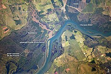
Paraná River Floodplain.jpg 720 × 480; 179 KB
-
PetalumaRiverFloodplain.jpg 4 000 × 2 250; 2,59 MB
-
Pine Creek Valley (14599306192).jpg 5 184 × 3 456; 12,61 MB
-
Planina Postojna Slovenia - flooded plain.JPG 2 509 × 1 741; 1,36 MB
-
Pustopolje-poplavnaravnica.JPG 4 000 × 3 000; 4,59 MB
-
Queensland State Archives 3288 Coolibah Bundaleer c 1910.png 552 × 720; 353 KB
-
Receding glacier-en.svg 1 200 × 562; 260 KB
-
Red cedar floodplain.jpg 250 × 188; 51 KB
-
RedRiverMeandersArkansas1.jpg 3 055 × 3 580; 5,09 MB
-
RedRockRiverMontana.jpg 4 036 × 2 423; 1,14 MB
-
Rio Negro Floodplain, Patagonia, Argentina 2010-01-04 lrg.jpg 1 440 × 960; 833 KB
-
Rio Negro Floodplain, Patagonia, Argentina 2010-01-04.jpg 720 × 480; 162 KB
-
RioPastaza.jpg 2 816 × 2 112; 2,84 MB
-
River Severn flood plain - geograph.org.uk - 574091.jpg 640 × 408; 62 KB
-
Ruigte in de Bemmelse uiterwaarden.jpg 4 032 × 3 024; 15,75 MB
-
Stekendammsau.jpg 3 648 × 2 736; 3,72 MB
-
The Thames floodplain, Shiplake - geograph.org.uk - 510647.jpg 640 × 480; 139 KB
-
Timia Valley Floor.JPG 1 024 × 768; 494 KB
-
Traisenau bei Getzersdorf.jpg 4 928 × 3 264; 5,67 MB
-
Uren Flood plain of Usta River.JPG 1 920 × 2 560; 1,93 MB
-
Valle di Muggio, after the 2021 floods 01.jpg 4 032 × 3 024; 5,81 MB
-
Valle di Muggio, after the 2021 floods 09.jpg 4 032 × 3 024; 7,37 MB
-
Valle di Muggio, after the 2021 floods 10.jpg 16 358 × 3 628; 20,03 MB
-
Valle di Muggio, after the 2021 floods 11.jpg 4 032 × 3 024; 6,04 MB
-
Valle di Muggio, after the 2021 floods 12.jpg 3 024 × 4 032; 6,48 MB
-
Valle di Muggio, after the 2021 floods 13.jpg 3 024 × 4 032; 5,71 MB
-
Valle di Muggio, after the 2021 floods 14.jpg 16 382 × 3 628; 18,12 MB
-
Valle di Muggio, after the 2021 floods 15.jpg 4 032 × 3 024; 6,51 MB
-
View of the Trinity River and its floodplain in Dallas Texas May 2024.png 11 683 × 4 805; 68,53 MB
-
Village at Nyimba on the Kafue floodplain in Zambia 1969.jpg 4 928 × 3 264; 5,79 MB
-
Wien Toter Grund.jpg 3 000 × 2 240; 1,78 MB
-
Zambezi Barotse floodplain.jpg 396 × 700; 61 KB
-
Природний біоценоз заплавних лук.jpg 1 200 × 900; 349 KB
-
ივრის ჭალა (G.N. 2009).jpg 3 264 × 2 448; 2,85 MB
-
მდინარე ლოპოტის ჭალა.jpg 2 592 × 1 456; 921 KB


