Category:Forrabury and Minster
Aller à la navigation
Aller à la recherche
English: Forrabury and Minster is a civil parish on the north coast of Cornwall. The parish was originally divided between the coastal parish of Forrabury and inland parish of Minster until they were united in 1779.
village britannique  | |||||
| Téléverser des médias | |||||
| Nature de l’élément | |||||
|---|---|---|---|---|---|
| Lieu | Cornouailles, Angleterre du Sud-Ouest, Angleterre | ||||
 | |||||
Sous-catégories
Cette catégorie comprend 4 sous-catégories, dont les 4 ci-dessous.
Média dans la catégorie « Forrabury and Minster »
Cette catégorie comprend 204 fichiers, dont les 200 ci-dessous.
(page précédente) (page suivante)-
 A glimpse of Home Farm, Boscastle - geograph.org.uk - 3039504.jpg 1 600 × 1 064 ; 390 kio
-
 A quiet Cornish lane in the bright sunlight - geograph.org.uk - 4152907.jpg 640 × 480 ; 139 kio
-
 B3263 near Tresuck - geograph.org.uk - 5722672.jpg 4 238 × 2 327 ; 1,22 Mio
-
 B3266, Boscastle (geograph 7058312).jpg 4 047 × 2 522 ; 1,52 Mio
-
 Bank on Waterpit Down - geograph.org.uk - 730643.jpg 640 × 480 ; 94 kio
-
 Boat seat - geograph.org.uk - 5613815.jpg 1 000 × 662 ; 745 kio
-
 Boscastle , Climbing the Cliffs - geograph.org.uk - 2491335.jpg 4 288 × 2 848 ; 6,73 Mio
-
 Boscastle , Crab Cages - geograph.org.uk - 2491330.jpg 4 288 × 2 848 ; 6,53 Mio
-
 Boscastle , Tintagel Road - geograph.org.uk - 2491372.jpg 4 210 × 2 726 ; 4,48 Mio
-
 Boscastle - geograph.org.uk - 2911949.jpg 640 × 480 ; 96 kio
-
 Boscastle Busker - geograph.org.uk - 5790892.jpg 1 024 × 770 ; 220 kio
-
 Boscastle car park - geograph.org.uk - 3416842.jpg 640 × 480 ; 57 kio
-
 Boscastle CP Primary School - geograph.org.uk - 2033972.jpg 896 × 672 ; 190 kio
-
 Boscastle filling station - geograph.org.uk - 3027747.jpg 1 600 × 1 064 ; 362 kio
-
 Boscastle from above - geograph.org.uk - 2031552.jpg 742 × 557 ; 198 kio
-
 Boscastle from Penally Hill - geograph.org.uk - 1566735.jpg 640 × 480 ; 103 kio
-
 Boscastle from the coast path - geograph.org.uk - 3813704.jpg 1 056 × 793 ; 1,03 Mio
-
 Boscastle from the coast path - geograph.org.uk - 3813720.jpg 1 056 × 793 ; 906 kio
-
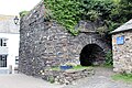
 Boscastle Lime Kiln - geograph.org.uk - 6010141.jpg 640 × 480 ; 216 kio
-
 Boscastle Newsagents - geograph.org.uk - 3067855.jpg 1 600 × 1 064 ; 285 kio
-

-
 Boscastle on the north coast of Cornwall - arial image (29959338325).jpg 2 200 × 1 457 ; 1,19 Mio
-
 Boscastle Village - geograph.org.uk - 4037590.jpg 1 556 × 894 ; 1,14 Mio
-
 Boscastle Village Hall - geograph.org.uk - 2033981.jpg 768 × 576 ; 189 kio
-
 Boscastle War Memorial - geograph.org.uk - 2033962.jpg 557 × 742 ; 199 kio
-
 Boscastle YHA and footbridge across the River Valency - geograph.org.uk - 6121388.jpg 4 966 × 2 793 ; 3,26 Mio
-
 Boscastle Youth Hostel - geograph.org.uk - 2032611.jpg 768 × 576 ; 190 kio
-
 Boscastle Youth Hostel - geograph.org.uk - 3051163.jpg 1 600 × 1 064 ; 583 kio
-
 Boscastle, a jagged edge - geograph.org.uk - 1466320.jpg 480 × 640 ; 91 kio
-

-
 Boscastle, looking down the River Valency - geograph.org.uk - 1466255.jpg 640 × 480 ; 89 kio
-

-
 Boscastle, October 1983 - geograph.org.uk - 2852545.jpg 848 × 577 ; 122 kio
-
 Boscastle, Penally Hill - geograph.org.uk - 1466317.jpg 640 × 480 ; 98 kio
-
 Boscastle, phone box and postbox - geograph.org.uk - 1466516.jpg 640 × 480 ; 101 kio
-
 Boscastle, the Cobweb Inn - geograph.org.uk - 1466522.jpg 640 × 480 ; 96 kio
-
 Boscastle, the Harbour Lights - geograph.org.uk - 1466506.jpg 640 × 480 ; 99 kio
-
 Boscastle, the new bridge - geograph.org.uk - 1466268.jpg 640 × 480 ; 90 kio
-
 Boscastle, the Old Manor House - geograph.org.uk - 1466520.jpg 480 × 640 ; 93 kio
-
 Boscastle, the village from Penally Point - geograph.org.uk - 1466309.jpg 640 × 480 ; 87 kio
-
 Boscastle, the visitor centre - geograph.org.uk - 1466510.jpg 640 × 480 ; 94 kio
-
 Boscastle, the Wellington Hotel - geograph.org.uk - 1466519.jpg 640 × 480 ; 77 kio
-
 Boscastle, view upriver from Penally Point - geograph.org.uk - 1466288.jpg 480 × 640 ; 81 kio
-
 Boscastle, white cottages - geograph.org.uk - 1466324.jpg 480 × 640 ; 70 kio
-
 Boscastle-The Cobweb Inn - geograph.org.uk - 4725552.jpg 1 600 × 1 200 ; 632 kio
-
 Boscastle-The Wellington Hotel - geograph.org.uk - 4725560.jpg 1 600 × 1 200 ; 494 kio
-
 Bridge House tea rooms, Boscastle - geograph.org.uk - 4171974.jpg 640 × 425 ; 97 kio
-
 Bridge over the River Valency - geograph.org.uk - 1516566.jpg 640 × 427 ; 77 kio
-
 Bridge over the River Valency, Boscastle - geograph.org.uk - 4171977.jpg 640 × 425 ; 97 kio
-
 Bridge over the Valency - Boscastle, Cornwall - geograph.org.uk - 4186970.jpg 1 760 × 1 188 ; 854 kio
-
 Bridge, Boscastle (geograph 7048843).jpg 4 154 × 2 618 ; 2,06 Mio
-
 By Boscastle Bridge - Boscastle, Cornwall - geograph.org.uk - 5341041.jpg 640 × 429 ; 76 kio
-
 California Quarry - geograph.org.uk - 5612775.jpg 1 000 × 662 ; 944 kio
-
 California Quarry - geograph.org.uk - 5612776.jpg 1 000 × 662 ; 804 kio
-
 Camelford Station house now a private dwelling - geograph.org.uk - 1879313.jpg 800 × 533 ; 127 kio
-
 Car park at Boscastle - geograph.org.uk - 1861909.jpg 640 × 480 ; 189 kio
-
 Cattle in the Fields nr Trekeek - geograph.org.uk - 1888568.jpg 640 × 427 ; 71 kio
-
 Cliffs south of Western Blackapit - geograph.org.uk - 4527723.jpg 1 229 × 1 843 ; 880 kio
-
 Coast viewed from Penally Hill - geograph.org.uk - 1566732.jpg 640 × 480 ; 71 kio
-
 Coastal path North East of Boscastle - geograph.org.uk - 4353310.jpg 800 × 451 ; 106 kio
-
 Coastal views near Boscastle - geograph.org.uk - 4152924.jpg 640 × 480 ; 139 kio
-
 Coastguard lookout on Willapark headland - geograph.org.uk - 2275646.jpg 3 072 × 2 304 ; 2,32 Mio
-
 Coastguard lookout, Boscastle - geograph.org.uk - 3051702.jpg 1 600 × 1 064 ; 200 kio
-
 Coastline at Grower Rock - geograph.org.uk - 3563582.jpg 640 × 475 ; 82 kio
-
 Cobbled lane, Boscastle - geograph.org.uk - 5075889.jpg 1 024 × 768 ; 214 kio
-
 Colours in the sea, Boscastle - geograph.org.uk - 1325114.jpg 640 × 480 ; 112 kio
-
 Confluence of stream with River Valency - geograph.org.uk - 3736682.jpg 1 064 × 1 600 ; 805 kio
-
 Convoluted slate, Boscastle - geograph.org.uk - 1325030.jpg 640 × 480 ; 138 kio
-
 Cornish cottage - geograph.org.uk - 3039511.jpg 1 600 × 1 064 ; 399 kio
-
 Cornish cul-de-sac - Boscastle, Cornwall - geograph.org.uk - 4186951.jpg 1 760 × 1 188 ; 1,46 Mio
-
 Cottage at the corner, Fore Street, Boscastle - geograph.org.uk - 3034026.jpg 1 449 × 1 600 ; 537 kio
-
 Cottage, Fore Street, Boscastle - geograph.org.uk - 3261820.jpg 1 600 × 1 064 ; 400 kio
-
 Cottages and a boat, Boscastle, October 1983 - geograph.org.uk - 2852567.jpg 865 × 576 ; 135 kio
-
 Cottages at Boscastle, Cornwall. - geograph.org.uk - 917091.jpg 640 × 604 ; 72 kio
-
 Cottages Boscastle - geograph.org.uk - 3813733.jpg 1 056 × 793 ; 860 kio
-
 Cottages in Boscastle - geograph.org.uk - 1653369.jpg 640 × 480 ; 77 kio
-
 Cottages in Boscastle - geograph.org.uk - 1870968.jpg 640 × 480 ; 177 kio
-
 Cottages in Dunn Street, Boscastle - geograph.org.uk - 3894805.jpg 1 024 × 716 ; 241 kio
-
 Cottages Valency Row - Boscastle - geograph.org.uk - 5728792.jpg 1 024 × 768 ; 248 kio
-
 Cottages, Boscastle - geograph.org.uk - 4171981.jpg 640 × 425 ; 80 kio
-
 Cottages, Boscastle - geograph.org.uk - 5075897.jpg 1 024 × 774 ; 210 kio
-
 Dark Green Fritillary (^) in Boscastle - geograph.org.uk - 2033939.jpg 896 × 672 ; 178 kio
-
 Doctors Hill, Boscastle (geograph 7047970).jpg 3 919 × 2 053 ; 766 kio
-
 Ducks in Jordan Valley, Boscastle - geograph.org.uk - 2269671.jpg 3 264 × 2 448 ; 2,9 Mio
-
 Dunn Street, Boscastle (geograph 6848253).jpg 4 288 × 2 848 ; 2,44 Mio
-
 Eastern Blackapit - geograph.org.uk - 2032645.jpg 717 × 538 ; 207 kio
-

-
 Farm vehicles at New Farm - geograph.org.uk - 4152909.jpg 640 × 480 ; 134 kio
-
 Field and boundary near Beeny - geograph.org.uk - 5722695.jpg 4 062 × 2 562 ; 1,41 Mio
-
 Field system at Forrabury Common - geograph.org.uk - 2032640.jpg 896 × 672 ; 194 kio
-
 Field system near Forrabury - geograph.org.uk - 1885988.jpg 2 288 × 1 712 ; 800 kio
-
 Five-way junction... - geograph.org.uk - 3051106.jpg 1 600 × 1 064 ; 316 kio
-
 Flood damage - geograph.org.uk - 401617.jpg 640 × 480 ; 144 kio
-
 Footbridge over the River Valency - geograph.org.uk - 1516580.jpg 640 × 415 ; 100 kio
-
 Footpath by River Valency - geograph.org.uk - 5754355.jpg 1 200 × 1 600 ; 730 kio
-
 Footpath by Valency in Minster Wood - geograph.org.uk - 5757476.jpg 1 200 × 1 600 ; 799 kio
-
 Former chapel - geograph.org.uk - 4709894.jpg 722 × 512 ; 80 kio
-
 Former chapel at Melorne - geograph.org.uk - 5761644.jpg 1 600 × 1 066 ; 756 kio
-

-
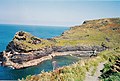
 Forrabury and Minster - Boscastle pier - geograph.org.uk - 93967.jpg 640 × 424 ; 167 kio
-
 Geological waymark - Boscastle, Cornwall - geograph.org.uk - 4187004.jpg 1 776 × 1 196 ; 1,56 Mio
-
 Grassy slopes above the Jordan Valley near Boscastle - geograph.org.uk - 3890802.jpg 1 024 × 528 ; 113 kio
-
 Grower Gut - geograph.org.uk - 4527181.jpg 2 119 × 3 178 ; 1,88 Mio
-
 Growers Rock - geograph.org.uk - 5562700.jpg 526 × 811 ; 191 kio
-
 Harbour Lights cafe - geograph.org.uk - 5075942.jpg 1 024 × 801 ; 202 kio
-
 Heather on Penally Hill - geograph.org.uk - 1516593.jpg 640 × 427 ; 156 kio
-
 Houses on Dunn Street, Boscastle (geograph 6848076).jpg 4 288 × 2 848 ; 2,85 Mio
-
 Hut by the inner breakwater, Boscastle Harbour - geograph.org.uk - 1325074.jpg 640 × 480 ; 119 kio
-
 In Boscastle - geograph.org.uk - 4197390.jpg 4 000 × 2 664 ; 5,32 Mio
-
 Lane and wind turbines - geograph.org.uk - 4152899.jpg 640 × 480 ; 110 kio
-
 Lane south of Beeny - geograph.org.uk - 5722703.jpg 640 × 392 ; 103 kio
-
 Lane with wind turbines on the horizon - geograph.org.uk - 4152904.jpg 640 × 480 ; 127 kio
-
 Lime kiln by the river in Boscastle - geograph.org.uk - 5757470.jpg 1 600 × 1 200 ; 734 kio
-
 Limekiln, The Harbour, Boscastle - geograph.org.uk - 6210184.jpg 4 928 × 3 284 ; 4,98 Mio
-
 Listed cottage, Dunn Street (geograph 6848179).jpg 4 128 × 2 538 ; 1,32 Mio
-
 Looking back at Boscastle - geograph.org.uk - 3051154.jpg 1 600 × 1 064 ; 586 kio
-

-
 Looking towards Condolden Farm - geograph.org.uk - 495375.jpg 640 × 480 ; 232 kio
-
 Looking up Penally Hill - geograph.org.uk - 1516587.jpg 640 × 427 ; 110 kio
-

-
 Lookout - geograph.org.uk - 5612363.jpg 1 000 × 662 ; 579 kio
-
 Lower Bridge at Boscastle - geograph.org.uk - 6121354.jpg 2 406 × 1 353 ; 2,71 Mio
-
 Lower Pennycrocker Farm caravan site - geograph.org.uk - 437351.jpg 640 × 337 ; 57 kio
-
 LSWR former North Cornwall railway - geograph.org.uk - 1888544.jpg 640 × 423 ; 93 kio
-
 LSWR former North Cornwall Railway - geograph.org.uk - 1888554.jpg 640 × 448 ; 78 kio
-
 LSWR North Cornwall line railbridge - geograph.org.uk - 1887157.jpg 640 × 427 ; 93 kio
-
 Marine Terrace Cottages - geograph.org.uk - 1470137.jpg 640 × 480 ; 141 kio
-
 Marine Terrace, Boscastle (geograph 6848046).jpg 3 866 × 2 705 ; 1,58 Mio
-
 Methodist Church, Fore Street - geograph.org.uk - 2033977.jpg 742 × 557 ; 194 kio
-
 Mt Pleasant, Boscastle - geograph.org.uk - 3029559.jpg 1 600 × 1 064 ; 453 kio
-
 Old Milestone by the A39, near Starapark - geograph.org.uk - 5623351.jpg 435 × 640 ; 125 kio
-
 Paradise Road, Boscastle - geograph.org.uk - 5757480.jpg 1 600 × 1 200 ; 672 kio
-
 Path to join the Coast Path - geograph.org.uk - 5652044.jpg 640 × 480 ; 77 kio
-
 Path to the mouth - Boscastle, Cornwall - geograph.org.uk - 4186995.jpg 1 772 × 1 184 ; 1,38 Mio
-
 Peacock butterfly beside the SW Coast Path - geograph.org.uk - 2033917.jpg 973 × 730 ; 164 kio
-
 Penally Hill - geograph.org.uk - 3813677.jpg 1 056 × 793 ; 885 kio
-
 Penally Hill - geograph.org.uk - 5580609.jpg 640 × 427 ; 219 kio
-
 Penally Point - geograph.org.uk - 4527747.jpg 2 756 × 1 837 ; 1,08 Mio
-
 Penally Point - geograph.org.uk - 5612349.jpg 1 000 × 662 ; 801 kio
-
 Penally Point - geograph.org.uk - 5612787.jpg 1 000 × 662 ; 861 kio
-
 Penally Point and Meachard - geograph.org.uk - 5613827.jpg 1 000 × 662 ; 668 kio
-
 Penally Point and Meachard - geograph.org.uk - 5614145.jpg 1 000 × 662 ; 758 kio
-
 Penally Terrace - geograph.org.uk - 2554092.jpg 3 567 × 2 627 ; 1,84 Mio
-
 Penally Terrace, Boscastle (geograph 7049706).jpg 4 288 × 2 848 ; 1,76 Mio
-
 Pentargon - geograph.org.uk - 2911967.jpg 640 × 480 ; 80 kio
-
 Pentargon - geograph.org.uk - 2911973.jpg 640 × 480 ; 90 kio
-
 Polqueens, B3263, New Road, Boscastle - geograph.org.uk - 6210126.jpg 5 184 × 3 456 ; 3,01 Mio
-
 Red Admirals in Boscastle - geograph.org.uk - 2033946.jpg 653 × 870 ; 207 kio
-
 River at Boscastle - geograph.org.uk - 1870966.jpg 640 × 480 ; 181 kio
-
 River Valency - geograph.org.uk - 5075913.jpg 1 024 × 768 ; 243 kio
-
 River Valency - geograph.org.uk - 5580621.jpg 640 × 427 ; 243 kio
-
 River Valency - geograph.org.uk - 5614212.jpg 1 000 × 662 ; 754 kio
-
 River Valency at Boscastle (geograph 7049010).jpg 4 288 × 2 848 ; 1,23 Mio
-
 River Valency at Boscastle - geograph.org.uk - 6160962.jpg 600 × 800 ; 551 kio
-
 Road junction and wind turbine - geograph.org.uk - 4152894.jpg 640 × 480 ; 133 kio
-
 Rock formations - geograph.org.uk - 1095370.jpg 640 × 480 ; 101 kio
-
 See almost to the sea - Boscastle, Cornwall - geograph.org.uk - 4186839.jpg 1 756 × 1 196 ; 1,33 Mio
-
 Sign for Boscastle - geograph.org.uk - 5672190.jpg 4 288 × 2 658 ; 1,54 Mio
-
 Slate folding (close up) - geograph.org.uk - 3068326.jpg 1 258 × 1 600 ; 609 kio
-
 South Harbour Pier - geograph.org.uk - 5614586.jpg 1 000 × 662 ; 739 kio
-
 South West Coast Path - geograph.org.uk - 5612769.jpg 662 × 1 000 ; 928 kio
-
 South West Coast Path - geograph.org.uk - 5612772.jpg 662 × 1 000 ; 935 kio
-
 Steep lane down into Boscastle - geograph.org.uk - 4152926.jpg 640 × 480 ; 211 kio
-
 Stitches at Forrabury Common - geograph.org.uk - 3890805.jpg 1 024 × 577 ; 201 kio
-
 Strip field at Forraby - geograph.org.uk - 1324926.jpg 640 × 462 ; 113 kio
-
 The Arthurian Centre, Slaughterbridge - geograph.org.uk - 3556349.jpg 640 × 480 ; 105 kio
-
 The B 3263 - geograph.org.uk - 4197434.jpg 4 000 × 2 664 ; 5,33 Mio
-
 The B3263 - geograph.org.uk - 4197379.jpg 4 000 × 2 664 ; 4,84 Mio
-
 The B3266 - geograph.org.uk - 4197411.jpg 2 340 × 1 524 ; 1,84 Mio
-
 The B3266 - geograph.org.uk - 4197418.jpg 4 000 × 2 664 ; 3,99 Mio
-
 The B3266 - geograph.org.uk - 4197457.jpg 4 000 × 2 664 ; 4,1 Mio
-
 The B3266 heading for Boscastle - geograph.org.uk - 4152918.jpg 640 × 480 ; 141 kio
-
 The coast at Penally Hill - geograph.org.uk - 3813679.jpg 1 056 × 793 ; 834 kio
-
 The Cobweb Inn - geograph.org.uk - 5075303.jpg 1 024 × 768 ; 213 kio
-
 The Cobweb Inn - geograph.org.uk - 5614681.jpg 1 000 × 662 ; 671 kio
-
 The Cobweb Inn, Boscastle (geograph 7048814).jpg 4 288 × 2 848 ; 2,09 Mio
-
 The Cobweb Inn, The Bridge, Boscastle - geograph.org.uk - 6210155.jpg 5 184 × 3 456 ; 5,36 Mio
-
 The Harbour Light, The Harbour, Boscastle - geograph.org.uk - 6210201.jpg 5 184 × 3 456 ; 4,19 Mio
-
 The Pentargon Valley - geograph.org.uk - 1493043.jpg 640 × 426 ; 116 kio
-
 The Pixie Shop, Boscastle - geograph.org.uk - 6123180.jpg 2 418 × 1 360 ; 2,68 Mio
-
 The road climbing out of Boscastle - geograph.org.uk - 3731652.jpg 1 600 × 1 064 ; 375 kio
-
 The road to Boscastle - geograph.org.uk - 4152920.jpg 640 × 480 ; 127 kio
-
 The road to Tintagel - geograph.org.uk - 4152901.jpg 640 × 480 ; 123 kio
-
 The Valency River - geograph.org.uk - 4197397.jpg 4 000 × 2 664 ; 6,73 Mio
-
 Towards Firebeacon Hill - geograph.org.uk - 5612360.jpg 1 000 × 662 ; 734 kio
-
 Two gates, two fields and a wall at Welltown - geograph.org.uk - 5757484.jpg 1 600 × 1 200 ; 714 kio
-
 Valency House, Boscastle (geograph 6848296).jpg 3 736 × 2 292 ; 1,54 Mio
-
 Valency River, view upstream from the footbridge in Peter's Wood - geograph.org.uk - 3731361.jpg 1 600 × 1 064 ; 683 kio
-
 View seawards from the road climbing out of Boscastle - geograph.org.uk - 3730885.jpg 1 600 × 1 064 ; 275 kio
-
 Waterfall at Pentargon near Boscastle - geograph.org.uk - 2275654.jpg 3 072 × 2 304 ; 2,77 Mio
-
 Waterpit Down - geograph.org.uk - 4197428.jpg 4 000 × 2 664 ; 4 Mio
-
 Weir in River Valency - geograph.org.uk - 3736676.jpg 1 600 × 1 064 ; 661 kio
-
 West from Willapark - geograph.org.uk - 5612377.jpg 1 000 × 662 ; 848 kio
-
 Willapark - geograph.org.uk - 5612777.jpg 1 000 × 662 ; 767 kio
-
 Willapark - geograph.org.uk - 5612783.jpg 1 000 × 662 ; 688 kio
-

-
 WorthyValeManorGatesSlaughterbridgeCornwall.jpg 640 × 498 ; 186 kio
-
 Youth Hostel at Boscastle - geograph.org.uk - 5580613.jpg 640 × 427 ; 242 kio
-
 Buckator Cliff and Gull Rock - geograph.org.uk - 1492996.jpg 640 × 426 ; 104 kio
-
 Coastal footpath at North Lodge junction - geograph.org.uk - 437365.jpg 640 × 350 ; 72 kio


.jpg)


.jpg)


.jpg)


_in_Boscastle_-_geograph.org.uk_-_2033939.jpg)
.jpg)

.jpg)


.jpg)


.jpg)


.jpg)


.jpg)


.jpg)


_-_geograph.org.uk_-_3068326.jpg)


.jpg)


.jpg)


