Category:Fort Kent, Maine
Gezinti kısmına atla
Arama kısmına atla
town in Maine, USA   | |||||
| Medya yükle | |||||
| Nedir | |||||
|---|---|---|---|---|---|
| Konumu | Aroostook bölgesi, Maine, ABD | ||||
| Nüfus |
| ||||
| Alanı |
| ||||
| Deniz seviyesinden yüksekliği |
| ||||
| Aynı değil | |||||
| resmî sitesi | |||||
 | |||||
Alt kategoriler
Bu kategoride, aşağıdaki 3 alt kategori dahil toplam 3 alt kategori vardır.
C
- Clair–Fort Kent Bridge (2 F)
U
"Fort Kent, Maine" kategorisindeki ortam dosyaları
Bu kategoride yer alan toplam 20 dosyanın 20 adedi aşağıdadır.
-

-
 Aroostook County Maine incorporated and unincorporated areas Fort Kent highlighted.svg 1.056 × 1.259; 188 KB
-
 Blockhouse - Fort Kent, Maine, USA - September 25, 2023 01.jpg 8.256 × 5.897; 22,42 MB
-
 Blockhouse - Fort Kent, Maine, USA - September 25, 2023 02.jpg 6.490 × 5.192; 18,75 MB
-
 DaveJacksonCar.png 1.248 × 1.259; 572 KB
-
 DowntownFortKent1.jpg 2.048 × 1.536; 1 MB
-
 FishRiverFortKent.png 1.301 × 1.175; 605 KB
-
 Fort Kent, Fort Kent (Aroostock County, Maine).jpg 1.567 × 1.150; 495 KB
-
 FortKentBlockhouse.png 1.104 × 1.134; 555 KB
-
 FortKentSchool.png 1.326 × 1.315; 721 KB
-
 FortKentWiki.JPG 197 × 147; 6 KB
-
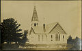 Ft Kent ME Presby PHS695.jpg 4.376 × 2.752; 1,61 MB
-

-
 Lonesome Pines Fort Kent.jpg 2.048 × 1.536; 1,1 MB
-
 Map highlighting fort kent.JPG 398 × 538; 20 KB
-
 MEMap-location-of-Fort Kent.png 344 × 410; 16 KB
-
 Northern Terminus of US Route 1.jpg 2.848 × 2.136; 1,82 MB
-
 NPS FortKentRRStation.jpg 3.000 × 2.250; 1,01 MB
-
 The End Of Route 1.jpg 4.207 × 2.745; 3,44 MB
-
 WWPI16TV.svg 299 × 275; 11 KB
_highlighted.svg)


.jpg)


_(14784840662).jpg)


