Category:Foveaux Strait
Salti al navigilo
Salti al serĉilo
strait in New Zealand between Stewart Island / Rakiura and South Island / Te Waipounamu  Mount Anglem and nothern range of Stewart Island - Rakiura seen from the Bluff over Foveaux Strait in New Zealand, 2018 | |||||
| Alŝuti plurmedion | |||||
| Estas | |||||
|---|---|---|---|---|---|
| Nomita laŭ |
| ||||
| Loko | Southland District, Sudlando Regiono, Nov-Zelando | ||||
| Larĝeco |
| ||||
| Longo |
| ||||
| Alfluo |
| ||||
 | |||||
Subkategorioj
Ĉi tiu kategorio havas la 7 jenajn subkategoriojn, el 7 entute.
Dosieroj en kategorio “Foveaux Strait”
La jenaj 37 dosieroj estas en ĉi tiu kategorio, el 37 entute.
-

-
 Bluff from Stewart Island ferry.jpg 4 608 × 3 456; 6,11 MB
-
 Bluff Hill in Southland.jpg 5 013 × 2 022; 941 KB
-
 Bunker Islets, Sentinel-2.png 228 × 181; 121 KB
-
 Coast of Aparima, NZ.jpg 5 120 × 3 840; 6,78 MB
-
 Dog Island Lighthouse 04.jpg 1 024 × 681; 194 KB
-
 Dog Island Lighthouse 05.jpg 1 024 × 682; 176 KB
-
 Dog Island Lighthouse 08.jpg 1 024 × 681; 125 KB
-
 Dog Island Lighthouse.jpg 1 024 × 681; 240 KB
-
 Dog Island New Zealand.jpg 1 600 × 1 200; 596 KB
-
 Dog Island.JPG 1 600 × 1 063; 194 KB
-
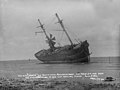
 England's Glory (ship, 1869), totally wrecked.jpg 474 × 266; 10 KB
-
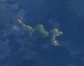
 Foveaux Strait, New Zealand by Sally Ride EarthKAM.jpg 4 312 × 2 868; 4,96 MB
-
 Mount Anglem on Rakiura over Foveaux Strait.jpg 4 608 × 3 456; 7,49 MB
-
 Mouth-of-the-Wairaurahiri-River.jpg 1 371 × 863; 280 KB
-
 N2 Rakiura and Foveaux Strait from Bluff Hill.jpg 640 × 480; 63 KB
-

-

-

-
 NZStewardIslandAreaMap.png 911 × 579; 64 KB
-
 O F Smith Sketch of a strait 1804.tif 636 × 447; 435 KB
-
 Rakiura and Foveaux Strait from Bluff Hill.jpg 542 × 352; 92 KB
-
 Riverton Fishing Boats.JPG 2 048 × 1 074; 424 KB
-
 Rocks at Waipapa Point.jpg 1 024 × 768; 401 KB
-
 Sailing ship Chance, aground at Bluff, 1902.jpg 4 912 × 3 702; 4,36 MB
-
 Smith's Straits by OF Smith.tif 4 309 × 3 004; 4,19 MB
-
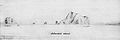 Solander Islands 1770 020102-13.jpg 500 × 166; 12 KB
-
 Stewart Island map-cs.svg 2 237 × 1 635; 1,71 MB
-
 Stewart Island map-en.svg 2 237 × 1 635; 1,7 MB
-
 Stewart Island map-fr.svg 2 237 × 1 635; 1,71 MB
-
 Stewart Island map-mk.svg 2 237 × 1 635; 1,96 MB
-
 Stewart island2.png 588 × 605; 124 KB
-
 Stirling Point sign.jpg 3 264 × 2 448; 1,88 MB
-
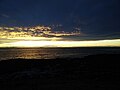 Sunset over Toetoes Bay, NZ.jpg 4 160 × 3 120; 3,19 MB
-
 Te Puka A Māui.jpg 4 912 × 3 264; 5,04 MB
-
 The end of the South Island Road, Bluff.jpg 611 × 455; 119 KB
-
 Unloading a cow from a ship 76.jpg 4 658 × 4 681; 6,39 MB


,_totally_wrecked.jpg)


_-_Acanthochitonidae_-_Mollusc_shell.jpeg)
_-_Acanthochitonidae_-_Mollusc_shell.jpeg)


