Category:Fowey
Zur Navigation springen
Zur Suche springen
Kleinstadt im Vereinigten Königreich  | |||||
| Medium hochladen | |||||
| Tondatei | |||||
|---|---|---|---|---|---|
| Ist ein(e) | |||||
| Ort | Cornwall, Südwestengland, England | ||||
| Einwohnerzahl |
| ||||
| Verschieden von | |||||
| Eventuell gleichwertig | Fowey (Wikimedia-Dublette, Civil Parish in England) | ||||
| offizielle Website | |||||
 | |||||
Unterkategorien
Es werden 24 von insgesamt 24 Unterkategorien in dieser Kategorie angezeigt:
In Klammern die Anzahl der enthaltenen Kategorien (K), Seiten (S), Dateien (D)
B
C
- Coombe Hawne, Fowey (17 D)
F
- Fowey War Memorial (3 D)
G
- Gribbin Daymark, Gribbin Head (30 D)
H
- Hall Walk, Cornwall (6 D)
L
M
P
- Polmear, Cornwall (14 D)
- Polruan-Fowey ferry (11 D)
- Pont Pill, Fowey (12 D)
R
- Readymoney Beach, Fowey (26 D)
S
- Southground Point (7 D)
- St Catherine's Castle (27 D)
- St Catherine's Point light (4 D)
T
W
- Whitehouse Point light (1 D)
Medien in der Kategorie „Fowey“
Folgende 200 Dateien sind in dieser Kategorie, von 670 insgesamt.
(vorherige Seite) (nächste Seite)-
 "Three boats".jpg 1.600 × 1.200; 630 KB
-
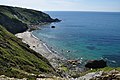
 A Cornish cove - geograph.org.uk - 5650107.jpg 640 × 426; 99 KB
-
 A cornish field - geograph.org.uk - 5668052.jpg 640 × 426; 48 KB
-
 A field of brassicas - geograph.org.uk - 5664396.jpg 640 × 426; 105 KB
-
 A fine house at Readymoney - geograph.org.uk - 5900438.jpg 640 × 480; 143 KB
-
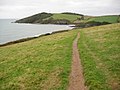
 A marker on the Southwest Coast Path - geograph.org.uk - 2501247.jpg 978 × 1.500; 340 KB
-
 A small cove - geograph.org.uk - 5664432.jpg 640 × 426; 97 KB
-
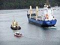
 A Steam Launch, Fowey - geograph.org.uk - 3027917.jpg 2.848 × 2.134; 1,31 MB
-
 A well-worn short cut on the coast path - geograph.org.uk - 6002803.jpg 1.600 × 1.200; 976 KB
-
 Above Coombe Haven - geograph.org.uk - 5498728.jpg 640 × 480; 197 KB
-
 Above Coombe Haven - geograph.org.uk - 5498732.jpg 640 × 480; 172 KB
-
 Above Lankelly Cliff - geograph.org.uk - 2103273.jpg 1.024 × 768; 196 KB
-
 Above Lankelly Cliff - geograph.org.uk - 5498700.jpg 640 × 480; 180 KB
-
 Above Southground Cliffs - geograph.org.uk - 5498702.jpg 640 × 480; 200 KB
-
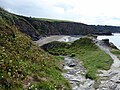
 Access to a small beach - geograph.org.uk - 2124279.jpg 640 × 475; 121 KB
-
 Access to the coastal path - geograph.org.uk - 5496201.jpg 640 × 480; 234 KB
-
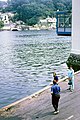
 Across the River - geograph.org.uk - 395245.jpg 480 × 640; 110 KB
-
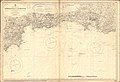 Admiralty Chart No 1267 Approaches to Plymouth, Published 1890.jpg 12.155 × 8.314; 29,86 MB
-
 Aircraft from the Gribbin Daymark (9677).jpg 4.288 × 2.848; 2,89 MB
-
 Albert Quay - geograph.org.uk - 5828544.jpg 1.024 × 681; 130 KB
-
 Albert Quay Jetty - geograph.org.uk - 5828493.jpg 1.024 × 681; 146 KB
-
 Albert Quay, Fowey - geograph.org.uk - 4788407.jpg 1.600 × 1.067; 369 KB
-
 Allday's Field - geograph.org.uk - 5655216.jpg 640 × 426; 42 KB
-
 B3415 - geograph.org.uk - 5821641.jpg 1.024 × 681; 188 KB
-
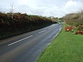 B3415 heading north west - geograph.org.uk - 4244669.jpg 640 × 480; 67 KB
-
 Back Street in Fowey - geograph.org.uk - 387728.jpg 480 × 640; 108 KB
-
 Beach by Little Gribbin (9660).jpg 4.288 × 2.848; 6,7 MB
-
 Beach west of Gribbin Head (9661).jpg 4.288 × 2.848; 6,43 MB
-
 Beach west of Gribbin Head (9662).jpg 4.288 × 2.848; 6,41 MB
-
 Beacon on Fowey waterfront, 1968 - geograph.org.uk - 2265580.jpg 428 × 640; 102 KB
-
 Below Lankelly Cliff - geograph.org.uk - 5655284.jpg 640 × 426; 98 KB
-
 Birds in a field - geograph.org.uk - 5659907.jpg 640 × 426; 62 KB
-

-
 Boardwalk, South West Coast Path - geograph.org.uk - 5659878.jpg 640 × 426; 105 KB
-
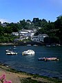
 Boats at anchor at Fowey - geograph.org.uk - 5981481.jpg 5.184 × 3.888; 4,62 MB
-
 Bodinnick - Fowey Ferry - 1990 - geograph.org.uk - 4116378.jpg 2.272 × 1.514; 438 KB
-
 Bodinnick Ferry Landing - 1987 - geograph.org.uk - 2381653.jpg 2.272 × 1.514; 445 KB
-
 Bodinnick Ferry. 1968 - geograph.org.uk - 4281130.jpg 428 × 640; 128 KB
-
 Bodinnick, the ferry from above the village - geograph.org.uk - 5315939.jpg 1.600 × 1.064; 501 KB
-
 Booley Beach (9643).jpg 4.288 × 2.848; 6,98 MB
-
 Booley Beach - geograph.org.uk - 5495783.jpg 640 × 480; 240 KB
-
 Brick-a-fowey.jpg 2.288 × 1.712; 788 KB
-
 Bridge on the Saints Way - geograph.org.uk - 354116.jpg 640 × 480; 171 KB
-
 Bridge over the A3082, Polmear - geograph.org.uk - 4244643.jpg 640 × 480; 75 KB
-
 Brown seaweed on Par Sands - geograph.org.uk - 6003098.jpg 1.600 × 1.200; 992 KB
-
-
 Bushes by South West Coast Path - geograph.org.uk - 5655207.jpg 640 × 426; 82 KB
-

-
 By the ferry landing, Fowey - geograph.org.uk - 3380468.jpg 427 × 640; 103 KB
-
 Caffa Mill, Fowey - geograph.org.uk - 5314160.jpg 1.600 × 1.064; 331 KB
-
 Car park at Coombe Farm - geograph.org.uk - 2702325.jpg 640 × 480; 100 KB
-
 Car Park at Hambland - geograph.org.uk - 5134107.jpg 640 × 428; 64 KB
-
 Car park, Par Sands - geograph.org.uk - 5591747.jpg 1.000 × 662; 515 KB
-
 Carnethic House - geograph.org.uk - 5646057.jpg 640 × 426; 101 KB
-
 Cathy's Dog on boat trip, Fowey, Cornwall - UK, July 24 2012. (7689966446).jpg 3.888 × 2.592; 3,16 MB
-
 Cattle at Menabilly Barton - geograph.org.uk - 5134046.jpg 640 × 428; 79 KB
-
 Cattle on Lankelly Cliff - geograph.org.uk - 2307570.jpg 640 × 416; 78 KB
-
 Cattle Pasture at Menabilly Barton - geograph.org.uk - 5134048.jpg 640 × 428; 80 KB
-
 Cave in the cliff on Par Beach - geograph.org.uk - 2501226.jpg 1.500 × 1.000; 160 KB
-
 Charlestown from Par (9641).jpg 4.288 × 2.848; 5,15 MB
-
-
 China clay Dries, Par Harbour - geograph.org.uk - 5668046.jpg 640 × 426; 57 KB
-
 China clay Dries, Par Harbour - geograph.org.uk - 5668048.jpg 640 × 426; 44 KB
-
 China clay ship - 2 - geograph.org.uk - 717233.jpg 640 × 614; 76 KB
-
 China clay ship at Fowey - geograph.org.uk - 717218.jpg 640 × 521; 82 KB
-
 Class 37 on a china clay train leaving Fowey Docks in July 1991.jpg 3.156 × 4.884; 3,84 MB
-
 Cliff at Little Hell - geograph.org.uk - 2501231.jpg 1.500 × 1.000; 166 KB
-
 Cliffs above Platt on west of Gribbin Head - geograph.org.uk - 6002722.jpg 1.200 × 1.600; 1,03 MB
-
 Cliffs at Little Hell - geograph.org.uk - 2501230.jpg 1.500 × 1.000; 107 KB
-
 Cliffs by Coombe Haven (9700).jpg 4.288 × 2.848; 6,5 MB
-
 Cliffs east of Booley Beach (9644).jpg 4.288 × 2.848; 6,64 MB
-
 Cliffs in Fowey (9726).jpg 4.288 × 2.848; 6,29 MB
-
 Cliffs near Coombe Haven - geograph.org.uk - 5498754.jpg 640 × 480; 234 KB
-
 Cliffs south of Polruan (9697).jpg 4.288 × 2.848; 5,58 MB
-
 Cliffs west of Menabilly Barton - geograph.org.uk - 6002790.jpg 3.314 × 4.513; 6,06 MB
-
 Cliffs, Coombe Haven - geograph.org.uk - 5655222.jpg 640 × 426; 94 KB
-
 Climbing through Colvithick Wood - geograph.org.uk - 5499410.jpg 640 × 480; 338 KB
-
 Coast path and Little Gribbin - geograph.org.uk - 6002780.jpg 1.200 × 1.600; 973 KB
-
 Coast path between Menabilly Farm and the sea - geograph.org.uk - 6002799.jpg 1.200 × 1.600; 992 KB
-
 Coastal footpath and Gribbin Tower - geograph.org.uk - 6002727.jpg 1.600 × 1.200; 895 KB
-
 Coastal grassland - geograph.org.uk - 5655224.jpg 640 × 426; 78 KB
-
 Coastal path north of Little Gribbin - geograph.org.uk - 6002770.jpg 1.200 × 1.600; 1,03 MB
-
 Coastal rocks - geograph.org.uk - 5664404.jpg 640 × 426; 86 KB
-
 Coastal rocks - geograph.org.uk - 5664425.jpg 640 × 426; 109 KB
-
 Coastline north of Little Hell - geograph.org.uk - 5668062.jpg 640 × 426; 92 KB
-
 Cobbs Well, Fowey - geograph.org.uk - 1240037.jpg 480 × 640; 110 KB
-
 Commemorative obelisk, Caffamill Pill, Fowey - geograph.org.uk - 5314121.jpg 1.064 × 1.600; 383 KB
-
 Commemorative plaque, Albert Quay, Fowey - geograph.org.uk - 5314047.jpg 1.600 × 1.064; 217 KB
-
 Coombe Haven (9701).jpg 4.288 × 2.848; 6,5 MB
-
 Coombe Haven - geograph.org.uk - 2018590.jpg 640 × 480; 86 KB
-
 Coombe Haven - geograph.org.uk - 5498716.jpg 640 × 480; 222 KB
-
 Coombe Haven - geograph.org.uk - 5498719.jpg 640 × 480; 179 KB
-
 Coombe Haven - geograph.org.uk - 5498722.jpg 640 × 480; 198 KB
-
 Coombe Haven - geograph.org.uk - 5498758.jpg 640 × 480; 217 KB
-
 Coombe Haven - geograph.org.uk - 5655215.jpg 640 × 425; 64 KB
-
 Coombe Haven - geograph.org.uk - 5655219.jpg 640 × 426; 80 KB
-
 Coombe Haven - geograph.org.uk - 5655221.jpg 640 × 426; 98 KB
-
 Coombe Haven - geograph.org.uk - 5655248.jpg 640 × 426; 101 KB
-
 Coombe Haven - geograph.org.uk - 6003430.jpg 1.600 × 1.200; 454 KB
-
 Cornish coastal scenery - geograph.org.uk - 5655227.jpg 640 × 426; 111 KB
-
 Cornish field - geograph.org.uk - 5668067.jpg 640 × 426; 52 KB
-
 D-Day memorial plaque - geograph.org.uk - 5707389.jpg 640 × 480; 86 KB
-
 Descending on the South West Coast Path - geograph.org.uk - 5664423.jpg 640 × 426; 104 KB
-

-
 Docks at Fowey - geograph.org.uk - 5001250.jpg 640 × 470; 78 KB
-
 Dodman Point from the Gribbin Daymark (9674).jpg 4.288 × 2.848; 4,5 MB
-
 Dollart fowey.jpg 2.288 × 1.712; 796 KB
-
 Dollart off Fowey (9698).jpg 4.288 × 2.848; 6,43 MB
-
-
 Drainage channel, Par Sands - geograph.org.uk - 5668077.jpg 640 × 426; 103 KB
-
 Drainage channel, Par Sands - geograph.org.uk - 5668078.jpg 640 × 426; 116 KB
-
 Drinking fountain, Market Street, Fowey, Cornwall - February 2024.jpg 3.024 × 3.806; 4,46 MB
-
 Early Mist Over Fowey, Cornwall. - geograph.org.uk - 401988.jpg 581 × 640; 107 KB
-
 Elongated field - geograph.org.uk - 5659909.jpg 640 × 426; 57 KB
-
En-uk-Fowey.ogg 1,5 s; 30 KB
-
 Entering Fowey - geograph.org.uk - 5646052.jpg 640 × 426; 95 KB
-
 Entrance to Fowey Docks - geograph.org.uk - 1590271.jpg 640 × 480; 106 KB
-
 Entrance to Penhale Farm Caravan Park - geograph.org.uk - 5821633.jpg 1.024 × 681; 165 KB
-
 Estuary of the River Fowey - geograph.org.uk - 5817048.jpg 640 × 480; 62 KB
-
 Estuary of the River Fowey - geograph.org.uk - 6256578.jpg 5.472 × 3.648; 3,49 MB
-

-
 Farm buildings at Penventinue - geograph.org.uk - 2414503.jpg 640 × 480; 72 KB
-
 Farmland on Gribbin Head - geograph.org.uk - 4891779.jpg 800 × 600; 151 KB
-
-
 Fence, Southground Point - geograph.org.uk - 5655309.jpg 640 × 426; 69 KB
-
 Fenceline - geograph.org.uk - 5659939.jpg 640 × 426; 67 KB
-
 Ferns by South West Coast Path - geograph.org.uk - 5659915.jpg 640 × 426; 104 KB
-

-
 Ferry pier, Fowey - geograph.org.uk - 4788409.jpg 1.600 × 1.067; 442 KB
-
 Field by A3052 - geograph.org.uk - 5646026.jpg 640 × 426; 56 KB
-
 Field entrance, A3082 - geograph.org.uk - 5821637.jpg 1.024 × 681; 171 KB
-
 Fields at Gribbin Head - geograph.org.uk - 5134069.jpg 640 × 428; 55 KB
-
 Fields at Lower Lampetho - geograph.org.uk - 2414850.jpg 640 × 480; 81 KB
-
 Fields near Frogmore Farm - geograph.org.uk - 530788.jpg 640 × 480; 190 KB
-
 Fields north of the Gribbin Daymark (9670).jpg 4.288 × 2.848; 6,4 MB
-
 Fitzroy Barometer, Fowey - geograph.org.uk - 5652008.jpg 426 × 640; 45 KB
-
 Flickr - law keven - All quite on the Western front....jpg 3.878 × 1.840; 1,1 MB
-
 Flickr - law keven - It's all up hill from here....jpg 3.888 × 2.592; 915 KB
-
 Flickr - law keven - Morning has broken... (1).jpg 3.878 × 2.216; 837 KB
-
 Flotsam ^ Jetsam - geograph.org.uk - 5664659.jpg 640 × 426; 60 KB
-
 Flowers in field above Polkerris (9650).jpg 4.288 × 2.848; 6,36 MB
-
 Flying buttress-arch, Church of St Finbarr - geograph.org.uk - 5828255.jpg 681 × 1.024; 227 KB
-
 Folded Rock Strata Polridmouth - geograph.org.uk - 5134101.jpg 640 × 428; 138 KB
-
 Footbridge by Bodmin Pill - geograph.org.uk - 5499427.jpg 640 × 480; 351 KB
-
 Footbridge over Polmear Stream - geograph.org.uk - 2501242.jpg 1.500 × 1.000; 241 KB
-
 Footbridge, St Catherine’s Parade - geograph.org.uk - 2307671.jpg 640 × 446; 126 KB
-
 Footpath above Polkerris - geograph.org.uk - 4891638.jpg 800 × 600; 165 KB
-
 Footpath into Polkerris - geograph.org.uk - 6002841.jpg 1.200 × 1.600; 1,08 MB
-
 Footpath off Polvillion Road - geograph.org.uk - 4244680.jpg 640 × 480; 110 KB
-
 Footpath on Gribbin Head - geograph.org.uk - 4891807.jpg 800 × 600; 111 KB
-
 Footpath to Polridmouth - geograph.org.uk - 2307580.jpg 640 × 388; 99 KB
-
 Foreshore at Fowey - geograph.org.uk - 2306840.jpg 640 × 457; 78 KB
-
 Foreshore at Fowey - geograph.org.uk - 2307184.jpg 640 × 472; 82 KB
-

-
 Fowey (2021-09-07) 01.jpg 5.568 × 3.712; 16,54 MB
-
 Fowey (2021-09-07) 02.jpg 5.568 × 3.712; 17,51 MB
-
 Fowey (2021-09-07) 03.jpg 5.568 × 3.712; 16,47 MB
-
 Fowey (2021-09-07) 04.jpg 5.568 × 3.712; 16,94 MB
-
 Fowey (2021-09-07) 05.jpg 5.568 × 3.712; 18,09 MB
-
 Fowey (2021-09-07) 06.jpg 5.568 × 3.712; 17,18 MB
-
 Fowey (2021-09-07) 08.jpg 5.568 × 3.712; 15,25 MB
-
 Fowey (2021-09-07) 09.jpg 5.568 × 3.712; 16,15 MB
-
 Fowey (2021-09-07) 10.jpg 5.568 × 3.712; 18,14 MB
-
 Fowey (2021-09-07) 105.jpg 3.712 × 5.568; 18,14 MB
-
 Fowey (2021-09-07) 106.jpg 3.712 × 5.568; 17,11 MB
-
 Fowey (2021-09-07) 107.jpg 3.712 × 5.568; 16,12 MB
-
 Fowey (2021-09-07) 109.jpg 3.712 × 5.568; 16,37 MB
-
 Fowey (2021-09-07) 11.jpg 5.568 × 3.712; 15,55 MB
-
 Fowey (2021-09-07) 118.jpg 3.712 × 5.568; 15,38 MB
-
 Fowey (2021-09-07) 15.jpg 5.568 × 3.712; 17,63 MB
-
 Fowey (2021-09-07) 19.jpg 3.712 × 5.568; 13,55 MB
-
 Fowey (2021-09-07) 24.jpg 3.712 × 5.568; 13,44 MB
-
 Fowey (2021-09-07) 27.jpg 5.568 × 3.712; 17,6 MB
-
 Fowey (2021-09-07) 28.jpg 5.568 × 3.712; 16,58 MB
-
 Fowey (2021-09-07) 29.jpg 3.712 × 5.568; 18,58 MB
-
 Fowey (2021-09-07) 30.jpg 3.712 × 5.568; 14,08 MB
-
 Fowey (2021-09-07) 48.jpg 5.568 × 3.712; 17,69 MB
-
 Fowey (2021-09-07) 49.jpg 5.568 × 3.712; 14,67 MB
-
 Fowey (2021-09-07) 51.jpg 3.712 × 5.568; 15,42 MB
-
 Fowey (2021-09-07) 52.jpg 5.568 × 3.712; 14,69 MB
-
 Fowey (2021-09-07) 56.jpg 3.712 × 5.568; 18,42 MB
-
 Fowey (2021-09-07) 73.jpg 5.568 × 3.712; 16,55 MB
-
 Fowey (2021-09-07) 74.jpg 5.568 × 3.712; 18,3 MB
-
 Fowey (2021-09-07) 79.jpg 5.568 × 3.712; 18,08 MB
-
 Fowey - 1990 - geograph.org.uk - 4115303.jpg 1.462 × 2.272; 538 KB
-
 Fowey - Allday Fields.jpg 3.456 × 4.515; 5,71 MB
-
 Fowey - Alldays Fields.jpg 3.328 × 4.514; 5,14 MB
-
-
 Fowey - Fitzroy Barometer 2.jpg 2.266 × 3.477; 5,08 MB
-
 Fowey - Fitzroy Barometer.jpg 1.162 × 3.179; 1,54 MB
-
 Fowey - geograph.org.uk - 2103290.jpg 1.024 × 768; 213 KB
-
 Fowey - geograph.org.uk - 2336973.jpg 1.280 × 856; 259 KB
-
 Fowey - geograph.org.uk - 2745.jpg 640 × 419; 37 KB
-
 Fowey - geograph.org.uk - 5828547.jpg 1.024 × 681; 156 KB
-
 Fowey - geograph.org.uk - 5828548.jpg 1.024 × 681; 142 KB
-
 Fowey - panoramio.jpg 2.356 × 1.494; 2,66 MB
-
 Fowey - Polridmouth Cove - 2.jpg 5.207 × 3.477; 6,26 MB
-
 Fowey - View from the south.jpg 5.327 × 3.452; 5,89 MB
-
 Fowey 2.jpg 2.418 × 2.757; 1,55 MB
-
 Fowey across the water, evening - geograph.org.uk - 5293246.jpg 1.600 × 1.064; 321 KB


.jpg)


.jpg)
.jpg)
.jpg)


.jpg)


.jpg)


.jpg)


.jpg)
.jpg)
.jpg)

.jpg)


.jpg)


.jpg)

.jpg)


.jpg)


.jpg)

.jpg)


_01.jpg)
_02.jpg)
_03.jpg)
_04.jpg)
_05.jpg)
_06.jpg)
_08.jpg)
_09.jpg)
_10.jpg)
_105.jpg)
_106.jpg)
_107.jpg)
_109.jpg)
_11.jpg)
_118.jpg)
_15.jpg)
_19.jpg)
_24.jpg)
_27.jpg)
_28.jpg)
_29.jpg)
_30.jpg)
_48.jpg)
_49.jpg)
_51.jpg)
_52.jpg)
_56.jpg)
_73.jpg)
_74.jpg)
_79.jpg)


