Category:Fressingfield
Aller à la navigation
Aller à la recherche
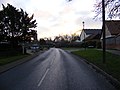
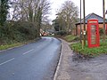
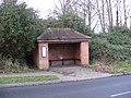
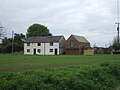
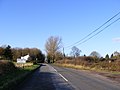
English: Fressingfield is a small village in Suffolk, located 12 miles east of Diss and the A140 and just 40 minutes drive from the coast at Southwold. It has a population of over 900, With 2 shops: Fressingfield Stores and The Pottery, a Medical Centre and 3 churches with Anglican, Baptist and Methodist congregations.
village britannique  | |||||
| Téléverser des médias | |||||
| Nature de l’élément | |||||
|---|---|---|---|---|---|
| Lieu | Mid Suffolk, Suffolk, Angleterre de l'Est, Angleterre | ||||
 | |||||
Sous-catégories
Cette catégorie comprend 12 sous-catégories, dont les 12 ci-dessous.
C
- Chippenhall Green (23 F)
E
F
- Fressingfield Baptist Church (5 F)
- Fressingfield War Memorial (4 F)
L
- Little Whittingham Green (2 F)
P
S
- William Sancroft (10 F)
- The Swan, Fressingfield (3 F)
U
- Ufford Hall, Suffolk (2 F)
V
- Fressingfield Village Sign (4 F)
Média dans la catégorie « Fressingfield »
Cette catégorie comprend 414 fichiers, dont les 200 ci-dessous.
(page précédente) (page suivante)-
 A colourful carpet - geograph.org.uk - 3906690.jpg 480 × 640 ; 195 kio
-
 A gap in the hedge - geograph.org.uk - 2601781.jpg 640 × 480 ; 318 kio
-
 A pleasing contrast - geograph.org.uk - 3906689.jpg 640 × 578 ; 310 kio
-
 Access road to Lodge Farm - geograph.org.uk - 3906619.jpg 640 × 480 ; 203 kio
-
 Access road to Nunnery Farm - geograph.org.uk - 3906676.jpg 640 × 480 ; 143 kio
-
 Access road to Olivedale - geograph.org.uk - 3906600.jpg 640 × 407 ; 157 kio
-
 Alders beside small stream at Gules Green - geograph.org.uk - 3906612.jpg 640 × 480 ; 210 kio
-
 Approaching the Cattle Grid at Chippenhall Green - geograph.org.uk - 2729751.jpg 3 072 × 2 304 ; 1,4 Mio
-

-
 B1116 at Fressingfield - geograph.org.uk - 1096044.jpg 3 072 × 2 304 ; 1,32 Mio
-
 B1116 at Fressingfield - geograph.org.uk - 1096048.jpg 3 072 × 2 304 ; 1,53 Mio
-
 B1116 Harleston Road - geograph.org.uk - 2727578.jpg 3 072 × 2 304 ; 1,42 Mio
-
 B1116 Harleston Road - geograph.org.uk - 2728145.jpg 3 072 × 2 304 ; 1,43 Mio
-
 B1116 Harleston Road - geograph.org.uk - 2728155.jpg 3 072 × 2 304 ; 1,25 Mio
-
 B1116 junction Fressingfield - geograph.org.uk - 1095787.jpg 3 072 × 2 304 ; 1,33 Mio
-
 B1116 Laxfield Road - geograph.org.uk - 2725674.jpg 3 072 × 2 304 ; 1,5 Mio
-
 B1116 Laxfield Road - geograph.org.uk - 2725676.jpg 3 072 × 2 304 ; 1,4 Mio
-
 B1116 Laxfield Road - geograph.org.uk - 2725680.jpg 3 072 × 2 304 ; 1,39 Mio
-
 B1116 Laxfield Road - geograph.org.uk - 2726172.jpg 3 072 × 2 304 ; 1,36 Mio
-
 B1116 Laxfield Road - geograph.org.uk - 2726238.jpg 3 072 × 2 304 ; 1,35 Mio
-
 B1116 Laxfield Road - geograph.org.uk - 2726248.jpg 3 072 × 2 304 ; 1,5 Mio
-
 B1116 Laxfield Road at Rackhams Corner - geograph.org.uk - 2725077.jpg 3 072 × 2 304 ; 1,44 Mio
-
 B1116 Laxfield Road at Rackhams Corner - geograph.org.uk - 2725089.jpg 3 072 × 2 304 ; 1,51 Mio
-
 B1116 Laxfield Road at Rackhams Corner - geograph.org.uk - 2725091.jpg 3 072 × 2 304 ; 1,39 Mio
-
 B1116 Laxfield Road at White Post Corner - geograph.org.uk - 2725692.jpg 3 072 × 2 304 ; 1,37 Mio
-
 B1116 Laxfield Road at White Post Corner - geograph.org.uk - 2726127.jpg 3 072 × 2 304 ; 1,49 Mio
-
 B1116 Laxfield Road ^ the footpath to Storeys Lane - geograph.org.uk - 2726154.jpg 3 072 × 2 304 ; 1,4 Mio
-
 B1116 Laxfield Road ^ the Post Office Church Street Postbox - geograph.org.uk - 2726244.jpg 3 072 × 2 304 ; 1,36 Mio
-
 B1116 Laxfield Road, Fressingfield - geograph.org.uk - 1095795.jpg 3 072 × 2 304 ; 1,45 Mio
-
 B1116Laxfield Road and the entrance to Chippenhall Hall - geograph.org.uk - 2725694.jpg 3 072 × 2 304 ; 1,44 Mio
-
 B1117 New Street ^ New Street Close Postbox - geograph.org.uk - 2727265.jpg 3 072 × 2 304 ; 1,64 Mio
-
 Barns by Whittingham Hall - geograph.org.uk - 3906603.jpg 640 × 482 ; 253 kio
-
 Bend In Road - geograph.org.uk - 1286659.jpg 640 × 480 ; 67 kio
-
 Bend In Road - geograph.org.uk - 4040753.jpg 1 024 × 768 ; 253 kio
-
 Bend in Top Road - geograph.org.uk - 5169156.jpg 640 × 480 ; 89 kio
-
 Bend on Roman Road (B1116) - geograph.org.uk - 3906682.jpg 640 × 431 ; 196 kio
-
 Blue house, Fressingfield - geograph.org.uk - 5169151.jpg 640 × 480 ; 62 kio
-
 Brick farm sheds - geograph.org.uk - 3906596.jpg 640 × 428 ; 141 kio
-
 Buckingham's Hill - geograph.org.uk - 5168240.jpg 640 × 480 ; 53 kio
-
 Bus Shelter on B1116 at Fressingfield - geograph.org.uk - 1095846.jpg 3 072 × 2 304 ; 1,45 Mio
-
 Canham's Farm, Laxfield - geograph.org.uk - 3911496.jpg 640 × 480 ; 61 kio
-
 Canham's Lane near Fressingfield - geograph.org.uk - 2178756.jpg 580 × 435 ; 97 kio
-
 Canhams Lane - geograph.org.uk - 2715896.jpg 3 072 × 2 304 ; 1,46 Mio
-
 Canhams Lane - geograph.org.uk - 2716164.jpg 3 072 × 2 304 ; 1,32 Mio
-
 Canhams Lane - geograph.org.uk - 3657293.jpg 1 024 × 768 ; 150 kio
-
 Canhams Lane sign - geograph.org.uk - 2716167.jpg 3 072 × 2 304 ; 1,62 Mio
-
 Caterpole Corner - geograph.org.uk - 2768158.jpg 640 × 480 ; 114 kio
-
 Cattle Grid And Sign - geograph.org.uk - 3657325.jpg 1 024 × 768 ; 274 kio
-
 Cattle Grid at Chippenhall Green - geograph.org.uk - 2729753.jpg 3 072 × 2 304 ; 1,42 Mio
-
 Cattle Grid on the road onto Chippenhall Green - geograph.org.uk - 2724032.jpg 1 980 × 2 640 ; 1,07 Mio
-
 Cereal crop by Dry Docking - geograph.org.uk - 3906618.jpg 640 × 480 ; 161 kio
-
 Cereal crop by Nunnery Farm - geograph.org.uk - 3906681.jpg 640 × 480 ; 149 kio
-
 Cereal crop by Olivedale - geograph.org.uk - 3906601.jpg 640 × 414 ; 141 kio
-
 Cereal crop spraying by Nunnery Farm - geograph.org.uk - 3906679.jpg 640 × 421 ; 136 kio
-
 Chevron Sign - geograph.org.uk - 3657290.jpg 1 024 × 768 ; 248 kio
-
 Chippenhall Green - geograph.org.uk - 2723563.jpg 2 640 × 1 980 ; 886 kio
-
 Chippenhall Green - geograph.org.uk - 2729756.jpg 3 072 × 2 304 ; 1,36 Mio
-
 Chippenhall Green junction - geograph.org.uk - 2729757.jpg 3 072 × 2 304 ; 1,36 Mio
-
 Chippenhall Green Road - geograph.org.uk - 2729739.jpg 3 072 × 2 304 ; 1,49 Mio
-
 Chippenhall Green Road - geograph.org.uk - 2729743.jpg 3 072 × 2 304 ; 1,6 Mio
-
 Chippenhall Hall sign - geograph.org.uk - 2725698.jpg 2 304 × 3 072 ; 1,44 Mio
-
 Church Street, Fressingfield - geograph.org.uk - 1096006.jpg 3 072 × 2 304 ; 1,45 Mio
-
 Clear Footpath - geograph.org.uk - 4041202.jpg 1 024 × 768 ; 294 kio
-
 Close up, Elizabeth II postbox on New Street, Fressingfield - geograph.org.uk - 5180142.jpg 1 450 × 2 767 ; 882 kio
-

-
 Cottage at Little Whittingham Green - geograph.org.uk - 3911588.jpg 640 × 480 ; 80 kio
-
 Cottage, Fressingfield - geograph.org.uk - 5168260.jpg 640 × 480 ; 63 kio
-
 Cottages at the north end of The Common - geograph.org.uk - 2179012.jpg 580 × 435 ; 144 kio
-
 Cottages near Oak Farm - geograph.org.uk - 5168233.jpg 640 × 480 ; 56 kio
-
 Cottages on The Common - geograph.org.uk - 2178976.jpg 580 × 435 ; 122 kio
-
 Country Road - geograph.org.uk - 3657296.jpg 1 024 × 768 ; 234 kio
-
 Country Road And Farm Entrance - geograph.org.uk - 4040674.jpg 1 024 × 768 ; 287 kio
-
 Country road and house - geograph.org.uk - 2178571.jpg 580 × 435 ; 141 kio
-
 Country road with footpath to the right - geograph.org.uk - 2178893.jpg 580 × 435 ; 151 kio
-
 Cratfield Road - geograph.org.uk - 5168220.jpg 640 × 480 ; 62 kio
-
 Cratfield Road - geograph.org.uk - 5168235.jpg 640 × 480 ; 89 kio
-
 Cratfield Road, Fressingfield - geograph.org.uk - 5168253.jpg 640 × 480 ; 61 kio
-
 Crop field near Apricot Farm - geograph.org.uk - 5168216.jpg 640 × 480 ; 81 kio
-
 Crop field off Top Road - geograph.org.uk - 5169154.jpg 640 × 480 ; 70 kio
-
 Crop field, Chippenhall Green - geograph.org.uk - 5168192.jpg 640 × 480 ; 81 kio
-
 Crop spraying at Goff's Corner - geograph.org.uk - 3906579.jpg 640 × 220 ; 65 kio
-
 Crop spraying by Nunnery Farm - geograph.org.uk - 3906680.jpg 640 × 480 ; 151 kio
-
 Cucumber Hall - geograph.org.uk - 2728143.jpg 3 072 × 2 304 ; 1,45 Mio
-
 Cucumber Hall sign - geograph.org.uk - 2728144.jpg 3 072 × 2 304 ; 1,45 Mio
-
 Daffodils growing beside Fressingfield Road - geograph.org.uk - 3906599.jpg 640 × 413 ; 224 kio
-
 Daisy Hill - geograph.org.uk - 2739271.jpg 3 072 × 2 304 ; 1,47 Mio
-
 Daisy Hill - geograph.org.uk - 2739279.jpg 3 072 × 2 304 ; 1,4 Mio
-
 Daisy Hill junction - geograph.org.uk - 3520215.jpg 3 072 × 2 304 ; 1,41 Mio
-

-
 Daisy Hill road junction - geograph.org.uk - 2739273.jpg 3 072 × 2 304 ; 1,51 Mio
-
 Dale Road - geograph.org.uk - 3519098.jpg 3 072 × 2 304 ; 1,27 Mio
-
 Dale Road by Dale Bridge, Weybread - geograph.org.uk - 2613463.jpg 640 × 480 ; 201 kio
-
 Dale Road ^ footpath - geograph.org.uk - 3518833.jpg 3 072 × 2 304 ; 1,38 Mio
-
 Dale Road ^ footpath - geograph.org.uk - 3518853.jpg 3 072 × 1 949 ; 1,51 Mio
-
 Dale Road ^ footpaths - geograph.org.uk - 5168191.jpg 2 970 × 2 228 ; 4,88 Mio
-
 Dale Road, Fressingfield - geograph.org.uk - 5168223.jpg 3 072 × 2 304 ; 1,89 Mio
-
 Dead End - geograph.org.uk - 4041225.jpg 1 024 × 768 ; 284 kio
-
 Deadman's grave Lane - geograph.org.uk - 3911566.jpg 640 × 480 ; 97 kio
-
 Deadman'sgrave Lane - geograph.org.uk - 3911534.jpg 640 × 480 ; 75 kio
-
 Disused farm cottage - geograph.org.uk - 3906687.jpg 640 × 480 ; 185 kio
-
 Ditch beside Fressingfield Road - geograph.org.uk - 3906584.jpg 555 × 640 ; 296 kio
-
 Ditch beside lane past Lodge Farm - geograph.org.uk - 3906620.jpg 640 × 480 ; 232 kio
-
 Ditch beside the road past Moat Farm - geograph.org.uk - 2768137.jpg 640 × 480 ; 238 kio
-
 Down Hill Road - geograph.org.uk - 1286716.jpg 480 × 640 ; 112 kio
-
 Dutch barn and grain silo by Vales Hall - geograph.org.uk - 3906686.jpg 640 × 480 ; 207 kio
-
 Ebden's Farm sign - geograph.org.uk - 2770613.jpg 3 072 × 2 304 ; 1,44 Mio
-
 Electricity poles in field by Nunnery Farm - geograph.org.uk - 3906678.jpg 486 × 640 ; 160 kio
-

-

-
 Entering Fressingfield on New Street - geograph.org.uk - 2727326.jpg 3 072 × 2 304 ; 1,5 Mio
-
 Entering Fressingfield on New Street - geograph.org.uk - 5168119.jpg 3 072 × 2 304 ; 1,66 Mio
-
 Entering Fressingfield on the B1116 Harleston Road - geograph.org.uk - 2728050.jpg 3 072 × 2 304 ; 1,33 Mio
-
 Entering Fressingfield on the B1116 Laxfield Road - geograph.org.uk - 2726174.jpg 3 072 × 2 304 ; 1,46 Mio
-
 Entering Fressingfield on the B1116 Laxfield Road - geograph.org.uk - 2726190.jpg 3 072 × 2 304 ; 1,37 Mio
-
 Entering Fressingfield on the B1116 Laxfield Road - geograph.org.uk - 4387719.jpg 3 072 × 2 222 ; 3,13 Mio
-
 Entering Weybread on the B1116 Harleston Road - geograph.org.uk - 2728148.jpg 3 072 × 2 304 ; 1,4 Mio
-
 Entrance to Knight's Farm, Fressingfield - geograph.org.uk - 2178557.jpg 580 × 435 ; 127 kio
-
 Entrance to Lodge Farm, Withersdale - geograph.org.uk - 2178901.jpg 580 × 435 ; 173 kio
-
 Entrance to Whittingham Hall, Fressingfield - geograph.org.uk - 2178944.jpg 580 × 435 ; 226 kio
-
 Entrance to Woodside ^ Barbers Far ms - geograph.org.uk - 3520182.jpg 3 072 × 2 304 ; 1,43 Mio
-
 Farm building, Yewtree Farm - geograph.org.uk - 5168200.jpg 640 × 480 ; 55 kio
-
 Farm Grain Silo - geograph.org.uk - 4040638.jpg 1 024 × 768 ; 190 kio
-
 Farm track - geograph.org.uk - 3906111.jpg 640 × 480 ; 79 kio
-
 Fields beside Fressingfield Road - geograph.org.uk - 3906588.jpg 640 × 480 ; 138 kio
-
 Fields by Caterpole Corner - geograph.org.uk - 2768155.jpg 640 × 480 ; 189 kio
-
 Fields by Fressingfield Hall - geograph.org.uk - 3906610.jpg 640 × 425 ; 200 kio
-
 Fields by Oxbridge Farm - geograph.org.uk - 2768143.jpg 640 × 480 ; 148 kio
-
 Fields by Redhouse Farm - geograph.org.uk - 2768144.jpg 640 × 480 ; 187 kio
-
 Fishing Lake - geograph.org.uk - 3657211.jpg 1 024 × 768 ; 213 kio
-
 Flush Bracket OSBM S9647 Fressingfield St Peter ^ St Pauls Church - geograph.org.uk - 5462047.jpg 2 231 × 2 231 ; 3,53 Mio
-
 Footbridge - geograph.org.uk - 3657314.jpg 768 × 1 024 ; 333 kio
-
 Footpath - geograph.org.uk - 3657306.jpg 768 × 1 024 ; 276 kio
-
 Footpath - geograph.org.uk - 3657318.jpg 768 × 1 024 ; 242 kio
-
 Footpath - geograph.org.uk - 3852208.jpg 768 × 1 024 ; 376 kio
-
 Footpath - geograph.org.uk - 4040623.jpg 768 × 1 024 ; 278 kio
-
 Footpath - geograph.org.uk - 4041198.jpg 1 024 × 768 ; 238 kio
-
 Footpath along the headland at Fressingfield - geograph.org.uk - 2178910.jpg 580 × 435 ; 192 kio
-
 Footpath And Sign - geograph.org.uk - 3657204.jpg 768 × 1 024 ; 216 kio
-
 Footpath And Sign - geograph.org.uk - 4040619.jpg 1 024 × 768 ; 198 kio
-
 Footpath Junction - geograph.org.uk - 3657311.jpg 768 × 1 024 ; 255 kio
-
 Footpath Leading Behind Oak Farm - geograph.org.uk - 3657207.jpg 1 024 × 768 ; 277 kio
-
 Footpath near Westhouse Farm - geograph.org.uk - 5169153.jpg 640 × 480 ; 82 kio
-
 Footpath off Dale Road - geograph.org.uk - 5168204.jpg 3 072 × 2 304 ; 2,01 Mio
-
 Footpath off Dale Road - geograph.org.uk - 5168209.jpg 3 072 × 2 304 ; 1,95 Mio
-
 Footpath off Dale Road - geograph.org.uk - 5168214.jpg 3 072 × 2 232 ; 4,15 Mio
-
 Footpath off Dales Road - geograph.org.uk - 3518849.jpg 3 072 × 2 304 ; 1,44 Mio
-
 Footpath off Dales Road - geograph.org.uk - 3518863.jpg 3 072 × 2 304 ; 1,25 Mio
-
 Footpath off New Street - geograph.org.uk - 5168129.jpg 3 072 × 2 304 ; 1,81 Mio
-
 Footpath Off Stradbroke Road - geograph.org.uk - 3852201.jpg 1 024 × 768 ; 349 kio
-
 Footpath past Vales Hall - geograph.org.uk - 3906685.jpg 640 × 480 ; 155 kio
-
 Footpath Sign And Path - geograph.org.uk - 4041206.jpg 1 024 × 768 ; 306 kio
-
 Footpath to Buckingham's Hill - geograph.org.uk - 2726181.jpg 3 072 × 2 304 ; 1,54 Mio
-
 Footpath to Buckingham's Hill - geograph.org.uk - 2726193.jpg 2 304 × 3 072 ; 1,51 Mio
-
 Footpath to Dale Road - geograph.org.uk - 2727305.jpg 3 072 × 2 304 ; 1,63 Mio
-
 Footpath to Dale Road - geograph.org.uk - 2728053.jpg 3 072 × 2 304 ; 1,4 Mio
-
 Footpath to Dale Road ^ Vale Hall - geograph.org.uk - 2728141.jpg 3 072 × 2 304 ; 1,6 Mio
-
 Footpath to Deadmans Grave Lane - geograph.org.uk - 2725670.jpg 3 072 × 2 304 ; 1,43 Mio
-
 Footpath to Deadmans Grave Lane - geograph.org.uk - 2725677.jpg 3 072 × 2 304 ; 1,4 Mio
-
 Footpath to Deadmans Grave Lane - geograph.org.uk - 2725678.jpg 3 072 × 2 304 ; 1,64 Mio
-
 Footpath to Halesworth Road - geograph.org.uk - 2724015.jpg 2 640 × 1 841 ; 621 kio
-
 Footpath to Lawn Farm - geograph.org.uk - 3906616.jpg 640 × 480 ; 200 kio
-
 Footpath to Laxfield Road - geograph.org.uk - 2768134.jpg 640 × 480 ; 156 kio
-
 Footpath to Moat Farm - geograph.org.uk - 2715887.jpg 2 304 × 3 072 ; 1,66 Mio
-
 Footpath to Moat Farm - geograph.org.uk - 2715889.jpg 2 304 × 3 072 ; 1,49 Mio
-
 Footpath to North Lane - geograph.org.uk - 2727330.jpg 3 072 × 2 304 ; 1,64 Mio
-
 Footpath to North Lane - geograph.org.uk - 2727332.jpg 3 072 × 2 304 ; 1,47 Mio
-
 Footpath to Nunnery Farm - geograph.org.uk - 3906677.jpg 640 × 480 ; 155 kio
-
 Footpath to Priory Road - geograph.org.uk - 2712774.jpg 3 072 × 2 304 ; 1,67 Mio
-
 Footpath to Rattlerow Hill - geograph.org.uk - 2712741.jpg 3 072 × 2 304 ; 1,42 Mio
-
 Footpath to Rattlerow Hill - geograph.org.uk - 2712744.jpg 3 072 × 2 304 ; 1,25 Mio
-
 Footpath to Redhouse Farm - geograph.org.uk - 2727337.jpg 3 072 × 2 304 ; 1,27 Mio
-
 Footpath to Redhouse Farm - geograph.org.uk - 2727338.jpg 3 072 × 2 304 ; 1,43 Mio
-
 Footpath to Rookery Farm - geograph.org.uk - 2722060.jpg 3 072 × 2 304 ; 1,49 Mio
-
 Footpath to Rookery Farm - geograph.org.uk - 2722063.jpg 3 072 × 2 304 ; 1,49 Mio
-
 Footpath to Rookery Farm - geograph.org.uk - 2722065.jpg 3 072 × 2 304 ; 1,46 Mio
-
 Footpath to Storeys Lane - geograph.org.uk - 2726159.jpg 3 072 × 2 304 ; 1,29 Mio
-
 Footpath to Stradbroke Road ^ entrance to Moat Farm - geograph.org.uk - 2770590.jpg 3 072 × 2 304 ; 1,36 Mio
-
 Footpath to the B1116 Laxfield Road - geograph.org.uk - 2725665.jpg 3 072 × 2 304 ; 1,38 Mio
-
 Footpath to the B1116 Laxfield Road - geograph.org.uk - 2725666.jpg 3 072 × 2 304 ; 1,31 Mio
-
 Footpath to the B1116 Laxfield Road - geograph.org.uk - 2726140.jpg 3 072 × 2 304 ; 1,23 Mio
-
 Footpath to the B1116 Laxfield Road - geograph.org.uk - 2726152.jpg 2 640 × 1 980 ; 999 kio
-
 Footpath to the B1116 Laxfield Road - geograph.org.uk - 2770587.jpg 3 072 × 2 304 ; 1,46 Mio
-
 Footpath to the B1116 ^ entrance to Knights Cottage - geograph.org.uk - 2723248.jpg 3 072 × 2 304 ; 1,45 Mio
-
 Footpath to Ufford Hall ^ Moat Farm - geograph.org.uk - 2715811.jpg 3 072 × 2 304 ; 1,64 Mio
-
 Footpath to Ufford Hall ^ Moat Farm - geograph.org.uk - 2715815.jpg 3 072 × 2 304 ; 1,44 Mio
-
 Former school, Fressingfield - geograph.org.uk - 5168243.jpg 640 × 480 ; 65 kio
-
 Former Telephone Box - geograph.org.uk - 4040592.jpg 768 × 1 024 ; 254 kio
-
 Former Telephone Exchange in Gules Green Lane - geograph.org.uk - 2723241.jpg 2 304 × 3 072 ; 1,55 Mio
-
 Former Telephone Exchange in Gules Green Lane - geograph.org.uk - 2723242.jpg 3 072 × 2 304 ; 1,68 Mio
-
 Fressingfield Baptist Church - geograph.org.uk - 5168254.jpg 640 × 480 ; 95 kio
-
 Fressingfield Road past Lawn Farm - geograph.org.uk - 3906597.jpg 640 × 436 ; 233 kio
-
 Fressingfield Telephone Exchange - geograph.org.uk - 1096383.jpg 640 × 480 ; 96 kio
-
 Fressingfield Village Name sign on New Street - geograph.org.uk - 5168199.jpg 2 169 × 2 893 ; 4,01 Mio
-
 Fressingfield Village Name sign on the B1116 Laxfield Road - geograph.org.uk - 4387720.jpg 2 304 × 3 072 ; 2,86 Mio
-
 Fressingfield Village Pump - geograph.org.uk - 2729732.jpg 2 304 × 3 072 ; 1,34 Mio
-
 Fressingfield Water Pump - geograph.org.uk - 5294512.jpg 3 872 × 2 592 ; 1,46 Mio
-
 Fressingfield Water Tower - geograph.org.uk - 2712710.jpg 2 304 × 3 072 ; 1,43 Mio
-
 Fressingfield Water Tower - geograph.org.uk - 2712712.jpg 2 304 × 3 072 ; 1,49 Mio
-
 FW3-22 type pillbox beside the road - geograph.org.uk - 2178960.jpg 580 × 435 ; 154 kio
-
 Ghost Sign - geograph.org.uk - 4040573.jpg 1 024 × 768 ; 259 kio


_-_geograph.org.uk_-_3906682.jpg)


