Category:Frohnhofen
Vai alla navigazione
Vai alla ricerca
municipality of Germany    | |||||
| Carica un file multimediale | |||||
| Istanza di |
| ||||
|---|---|---|---|---|---|
| Luogo | Verbandsgemeinde Oberes Glantal, circondario di Kusel, Renania-Palatinato, Germania | ||||
| Popolazione |
| ||||
| Superficie |
| ||||
| Altezza sul mare |
| ||||
| Distinto da | |||||
| sito web ufficiale | |||||
 | |||||
Sottocategorie
Questa categoria contiene un'unica sottocategoria, indicata di seguito.
H
File nella categoria "Frohnhofen"
Questa categoria contiene 13 file, indicati di seguito, su un totale di 13.
-
 Aushangtafel Entenweiher.JPG 2 048 × 1 536; 629 KB
-
 DRK Zeltlager1.JPG 2 048 × 1 536; 667 KB
-
 DRK Zeltplatz Frohnhofen.JPG 2 048 × 1 536; 774 KB
-
 Fischerhütte am Entenweiher Frohnhofen.JPG 2 048 × 1 536; 698 KB
-
 Frohnhof.jpg 210 × 247; 14 KB
-
 Frohnhofen in KUS.svg 249 × 249; 214 KB
-
 Frohnhofen, Blick zum Dorf.jpg 2 551 × 1 701; 1,26 MB
-
 Frohnhofen, das Dorf.jpg 2 551 × 1 701; 1,18 MB
-
 Frohnhofen, der Entenweiher.jpg 2 551 × 1 701; 1,68 MB
-
 Frohnhofen, in Dorfnähe.jpg 2 551 × 1 701; 1,31 MB
-
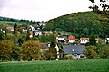 Frohnhofen-03.jpg 2 551 × 1 701; 1,17 MB
-
 Großer Entenweiher Frohnhofen.JPG 2 048 × 1 536; 746 KB
-
 Kleiner Entenweiher Frohnhofen.JPG 2 048 × 1 536; 657 KB


