Category:Fuencaliente
Salta a la navigazzion
Và a cercà
English: Pictures of Fuencaliente in the south of La Palma, the most north-westerly island of the Canary Islands in Spain
comune spagnolo della provincia di Santa Cruz de Tenerife     | |||||
| Carega su un fail audio / video | |||||
| L'è un(a) | |||||
|---|---|---|---|---|---|
| Sit | Provincia de Santa Cruz de Tenerife, Ìsole Canarie, Spagna | ||||
| Bagnad de | |||||
| Capo de governo |
| ||||
| Popolazzion |
| ||||
| Area |
| ||||
| Altezza in sul mar |
| ||||
 | |||||
Sotocategorie
Quella categoria chì la gh'ha 19 sot-categorie chì de sota, su un numer complessiv de 19.
- Maps of Fuencaliente (7 F)
- Nature of Fuencaliente (65 F)
C
H
- Houses in Fuencaliente (11 F)
R
- Roque del Teneguía (10 F)
S
T
V
Fail in la categoria "Fuencaliente"
Quella categoria chì la gh'ha denter 38 i fail riportad chì de sota, su un total de 38.
-
 Escudo de Fuencaliente de La Palma.svg 550 × 959; 250 KByte
-
 At La Palma 2021 1333.jpg 6 960 × 4 640; 20,3 MByte
-
 At La Palma 2021 1334.jpg 6 960 × 4 640; 20,3 MByte
-
 At La Palma 2021 1946.jpg 4 032 × 3 024; 7,14 MByte
-
 At La Palma 2021 1947.jpg 4 032 × 3 024; 9,64 MByte
-
 At La Palma 2021 1948.jpg 4 032 × 3 024; 9,14 MByte
-
 Bandera fuencaliente.jpg 400 × 267; 10 KByte
-
 Ciudad Real (provincia) 1981 19.jpg 687 × 1 031; 611 KByte
-
 Cueva de salinas, La Palma.jpg 4 000 × 3 000; 2,28 MByte
-
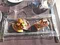
 Desserts, Fuencaliente, La Palma.jpg 3 635 × 2 726; 1,96 MByte
-
 First course, La Palma.jpg 3 865 × 2 899; 3,71 MByte
-
 Fuencaliente de la Palma - Scritta 01.jpg 4 476 × 3 356; 9,13 MByte
-
 Fuencaliente de la Palma - Scritta 02.jpg 4 372 × 3 278; 8,75 MByte
-
 Fuencaliente de la Palma - Scritta 03.jpg 4 896 × 3 672; 8,9 MByte
-
 Fuencaliente de la Palma - Scritta 04.jpg 4 896 × 3 672; 9,3 MByte
-
 Fuencaliente, Santa Cruz de Tenerife, Spain - panoramio (18).jpg 2 048 × 1 229; 657 KByte
-
 Fuencaliente.jpg 3 734 × 1 084; 844 KByte
-
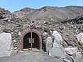 Fuente Santa 2019-03 01.JPG 4 608 × 3 456; 6,17 MByte
-
 Fuente Santa 2019-03 02.JPG 4 608 × 3 456; 3,88 MByte
-
 Fuente Santa 2019-03 03.JPG 4 608 × 3 456; 5,47 MByte
-
 Horno, Fuencaliente, La Palma.jpg 3 853 × 2 889; 2,51 MByte
-
 Karte Gemeinde Fuencaliente de La Palma 2022.png 3 000 × 3 484; 689 KByte
-
 La Palma vulcano area Fuencaliente - panoramio.jpg 3 008 × 2 000; 2,62 MByte
-
 Playa las cabras, lava coast, Fuencaliente, La Palma.jpg 4 000 × 3 000; 3,37 MByte
-
 Trail to Puertito, La Palma, "daisies".jpg 4 000 × 3 000; 3,94 MByte
-
 Trail to Puertito, La Palma, signs.jpg 4 000 × 3 000; 4,38 MByte
-
 Trail to Puertito, La Palma, view north to Faro Saremera.jpg 4 000 × 3 000; 4,09 MByte
-
 Trail to Puertito, La Palma, view south.jpg 4 000 × 3 000; 2,61 MByte
-
 Trail to Puertito, La Palma, view to hille with sunset clouds.jpg 4 000 × 3 000; 2,62 MByte
-
 Trail to Puertito, La Palma, view to Puertito below.jpg 4 000 × 3 000; 2,68 MByte
-
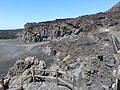
 Volcan de Teneguia D81 6888 (31841852333).jpg 7 328 × 1 892; 1,12 MByte
-
 Volcan de Teneguia D81 6935 (32654174165).jpg 3 286 × 3 286; 656 KByte
-
 Volcan de Teneguia D81 6936 (31841964233).jpg 3 009 × 3 009; 713 KByte
-
 Volcan de Teneguia D81 6937 (32501191442).jpg 6 876 × 4 589; 2,03 MByte
-
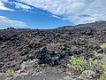
 Volcanic Rock (5494085913).jpg 4 014 × 2 922; 12,26 MByte
-
 Volcanoes (5489310193).jpg 4 752 × 3 168; 9,35 MByte
-
 Volcanoes at southern tip, La Palma.jpg 4 000 × 3 000; 1,77 MByte
-
 Wall (5489911972).jpg 3 168 × 4 752; 8,04 MByte


_1981_19.jpg)


.jpg)


.jpg)
.jpg)
.jpg)
.jpg)
.jpg)

.jpg)
.jpg)