Category:Fulbrook, Warwickshire
Aller à la navigation
Aller à la recherche
English: Fulbrook is a civil parish in Warwickshire, England, situated about four miles north east of Stratford-Upon-Avon.
village britannique | |||||
| Téléverser des médias | |||||
| Nature de l’élément | |||||
|---|---|---|---|---|---|
| Lieu | Stratford-on-Avon, Warwickshire, Midlands de l'Ouest, Angleterre | ||||
 | |||||
Média dans la catégorie « Fulbrook, Warwickshire »
Cette catégorie comprend 32 fichiers, dont les 32 ci-dessous.
-
 A46 Approaching Island For A439 Turn - geograph.org.uk - 4208109.jpg 640 × 448 ; 38 kio
-
 A46 approaching junction with A439 - geograph.org.uk - 5167941.jpg 2 836 × 1 785 ; 1,25 Mio
-
 A46 by Coplow Wood - geograph.org.uk - 3155332.jpg 640 × 408 ; 59 kio
-
 A46 entering The District of Stratford On Avon - geograph.org.uk - 5167938.jpg 3 008 × 2 000 ; 709 kio
-
 A46 Warwick Road Sherbourne Hill - geograph.org.uk - 4208105.jpg 640 × 446 ; 39 kio
-
 Banks of Sherbourne Brook, dusk - geograph.org.uk - 2243407.jpg 640 × 480 ; 452 kio
-
 Bridge on a road to Sherbourne - geograph.org.uk - 5747912.jpg 1 024 × 680 ; 375 kio
-
 Collapsing willow by a brook - geograph.org.uk - 2243403.jpg 640 × 480 ; 552 kio
-
 Countryside near Sherbourne - geograph.org.uk - 2187224.jpg 640 × 480 ; 99 kio
-

-
 Court Farm House - geograph.org.uk - 2827184.jpg 640 × 480 ; 76 kio
-
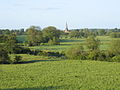 Distant view of All Saints Church, Sherbourne - geograph.org.uk - 13342.jpg 640 × 480 ; 100 kio
-
 Footpath crosses the A46, Sherbourne Hill - geograph.org.uk - 2076271.jpg 2 000 × 1 500 ; 179 kio
-
 Fulbrook Edge - geograph.org.uk - 13595.jpg 640 × 480 ; 75 kio
-
 Fulbrook Edge - geograph.org.uk - 13597.jpg 640 × 480 ; 68 kio
-
 Grand Entrance Gates on Warwick Road - geograph.org.uk - 3867331.jpg 2 176 × 1 411 ; 1,58 Mio
-
 Hillcrest Bed and Breakfast. - geograph.org.uk - 2869908.jpg 640 × 480 ; 79 kio
-
 IF Barn - geograph.org.uk - 2827176.jpg 640 × 480 ; 70 kio
-
 Lay By on Warwick Road (A46) - geograph.org.uk - 3786517.jpg 640 × 480 ; 319 kio
-
 Lay-by on the Warwick Road - geograph.org.uk - 1069240.jpg 640 × 464 ; 58 kio
-
 Nineteenth-century benchmark on Hillcrest - geograph.org.uk - 4537962.jpg 2 560 × 1 920 ; 1,03 Mio
-
 Northbrook Farm - geograph.org.uk - 4048371.jpg 1 696 × 1 315 ; 305 kio
-
 Park ^ Ride sign on A46, Fulbrook Edge - geograph.org.uk - 2076321.jpg 2 000 × 1 500 ; 182 kio
-
 Sherbourne Brook - geograph.org.uk - 2243405.jpg 640 × 480 ; 500 kio
-
 Sherbourne Brook above a weir - geograph.org.uk - 2242847.jpg 640 × 480 ; 476 kio
-
 Snow Hill at sundown - geograph.org.uk - 2242834.jpg 640 × 480 ; 321 kio
-
 Southbound A46 (Warwick Road) - geograph.org.uk - 3786522.jpg 640 × 480 ; 317 kio
-
 The old route of the A46, Sherbourne Hill - geograph.org.uk - 2076244.jpg 2 000 × 1 500 ; 181 kio
-
 Trees along a brook, moonrise - geograph.org.uk - 2243409.jpg 640 × 427 ; 274 kio
-
 Trees in afternoon sun - geograph.org.uk - 2243399.jpg 640 × 480 ; 483 kio
-
 Weir on the Sherbourne Brook - geograph.org.uk - 2242816.jpg 640 × 480 ; 411 kio
-


_-_geograph.org.uk_-_3786517.jpg)


_-_geograph.org.uk_-_3786522.jpg)


