Category:Gaulby
Vai alla navigazione
Vai alla ricerca
English: Gaulby (or Galby) is a village in East Leicestershire, England, 7 miles east of the city of Leicester. According to the 2001 census it had a population of 131.
Centro abitato in Inghilterra  | |||||
| Carica un file multimediale | |||||
| Istanza di | |||||
|---|---|---|---|---|---|
| Luogo | Harborough, Leicestershire, Midlands Orientali, Inghilterra | ||||
| Popolazione |
| ||||
| Superficie |
| ||||
 | |||||
Sottocategorie
Questa categoria contiene un'unica sottocategoria, indicata di seguito.
S
- St Peter, Gaulby (18 F)
File nella categoria "Gaulby"
Questa categoria contiene 46 file, indicati di seguito, su un totale di 46.
-
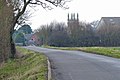 Billesdon Road near Gaulby - geograph.org.uk - 3295028.jpg 2 929 × 1 951; 1,22 MB
-
 Church of St Peter, Gaulby - geograph.org.uk - 6285018.jpg 3 776 × 2 520; 4,14 MB
-
 Countryside view near Gaulby - geograph.org.uk - 3295017.jpg 3 879 × 2 780; 1,74 MB
-
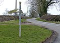 Damaged sign on Burton Overy Lane - geograph.org.uk - 3412979.jpg 3 572 × 2 586; 3,17 MB
-
 Entering Gaulby - geograph.org.uk - 4005528.jpg 640 × 480; 75 KB
-
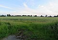
 Farmland near Gaulby - geograph.org.uk - 3294986.jpg 3 891 × 2 773; 3,57 MB
-
 Farmland next to Ilston Road - geograph.org.uk - 3413119.jpg 4 000 × 3 000; 4,42 MB
-
 Farmland off Illston Road - geograph.org.uk - 4005539.jpg 640 × 480; 63 KB
-
 Farmland south of King's Norton - geograph.org.uk - 3412943.jpg 3 928 × 2 634; 2,37 MB
-
 Field entrance off Illston Road - geograph.org.uk - 4005535.jpg 640 × 480; 72 KB
-
 Field to the west of Gaulby Road - geograph.org.uk - 5097562.jpg 640 × 450; 66 KB
-

-
 Footpath notices - geograph.org.uk - 5097564.jpg 640 × 627; 139 KB
-
 Footpath to Gaulby - geograph.org.uk - 5518064.jpg 516 × 640; 60 KB
-
 Gate and farmland along Burton Overy Lane - geograph.org.uk - 3412935.jpg 3 900 × 2 829; 3,38 MB
-
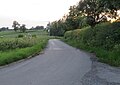
 Gaulby Road towards Gaulby - geograph.org.uk - 5097565.jpg 640 × 458; 65 KB
-
 Gaulby Road towards Gaulby - geograph.org.uk - 5097590.jpg 640 × 470; 96 KB
-

-
 Gaulby, Leicestershire - geograph.org.uk - 500978.jpg 640 × 402; 85 KB
-
 Grey Ladies, Gaulby (geograph 7016155).jpg 1 024 × 768; 223 KB
-
 Hedge and field along Burton Overy Lane - geograph.org.uk - 3412952.jpg 3 995 × 2 836; 4,02 MB
-
 Houghton Lane north of Gaulby - geograph.org.uk - 6420643.jpg 3 776 × 2 520; 3,92 MB
-
 House east of Gaulby churchyard - geograph.org.uk - 962055.jpg 640 × 496; 104 KB
-
 Housing in Gaulby - geograph.org.uk - 186775.jpg 640 × 480; 70 KB
-
 Housing in Gaulby - geograph.org.uk - 3417400.jpg 3 226 × 2 398; 2,07 MB
-
 Illston Road - geograph.org.uk - 4005536.jpg 640 × 480; 95 KB
-
 Illston Road south of Gaulby - geograph.org.uk - 6285408.jpg 3 776 × 2 520; 3,34 MB
-
 Illston Road towards Gaulby - geograph.org.uk - 5097567.jpg 640 × 454; 72 KB
-
-
 Ilston Road towards Gaulby - geograph.org.uk - 3413125.jpg 4 000 × 3 000; 3,34 MB
-
 Large house north of Gaulby Church - geograph.org.uk - 962057.jpg 640 × 499; 103 KB
-
 National Cycle Route 63 - geograph.org.uk - 4005542.jpg 640 × 480; 59 KB
-
 Norton Lane entering Gaulby - geograph.org.uk - 6284976.jpg 3 776 × 2 520; 3,24 MB
-
 Road towards Frisby - geograph.org.uk - 5518067.jpg 480 × 640; 44 KB
-
 Stack of hay bales - geograph.org.uk - 3413618.jpg 1 564 × 1 093; 469 KB
-
 Stoughton Road - geograph.org.uk - 4005523.jpg 640 × 480; 56 KB
-
 Stoughton Road in Gaulby - geograph.org.uk - 3295004.jpg 3 878 × 2 811; 3,16 MB
-
 Telephone Box - geograph.org.uk - 501156.jpg 473 × 640; 144 KB
-
 The Main Street in Gaulby - geograph.org.uk - 3417393.jpg 3 991 × 2 715; 3,49 MB
-
 Threatening clouds as seen from Houghton Ln, Gaulby - geograph.org.uk - 5243527.jpg 5 184 × 2 920; 4,4 MB
-
 Track of Stoughton Road, Gaulby - geograph.org.uk - 4005525.jpg 640 × 480; 96 KB
-

-
 View towards Gaulby village - geograph.org.uk - 3413112.jpg 3 302 × 2 677; 3,25 MB
-
 View towards the village of Gaulby - geograph.org.uk - 4169953.jpg 1 600 × 1 496; 576 KB
-
 Welcome to Gaulby - geograph.org.uk - 500982.jpg 640 × 477; 91 KB
-
 Welcome to Gaulby - geograph.org.uk - 501148.jpg 640 × 589; 170 KB


.jpg)


