Category:Gayton le Marsh
Aller à la navigation
Aller à la recherche
localité britannique du comté anglais de Lincolnshire  | |||||
| Téléverser des médias | |||||
| Nature de l’élément | |||||
|---|---|---|---|---|---|
| Lieu | East Lindsey, Lincolnshire, Midlands de l'Est, Angleterre | ||||
 | |||||
Sous-catégories
Cette catégorie comprend 3 sous-catégories, dont les 3 ci-dessous.
A
S
- Streets in Gayton le Marsh (5 F)
Média dans la catégorie « Gayton le Marsh »
Cette catégorie comprend 149 fichiers, dont les 149 ci-dessous.
-

-
 All bridleroads lead to Theddlethorpe - geograph.org.uk - 3530569.jpg 640 × 427 ; 61 kio
-

-
 Barn at the entrance to Chestnut Farm - geograph.org.uk - 3530514.jpg 640 × 427 ; 91 kio
-
 Bench in the middle of nowhere - geograph.org.uk - 2515820.jpg 1 280 × 960 ; 471 kio
-

-
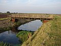
 Bridge over Two Mile Bank Drain - geograph.org.uk - 3835944.jpg 640 × 427 ; 80 kio
-
 Bridleway near Gayton le Marsh - geograph.org.uk - 481917.jpg 640 × 427 ; 90 kio
-
 Bulrushes in drain - geograph.org.uk - 2515824.jpg 1 280 × 960 ; 475 kio
-
 Byway towards Barfen Farm - geograph.org.uk - 3799550.jpg 640 × 427 ; 77 kio
-
 Chapel Lane and the Carltons, aerial 2015 - geograph.org.uk - 4358098.jpg 640 × 427 ; 68 kio
-

-
 Construction work at Gayton Windfarm - geograph.org.uk - 4611360.jpg 640 × 427 ; 41 kio
-

-
 Converted chapel at Gayton le Marsh - geograph.org.uk - 1960762.jpg 640 × 480 ; 68 kio
-
 Cow's little house on the prairie - geograph.org.uk - 3530594.jpg 640 × 427 ; 47 kio
-
 Crop field near Chestnut Farm - geograph.org.uk - 4656478.jpg 640 × 480 ; 80 kio
-
 Crops off New Lane, near South Reston - geograph.org.uk - 2515832.jpg 1 280 × 960 ; 789 kio
-
 Crossed paths - geograph.org.uk - 3530521.jpg 640 × 427 ; 70 kio
-
 Datestone on Wesleyan chapel - geograph.org.uk - 3530543.jpg 640 × 427 ; 85 kio
-
 Derelict House by the Great Eau - geograph.org.uk - 3799567.jpg 640 × 427 ; 38 kio
-
 Drain behind the Great Eau - geograph.org.uk - 3799515.jpg 640 × 427 ; 86 kio
-

-
 Engine Drain - geograph.org.uk - 4177162.jpg 1 024 × 683 ; 297 kio
-
 Engine Drain - geograph.org.uk - 4407108.jpg 640 × 480 ; 69 kio
-
 Entering Gayton le Marsh - geograph.org.uk - 4656463.jpg 640 × 480 ; 120 kio
-

-

-
 Farm buildings at Elvins Farm nr Gayton Le Marsh - geograph.org.uk - 2515779.jpg 1 280 × 960 ; 347 kio
-
 Farm buildings at Gayton le Marsh - geograph.org.uk - 3530507.jpg 640 × 427 ; 68 kio
-

-

-

-
-
 Field entrance, Gayton le Marsh - geograph.org.uk - 4656477.jpg 640 × 480 ; 86 kio
-
 Fire damaged house - geograph.org.uk - 3524167.jpg 640 × 480 ; 66 kio
-

-

-
-
 Flying the blimp for NOWAG - geograph.org.uk - 3168186.jpg 427 × 640 ; 19 kio
-
 Flying the blimp for NOWAG - geograph.org.uk - 3171053.jpg 427 × 640 ; 60 kio
-
 Flying the blimp for NOWAG - geograph.org.uk - 3171072.jpg 640 × 427 ; 60 kio
-
 Gate on the Bank - geograph.org.uk - 1003784.jpg 640 × 480 ; 85 kio
-
 Gayton Engine at Theddlethorpe All Saints - geograph.org.uk - 1502478.jpg 640 × 480 ; 78 kio
-

-
 Gayton Engine Pumping Station - geograph.org.uk - 215238.jpg 640 × 480 ; 77 kio
-
 Gayton Engine Pumping Station - geograph.org.uk - 2517221.jpg 1 280 × 960 ; 350 kio
-
 Gayton Engine Pumping Station - geograph.org.uk - 3168135.jpg 640 × 427 ; 80 kio
-
 Gayton Engine Pumping Station - geograph.org.uk - 4177158.jpg 1 024 × 683 ; 257 kio
-
 Gayton Engine Pumping Station, aerial 2016 - geograph.org.uk - 5149099.jpg 640 × 427 ; 86 kio
-
 Gayton le Marsh - geograph.org.uk - 1960756.jpg 640 × 480 ; 69 kio
-
 Gayton le Marsh Grange, aerial 2014 - geograph.org.uk - 3965792.jpg 640 × 427 ; 59 kio
-

-
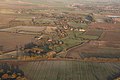
 Gayton le Marsh, aerial 2014 (1) - geograph.org.uk - 3871518.jpg 640 × 427 ; 60 kio
-
 Gayton le Marsh, aerial 2014 (2) - geograph.org.uk - 4358115.jpg 640 × 427 ; 71 kio
-
 Gayton le Marsh, aerial 2015 (1) - geograph.org.uk - 4358264.jpg 452 × 640 ; 59 kio
-
 Gayton le Marsh, aerial 2015 (2) - geograph.org.uk - 4358228.jpg 640 × 399 ; 53 kio
-
 Gayton le Marsh, aerial 2015 (3) - geograph.org.uk - 4358133.jpg 640 × 427 ; 43 kio
-
 Gayton le Marsh, aerial 2015 (4) - geograph.org.uk - 4303366.jpg 1 024 × 575 ; 92 kio
-
 Gayton le Marsh, aerial 2015 - geograph.org.uk - 4358210.jpg 472 × 640 ; 53 kio
-
 Gayton le Marsh, aerial 2018 - geograph.org.uk - 5673379.jpg 800 × 533 ; 89 kio
-
 Gayton le Marsh, Lincolnshire - geograph.org.uk - 482018.jpg 640 × 427 ; 94 kio
-
 Gayton le Marsh, Lincolnshire - geograph.org.uk - 482021.jpg 640 × 427 ; 84 kio
-
 Gayton le Marsh, Lincolnshire - geograph.org.uk - 482029.jpg 640 × 427 ; 97 kio
-

-
 Gayton North Fen drain - geograph.org.uk - 2516574.jpg 640 × 480 ; 83 kio
-
 Gayton pumping station - geograph.org.uk - 4314532.jpg 1 024 × 768 ; 233 kio
-
 Gayton Top - geograph.org.uk - 4179688.jpg 1 024 × 683 ; 141 kio
-
 Gayton Windfarm construction, August 2015 - geograph.org.uk - 4611346.jpg 640 × 427 ; 52 kio
-
 Gayton Windfarm turbine site, aerial 2015 - geograph.org.uk - 4346477.jpg 640 × 427 ; 50 kio
-
 Gayton Windfarm, piling (aerial 2015) - geograph.org.uk - 4346464.jpg 640 × 427 ; 53 kio
-
 Grazing near Gayton le Marsh - geograph.org.uk - 4656458.jpg 640 × 480 ; 56 kio
-
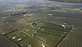
 Great Carlton, aerial 2015 - geograph.org.uk - 4303013.jpg 800 × 533 ; 70 kio
-

-
 Great Eau and Theddlethorpe, aerial 2015 - geograph.org.uk - 4303354.jpg 1 024 × 592 ; 110 kio
-
 Great Eau dredging - geograph.org.uk - 4179664.jpg 1 024 × 683 ; 222 kio
-
 Great Eau dredging - geograph.org.uk - 4179671.jpg 1 024 × 683 ; 197 kio
-
 Great Eau Footbridge - geograph.org.uk - 1003508.jpg 640 × 480 ; 88 kio
-
 Great Eau from Bridge - geograph.org.uk - 1003352.jpg 640 × 480 ; 72 kio
-

-
 Great Eau SW of Theddlethorpe, aerial 2014 - geograph.org.uk - 3871112.jpg 640 × 427 ; 52 kio
-
 Great Eau SW of Theddlethorpe, aerial 2015 - geograph.org.uk - 4684043.jpg 427 × 640 ; 50 kio
-
 Hedge enclosed lane under repair near to Gayton Top - geograph.org.uk - 6078950.jpg 4 000 × 3 000 ; 4,09 Mio
-
 Hedge-lined road heading towards Gayton-le-Marsh - geograph.org.uk - 6078954.jpg 4 000 × 3 000 ; 3,72 Mio
-
 Hoody at Gayton le Marsh - geograph.org.uk - 3530519.jpg 640 × 427 ; 68 kio
-

-

-
 Lane approaching Washdyke Farm, Gayton-le-Marsh - geograph.org.uk - 6079916.jpg 4 000 × 3 000 ; 4,57 Mio
-
 Lane beside New Gayton Engine Drain at Slates Farm - geograph.org.uk - 6079930.jpg 4 000 × 3 000 ; 3,7 Mio
-
 Lane from Pyewipe Farm entrance - geograph.org.uk - 1960776.jpg 480 × 640 ; 76 kio
-

-
 Lincolnshire Fens - geograph.org.uk - 482003.jpg 640 × 427 ; 108 kio
-
 Lincolnshire Fens - geograph.org.uk - 482012.jpg 640 × 427 ; 111 kio
-
 Looking along the field drain towards Highgate - geograph.org.uk - 1010222.jpg 457 × 640 ; 162 kio
-

-
 Lord of all he surveys - geograph.org.uk - 3530506.jpg 640 × 427 ; 63 kio
-
 Minor road into Gayton le Marsh - geograph.org.uk - 4656482.jpg 640 × 480 ; 83 kio
-
 Minor road towards Gayton le Marsh - geograph.org.uk - 4656459.jpg 640 × 480 ; 85 kio
-
 Minor road towards Gayton le Marsh - geograph.org.uk - 4669476.jpg 640 × 480 ; 73 kio
-
 Minor road towards Gayton le Marsh - geograph.org.uk - 4669478.jpg 640 × 480 ; 93 kio
-
 Modern pipe bridge over Two Mile Bank Drain - geograph.org.uk - 3835950.jpg 640 × 427 ; 40 kio
-
 New Gayton Engine Drain - geograph.org.uk - 3799507.jpg 640 × 427 ; 81 kio
-
 New Gayton Engine Drain - geograph.org.uk - 3835946.jpg 640 × 427 ; 59 kio
-
 New Gayton Engine Drain - geograph.org.uk - 482005.jpg 640 × 427 ; 107 kio
-
 New house at Poplar Farm - geograph.org.uk - 3530555.jpg 640 × 427 ; 70 kio
-

-
 Old Track towards Tantilla Lodge - geograph.org.uk - 2516585.jpg 1 280 × 960 ; 516 kio
-
 Park Farm - geograph.org.uk - 3799565.jpg 640 × 427 ; 73 kio
-
 Path to the Great Eau and Withern - geograph.org.uk - 3799498.jpg 640 × 427 ; 88 kio
-
 Poor old house - geograph.org.uk - 3260554.jpg 640 × 427 ; 59 kio
-

-
 Ridge and furrow north of Gayton le Marsh - geograph.org.uk - 4777606.jpg 640 × 427 ; 41 kio
-
 Ridge and furrow north of Gayton le Marsh - geograph.org.uk - 4777616.jpg 640 × 427 ; 42 kio
-

-
 Road into Gayton le Marsh - geograph.org.uk - 1960783.jpg 640 × 480 ; 82 kio
-
 Road junction at Gayton le Marsh - geograph.org.uk - 1960767.jpg 640 × 480 ; 68 kio
-
 Road out of Withern, aerial - geograph.org.uk - 3160944.jpg 640 × 427 ; 50 kio
-
 Road towards Gayton Pumping Station - geograph.org.uk - 2507940.jpg 640 × 480 ; 52 kio
-
 Seat at the intersection - geograph.org.uk - 3530608.jpg 640 × 427 ; 61 kio
-
 Shades of green and yellow - geograph.org.uk - 3530496.jpg 640 × 427 ; 90 kio
-
 Short back and sides - geograph.org.uk - 3799522.jpg 640 × 427 ; 89 kio
-
 Slates farm - geograph.org.uk - 2516570.jpg 1 280 × 960 ; 279 kio
-
 South Reston towards Authorpe, aerial 2018 - geograph.org.uk - 5673364.jpg 800 × 533 ; 69 kio
-
 Swans in the Two Mile Bank Drain - geograph.org.uk - 1010314.jpg 457 × 640 ; 152 kio
-
 T junction near Gayton Top - geograph.org.uk - 1960755.jpg 640 × 480 ; 59 kio
-

-
 The house at Gayton Top - geograph.org.uk - 2899364.jpg 800 × 600 ; 102 kio
-
 The road to Barfen Farm - geograph.org.uk - 3799552.jpg 640 × 427 ; 51 kio
-
 The road to Slates Farm - geograph.org.uk - 3799534.jpg 640 × 427 ; 56 kio
-
 Theddlethorpe gas terminal, aerial - geograph.org.uk - 3006925.jpg 640 × 427 ; 39 kio
-
 Towards the Great Eau - geograph.org.uk - 1003569.jpg 640 × 480 ; 92 kio
-
 Track beside New Gayton Engine Drain near to Slates Farm - geograph.org.uk - 6079932.jpg 4 000 × 3 000 ; 4,08 Mio
-
 Track that becomes a byway - geograph.org.uk - 3799545.jpg 640 × 427 ; 76 kio
-
 Track to Pyewipe Farm - geograph.org.uk - 1960781.jpg 640 × 480 ; 60 kio
-

-

-
 Two Mile Bank Drain - geograph.org.uk - 1010206.jpg 457 × 640 ; 143 kio
-
 Two Mile Bank Drain - geograph.org.uk - 1010276.jpg 640 × 457 ; 149 kio
-

-
 View along the old Salt Road (Two Mile Bank) - geograph.org.uk - 3530620.jpg 640 × 427 ; 69 kio
-
 View along Two Mile Bank Drain - geograph.org.uk - 2468036.jpg 1 024 × 768 ; 184 kio
-
 View from the Bridge - geograph.org.uk - 1003757.jpg 640 × 480 ; 67 kio
-
 View towards Gayton Engine - geograph.org.uk - 2468045.jpg 1 024 × 768 ; 149 kio
-
 Village Hall, Gayton Le Marsh - geograph.org.uk - 2515799.jpg 1 280 × 960 ; 369 kio
-
 West End Farm Caravan Site, Salters Way, South Reston - geograph.org.uk - 3642656.jpg 5 184 × 3 456 ; 7,25 Mio
-

-

-

-
 Working start to the New Year - geograph.org.uk - 3798859.jpg 640 × 427 ; 91 kio


_-_geograph.org.uk_-_3834328.jpg)

_-_geograph.org.uk_-_3834335.jpg)


_-_geograph.org.uk_-_5706498.jpg)


_-_geograph.org.uk_-_3871518.jpg)
_-_geograph.org.uk_-_4358115.jpg)
_-_geograph.org.uk_-_4358264.jpg)
_-_geograph.org.uk_-_4358228.jpg)
_-_geograph.org.uk_-_4358133.jpg)
_-_geograph.org.uk_-_4303366.jpg)


_-_geograph.org.uk_-_4346464.jpg)


_-_geograph.org.uk_-_3834319.jpg)


_-_geograph.org.uk_-_3530620.jpg)


_-_geograph.org.uk_-_5148881.jpg)


