Category:Geography of Alberta
ナビゲーションに移動
検索に移動
カナダの州: Alberta · British Columbia · Manitoba · New Brunswick · Newfoundland and Labrador · Nova Scotia · Ontario · Prince Edward Island · Quebec · Saskatchewan · Northwest Territories · Nunavut · Yukon
Physical features of the Canadian province  Relief of Alberta, Canada | |||||
| メディアをアップロード | |||||
| 分類 |
| ||||
|---|---|---|---|---|---|
| 上位クラス | |||||
| 親項目 | |||||
| 場所 |
| ||||
| 面積 |
| ||||
 | |||||
下位カテゴリ
このカテゴリに属する 24 個のサブカテゴリのうち、 24 個を表示しています。
*
A
- District of Athabasca (5ファイル)
B
- Big Rock (glacial erratic) (4ファイル)
C
E
- Elbow-Sheep Wildland Provincial Park (11ファイル)
G
I
L
M
P
R
W
カテゴリ「Geography of Alberta」にあるメディア
このカテゴリに属する 10 個のファイルのうち、 10 個を表示しています。
-
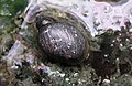 Banff snail.jpg 885 × 577;80キロバイト
-
 Cadomin Cave.jpg 426 × 576;53キロバイト
-
 Dinosaur Park Fm.jpg 720 × 468;279キロバイト
-
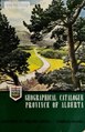 Geographical catalogue, Province of Alberta (IA geographicalcata00albe).pdf 727 × 1,125、52 ページ;2.85メガバイト
-
 Lake Louise Boulder Pass Trek - panoramio.jpg 2,592 × 1,772;1.89メガバイト
-
 Lake Louise Sightseeing Gondola - panoramio.jpg 2,592 × 1,553;2.02メガバイト
-
 Paradise Valley.jpg 2,272 × 1,704;2.79メガバイト
-
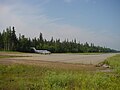 Pelican airport.jpg 1,280 × 960;554キロバイト
-
 Syncrude mildred lake plant.jpg 1,024 × 768;136キロバイト
-
 Yellowhead-pass sign.jpg 960 × 1,280;799キロバイト


