Category:Geography of Barbados
Salti al navigilo
Salti al serĉilo
Geography of Barbados  | |||||
| Alŝuti plurmedion | |||||
| Estas |
| ||||
|---|---|---|---|---|---|
| Subaro de | |||||
| Rilatas al |
| ||||
| Loko | Briĝurbo, Sankta Mikaelo, Barbado | ||||
| Areo |
| ||||
| |||||
Subkategorioj
Ĉi tiu kategorio havas la 9 jenajn subkategoriojn, el 9 entute.
Dosieroj en kategorio “Geography of Barbados”
La jenaj 9 dosieroj estas en ĉi tiu kategorio, el 9 entute.
-
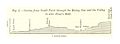
 Pg580 Fig1 Section fromnear Paynes Bay to Chalky Mount.jpg 1 405 × 475; 221 KB
-
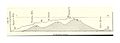
 Pg580 Fig2 Section from South Point through the Rising Sun and the Valley.jpg 1 418 × 516; 233 KB
-
 Pg585.jpg 1 392 × 497; 215 KB
-
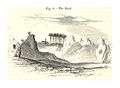 Pg588 Fig8 The Rock.jpg 1 309 × 963; 554 KB
-
 Barbados Input Administrative Boundaries (5457754450).jpg 2 524 × 3 209; 563 KB
-
 Double turbulence.jpg 576 × 428; 180 KB
-
 Front of derelict house.JPG 2 848 × 2 136; 1,47 MB
-
 Houses Excellent Landmark.JPG 2 848 × 2 136; 1,42 MB
-


.jpg)


_-_comprising_a_geographical_and_statistical_description_of_the_island,_a_sketch_of_the_historical_events_since_the_settlement_and_an_account_of_its_(14780342261).jpg)