Category:Geography of County Louth
Zur Navigation springen
Zur Suche springen
Wikimedia-Kategorie | |||||
| Medium hochladen | |||||
| Ist ein(e) | |||||
|---|---|---|---|---|---|
| |||||
Unterkategorien
Es werden 15 von insgesamt 15 Unterkategorien in dieser Kategorie angezeigt:
In Klammern die Anzahl der enthaltenen Kategorien (K), Seiten (S), Dateien (D)
B
- Beaches of County Louth (32 D)
C
- Coasts of County Louth (120 D)
D
- Dundalk Bay (13 D)
F
- Fields in County Louth (11 D)
- Forests in County Louth (3 D)
M
R
S
T
Medien in der Kategorie „Geography of County Louth“
Folgende 36 Dateien sind in dieser Kategorie, von 36 insgesamt.
-
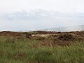
 A forest fire break at the border - geograph.org.uk - 5713820.jpg 2.668 × 2.000; 3,08 MB
-
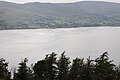
 A misty Carlingford Lough from Hill 421 - geograph.org.uk - 5144766.jpg 4.000 × 3.000; 2,97 MB
-
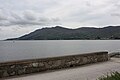
 Carlingford Lough from Hill 464 - geograph.org.uk - 5144977.jpg 4.000 × 3.000; 2,9 MB
-
 Carlingford Lough from the slopes of Carlingford Mountain - geograph.org.uk - 5432239.jpg 4.000 × 3.000; 2,92 MB
-
 Carlingford Lough from the summit of Clermont Carn - geograph.org.uk - 5119163.jpg 4.000 × 3.000; 3,4 MB
-
 Cooley Peninsula in Ireland.png 800 × 1.021; 111 KB
-
 Cooley Peninsula, July 2010 (01).JPG 4.272 × 2.848; 4,66 MB
-
 Cooley Peninsula, July 2010 (02).JPG 4.272 × 2.848; 3,87 MB
-
 Cumulus humilis radiatus clouds over Carlingford Lough - geograph.org.uk - 5858887.jpg 3.826 × 2.754; 6,08 MB
-
 Farmland next to the coast road - geograph.org.uk - 5862418.jpg 3.878 × 2.832; 5,55 MB
-
 Horse on the shore at Ballytrasna - geograph.org.uk - 980129.jpg 640 × 480; 92 KB
-
 Mourne Mountains from Carlingford - geograph.org.uk - 985645.jpg 640 × 428; 69 KB
-
 Mudflats on the south side of Castletown River - geograph.org.uk - 5121541.jpg 3.755 × 2.817; 1,5 MB
-
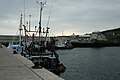 Port Oriel.jpg 3.456 × 2.304; 1,47 MB
-
 Raised beach west of the Castletown River - geograph.org.uk - 5840792.jpg 3.840 × 2.778; 5,55 MB
-

-
 Reed beds along the southern edge of Dundalk Bay - geograph.org.uk - 6088565.jpg 4.000 × 3.000; 2,59 MB
-
 Reed beds at the Loakers - geograph.org.uk - 6025786.jpg 3.972 × 2.962; 6,09 MB
-
 Salt marshes along the shoreline of Dundalk Bay - geograph.org.uk - 6088557.jpg 3.916 × 2.886; 6,12 MB
-
 Salt marshes between Blackrock and Dundalk - geograph.org.uk - 6089184.jpg 3.914 × 2.882; 5,49 MB
-

-

-

-
 Sliabh Foy Wood Carlingford.JPG 640 × 480; 131 KB
-
 Summit of Slieve Foye - geograph.org.uk - 223994.jpg 640 × 434; 65 KB
-

-
 The Castletown River discharging into Dundalk Bay - geograph.org.uk - 5144537.jpg 2.340 × 2.084; 868 KB
-
 The confluence of the Flurry and Castletown Rivers - geograph.org.uk - 5121288.jpg 3.641 × 1.650; 887 KB
-

-

-
 Travelling parallel to an international border - geograph.org.uk - 1981709.jpg 1.024 × 721; 117 KB
-
 Vessel in Port Oriel.jpg 3.456 × 2.304; 1,88 MB
-

-

-
 View south-westerly across the Greenore Raised Beach - geograph.org.uk - 5851761.jpg 1.643 × 1.587; 1,63 MB
-
 Farm buildings across a stubble field - geograph.org.uk - 592579.jpg 640 × 480; 99 KB


.JPG)
.JPG)


