Category:Geography of County Wicklow
Zur Navigation springen
Zur Suche springen
Wikimedia-Kategorie | |||||
| Medium hochladen | |||||
| Ist ein(e) | |||||
|---|---|---|---|---|---|
| |||||
Unterkategorien
Es werden 21 von insgesamt 21 Unterkategorien in dieser Kategorie angezeigt:
In Klammern die Anzahl der enthaltenen Kategorien (K), Seiten (S), Dateien (D)
B
C
- Coasts of County Wicklow (10 D)
D
- Drumgoff Forest (5 D)
F
- Fields in County Wicklow (18 D)
G
L
M
- Maps of County Wicklow (16 D)
- Moorlands in County Wicklow (1 D)
P
- Poulanass Waterfall (8 D)
- Powerscourt Waterfall (41 D)
R
S
- Streams in County Wicklow (14 D)
T
W
Medien in der Kategorie „Geography of County Wicklow“
Folgende 200 Dateien sind in dieser Kategorie, von 234 insgesamt.
(vorherige Seite) (nächste Seite)-
 (1) Lord Shiva - Victoria's Way Ireland.jpg 1.696 × 2.560; 936 KB
-
 A Statue at Powerscourt Garden - panoramio.jpg 3.888 × 2.592; 3,57 MB
-
 Ashtown, Co. Wicklow, Ireland - panoramio (1).jpg 2.048 × 1.536; 1,1 MB
-
 Ashtown, Co. Wicklow, Ireland - panoramio.jpg 2.048 × 1.536; 1,19 MB
-
 Avonmore River - geograph.org.uk - 1773976.jpg 1.600 × 1.096; 637 KB
-
 Balinacor townland, County Wicklow - geograph.org.uk - 1801598.jpg 2.585 × 1.446; 519 KB
-
 Ballanagh, Co. Wicklow, Ireland - panoramio - georama (1).jpg 3.072 × 2.304; 3,43 MB
-
 Ballanagh, Co. Wicklow, Ireland - panoramio - georama (2).jpg 3.072 × 2.304; 3,44 MB
-
 Ballanagh, Co. Wicklow, Ireland - panoramio - georama (3).jpg 2.304 × 3.072; 3,16 MB
-
 Ballanagh, Co. Wicklow, Ireland - panoramio - georama (4).jpg 3.072 × 2.304; 3,43 MB
-
 Ballanagh, Co. Wicklow, Ireland - panoramio - georama (5).jpg 3.072 × 2.304; 3,51 MB
-
 Ballanagh, Co. Wicklow, Ireland - panoramio - georama (6).jpg 2.304 × 3.072; 3,48 MB
-
 Ballanagh, Co. Wicklow, Ireland - panoramio - georama (7).jpg 3.072 × 2.304; 3,4 MB
-
 Ballanagh, Co. Wicklow, Ireland - panoramio - georama.jpg 3.072 × 2.304; 3,47 MB
-
 Ballanagh, Co. Wicklow, Ireland - panoramio.jpg 2.304 × 3.072; 3,27 MB
-
 Ballard, Co. Wicklow, Ireland - panoramio (1).jpg 2.048 × 1.536; 1,17 MB
-
 Ballard, Co. Wicklow, Ireland - panoramio - georama.jpg 3.072 × 2.304; 3,44 MB
-
 Ballard, Co. Wicklow, Ireland - panoramio.jpg 3.072 × 2.304; 3,49 MB
-
 Ballinafunshoge, Co. Wicklow, Ireland - panoramio (1).jpg 2.048 × 1.536; 1,52 MB
-
 Ballinafunshoge, Co. Wicklow, Ireland - panoramio (2).jpg 2.048 × 1.536; 1,04 MB
-
 Ballinafunshoge, Co. Wicklow, Ireland - panoramio (3).jpg 2.048 × 1.536; 984 KB
-
 Ballinafunshoge, Co. Wicklow, Ireland - panoramio (4).jpg 1.536 × 2.048; 1,07 MB
-
 Ballinafunshoge, Co. Wicklow, Ireland - panoramio (5).jpg 2.048 × 1.530; 875 KB
-
 Ballinafunshoge, Co. Wicklow, Ireland - panoramio (6).jpg 2.048 × 1.536; 1,03 MB
-
 Ballinafunshoge, Co. Wicklow, Ireland - panoramio (7).jpg 2.048 × 1.536; 1,03 MB
-
 Ballinafunshoge, Co. Wicklow, Ireland - panoramio.jpg 2.048 × 1.536; 1,08 MB
-
 Ballinagappoge, Co. Wicklow, Ireland - panoramio (1).jpg 2.048 × 1.536; 1,9 MB
-
 Ballinagappoge, Co. Wicklow, Ireland - panoramio.jpg 1.536 × 2.048; 1,57 MB
-
 Ballinastoe, Co. Wicklow, Ireland - panoramio (1).jpg 2.048 × 1.536; 1,36 MB
-
 Ballinastoe, Co. Wicklow, Ireland - panoramio (2).jpg 1.536 × 2.048; 1,7 MB
-
 Ballinastoe, Co. Wicklow, Ireland - panoramio (3).jpg 2.048 × 1.536; 1,27 MB
-
 Ballinastoe, Co. Wicklow, Ireland - panoramio.jpg 2.048 × 1.536; 1,23 MB
-
 Ballyboy, Co. Wicklow, Ireland - panoramio (1).jpg 1.536 × 2.048; 1,49 MB
-
 Ballyboy, Co. Wicklow, Ireland - panoramio (2).jpg 2.048 × 1.536; 1,67 MB
-
 Ballyboy, Co. Wicklow, Ireland - panoramio (3).jpg 2.048 × 1.536; 1,25 MB
-
 Ballyboy, Co. Wicklow, Ireland - panoramio (4).jpg 2.048 × 1.536; 1,24 MB
-
 Ballyboy, Co. Wicklow, Ireland - panoramio (5).jpg 2.048 × 1.536; 1,27 MB
-
 Ballyboy, Co. Wicklow, Ireland - panoramio (6).jpg 2.048 × 1.536; 1,51 MB
-
 Ballyboy, Co. Wicklow, Ireland - panoramio.jpg 2.048 × 1.536; 1,41 MB
-
 Ballygahan Lower, Co. Wicklow, Ireland - panoramio.jpg 3.072 × 2.304; 3,57 MB
-
 Ballyhad Upper, Co. Wicklow, Ireland - panoramio - georama.jpg 3.072 × 2.304; 3,26 MB
-
 Ballyhad Upper, Co. Wicklow, Ireland - panoramio.jpg 3.072 × 2.304; 3,37 MB
-
 Ballyteige, Co. Wicklow, Ireland - panoramio.jpg 2.048 × 1.536; 1,65 MB
-
 Baltynanima, Co. Wicklow, Ireland - panoramio (1).jpg 2.048 × 1.536; 633 KB
-
 Baltynanima, Co. Wicklow, Ireland - panoramio (2).jpg 2.048 × 1.536; 1,86 MB
-
 Baltynanima, Co. Wicklow, Ireland - panoramio (3).jpg 2.048 × 1.536; 984 KB
-
 Baltynanima, Co. Wicklow, Ireland - panoramio.jpg 2.048 × 1.536; 1,24 MB
-
 Bathing Strand, Co. Wicklow (25340935660).jpg 2.000 × 1.313; 1,39 MB
-
 Blue (7401713394).jpg 4.891 × 3.250; 6,98 MB
-
 Boystown, Co. Wicklow, Ireland - panoramio (1).jpg 4.000 × 2.664; 2,46 MB
-
 Boystown, Co. Wicklow, Ireland - panoramio.jpg 4.000 × 2.664; 1,89 MB
-
 Camenabologue.jpg 485 × 363; 14 KB
-
 Carriglinneen, Co. Wicklow, Ireland - panoramio (2).jpg 1.536 × 2.048; 1,39 MB
-
 Carriglinneen, Co. Wicklow, Ireland - panoramio.jpg 2.048 × 1.536; 1,15 MB
-
 Carrigroe, Co. Wicklow, Ireland - panoramio (1).jpg 2.048 × 1.536; 1,08 MB
-
 Carrigroe, Co. Wicklow, Ireland - panoramio (2).jpg 2.048 × 1.536; 1,06 MB
-
 Carrigroe, Co. Wicklow, Ireland - panoramio.jpg 2.048 × 1.536; 957 KB
-
 Castlehoward, Co. Wicklow, Ireland - panoramio - georama.jpg 3.072 × 2.304; 3,31 MB
-
 Castlehoward, Co. Wicklow, Ireland - panoramio.jpg 3.072 × 2.304; 3,42 MB
-
 Clohernagh, Co. Wicklow, Ireland - panoramio (1).jpg 2.048 × 1.536; 1,26 MB
-
 Clohernagh, Co. Wicklow, Ireland - panoramio.jpg 1.536 × 2.048; 1,75 MB
-
 Conavalla.jpg 485 × 363; 19 KB
-
 Corrigasleggaun - geograph.org.uk - 128633.jpg 640 × 430; 70 KB
-
 Corrigasleggaun.jpg 485 × 363; 19 KB
-
 County Wicklow Population Density Map (2016).png 2.808 × 2.464; 970 KB
-
 Deerpark, Co. Wicklow, Ireland - panoramio (1).jpg 2.048 × 1.536; 1,53 MB
-
 Deerpark, Co. Wicklow, Ireland - panoramio (2).jpg 2.048 × 1.536; 1,1 MB
-
 Deerpark, Co. Wicklow, Ireland - panoramio (3).jpg 1.536 × 2.048; 1,79 MB
-
 Deerpark, Co. Wicklow, Ireland - panoramio.jpg 1.536 × 2.048; 1,47 MB
-
 Derrybawn, Co. Wicklow, Ireland - panoramio (1).jpg 2.048 × 412; 340 KB
-
 Derrybawn, Co. Wicklow, Ireland - panoramio (10).jpg 2.048 × 1.536; 1,72 MB
-
 Derrybawn, Co. Wicklow, Ireland - panoramio (12).jpg 1.536 × 2.048; 1,79 MB
-
 Derrybawn, Co. Wicklow, Ireland - panoramio (13).jpg 2.048 × 1.536; 1,11 MB
-
 Derrybawn, Co. Wicklow, Ireland - panoramio (14).jpg 2.048 × 1.536; 1,02 MB
-
 Derrybawn, Co. Wicklow, Ireland - panoramio (15).jpg 2.048 × 1.536; 800 KB
-
 Derrybawn, Co. Wicklow, Ireland - panoramio (16).jpg 2.048 × 1.536; 1,48 MB
-
 Derrybawn, Co. Wicklow, Ireland - panoramio (17).jpg 2.048 × 1.536; 919 KB
-
 Derrybawn, Co. Wicklow, Ireland - panoramio (18).jpg 1.536 × 2.048; 783 KB
-
 Derrybawn, Co. Wicklow, Ireland - panoramio (2).jpg 2.048 × 1.536; 1,22 MB
-
 Derrybawn, Co. Wicklow, Ireland - panoramio (20).jpg 2.048 × 1.536; 990 KB
-
 Derrybawn, Co. Wicklow, Ireland - panoramio (21).jpg 1.536 × 2.048; 1,03 MB
-
 Derrybawn, Co. Wicklow, Ireland - panoramio (22).jpg 2.048 × 1.536; 1,21 MB
-
 Derrybawn, Co. Wicklow, Ireland - panoramio (23).jpg 1.536 × 2.048; 1,16 MB
-
 Derrybawn, Co. Wicklow, Ireland - panoramio (24).jpg 2.048 × 1.536; 1,08 MB
-
 Derrybawn, Co. Wicklow, Ireland - panoramio (25).jpg 2.048 × 1.536; 1,78 MB
-
 Derrybawn, Co. Wicklow, Ireland - panoramio (26).jpg 2.048 × 1.536; 717 KB
-
 Derrybawn, Co. Wicklow, Ireland - panoramio (27).jpg 2.048 × 1.536; 1,28 MB
-
 Derrybawn, Co. Wicklow, Ireland - panoramio (28).jpg 2.048 × 1.536; 1,01 MB
-
 Derrybawn, Co. Wicklow, Ireland - panoramio (29).jpg 2.048 × 2.048; 1,8 MB
-
 Derrybawn, Co. Wicklow, Ireland - panoramio (3).jpg 1.536 × 2.048; 1,53 MB
-
 Derrybawn, Co. Wicklow, Ireland - panoramio (30).jpg 2.048 × 1.536; 1,6 MB
-
 Derrybawn, Co. Wicklow, Ireland - panoramio (4).jpg 1.536 × 2.048; 1,64 MB
-
 Derrybawn, Co. Wicklow, Ireland - panoramio (5).jpg 1.536 × 2.048; 1,87 MB
-
 Derrybawn, Co. Wicklow, Ireland - panoramio (6).jpg 2.048 × 1.536; 1,31 MB
-
 Derrybawn, Co. Wicklow, Ireland - panoramio (7).jpg 2.048 × 1.536; 883 KB
-
 Derrybawn, Co. Wicklow, Ireland - panoramio (8).jpg 2.048 × 1.536; 1,21 MB
-
 Derrybawn, Co. Wicklow, Ireland - panoramio (9).jpg 2.048 × 1.536; 969 KB
-
 Derrybawn, Co. Wicklow, Ireland - panoramio.jpg 1.200 × 1.600; 511 KB
-
 Djouce2.jpg 4.903 × 344; 337 KB
-
 East towards Carrick Mountain - geograph.org.uk - 1801679.jpg 1.600 × 1.200; 439 KB
-
 Enniskerry, Co. Wicklow, Ireland - panoramio (1).jpg 2.048 × 1.536; 1,36 MB
-
 Enniskerry, Co. Wicklow, Ireland - panoramio (2).jpg 1.536 × 2.048; 1,17 MB
-
 Enniskerry, Co. Wicklow, Ireland - panoramio (3).jpg 2.048 × 1.536; 906 KB
-
 Enniskerry, Co. Wicklow, Ireland - panoramio (4).jpg 1.536 × 2.048; 888 KB
-
 Enniskerry, Co. Wicklow, Ireland - panoramio.jpg 2.048 × 1.536; 1,17 MB
-
 Feral goats in glendalough.jpg 2.048 × 1.617; 1,1 MB
-
 Fire(y coldness), take two (3056391249).jpg 2.500 × 1.677; 3,99 MB
-
 Glaskenny, Co. Wicklow, Ireland - panoramio (1).jpg 2.048 × 1.536; 1,42 MB
-
 Glaskenny, Co. Wicklow, Ireland - panoramio.jpg 2.048 × 1.536; 1,33 MB
-
 Glendalough (2539745002).jpg 2.036 × 1.169; 389 KB
-
 Glendalough - panoramio (1).jpg 3.648 × 2.736; 3,59 MB
-
 Glendalough - panoramio (2).jpg 3.648 × 2.736; 3,55 MB
-
 Glendalough - panoramio (3).jpg 3.648 × 2.736; 3,61 MB
-
 Glendalough - panoramio (4).jpg 3.648 × 2.736; 3,18 MB
-
 Glendalough - panoramio (5).jpg 3.648 × 2.736; 3,61 MB
-
 Glendalough - panoramio (6).jpg 3.648 × 2.736; 3,24 MB
-
 Glendalough before Round Tower was restored (7871019630).jpg 2.000 × 1.957; 1,6 MB
-
 Glendalough bird (Unsplash).jpg 6.720 × 4.480; 12,36 MB
-
 GLENDALOUGH WALK 07 - panoramio.jpg 2.816 × 2.120; 3,17 MB
-
 GLENDALOUGH WALK 08 - panoramio.jpg 2.816 × 2.120; 4,1 MB
-
 Glendalough,Upper Lake - panoramio.jpg 3.888 × 2.592; 2,61 MB
-
 Glenmacnass Valley - geograph.org.uk - 64541.jpg 640 × 391; 117 KB
-
 Glenmacnass Waterfall - geograph.org.uk - 19567.jpg 640 × 480; 151 KB
-
 Glenmacnass waterfall from the south - geograph.org.uk - 64540.jpg 640 × 420; 141 KB
-
 GLENMALUR - panoramio.jpg 2.816 × 2.120; 4,15 MB
-
 Hydrothermal Breccia.jpg 700 × 465; 116 KB
-
 Ireland - panoramio - Raimundas Budzeika.jpg 1.600 × 1.200; 748 KB
-
 Keadeen.JPG 3.737 × 1.428; 2,27 MB
-
 Kilcoole, County Wicklow - geograph.org.uk - 1809225.jpg 2.592 × 1.944; 745 KB
-
 Kings River - geograph.org.uk - 932680.jpg 640 × 480; 48 KB
-
 Kings River Valley - geograph.org.uk - 932708.jpg 640 × 480; 52 KB
-
 Kings River Valley and Beyond - geograph.org.uk - 932685.jpg 640 × 480; 61 KB
-
 Lackareagh in West Wicklow - geograph.org.uk - 1774446.jpg 2.585 × 1.456; 1,01 MB
-
 Lake in the Wicklow Mountains National Park - Ireland - panoramio.jpg 3.648 × 2.736; 4,74 MB
-
 Landscape in Wicklow, Ireland.jpg 2.048 × 1.232; 2,43 MB
-
 Laragh East, Co. Wicklow, Ireland - panoramio (1).jpg 2.048 × 1.536; 1,33 MB
-
 Laragh East, Co. Wicklow, Ireland - panoramio (2).jpg 2.048 × 1.536; 1,18 MB
-
 Laragh East, Co. Wicklow, Ireland - panoramio (3).jpg 2.048 × 1.536; 1,37 MB
-
 Laragh East, Co. Wicklow, Ireland - panoramio (4).jpg 2.048 × 1.536; 2 MB
-
 Laragh East, Co. Wicklow, Ireland - panoramio (5).jpg 2.048 × 1.536; 1.002 KB
-
 Laragh East, Co. Wicklow, Ireland - panoramio (6).jpg 2.048 × 1.536; 1,57 MB
-
 Laragh East, Co. Wicklow, Ireland - panoramio (7).jpg 2.048 × 1.536; 1,16 MB
-
 Laragh East, Co. Wicklow, Ireland - panoramio.jpg 2.048 × 1.536; 1,05 MB
-
 Lough Bray Upper (condado de Wicklow, Irlanda).jpg 3.072 × 2.304; 2,54 MB
-
 Lough Bray Upper - geograph.org.uk - 64539.jpg 640 × 399; 145 KB
-
 Lough bray.jpg 640 × 480; 100 KB
-
 Lough Tay - panoramio (2).jpg 6.205 × 1.721; 7,25 MB
-
 Lough Tay - panoramio.jpg 4.928 × 3.264; 3,27 MB
-
 Madame Butterfly (2900015716).jpg 4.417 × 3.000; 10,52 MB
-
 Mucklagh, Co. Wicklow, Ireland - panoramio (1).jpg 2.048 × 1.536; 1,51 MB
-
 Mucklagh, Co. Wicklow, Ireland - panoramio (2).jpg 2.048 × 1.536; 1.024 KB
-
 Mucklagh, Co. Wicklow, Ireland - panoramio (3).jpg 2.048 × 1.536; 1,03 MB
-
 Mucklagh, Co. Wicklow, Ireland - panoramio (4).jpg 2.048 × 1.536; 956 KB
-
 Mucklagh, Co. Wicklow, Ireland - panoramio (5).jpg 2.048 × 1.536; 2,16 MB
-
 Mucklagh, Co. Wicklow, Ireland - panoramio (6).jpg 2.048 × 1.536; 985 KB
-
 Mucklagh, Co. Wicklow, Ireland - panoramio (7).jpg 1.536 × 2.048; 1,47 MB
-
 Mucklagh, Co. Wicklow, Ireland - panoramio (8).jpg 2.048 × 1.536; 1,21 MB
-
 Mucklagh, Co. Wicklow, Ireland - panoramio.jpg 1.536 × 2.048; 1,51 MB
-
 Old copper mine near Avoca - geograph.org.uk - 1556088.jpg 640 × 427; 73 KB
-
 Oldboleys, Co. Wicklow, Ireland - panoramio - georama (1).jpg 2.304 × 3.072; 3,45 MB
-
 Oldboleys, Co. Wicklow, Ireland - panoramio - georama (2).jpg 3.072 × 2.304; 3,32 MB
-
 Oldboleys, Co. Wicklow, Ireland - panoramio - georama.jpg 3.072 × 2.304; 3,48 MB
-
 Oldboleys, Co. Wicklow, Ireland - panoramio.jpg 3.072 × 2.304; 3,35 MB
-
 PAISAJE DE LAS MONTAÑAS WICKLOW - panoramio.jpg 7.360 × 4.912; 17,46 MB
-
 Postcard from Wicklow (3056396531).jpg 3.814 × 1.959; 4,4 MB
-
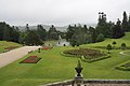
 Powerscourt Estate, Wicklow - panoramio.jpg 2.992 × 2.000; 3,33 MB
-
 Powerscourt Garden ,Wicklow,Ireland - panoramio.jpg 3.888 × 2.592; 2,9 MB
-
 Powerscourt Garden, Co. Wicklow,Ireland - panoramio.jpg 3.888 × 2.592; 3,94 MB
-
 Powerscourt Garden,Co. Wicklow,Ireland - panoramio.jpg 3.888 × 2.592; 3,37 MB
-
 Powerscourt Garden,Co.Wicklow,Ireland - panoramio (1).jpg 3.888 × 2.592; 3,33 MB
-
 Powerscourt Garden,Co.Wicklow,Ireland - panoramio (2).jpg 3.888 × 2.592; 3,17 MB
-
 Powerscourt Garden,Co.Wicklow,Ireland - panoramio (3).jpg 3.888 × 2.592; 3,87 MB
-
 Powerscourt Garden,Co.Wicklow,Ireland - panoramio (4).jpg 3.888 × 2.592; 2,57 MB
-
 Powerscourt Garden,Co.Wicklow,Ireland - panoramio.jpg 3.888 × 2.592; 2,27 MB
-
 Powerscourt Paddock, Co. Wicklow, Ireland - panoramio (1).jpg 2.048 × 1.536; 909 KB
-
 Powerscourt Paddock, Co. Wicklow, Ireland - panoramio (2).jpg 2.048 × 2.048; 1,7 MB
-
 Powerscourt Paddock, Co. Wicklow, Ireland - panoramio (3).jpg 2.048 × 1.536; 789 KB
-
 Powerscourt Paddock, Co. Wicklow, Ireland - panoramio (4).jpg 1.536 × 2.048; 1,38 MB
-
 Powerscourt Paddock, Co. Wicklow, Ireland - panoramio (5).jpg 2.048 × 1.536; 783 KB
-
 Powerscourt Paddock, Co. Wicklow, Ireland - panoramio (6).jpg 2.048 × 2.048; 1,15 MB
-
 Powerscourt Paddock, Co. Wicklow, Ireland - panoramio (7).jpg 2.048 × 1.536; 1.013 KB
-
 Powerscourt Paddock, Co. Wicklow, Ireland - panoramio (8).jpg 2.048 × 2.048; 1,67 MB
-
 Powerscourt Paddock, Co. Wicklow, Ireland - panoramio.jpg 2.048 × 1.536; 894 KB
-
 Raheen, Co. Wicklow, Ireland - panoramio.jpg 2.048 × 1.536; 1,58 MB
-
 River Glenmacnass, Wicklow Mountains, Ireland (17405285881).jpg 3.264 × 2.448; 7,45 MB
-
 Road bend (3409509071).jpg 3.900 × 2.523; 4,58 MB
-
 Rocks off the coast at Wicklow - geograph.org.uk - 1545042.jpg 640 × 480; 60 KB
-
 Sleamaine, Co. Wicklow, Ireland - panoramio (1).jpg 2.048 × 1.530; 1,3 MB
-
 Sleamaine, Co. Wicklow, Ireland - panoramio (2).jpg 2.048 × 1.536; 1,23 MB
-
 Sleamaine, Co. Wicklow, Ireland - panoramio (3).jpg 2.048 × 1.530; 1,14 MB
-
 Sleamaine, Co. Wicklow, Ireland - panoramio.jpg 2.048 × 1.536; 1,15 MB
-
 Slievemaan.jpg 350 × 304; 37 KB
-
 Small Cave - geograph.org.uk - 744967.jpg 640 × 480; 129 KB
-
 Sraghmore, Co. Wicklow, Ireland - panoramio.jpg 2.048 × 1.536; 996 KB
-
 ST,-KEVIN'S CATHEDRAL - panoramio.jpg 2.816 × 2.120; 3,84 MB
-
 ST.-KEVIN'S KITCHEN - panoramio.jpg 2.816 × 2.120; 3,61 MB
-
 The Gap Road - geograph.org.uk - 729202.jpg 640 × 480; 78 KB
-
 The Liffey near Kilbride, Co. Wicklow - geograph.org.uk - 568212.jpg 640 × 480; 143 KB
-
 TheSugarLoaf 5086w.jpg 2.592 × 1.944; 1,46 MB
-
 Tigroney West, Co. Wicklow, Ireland - panoramio - georama (1).jpg 3.072 × 2.304; 3,54 MB
_Lord_Shiva_-_Victoria%27s_Way_Ireland.jpg)

.jpg)


.jpg)
.jpg)
.jpg)
.jpg)
.jpg)
.jpg)
.jpg)


.jpg)


.jpg)
.jpg)
.jpg)
.jpg)
.jpg)
.jpg)
.jpg)

.jpg)

.jpg)
.jpg)
.jpg)

.jpg)
.jpg)
.jpg)
.jpg)
.jpg)
.jpg)


.jpg)
.jpg)
.jpg)

.jpg)
.jpg)
.jpg)


.jpg)

.jpg)
.jpg)


.jpg)


.png)
.jpg)
.jpg)
.jpg)

.jpg)
.jpg)
.jpg)
.jpg)
.jpg)
.jpg)
.jpg)
.jpg)
.jpg)
.jpg)
.jpg)
.jpg)
.jpg)
.jpg)
.jpg)
.jpg)
.jpg)
.jpg)
.jpg)
.jpg)
.jpg)
.jpg)
.jpg)
.jpg)
.jpg)
.jpg)
.jpg)


.jpg)
.jpg)
.jpg)
.jpg)


,_take_two_(3056391249).jpg)
.jpg)

.jpg)
.jpg)
.jpg)
.jpg)
.jpg)
.jpg)
.jpg)
.jpg)
.jpg)


.jpg)
.jpg)
.jpg)
.jpg)
.jpg)
.jpg)
.jpg)

.jpg)


.jpg)
.jpg)
.jpg)
.jpg)
.jpg)
.jpg)
.jpg)
.jpg)
.jpg)


.jpg)
.jpg)


.jpg)


.jpg)
.jpg)
.jpg)
.jpg)

.jpg)
.jpg)
.jpg)
.jpg)
.jpg)
.jpg)
.jpg)
.jpg)


.jpg)
.jpg)

.jpg)
.jpg)
.jpg)


.jpg)
.jpg)
.jpg)