Category:Geography of Ecuador
跳转到导航
跳转到搜索
geografia do Equador que fica na América do sul | |||||
| 上传媒体 | |||||
| 隶属于 |
| ||||
|---|---|---|---|---|---|
| 上级分类 | |||||
| 话题方面 | |||||
| 位置 |
| ||||
 | |||||
厄瓜多尔 | ||
|---|---|---|
|
子分类
本分类有以下18个子分类,共有18个子分类。
分类“Geography of Ecuador”中的媒体文件
以下39个文件属于本分类,共39个文件。
-
-
 14 terreno portete (12522741003).jpg 3,216 × 2,136;1.73 MB
-
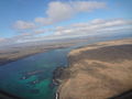
 Aerial photograph Itabaca Channel, to the right Santa Cruz Island is on the left.JPG 4,608 × 3,456;3.13 MB
-
 Aerial photograph of Santa Cruz ' on the left and the Itabaca Channel, to the right.JPG 4,608 × 3,456;2.96 MB
-
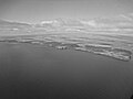
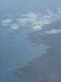
 Aerial photograph over the Galápagos Islands.JPG 4,608 × 3,456;2.16 MB
-
 Aerial photograph, Galápagos Black and white.JPG 4,608 × 3,456;3.87 MB
-
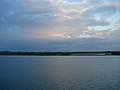 After The Sun Set - panoramio - ---=XEON=---.jpg 3,072 × 2,304;2.51 MB
-
 After The Sun Set - panoramio.jpg 3,072 × 2,304;2.48 MB
-
 After The Sun Set In Ecuador - panoramio.jpg 3,072 × 2,304;2.72 MB
-
 Alvaro Sevilla Design Isla Santa Cruz Galapagos foto tomada desde el avión.jpg 4,000 × 3,000;3.91 MB
-
 An Aerial photograph, Baltra Island, a small island of the Galápagos Islands.JPG 4,608 × 3,456;3.72 MB
-
 BAJANDO A BAÑOS POR COTALO - panoramio.jpg 2,592 × 1,936;1.23 MB
-
 Baltra Island Aerial photograph,a small island in the Galápagos.JPG 4,608 × 3,456;3.61 MB
-
 Baltra Island Aerial photograph.JPG 4,608 × 3,456;3.92 MB
-
 Black and white Aerial photograph, Galápagos.JPG 4,608 × 3,456;3.67 MB
-
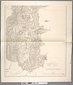
 Carta Geognóstica De La Provincia De Loja.jpg 2,942 × 3,611;1.99 MB
-
 Catamayo.JPG 356 × 267;36 KB
-
 Das Vulkangebiet Von Ecuador 01.jpg 7,236 × 8,494;20.13 MB
-
 Das Vulkangebiet Von Ecuador 02.jpg 7,240 × 8,453;7.48 MB
-
 Das Vulkangebiet Von Ecuador 03.jpg 7,725 × 8,533;19.21 MB
-
 Das Vulkangebiet Von Ecuador 04.jpg 7,775 × 8,592;19.48 MB
-
 Das Vulkangebiet Von Ecuador 05.jpg 8,006 × 9,289;10.78 MB
-
 Das Vulkangebiet Von Ecuador 06.jpg 8,014 × 9,330;11.51 MB
-
 Das Vulkangebiet Von Ecuador 07.jpg 7,642 × 8,771;10.51 MB
-
 Das Vulkangebiet Von Ecuador 08.jpg 8,040 × 9,309;10.83 MB
-
 Das Vulkangebiet Von Ecuador 09.jpg 7,831 × 9,308;10.53 MB
-
 Das Vulkangebiet Von Ecuador 10.jpg 7,895 × 9,375;10.44 MB
-
 Ecuador map.png 328 × 353;18 KB
-
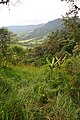 Ecuador Mindo Hill Scene.jpg 533 × 800;119 KB
-
-
 Galápagos Islands, Aerial photograph.JPG 4,608 × 3,456;2.51 MB
-
 Geography of Ecuador within South America.jpg 1,159 × 681;304 KB
-
 Geography of Ecuador.jpg 1,410 × 1,470;193 KB
-
 Isla Santa Cruz Galápagos foto tomada desde el avión Alvaro Sevilla Design.JPG 3,000 × 4,000;3.6 MB
-
 Islands of the Galápagos Islands.JPG 4,608 × 3,456;2.15 MB
-
 Itabaca channel between Baltra Island on the right and Santa Cruz on the left.JPG 4,608 × 3,456;3.13 MB
-
 Oxybelis fulgidus (Yasuni).jpg 1,800 × 1,200;1.15 MB
-
 The Itabaca channel between Baltra Island on the right and Santa Cruz on the left.JPG 4,608 × 3,456;3.12 MB
-
 Übersichtskarte von Mittel- und Nordecuador.jpg 3,813 × 5,660;7.19 MB
.jpg)


.jpg)

