Category:Geography of Greenland
Vai alla navigazione
Vai alla ricerca
geography of the world's largest island  | |||||
| Carica un file multimediale | |||||
| Istanza di |
| ||||
|---|---|---|---|---|---|
| Sottoclasse di | |||||
| Aspetto di | |||||
| Luogo |
| ||||
| Superficie |
| ||||
 | |||||
Sottocategorie
Questa categoria contiene le 16 sottocategorie indicate di seguito, su un totale di 16.
Pagine nella categoria "Geography of Greenland"
Questa categoria contiene un'unica pagina, indicata di seguito.
File nella categoria "Geography of Greenland"
Questa categoria contiene 8 file, indicati di seguito, su un totale di 8.
-
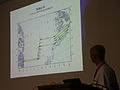 Geikie Flight Plan Map.jpg 4 280 × 3 210; 7,19 MB
-
 Geography-of-greenland.svg 300 × 500; 26 KB
-
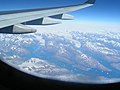
 King Frederick VI Coast 2005-08-22 01.jpg 2 048 × 1 536; 1,42 MB
-
 King Frederick VI Coast 2005-08-22 02.jpg 2 048 × 1 536; 1,24 MB
-
 King Frederick VI Coast 2005-08-22 03.jpg 2 048 × 1 536; 1,26 MB
-
 PSM V37 D325 View of upernavik.jpg 3 710 × 2 107; 2,49 MB
-
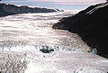 Rinksglacier.jpg 640 × 431; 156 KB
-
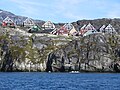 View from Nuuk Fiord.JPG 4 000 × 3 000; 3,78 MB


