Category:Geography of Libya
Pereiti į navigaciją
Jump to search
nature of the topology of a country | |||||
| Įkelti mediją | |||||
| Tai yra |
| ||||
|---|---|---|---|---|---|
| Poklasis | |||||
| Teminiu požiūriu nurodo | |||||
| Vieta |
| ||||
| |||||
Subkategorijos
Rodoma 13 subkategorijų (iš viso yra 13 subkategorijų).
Daugialypės terpės rinkmenos kategorijoje „Geography of Libya“
Rodoma 18 šios kategorijos rinkmenų (iš viso kategorijoje yra 18 rinkmenų).
-
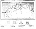 AFR V2 D020 Route of the chief explorers in Cyrenaica.jpg 1 834 × 1 485; 303 KiB
-
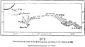
 AFR V2 D030 Tobruk.jpg 1 845 × 1 997; 575 KiB
-
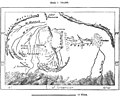
 AFR V2 D032 Cyrene.jpg 1 790 × 1 549; 525 KiB
-
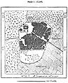
 AFR V2 D036 Benghazi.jpg 1 814 × 2 478; 732 KiB
-
 AFR V2 D040 Regions south of Barka lying below the level of the Mediterranean.jpg 1 769 × 973; 129 KiB
-
 AFR V2 D049 Kufra oasis.jpg 1 818 × 1 835; 191 KiB
-
 AFR V2 D051 Routes of the chief explorers in Tripolitania.jpg 2 138 × 1 410; 225 KiB
-
 AFR V2 D056 Jebel Ghurian.jpg 1 832 × 1 330; 207 KiB
-
 AFR V2 D065 Oases and arable lands of Tripolitania.jpg 1 739 × 1 747; 375 KiB
-
 AFR V2 D070 Inhabitants of Tripolitania.jpg 1 716 × 1 710; 378 KiB
-
 AFR V2 D076 Jofra oasis.jpg 1 737 × 1 408; 321 KiB
-
 AFR V2 D090 Routes of the chief explorers of Fezzan.jpg 1 784 × 1 507; 175 KiB
-
 AFR V2 D100 Murzuk.jpg 1 113 × 1 370; 292 KiB
-
 AFR V2 D105 Ghadames district.jpg 1 725 × 1 259; 230 KiB
-
 AFR V2 D113 Rhat, Libya.jpg 1 109 × 2 502; 377 KiB
-
 Arkenu aerialOD.png 4 000 × 2 250; 14,53 MiB
-
 Ionian Sea borders.png 975 × 678; 952 KiB
-
 Libyen-sandwueste1.jpg 353 × 232; 13 KiB


