Category:Geology of India
Zur Navigation springen
Zur Suche springen
Staaten in Asien: Afghanistan · Ägypten‡ · Armenien‡ · Aserbaidschan‡ · Bahrain · Bangladesch · Bhutan · Brunei Darussalam · Georgien‡ · Indien · Indonesien‡ · Irak · Iran · Israel · Japan · Jemen · Jordanien · Kambodscha · Kasachstan‡ · Katar · Kirgisistan · Kuwait · Laos · Libanon · Malaysia · Malediven · Mongolei · Myanmar · Nepal · Nordkorea · Oman · Osttimor · Pakistan · Philippinen · Russland‡ · Saudi-Arabien · Singapur · Sri Lanka · Südkorea · Syrien · Tadschikistan · Thailand · Türkei‡ · Turkmenistan · Usbekistan · Vereinigte Arabische Emirate · Vietnam · Volksrepublik China · Zypern‡
Begrenzte Anerkennung: Abchasien‡ · Republik China · Staat Palästina – Weitere Gebiete: Hongkong
‡: teilweise in Asien
Begrenzte Anerkennung: Abchasien‡ · Republik China · Staat Palästina – Weitere Gebiete: Hongkong
‡: teilweise in Asien
geological origins and structure of India | |||||
| Medium hochladen | |||||
| Unterklasse von | |||||
|---|---|---|---|---|---|
| |||||
Unterkategorien
Es werden 54 von insgesamt 54 Unterkategorien in dieser Kategorie angezeigt:
In Klammern die Anzahl der enthaltenen Kategorien (K), Seiten (S), Dateien (D)
*
+
- Geological diagrams of India (2 D)
C
D
E
F
G
H
I
K
- Karakorum Fault (2 D)
L
M
N
O
P
- Permafrost in India (3 D)
Q
S
T
V
W
Medien in der Kategorie „Geology of India“
Folgende 23 Dateien sind in dieser Kategorie, von 23 insgesamt.
-

-

-

-
 Ammonite fossil 2.jpg 4.000 × 1.840; 1,74 MB
-

-
 Continental-continental destructive plate boundary.svg 2.512 × 1.537; 2 KB
-
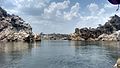
 Downstream of Dhuadhar Falls.jpg 3.264 × 1.836; 2,71 MB
-
 Expanse of Panchwati lake.jpg 3.264 × 1.836; 2,34 MB
-
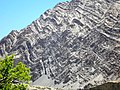 Folded Rock Layers in India 1.jpg 2.592 × 1.944; 2,39 MB
-
 Foreland basin development.png 689 × 251; 48 KB
-
 Himalayan foreland basin.png 3.389 × 1.966; 5,91 MB
-
 India-Eurasia collision.gif 480 × 360; 4,88 MB
-
 Kloster Rangdum Gompa.jpg 1.800 × 1.200; 790 KB
-
 Kutch Basin geology and Vasuki locality.png 1.984 × 614; 1,1 MB
-
 Location of Karakorum Fault.pdf 1.275 × 1.650; 3,26 MB
-
 Marmol-india.jpg 4.000 × 3.000; 3,12 MB
-
 Muséum de Nantes - 177 - Fluorapophyllite (Inde).jpg 2.976 × 2.620; 1,3 MB
-
 Nainital Geology.jpg 1.603 × 2.228; 472 KB
-
 PaleogeographicMapHimalayas.png 591 × 700; 179 KB
-
 Rocky outcrop at Nagi Dam Bird Sanctuary.png 649 × 538; 346 KB
-
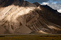
 Sarchu River.jpg 4.608 × 3.456; 5,19 MB
-
 The Quarterly journal of the Geological Society of London (12733760933).jpg 3.200 × 1.945; 1,01 MB
-
 Tor formation in Nagi Dam Bird Sanctuary.jpg 4.624 × 3.472; 3,23 MB
_Economic_Geology._By_..._V._Ball._..._Second_edition_revised_in_parts._Part_1._Corundum-By_T._H._Holland%27_(11246955814).jpg)
.jpg)
.jpg)


.jpg)


.jpg)
