Category:Geospatial Information Authority of Japan
跳转到导航
跳转到搜索
日本語: 国土交通省国土地理院
institution responsible for surveying and mapping the national land of Japan  | |||||
| 上传媒体 | |||||
| 隶属于 | |||||
|---|---|---|---|---|---|
| 位置 |
| ||||
| 总部位置 |
| ||||
| 成立或创建时间 |
| ||||
| 取代对象 |
| ||||
| 官方网站 | |||||
 | |||||
子分类
本分类有以下6个子分类,共有6个子分类。
分类“Geospatial Information Authority of Japan”中的媒体文件
以下15个文件属于本分类,共15个文件。
-

-

-
 Fukuoka National Government Building.jpg 3,264 × 2,448;479 KB
-
-
-
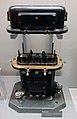
 GSI type magnetometer.jpg 1,992 × 1,496;1.72 MB
-
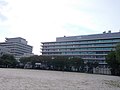
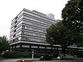
 Kokudochiriin.jpg 1,824 × 1,216;787 KB
-
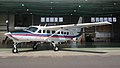 Kunikaze III.jpg 567 × 323;133 KB
-
 Nagoya Common Building for Government Offices No.2 20140824.jpg 4,288 × 3,216;4.73 MB
-
 Naha National Government Building No.1.JPG 3,062 × 2,213;1.07 MB
-
 Osaka National Government Building No.2 and 4.jpg 3,264 × 2,448;1.98 MB
-
 Osaka National Government Building No.4.JPG 2,280 × 1,651;577 KB
-
 Sendai 3th Joint-Government Office 1.jpg 5,184 × 3,888;5.23 MB
-
 国土地理院ウェブサイト「空中写真197708」.jpg 2,175 × 1,074;1.16 MB
-
 国土地理院ウェブサイト「空中写真201504」.jpg 2,175 × 1,074;1.2 MB
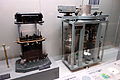
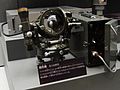
_model_-_National_Museum_of_Nature_and_Science,_Tokyo_-_DSC07797.JPG)
_model_-_National_Museum_of_Nature_and_Science,_Tokyo_-_DSC07837.JPG)

_and_absolute_(right)_-_National_Museum_of_Nature_and_Science,_Tokyo_-_DSC07808.JPG)


