Category:Gildersome
Aller à la navigation
Aller à la recherche
village and civil parish in West Yorkshire, England  | |||||
| Téléverser des médias | |||||
| Nature de l’élément | |||||
|---|---|---|---|---|---|
| Lieu | cité de Leeds, Yorkshire de l'Ouest, Yorkshire-et-Humber, Angleterre | ||||
 | |||||
Sous-catégories
Cette catégorie comprend 6 sous-catégories, dont les 6 ci-dessous.
Média dans la catégorie « Gildersome »
Cette catégorie comprend 194 fichiers, dont les 194 ci-dessous.
-
 A footpath off Street Lane, Gildersome - geograph.org.uk - 2727311.jpg 800 × 600 ; 341 kio
-
 A62 Gelderd Road - geograph.org.uk - 5062805.jpg 1 024 × 682 ; 198 kio
-
 Associated Waste Management, Gelderd Road - geograph.org.uk - 4718039.jpg 1 024 × 768 ; 786 kio
-
 Baptist chapel and Sunday school, Church Street, Gildersome - geograph.org.uk - 2460486.jpg 2 000 × 1 500 ; 845 kio
-
 Barker Hill Cottage Cattery - Gildersome Lane - geograph.org.uk - 648943.jpg 640 × 480 ; 52 kio
-
 Bownass News - Harthill Parade - geograph.org.uk - 1927719.jpg 640 × 480 ; 100 kio
-

-
 Bridleway off Gelderd Road - geograph.org.uk - 5062820.jpg 1 024 × 682 ; 234 kio
-
 Bruntcliffe Crossroads, Morley - geograph.org.uk - 99840.jpg 640 × 480 ; 80 kio
-
 Cockersdale - geograph.org.uk - 31826.jpg 640 × 480 ; 114 kio
-
 Cockersdale Village Gildersome - geograph.org.uk - 31829.jpg 640 × 482 ; 73 kio
-
 Communications masts at Hill Top Farm - geograph.org.uk - 4718069.jpg 1 024 × 768 ; 392 kio
-
 Construction plant at Rooms - geograph.org.uk - 4718066.jpg 1 024 × 768 ; 375 kio
-
 Datestone on Gelderd Road colliery buildings - geograph.org.uk - 4718053.jpg 640 × 480 ; 480 kio
-
 DHL - Gildersome Spur - geograph.org.uk - 2583814.jpg 640 × 480 ; 63 kio
-
 Disused railway bridge, Rooms Lane, Morley - geograph.org.uk - 1893565.jpg 2 000 × 1 500 ; 688 kio
-

-

-

-
 Electricity Substation No 3838 - Harthill - geograph.org.uk - 2454559.jpg 640 × 480 ; 81 kio
-

-
 Electricity Substation No 8230 - Branch End - geograph.org.uk - 2532254.jpg 640 × 483 ; 69 kio
-
 Elizabeth II Postbox, Gelderd Road - geograph.org.uk - 5062812.jpg 682 × 1 024 ; 211 kio
-
 Elizabeth II Postbox, Highfield Drive, Gildersome - geograph.org.uk - 5067729.jpg 682 × 1 024 ; 194 kio
-

-
 Farnley Wood beck - geograph.org.uk - 4717816.jpg 1 024 × 768 ; 1,41 Mio
-
 Field with pylons near Upper Moor Side - geograph.org.uk - 5371118.jpg 1 024 × 768 ; 176 kio
-
 Fly-tipping on Rooms Lane, Gildersome - geograph.org.uk - 2143232.jpg 2 000 × 1 406 ; 718 kio
-
 Fly-tipping on Rooms Lane, Gildersome - geograph.org.uk - 2143237.jpg 2 000 × 1 500 ; 1,06 Mio
-
 Football pitches, East View, Gildersome - geograph.org.uk - 6260191.jpg 1 024 × 768 ; 213 kio
-
 Footpath - Asquith Avenue - geograph.org.uk - 2532335.jpg 640 × 480 ; 140 kio
-
 Footpath - Asquith Avenue - geograph.org.uk - 2532340.jpg 480 × 640 ; 99 kio
-
 Footpath - Church Avenue - geograph.org.uk - 2454515.jpg 480 × 640 ; 62 kio
-
 Footpath - end of Suffield Drive - geograph.org.uk - 2331753.jpg 640 × 480 ; 56 kio
-
 Footpath - Gildersome Lane - geograph.org.uk - 2331755.jpg 640 × 480 ; 75 kio
-
 Footpath - Street Lane - geograph.org.uk - 1152086.jpg 510 × 640 ; 315 kio
-
 Footpath - Street Lane - geograph.org.uk - 2583988.jpg 480 × 640 ; 100 kio
-
 Footpath - Street Lane - geograph.org.uk - 2583995.jpg 480 × 640 ; 104 kio
-
 Footpath - Town Street - geograph.org.uk - 2454520.jpg 480 × 640 ; 96 kio
-
 Footpath - Town Street - geograph.org.uk - 2454531.jpg 480 × 640 ; 126 kio
-
 Footpath - Vicarage Avenue - geograph.org.uk - 2584032.jpg 640 × 480 ; 127 kio
-
 Footpath to Gelderd Road - geograph.org.uk - 4718070.jpg 1 024 × 768 ; 820 kio
-
 Friends' Meeting House, Street Lane, Gildersome - geograph.org.uk - 6111400.jpg 2 000 × 1 500 ; 863 kio
-
 Gas Installation - Gildersome Spur - geograph.org.uk - 2583841.jpg 640 × 480 ; 107 kio
-
 Gelderd Point - Gelderd Road - geograph.org.uk - 2583607.jpg 640 × 480 ; 52 kio
-
 Gelderd Road - geograph.org.uk - 5062814.jpg 1 024 × 682 ; 240 kio
-
 Chapel House - Harthill Lane - geograph.org.uk - 1153043.jpg 640 × 480 ; 278 kio
-

-
 Gildersome Cemetery - Church Street - geograph.org.uk - 1151696.jpg 640 × 387 ; 200 kio
-
 Gildersome Cemetery - Church Street - geograph.org.uk - 648927.jpg 640 × 409 ; 34 kio
-
 Gildersome Methodist Church - geograph.org.uk - 3967602.jpg 1 600 × 1 064 ; 582 kio
-

-
 Gildersome Spur - Wakefield Road - geograph.org.uk - 2583640.jpg 640 × 480 ; 53 kio
-
 Gildersome Spur Industrial Estate - geograph.org.uk - 1937504.jpg 1 024 × 681 ; 165 kio
-
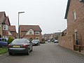
 Gildersome village green.jpg 3 648 × 2 736 ; 4,25 Mio
-
 Gildersome war memorial - geograph.org.uk - 5084865.jpg 1 024 × 768 ; 185 kio
-
 Gildersome, St Peter's Church - geograph.org.uk - 227558.jpg 432 × 285 ; 20 kio
-
 Graham Walk - Town End - geograph.org.uk - 1152177.jpg 640 × 455 ; 229 kio
-
 Harthill Lane - looking down from Trig Point - geograph.org.uk - 2454551.jpg 480 × 640 ; 145 kio
-
 Harthill Paddock - Harthill - geograph.org.uk - 1153056.jpg 640 × 468 ; 228 kio
-
 Harthill Paddock - Harthill - geograph.org.uk - 2454565.jpg 640 × 480 ; 67 kio
-
 Harthill Parade, Gildersome - geograph.org.uk - 5415684.jpg 1 024 × 768 ; 121 kio
-
 Highfield View - Highfield Close - geograph.org.uk - 2532263.jpg 640 × 470 ; 52 kio
-
 Houses on Mount Pleasant, Gildersome - geograph.org.uk - 3968446.jpg 1 600 × 1 064 ; 654 kio
-
 Junction of Rooms Lane and Gelderd Road - geograph.org.uk - 2142211.jpg 2 000 × 1 313 ; 519 kio
-

-
 Lancasterian School Room at Moor Top. - geograph.org.uk - 119225.jpg 640 × 480 ; 109 kio
-
 Leeds Country Way at Andrew Hill. Gildersome - geograph.org.uk - 3350982.jpg 2 048 × 1 536 ; 543 kio
-
 Leeds Country Way skirting Gildersome - geograph.org.uk - 1140031.jpg 640 × 480 ; 91 kio
-
 Leeds Country Way, Gildersome - geograph.org.uk - 1140026.jpg 640 × 480 ; 117 kio
-
 M62 eastbound at Junction 27 - geograph.org.uk - 3030794.jpg 640 × 481 ; 64 kio
-
 M621 - viewed from Wakefield Road - geograph.org.uk - 2583855.jpg 480 × 640 ; 57 kio
-
 M621 - viewed from Wakefield Road - geograph.org.uk - 2583859.jpg 480 × 640 ; 49 kio
-
 M621 at Bruntcliffe - geograph.org.uk - 2472653.jpg 2 592 × 1 944 ; 2,65 Mio
-
 M621 at Gildersome Street - geograph.org.uk - 3343005.jpg 640 × 481 ; 43 kio
-
 M621 at Rooms Lane overbridge - geograph.org.uk - 3343007.jpg 640 × 480 ; 48 kio
-
 M621 Motorway - geograph.org.uk - 77527.jpg 640 × 480 ; 89 kio
-
 M621 near Morley - geograph.org.uk - 2164634.jpg 640 × 480 ; 50 kio
-
 Mill Lane, Gildersome - geograph.org.uk - 5415761.jpg 1 024 × 768 ; 214 kio
-
 Moorfield - Church Street - geograph.org.uk - 1927518.jpg 640 × 439 ; 83 kio
-
 Moorfield - Church Street - geograph.org.uk - 2454275.jpg 640 × 550 ; 78 kio
-
 Mount Pleasant - Church Street - geograph.org.uk - 1927515.jpg 640 × 480 ; 71 kio
-
 Mount Pleasant - Church Street, Gildersome - geograph.org.uk - 648935.jpg 640 × 495 ; 45 kio
-
 Narrow Gated entrance in Gildersome - geograph.org.uk - 442947.jpg 575 × 640 ; 95 kio
-
 New Lane - Gildersome Lane - geograph.org.uk - 648937.jpg 640 × 428 ; 30 kio
-
 New Park Street - Fountain Street - geograph.org.uk - 1492791.jpg 640 × 480 ; 242 kio
-
 North end of Street Lane, Gildersome (1) - geograph.org.uk - 5415806.jpg 1 024 × 768 ; 121 kio
-
 North end of Street Lane, Gildersome (2) - geograph.org.uk - 5415811.jpg 1 024 × 768 ; 141 kio
-
 Northern part of Gildersome green - geograph.org.uk - 5415689.jpg 1 024 × 768 ; 255 kio
-
 Old Griffin Head, Branch End, Gildersome - geograph.org.uk - 5415679.jpg 1 024 × 768 ; 113 kio
-
 Old Griffin Head.jpg 3 648 × 2 736 ; 1,65 Mio
-
 Old railway bridge off Gelderd Road - geograph.org.uk - 4718065.jpg 1 024 × 768 ; 908 kio
-
 Paper shop, Harthill Parade, Gildersome - geograph.org.uk - 5415688.jpg 1 024 × 768 ; 125 kio
-
 Park Crescent - Parkway - geograph.org.uk - 1152128.jpg 640 × 480 ; 252 kio
-
 Park Grove - Parkway - geograph.org.uk - 1152149.jpg 640 × 480 ; 272 kio
-
 Patels Off Licence - Scott Green - geograph.org.uk - 1927511.jpg 640 × 480 ; 67 kio
-
 Path at Scott Green, Gildersome - geograph.org.uk - 3968463.jpg 1 600 × 1 064 ; 723 kio
-
 Path leading to Cockerdale - geograph.org.uk - 3968466.jpg 1 600 × 1 064 ; 748 kio
-
 Path leading to Cockerdale - geograph.org.uk - 3968487.jpg 1 600 × 1 064 ; 580 kio
-
 Pizza Kabin - Town Street - geograph.org.uk - 1927701.jpg 640 × 546 ; 84 kio
-
 Ploughed field near the M621 - geograph.org.uk - 4718068.jpg 1 024 × 768 ; 733 kio
-
 Pond - end of Suffield Drive - geograph.org.uk - 2331754.jpg 640 × 480 ; 47 kio
-
 Railway bridge number, Rooms Lane, Gildersome - geograph.org.uk - 2142230.jpg 2 000 × 1 388 ; 805 kio
-

-
 Reedsdale Avenue - Reedsdale Gardens - geograph.org.uk - 2454229.jpg 640 × 480 ; 51 kio
-

-
 Reedsdale Gardens - Street Lane - geograph.org.uk - 1151767.jpg 640 × 480 ; 269 kio
-
 Reedsdale Gardens - Street Lane - geograph.org.uk - 2454224.jpg 640 × 480 ; 43 kio
-
 Remains of Gelderd Road colliery buildings - geograph.org.uk - 4718045.jpg 1 024 × 768 ; 1,11 Mio
-
 Roadworks - geograph.org.uk - 958167.jpg 640 × 461 ; 90 kio
-
 Rooms Lane motorway bridge, Morley - geograph.org.uk - 2143248.jpg 2 000 × 1 500 ; 743 kio
-
 Rooms Lane, Gildersome - geograph.org.uk - 2143243.jpg 2 000 × 1 500 ; 746 kio
-
 Sandwich shop, Gildersome - geograph.org.uk - 5415759.jpg 1 024 × 768 ; 145 kio
-
 Scissors Hair Studio - Scott Green - geograph.org.uk - 1927505.jpg 483 × 640 ; 75 kio
-
 Scott Green Crescent - Moorland Avenue - geograph.org.uk - 1151735.jpg 640 × 430 ; 200 kio
-
 Scott Green Crescent - Scott Green Drive - geograph.org.uk - 2459958.jpg 640 × 480 ; 50 kio
-
 Scott Green Drive - Scott Green - geograph.org.uk - 1151719.jpg 640 × 433 ; 176 kio
-
 Scott Green Drive - Scott Green Crescent - geograph.org.uk - 1151737.jpg 640 × 428 ; 192 kio
-
 Scott Green Grove - Scptt Green Drive - geograph.org.uk - 2454323.jpg 640 × 480 ; 53 kio
-
 Scott Green Mount - Scott Green Crescent - geograph.org.uk - 1151747.jpg 640 × 430 ; 196 kio
-
 Scott Green Mount - Scott Green Drive - geograph.org.uk - 2459963.jpg 640 × 480 ; 55 kio
-
 Scott Green View - Scott Green Crescent - geograph.org.uk - 1151744.jpg 640 × 413 ; 187 kio
-
 Scott Green View - Scott Green Drive - geograph.org.uk - 2454320.jpg 640 × 480 ; 52 kio
-
 Shops at Ashwood Parade, Gildersome - geograph.org.uk - 3968462.jpg 1 600 × 1 064 ; 452 kio
-
 Slip from M62 to the M621 - geograph.org.uk - 3343004.jpg 640 × 480 ; 50 kio
-
 St Peter's church hall, Gildersome - geograph.org.uk - 5415777.jpg 1 024 × 768 ; 166 kio
-
 St Peter's Church, Gildersome - geograph.org.uk - 3350978.jpg 2 048 × 1 536 ; 518 kio
-
 St Peter's church, Gildersome - geograph.org.uk - 5415791.jpg 1 024 × 768 ; 190 kio
-

-
 Start of bridleway to New Farnley - geograph.org.uk - 4718042.jpg 1 024 × 768 ; 1,29 Mio
-
 Stone Gables on Street Lane, Gildersome - geograph.org.uk - 3967590.jpg 1 600 × 1 064 ; 693 kio
-
 Stone Pits Lane - Thistle Way - geograph.org.uk - 2583821.jpg 640 × 480 ; 66 kio
-
 Stone Pits Lane - Thistle Way - geograph.org.uk - 2583824.jpg 640 × 480 ; 69 kio
-
 Subway under the M621, north side - geograph.org.uk - 4718071.jpg 1 024 × 768 ; 605 kio
-
 Suffield Close - Suffield Road - geograph.org.uk - 2331749.jpg 640 × 480 ; 61 kio
-
 Suffield Crescent - Suffield Road - geograph.org.uk - 1927503.jpg 640 × 480 ; 67 kio
-
 Suffield Crescent - Suffield Road - geograph.org.uk - 2331746.jpg 640 × 571 ; 67 kio
-
 Suffield Crescent - Suffield Road - geograph.org.uk - 2331752.jpg 640 × 480 ; 58 kio
-
 Suffield Drive - Suffield Road - geograph.org.uk - 2331751.jpg 640 × 480 ; 45 kio
-
 Suffield Drive Open Space, Moor Head - geograph.org.uk - 5371106.jpg 1 024 × 768 ; 92 kio
-
 Suffield Drive Open Space, Moor Head - pond - geograph.org.uk - 5371107.jpg 1 024 × 768 ; 168 kio
-
 Suffield Motors - Gildersome Lane - geograph.org.uk - 2331745.jpg 640 × 480 ; 70 kio
-
 Suffield Road - Gildersome Lane - geograph.org.uk - 648938.jpg 640 × 430 ; 25 kio
-
 Suffield Road, Gildersome - geograph.org.uk - 5067734.jpg 1 024 × 682 ; 188 kio
-
 Tanning Studio - Highfield Drive - geograph.org.uk - 1928840.jpg 480 × 640 ; 82 kio
-
 The old Griffin Head, Gildersome - geograph.org.uk - 5067724.jpg 1 024 × 682 ; 186 kio
-
 The path to Cockerdale and the A58 - geograph.org.uk - 2025755.jpg 800 × 600 ; 299 kio
-
 The Woodlands hotel and restaurant - geograph.org.uk - 1298277.jpg 640 × 480 ; 79 kio
-
 Thistle Way - Gildersome Spur - geograph.org.uk - 2583642.jpg 640 × 480 ; 49 kio
-
 Thistle Way - Stone Pits Lane - geograph.org.uk - 2583829.jpg 640 × 480 ; 50 kio
-
 Tigaki Hair Studio - Street Lane - geograph.org.uk - 1927530.jpg 469 × 640 ; 76 kio
-
 Track - Asquith Avenue - geograph.org.uk - 2532338.jpg 640 × 480 ; 148 kio
-
 Track - Harthill Lane - geograph.org.uk - 2454539.jpg 640 × 480 ; 96 kio
-

-

-
 Treefield Industrial Estate - Gelderd Road - geograph.org.uk - 2583605.jpg 640 × 480 ; 57 kio
-
 Trig Point - off Harthill Lane - geograph.org.uk - 2454546.jpg 484 × 640 ; 52 kio
-
 Turnberry Park Road - Wakefield Road - geograph.org.uk - 2583846.jpg 640 × 480 ; 52 kio
-
 Turton Green - College Road - geograph.org.uk - 1153062.jpg 640 × 430 ; 178 kio
-
 Turton House - College Road, Gildersome - geograph.org.uk - 648671.jpg 640 × 519 ; 52 kio
-
 Turton Vale - College Road, Gildersome - geograph.org.uk - 648663.jpg 640 × 404 ; 32 kio
-
 UK Mail Depot, Gildersome - geograph.org.uk - 4389910.jpg 1 024 × 682 ; 164 kio
-
 Vicarage Avenue - Finkle Lane - geograph.org.uk - 1152122.jpg 640 × 427 ; 183 kio
-
 Vicarage Avenue - Finkle Lane - geograph.org.uk - 2584023.jpg 640 × 480 ; 55 kio
-

-

-
 War memorial Town Street Gildersome - geograph.org.uk - 4066983.jpg 1 024 × 768 ; 221 kio
-
 Water Tanker - Field off Gelderd Road - geograph.org.uk - 653203.jpg 640 × 432 ; 33 kio
-
 West End - Scott Green - geograph.org.uk - 1151707.jpg 640 × 472 ; 233 kio
-

-

-
 Wood Head Lane, Gildersome - geograph.org.uk - 3967597.jpg 1 600 × 1 064 ; 807 kio
-
 Woodhead Lane - Street Lane - geograph.org.uk - 1927673.jpg 480 × 640 ; 115 kio
-
 Woodhead Lane - Street Lane - geograph.org.uk - 2454142.jpg 480 × 640 ; 107 kio
-
 Worrall Street - Scatcherd Lane - geograph.org.uk - 1492165.jpg 640 × 480 ; 238 kio
-
 Yarra Court - Branch End - geograph.org.uk - 1928843.jpg 640 × 480 ; 73 kio
-
 Barker Hill Farm - Gildersome Lane - geograph.org.uk - 648940.jpg 640 × 533 ; 51 kio
-
 Deanfield Mills - Asquith Avenue - geograph.org.uk - 648575.jpg 640 × 427 ; 29 kio
-
 Farm Hill Road - geograph.org.uk - 648578.jpg 640 × 418 ; 26 kio
-
 Farmland and farm near Gildersome. - geograph.org.uk - 60419.jpg 640 × 480 ; 81 kio
-
 Farnley Forge pipe - geograph.org.uk - 346144.jpg 640 × 426 ; 172 kio
-
 Flagged path in Cockersdale - geograph.org.uk - 442509.jpg 480 × 640 ; 165 kio
-
 Footpath alongside Allotments - Gelderd Road - geograph.org.uk - 653201.jpg 539 × 640 ; 58 kio
-
 Footpath and Nettles, Gildersome - geograph.org.uk - 443546.jpg 316 × 640 ; 92 kio
-
 Footpath opposite Milestone - Gelderd Road - geograph.org.uk - 653213.jpg 528 × 640 ; 55 kio
-
 Gas House Tavern Whitehall Road - geograph.org.uk - 426676.jpg 640 × 480 ; 67 kio
-
 Gildersome Green and War memorial. - geograph.org.uk - 57148.jpg 640 × 480 ; 139 kio
-

-
 Glenree Farm - Gildersome Lane - geograph.org.uk - 648941.jpg 640 × 413 ; 23 kio
-
 Hawthorne Drive - Branch End - geograph.org.uk - 648653.jpg 640 × 412 ; 30 kio
-
 Ings Hall Farm - Whitehall Road - geograph.org.uk - 648588.jpg 640 × 384 ; 25 kio
-
 M621 Motorway from Asquith Avenue - geograph.org.uk - 648579.jpg 640 × 469 ; 25 kio
-
 Plaque on Cemetery Wall. - geograph.org.uk - 543566.jpg 427 × 640 ; 291 kio
-
 Pub with no name^ No, Valley Inn, Cockersdale - geograph.org.uk - 443509.jpg 640 × 480 ; 79 kio


_-_geograph.org.uk_-_5415806.jpg)
_-_geograph.org.uk_-_5415811.jpg)


