Category:Gillingham, Dorset
Aller à la navigation
Aller à la recherche
localité britannique  | |||||
| Téléverser des médias | |||||
| Nature de l’élément | |||||
|---|---|---|---|---|---|
| Lieu | Dorset, Angleterre du Sud-Ouest, Angleterre | ||||
| Réputé identique à | Gillingham (page en doublon, paroisse civile) | ||||
| site officiel | |||||
 | |||||
English: Gillingham is a town in the Blackmore Vale area of Dorset, England. The town is the most northerly in the county. It is 3 miles south of the A303 lying on the B3095 and B3081. It is near to the town of Shaftesbury which lies 7 miles to the south east. Neighbouring hamlets included Peacemarsh, Bay and Wyke. These hamlets have now however become part of Gillingham as it expanded.
Español: Gillingham es un pueblo en el área de Blackmore Vale, en Dorset (Inglaterra). Se encuentra en el distrito de gobierno local y circunscripción electoral de North Dorset. Situado unos 6 km al sur de la ruta A303 —la principal carretera entre Londres y el Sudoeste de Inglaterra—, sobre la B3095 y la B3081, constituye el pueblo más septentrional del condado y una popular ciudad dormitorio. Se encuentra en las cercanías de Shaftesbury, unos 11 km al sureste. Cuenta con una población de 9.323 habitantes, un gran aumento desde 1991, cuando tenía 6.187 pobladores. El 35% de la población está jubilada.
Nederlands: Gillingham is een plaats in het bestuurlijke gebied North Dorset, in het Engelse graafschap Dorset. De plaats telt 9.323 inwoners.
Norsk bokmål: Gillingham er en by i Dorset, England. Den er grevskapets nordligste by, og ligger i Blackmore Vale i distriktet North Dorset. Byen ligger ved jernbanelinjen mellom Exeter og London, og er noen få kilometer fra hovedveien A303.
Polski: Gillingham ( IPA /'gɪlɪŋ(ə)m/) - miasto w Wielkiej Brytanii. w Anglii w hrabstwie Dorset, na jego północnym krańcu. Położone jest w dolinie Blackmore Valley, nieopodal oddalonego o 12 kilometrów miasta Shaftesbury. Miejscowość liczy ponad 11 tys. mieszkańców.
Română: Gillingham este un oraş în comitatul Dorset, regiunea South West, Anglia. Oraşul se află în districtul North Dorset.
Sous-catégories
Cette catégorie comprend 12 sous-catégories, dont les 12 ci-dessous.
B
- Buckhorn Weston Tunnel (1 F)
- Bugley, Dorset (4 F)
G
K
- King's Court Palace (14 F)
L
- Longbury Long Barrow (6 F)
M
P
S
W
- Wyke, Dorset (6 F)
Média dans la catégorie « Gillingham, Dorset »
Cette catégorie comprend 469 fichiers, dont les 200 ci-dessous.
(page précédente) (page suivante)-

-
 1982 Saab 99 (9691691421).jpg 3 264 × 1 840 ; 1,81 Mio
-
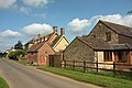
 A row of houses at the entrance to Shearstock Farm - geograph.org.uk - 3547667.jpg 1 024 × 768 ; 115 kio
-
 Addison Terrace Gillingham - geograph.org.uk - 1548835.jpg 640 × 480 ; 84 kio
-
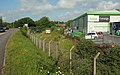
 Asda, Gillingham - geograph.org.uk - 4278756.jpg 800 × 472 ; 105 kio
-
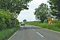
 B3081 and supermarket, Gillingham - geograph.org.uk - 5069913.jpg 3 060 × 1 919 ; 1,39 Mio
-
 B3081 east from Woodhouse Cross junction - geograph.org.uk - 3546033.jpg 1 024 × 409 ; 53 kio
-
 B3081 heading north-west - geograph.org.uk - 5805889.jpg 1 024 × 684 ; 287 kio
-
 B3081 heading north-west - geograph.org.uk - 5805917.jpg 1 024 × 684 ; 298 kio
-
 B3081 into Gillingham - geograph.org.uk - 5805779.jpg 1 024 × 684 ; 198 kio
-
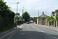
 B3081 Shaftesbury Road - geograph.org.uk - 5805758.jpg 1 024 × 684 ; 190 kio
-
 B3081 Shaftesbury Road - geograph.org.uk - 5805766.jpg 1 024 × 684 ; 186 kio
-
 B3081 Shaftesbury Road, Ham Common - geograph.org.uk - 5805772.jpg 1 024 × 684 ; 233 kio
-
 B3081 southeast of Gillingham - geograph.org.uk - 6169579.jpg 1 024 × 683 ; 237 kio
-
 B3081 Wyke Road, Gillingham - geograph.org.uk - 5805790.jpg 1 024 × 684 ; 233 kio
-
 B3092 at Madjeston - geograph.org.uk - 5071734.jpg 3 072 × 2 048 ; 1,4 Mio
-
 Bagley Court Farm - geograph.org.uk - 3474492.jpg 640 × 378 ; 53 kio
-
 Barn at Horkesley Hall Farm - geograph.org.uk - 3474519.jpg 640 × 293 ; 39 kio
-
 Barnaby Mill, Gillingham - geograph.org.uk - 4308260.jpg 800 × 561 ; 168 kio
-
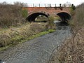
 Bay Bridge - geograph.org.uk - 3783065.jpg 1 600 × 1 200 ; 449 kio
-

-
 Bend in Shreen Water, Gillingham - geograph.org.uk - 4308268.jpg 800 × 600 ; 195 kio
-
 Bend in Standpitts Lane - geograph.org.uk - 5072772.jpg 2 048 × 3 072 ; 1,39 Mio
-
 Bend in the River Stour, Gillingham - geograph.org.uk - 4290523.jpg 800 × 675 ; 243 kio
-
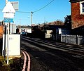
 Black on white station name sign, Gillingham - geograph.org.uk - 4360015.jpg 800 × 521 ; 136 kio
-
 Bleet Farm from Nations Road - geograph.org.uk - 1595153.jpg 640 × 480 ; 40 kio
-
 Bleet Lane - geograph.org.uk - 3783976.jpg 800 × 600 ; 407 kio
-
 Brainwave charity shop in Gillingham - geograph.org.uk - 4277878.jpg 800 × 650 ; 164 kio
-
 Briar Close, Gillingham - geograph.org.uk - 4290579.jpg 800 × 641 ; 162 kio
-
 Brickfields Business Park and adjacent field - geograph.org.uk - 5119735.jpg 640 × 480 ; 37 kio
-
 Brickyard Lane, Gillingham - geograph.org.uk - 5069919.jpg 3 072 × 2 048 ; 1,31 Mio
-
 Bridge over Bubbling Water - geograph.org.uk - 2803271.jpg 2 048 × 1 536 ; 2,97 Mio
-
 Bridge over the Lodden - geograph.org.uk - 5070072.jpg 2 048 × 3 072 ; 1,55 Mio
-
 Bridge over the railway line at Bugley - geograph.org.uk - 1910555.jpg 640 × 480 ; 201 kio
-
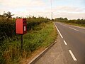
 Bugley, postbox № SP8 40 - geograph.org.uk - 3178366.jpg 640 × 480 ; 124 kio
-
 Buildings, Madjeston - geograph.org.uk - 5071732.jpg 3 072 × 2 048 ; 1,03 Mio
-
 Bungalow on corner of Shreen Close - geograph.org.uk - 6169587.jpg 1 024 × 683 ; 196 kio
-
 Bus shelter opposite Gillingham railway station - geograph.org.uk - 4308218.jpg 800 × 575 ; 153 kio
-
 Caffè Rimini, Gillingham - geograph.org.uk - 4277180.jpg 800 × 469 ; 107 kio
-
 Carriages at Gillingham - geograph.org.uk - 5069765.jpg 3 072 × 2 048 ; 1,13 Mio
-
 Catholic Church of St Benedict - geograph.org.uk - 4182407.jpg 1 600 × 1 064 ; 418 kio
-
 Catholic Church of St Benedict, Gillingham - geograph.org.uk - 4277068.jpg 800 × 398 ; 91 kio
-

-
 Cavell and Chantry in Gillingham - geograph.org.uk - 4288673.jpg 800 × 650 ; 139 kio
-
 Cemetery chapel - geograph.org.uk - 4182402.jpg 1 600 × 1 064 ; 607 kio
-
 Cereal crop by Standpitts Lane - geograph.org.uk - 5071881.jpg 1 920 × 1 078 ; 697 kio
-
 Chan's Chinese Takeaway in Gillingham - geograph.org.uk - 4291501.jpg 800 × 606 ; 150 kio
-

-
 Christmas is over 1 - geograph.org.uk - 1660709.jpg 640 × 480 ; 288 kio
-
 Christmas is over 2 - geograph.org.uk - 1660716.jpg 640 × 480 ; 297 kio
-
 Church schoolroom (geograph 6085778).jpg 4 320 × 3 240 ; 3,64 Mio
-
 Church View, Gillingham - geograph.org.uk - 4278755.jpg 800 × 509 ; 128 kio
-

-
 City Link van in Coldharbour, Gillingham - geograph.org.uk - 4290567.jpg 800 × 508 ; 130 kio
-
 Co-operative Travel shop in Gillingham (geograph 4288668).jpg 800 × 689 ; 159 kio
-
 Cole Street Lane - geograph.org.uk - 5070587.jpg 3 072 × 2 048 ; 1,38 Mio
-
 Cole Street Lane - geograph.org.uk - 5070652.jpg 1 920 × 1 227 ; 597 kio
-

-
 Common Mead Lane, Gillingham - geograph.org.uk - 4290534.jpg 800 × 587 ; 172 kio
-

-
 Coronation Club in Gillingham - geograph.org.uk - 4278954.jpg 800 × 638 ; 121 kio
-
 Crockers, High Street, Gillingham - geograph.org.uk - 4291460.jpg 800 × 684 ; 135 kio
-
 Culver farm lake - geograph.org.uk - 2797667.jpg 2 048 × 1 536 ; 2,47 Mio
-
 Cupids Corner, Newbury, Gillingham - geograph.org.uk - 4277517.jpg 800 × 621 ; 147 kio
-
 Distance marker at Gillingham railway station - geograph.org.uk - 4360062.jpg 800 × 478 ; 134 kio
-
 East across Rolls Bridge, Gillingham - geograph.org.uk - 4290619.jpg 800 × 581 ; 157 kio
-
 Eccliffe Viaduct - geograph.org.uk - 3783996.jpg 1 600 × 1 200 ; 723 kio
-

-
En-uk-Gillingham(Dorset).ogg 1,5 s ; 28 kio
-
 Entrance to Gillingham Bowling Club - geograph.org.uk - 4291476.jpg 800 × 709 ; 160 kio
-
 Esso filling station in Le Neubourg Way - geograph.org.uk - 3547646.jpg 1 024 × 768 ; 80 kio
-
 Eyes Right in Gillingham - geograph.org.uk - 4288657.jpg 800 × 710 ; 143 kio
-
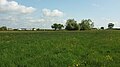
 Farmland near Gillingham - geograph.org.uk - 5070405.jpg 2 776 × 1 478 ; 973 kio
-
 Farnfields in Gillingham - geograph.org.uk - 4282074.jpg 800 × 600 ; 125 kio
-

-
 Field and hedgerows near Madjeston - geograph.org.uk - 5875346.jpg 4 032 × 3 024 ; 3,5 Mio
-
 Field by Standpitts Lane - geograph.org.uk - 4969071.jpg 1 920 × 1 280 ; 475 kio
-
 Field by the B3081 - geograph.org.uk - 5070622.jpg 3 052 × 1 711 ; 1,1 Mio
-
 Field by the Lodden - geograph.org.uk - 5070180.jpg 3 064 × 1 875 ; 1,14 Mio
-
 Field near Gillingham - geograph.org.uk - 5069951.jpg 3 071 × 1 690 ; 985 kio
-
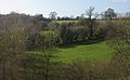 Fields near Thorngrove - geograph.org.uk - 3474507.jpg 640 × 394 ; 54 kio
-
-
 Flood Plain of the Stour at Gillingham - geograph.org.uk - 1548840.jpg 640 × 437 ; 57 kio
-
 Floodwall beside Shreen Water - geograph.org.uk - 6169592.jpg 1 024 × 683 ; 196 kio
-
 Flower shop - Gillingham - geograph.org.uk - 3969441.jpg 600 × 800 ; 128 kio
-
 Folly Lane - geograph.org.uk - 3783967.jpg 1 600 × 1 200 ; 774 kio
-
 Footbridge from the Red Lion to Waitrose - geograph.org.uk - 1636348.jpg 640 × 480 ; 130 kio
-
-
 Footbridge towards Buckingham Road, Gillingham - geograph.org.uk - 4278838.jpg 800 × 682 ; 226 kio
-
 Footpath junction near Cole Street Farm - geograph.org.uk - 5119732.jpg 640 × 480 ; 55 kio
-
 Footpath near Silton - geograph.org.uk - 2176072.jpg 640 × 480 ; 96 kio
-
 Footpath, Milton on Stour - geograph.org.uk - 2175852.jpg 640 × 481 ; 91 kio
-
 Ford near Milton on Stour - geograph.org.uk - 1145177.jpg 640 × 481 ; 204 kio
-
 Forest Side Farm - geograph.org.uk - 5308962.jpg 1 600 × 1 086 ; 616 kio
-
 Former chapel - geograph.org.uk - 6085799.jpg 3 165 × 4 219 ; 2,75 Mio
-
 Former Chapel at Huntingford - geograph.org.uk - 5310448.jpg 3 425 × 2 651 ; 2,8 Mio
-
 Former Gillingham Free School - geograph.org.uk - 4282196.jpg 800 × 621 ; 91 kio
-
 Former London & Country Mercedes Bus, M461 JPA (8589102641).jpg 4 272 × 2 848 ; 4,35 Mio
-
 G721 WDL Damory Coaches Leyland Olympian (8481892565).jpg 4 272 × 2 848 ; 4,57 Mio
-
 Garden centre at the end of Cole Street Lane - geograph.org.uk - 1910570.jpg 640 × 480 ; 143 kio
-
 Garden of Remembrance (1) - geograph.org.uk - 6086626.jpg 4 320 × 3 240 ; 4,63 Mio
-
 Garden of Remembrance (2) - geograph.org.uk - 6086627.jpg 4 320 × 3 240 ; 4,56 Mio
-
 Garden of Remembrance (3) - geograph.org.uk - 6086628.jpg 2 783 × 3 711 ; 3,19 Mio
-
 Garden of Remembrance (4) - geograph.org.uk - 6086629.jpg 4 101 × 3 078 ; 2,7 Mio
-
 Gate by Standpitts Lane - geograph.org.uk - 5071816.jpg 1 920 × 1 329 ; 946 kio
-
 Gently flows the stream - geograph.org.uk - 6083449.jpg 3 240 × 4 320 ; 3,78 Mio
-
 Gillingham (Dorset) railway station name sign - geograph.org.uk - 4308203.jpg 799 × 800 ; 157 kio
-
 Gillingham (Dorset) Sewage Treatment Works - geograph.org.uk - 3474536.jpg 640 × 352 ; 40 kio
-
 Gillingham , Gillingham Town Football Club - geograph.org.uk - 1185898.jpg 640 × 480 ; 44 kio
-
 Gillingham - Dorset dot.png 417 × 599 ; 122 kio
-
 Gillingham Band Room - geograph.org.uk - 1636278.jpg 640 × 480 ; 93 kio
-
 Gillingham Baptist Church - geograph.org.uk - 5154001.jpg 2 826 × 1 875 ; 978 kio
-
 Gillingham Cemetery chapel - geograph.org.uk - 4277050.jpg 800 × 488 ; 178 kio
-
 Gillingham Chinese Takeaway - geograph.org.uk - 4288297.jpg 800 × 563 ; 109 kio
-

-
-
 Gillingham Fire Station - geograph.org.uk - 219462.jpg 640 × 480 ; 59 kio
-
 Gillingham Ford - geograph.org.uk - 4872871.jpg 1 600 × 1 067 ; 1,89 Mio
-
 Gillingham Free School blue plaque - geograph.org.uk - 4282200.jpg 642 × 563 ; 143 kio
-

-
 Gillingham houses (1) - geograph.org.uk - 6084858.jpg 4 320 × 3 240 ; 3,78 Mio
-
 Gillingham houses (10) (geograph 6084872).jpg 3 166 × 3 166 ; 2,23 Mio
-
 Gillingham houses (11) (geograph 6084875).jpg 4 320 × 3 240 ; 3,06 Mio
-
 Gillingham houses (12) - geograph.org.uk - 6085780.jpg 4 320 × 3 240 ; 3,08 Mio
-
 Gillingham houses (13) - geograph.org.uk - 6085783.jpg 4 320 × 3 240 ; 2,46 Mio
-
 Gillingham houses (14) (geograph 6085785).jpg 4 320 × 3 240 ; 3,84 Mio
-
 Gillingham houses (15) (geograph 6085787).jpg 4 085 × 3 064 ; 3,84 Mio
-
 Gillingham houses (16) (geograph 6085788).jpg 4 320 × 3 240 ; 2,98 Mio
-
 Gillingham houses (17) - geograph.org.uk - 6085789.jpg 3 240 × 4 320 ; 2,53 Mio
-
 Gillingham houses (18) - geograph.org.uk - 6085793.jpg 3 923 × 2 943 ; 2,59 Mio
-
 Gillingham houses (19) - geograph.org.uk - 6085794.jpg 3 133 × 4 177 ; 2,49 Mio
-
 Gillingham houses (2) - geograph.org.uk - 6084859.jpg 3 240 × 4 320 ; 4,13 Mio
-
 Gillingham houses (20) - geograph.org.uk - 6085795.jpg 3 114 × 3 114 ; 1,44 Mio
-
 Gillingham houses (21) (geograph 6085797).jpg 4 320 × 3 240 ; 2,21 Mio
-
 Gillingham houses (22) (geograph 6085804).jpg 3 759 × 2 819 ; 2,51 Mio
-
 Gillingham houses (23) - geograph.org.uk - 6085808.jpg 4 320 × 3 240 ; 2,35 Mio
-
 Gillingham houses (24) - geograph.org.uk - 6085811.jpg 3 038 × 2 278 ; 1,49 Mio
-
 Gillingham houses (25) - geograph.org.uk - 6085850.jpg 4 320 × 3 240 ; 2,54 Mio
-
 Gillingham houses (26) - geograph.org.uk - 6085853.jpg 4 320 × 3 240 ; 3,68 Mio
-
 Gillingham houses (27) - geograph.org.uk - 6085868.jpg 4 212 × 3 159 ; 3,17 Mio
-
 Gillingham houses (28) - geograph.org.uk - 6085882.jpg 2 665 × 3 554 ; 1,67 Mio
-
 Gillingham houses (29) - geograph.org.uk - 6086624.jpg 3 615 × 2 711 ; 1,5 Mio
-
 Gillingham houses (3) - geograph.org.uk - 6084860.jpg 4 320 × 3 240 ; 2,25 Mio
-
 Gillingham houses (30) - geograph.org.uk - 6086632.jpg 4 320 × 3 240 ; 4,01 Mio
-
 Gillingham houses (31) - geograph.org.uk - 6086634.jpg 3 416 × 2 561 ; 2,15 Mio
-
 Gillingham houses (32) (geograph 6086635).jpg 3 943 × 2 957 ; 2,8 Mio
-
 Gillingham houses (33) (geograph 6086637).jpg 4 310 × 3 232 ; 3 Mio
-
 Gillingham houses (34) - geograph.org.uk - 6086647.jpg 4 320 × 3 240 ; 4,38 Mio
-
 Gillingham houses (35) - geograph.org.uk - 6086649.jpg 4 320 × 3 240 ; 4,51 Mio
-
 Gillingham houses (4) (geograph 6084862).jpg 4 320 × 3 240 ; 2,92 Mio
-
 Gillingham houses (5) (geograph 6084863).jpg 4 320 × 3 240 ; 2,26 Mio
-
 Gillingham houses (6) (geograph 6084864).jpg 4 320 × 3 240 ; 2,76 Mio
-
 Gillingham houses (7) - geograph.org.uk - 6084868.jpg 3 846 × 2 884 ; 2,08 Mio
-
 Gillingham houses (8) - geograph.org.uk - 6084869.jpg 4 320 × 3 240 ; 3,21 Mio
-
 Gillingham houses (9) - geograph.org.uk - 6084871.jpg 3 707 × 2 780 ; 2,37 Mio
-
 Gillingham Imperial Silver Band premises - geograph.org.uk - 4282250.jpg 800 × 597 ; 142 kio
-
 Gillingham Kebab ^ Pizza House - geograph.org.uk - 4278040.jpg 800 × 677 ; 141 kio
-
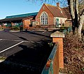
 Gillingham Library ^ Museum - geograph.org.uk - 4278754.jpg 800 × 479 ; 108 kio
-
 Gillingham Museum ^ Library - geograph.org.uk - 3389021.jpg 1 024 × 760 ; 103 kio
-
 Gillingham Police Station and Town Hall - geograph.org.uk - 4291470.jpg 800 × 542 ; 110 kio
-
 Gillingham Post Office - geograph.org.uk - 4966869.jpg 1 024 × 768 ; 126 kio
-
 Gillingham Primary School - geograph.org.uk - 4291466.jpg 800 × 708 ; 184 kio
-

-
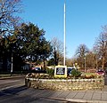
 Gillingham Roundabout - geograph.org.uk - 390754.jpg 640 × 480 ; 122 kio
-
 Gillingham School Playing Field - geograph.org.uk - 4242288.jpg 800 × 539 ; 146 kio
-
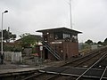 Gillingham Signal Box - geograph.org.uk - 2106398.jpg 1 024 × 768 ; 117 kio
-
 Gillingham signal box and station bench - geograph.org.uk - 4359997.jpg 776 × 800 ; 159 kio
-
 Gillingham Station, Dorset - Train pulling into station - geograph.org.uk - 6397866.jpg 1 797 × 1 198 ; 301 kio
-
 Gillingham Tandoori - geograph.org.uk - 4282228.jpg 800 × 629 ; 136 kio
-
 Gillingham Telephone Exchange - geograph.org.uk - 1275366.jpg 575 × 446 ; 240 kio
-
 Gillingham Town Bridge - geograph.org.uk - 4966901.jpg 1 024 × 768 ; 271 kio
-
 Gillingham Town Football Club - geograph.org.uk - 2910472.jpg 640 × 291 ; 45 kio
-
 Gillingham Town Hall - geograph.org.uk - 4291474.jpg 800 × 525 ; 127 kio
-
 Gillingham, a postbox catches the sunlight - geograph.org.uk - 3180287.jpg 640 × 480 ; 102 kio
-
 Gillingham, bench by a bend in the Stour - geograph.org.uk - 1541883.jpg 640 × 480 ; 122 kio
-
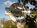 Gillingham, detail of Slaughtergate signpost - geograph.org.uk - 2133970.jpg 640 × 481 ; 94 kio
-

-
 Gillingham, Eccliffe Mill - geograph.org.uk - 85207.jpg 640 × 428 ; 150 kio
-
 Gillingham, Esso - geograph.org.uk - 3389028.jpg 1 024 × 760 ; 123 kio
-
 Gillingham, finger-post at Wyke - geograph.org.uk - 1435898.jpg 640 × 480 ; 139 kio
-

-
 Gillingham, High Street - geograph.org.uk - 1434129.jpg 640 × 480 ; 69 kio
-

-
 Gillingham, house and garage in Queen Street - geograph.org.uk - 1541742.jpg 640 × 480 ; 58 kio
-
 Gillingham, Lloyd's TSB bank - geograph.org.uk - 1434132.jpg 640 × 480 ; 92 kio
-
 Gillingham, meandering path at Rolls Bridge - geograph.org.uk - 1541873.jpg 640 × 480 ; 65 kio
-
 Gillingham, needlework display on tree - geograph.org.uk - 1434138.jpg 640 × 480 ; 113 kio
-
 Gillingham, not so well restored - geograph.org.uk - 1541724.jpg 480 × 640 ; 99 kio
-
 Gillingham, Phoenix Inn - geograph.org.uk - 4966890.jpg 1 024 × 768 ; 141 kio
-
-
 Gillingham, postbox No. SP8 101, Bay Road - geograph.org.uk - 1541754.jpg 640 × 480 ; 91 kio
-

-

-
 Gillingham, postbox No. SP8 123, Wessex Way - geograph.org.uk - 1541855.jpg 640 × 480 ; 51 kio
-
 Gillingham, postbox No. SP8 125, Hyde Road - geograph.org.uk - 1541867.jpg 640 × 480 ; 74 kio
-

-
 Gillingham, postbox No. SP8 127, Broad Robin - geograph.org.uk - 1541915.jpg 480 × 640 ; 86 kio
-
-
 Gillingham, postbox No. SP8 20, Gyllas Way - geograph.org.uk - 1541761.jpg 640 × 480 ; 75 kio
-
 Gillingham, postbox No. SP8 44, Station Road - geograph.org.uk - 1434128.jpg 480 × 640 ; 83 kio
.jpg)
.jpg)


.jpg)


.jpg)


.jpg)
.jpg)

_-_geograph.org.uk_-_6086626.jpg)
_-_geograph.org.uk_-_6086627.jpg)
_-_geograph.org.uk_-_6086628.jpg)
_-_geograph.org.uk_-_6086629.jpg)


_railway_station_name_sign_-_geograph.org.uk_-_4308203.jpg)
_Sewage_Treatment_Works_-_geograph.org.uk_-_3474536.jpg)


_-_geograph.org.uk_-_6084858.jpg)
_(geograph_6084872).jpg)
_(geograph_6084875).jpg)
_-_geograph.org.uk_-_6085780.jpg)
_-_geograph.org.uk_-_6085783.jpg)
_(geograph_6085785).jpg)
_(geograph_6085787).jpg)
_(geograph_6085788).jpg)
_-_geograph.org.uk_-_6085789.jpg)
_-_geograph.org.uk_-_6085793.jpg)
_-_geograph.org.uk_-_6085794.jpg)
_-_geograph.org.uk_-_6084859.jpg)
_-_geograph.org.uk_-_6085795.jpg)
_(geograph_6085797).jpg)
_(geograph_6085804).jpg)
_-_geograph.org.uk_-_6085808.jpg)
_-_geograph.org.uk_-_6085811.jpg)
_-_geograph.org.uk_-_6085850.jpg)
_-_geograph.org.uk_-_6085853.jpg)
_-_geograph.org.uk_-_6085868.jpg)
_-_geograph.org.uk_-_6085882.jpg)
_-_geograph.org.uk_-_6086624.jpg)
_-_geograph.org.uk_-_6084860.jpg)
_-_geograph.org.uk_-_6086632.jpg)
_-_geograph.org.uk_-_6086634.jpg)
_(geograph_6086635).jpg)
_(geograph_6086637).jpg)
_-_geograph.org.uk_-_6086647.jpg)
_-_geograph.org.uk_-_6086649.jpg)
_(geograph_6084862).jpg)
_(geograph_6084863).jpg)
_(geograph_6084864).jpg)
_-_geograph.org.uk_-_6084868.jpg)
_-_geograph.org.uk_-_6084869.jpg)
_-_geograph.org.uk_-_6084871.jpg)


