Category:Glenmavis
Aller à la navigation
Aller à la recherche
village britannique .jpg) | |||||
| Téléverser des médias | |||||
| Nature de l’élément | |||||
|---|---|---|---|---|---|
| Lieu |
| ||||
| Population |
| ||||
 | |||||
English: Glenmavis is a village in the North Lanarkshire area of Scotland. It is situated about 2 miles north-west of Airdrie on the B802 road.
Sous-catégories
Cette catégorie comprend 3 sous-catégories, dont les 3 ci-dessous.
Média dans la catégorie « Glenmavis »
Cette catégorie comprend 62 fichiers, dont les 62 ci-dessous.
-
 A scene at Glenmavis in North Lanarkshire - geograph.org.uk - 3420812.jpg 640 × 453 ; 61 kio
-
 Arderyth - geograph.org.uk - 3572697.jpg 640 × 480 ; 60 kio
-
 B802 Road Bridge over Shank Burn - geograph.org.uk - 3803875.jpg 640 × 480 ; 75 kio
-
 Bales of hay at Braidenhill - geograph.org.uk - 2122584.jpg 800 × 600 ; 83 kio
-
 Brackenhirst Road - geograph.org.uk - 3034981.jpg 640 × 480 ; 78 kio
-
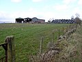
 Braidenhill Farm - geograph.org.uk - 2122618.jpg 800 × 600 ; 90 kio
-
 Bridge over a disused railway line - geograph.org.uk - 3034951.jpg 640 × 480 ; 70 kio
-
 Bridge over dismantled railway - geograph.org.uk - 3572694.jpg 640 × 480 ; 69 kio
-
 Court, Rochsoles Community Centre - geograph.org.uk - 2017743.jpg 640 × 359 ; 74 kio
-
 Dryflat Near Glenmavis - geograph.org.uk - 154531.jpg 640 × 441 ; 78 kio
-
 Entrance to Glenmavis - geograph.org.uk - 3485734.jpg 640 × 480 ; 52 kio
-
 Field by the Brackenhirst Road - geograph.org.uk - 3627515.jpg 640 × 427 ; 395 kio
-
 Fields west of Glenmavis, Airdrie - geograph.org.uk - 1281857.jpg 640 × 500 ; 51 kio
-
 Fields, Dryflat - geograph.org.uk - 1826071.jpg 640 × 480 ; 93 kio
-
 Former milk depot - geograph.org.uk - 1303300.jpg 640 × 480 ; 61 kio
-
 Garages, Balmoral Avenue - geograph.org.uk - 1826066.jpg 640 × 630 ; 114 kio
-
 Glenmavis (shops) - geograph.org.uk - 1729070.jpg 887 × 534 ; 147 kio
-
 Glenmavis - geograph.org.uk - 3034917.jpg 640 × 480 ; 70 kio
-
 Glenmavis Cemetery - geograph.org.uk - 3627485.jpg 640 × 427 ; 343 kio
-
 Glenmavis from the air (geograph 5625954).jpg 480 × 640 ; 189 kio
-
 Glenmavis from the southwest - geograph.org.uk - 2803782.jpg 640 × 480 ; 75 kio
-
 Glenmavis village centre - geograph.org.uk - 3420816.jpg 640 × 480 ; 68 kio
-
 Glenmavis, Coatbridge Road - geograph.org.uk - 2524400.jpg 1 024 × 768 ; 199 kio
-
 Glenmavis, Coatbridge Road - geograph.org.uk - 2524414.jpg 1 024 × 768 ; 186 kio
-
 Going the wrong way - geograph.org.uk - 3572692.jpg 640 × 480 ; 81 kio
-
 Grassland, Brackenhurst - geograph.org.uk - 2013074.jpg 640 × 480 ; 75 kio
-
 Haggmuir Farm Near Glenmavis - geograph.org.uk - 154567.jpg 640 × 480 ; 114 kio
-
 Interesting roundabout design near Glenmavis - geograph.org.uk - 3572805.jpg 640 × 480 ; 47 kio
-
 Kippsbyre - geograph.org.uk - 1836393.jpg 1 516 × 780 ; 203 kio
-
 Kirkstyle Inn (demolished) - geograph.org.uk - 1951553.jpg 1 489 × 1 018 ; 313 kio
-
 Kirkstyle Inn - geograph.org.uk - 1396387.jpg 640 × 480 ; 95 kio
-
 Lawn mowing, Glenmavis - geograph.org.uk - 1826049.jpg 640 × 466 ; 126 kio
-
 New Building near Drumbowie - geograph.org.uk - 3627519.jpg 640 × 427 ; 325 kio
-
 New Building near Drumbowie - geograph.org.uk - 3627522.jpg 640 × 417 ; 357 kio
-
 New houses, Stirling Road - geograph.org.uk - 2017396.jpg 640 × 359 ; 63 kio
-
 New Monkland Cemetery - geograph.org.uk - 3627490.jpg 640 × 427 ; 349 kio
-
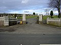 New Monkland Cemetery, Glenmavis - geograph.org.uk - 154545.jpg 640 × 480 ; 148 kio
-
 New Monkland Parish Kirk - geograph.org.uk - 4093594.jpg 640 × 427 ; 402 kio
-
 North Burn - geograph.org.uk - 3803850.jpg 640 × 480 ; 103 kio
-
 Old Post Office - geograph.org.uk - 1729087.jpg 773 × 520 ; 97 kio
-
 Open Field in Glenmavis, Scotland - geograph.org.uk - 2060634.jpg 640 × 406 ; 79 kio
-
 Palace Farm Near Glenmavis - geograph.org.uk - 154556.jpg 640 × 480 ; 114 kio
-

-
 Rochsoles Community Centre - geograph.org.uk - 2017737.jpg 640 × 359 ; 60 kio
-
 Ryden Mains - geograph.org.uk - 3627508.jpg 640 × 427 ; 351 kio
-
 The Haggmuir - geograph.org.uk - 2122162.jpg 800 × 600 ; 86 kio
-
 The Haggmuir - geograph.org.uk - 2122167.jpg 800 × 600 ; 110 kio
-
 The Haggmuir - geograph.org.uk - 2122175.jpg 800 × 600 ; 83 kio
-
 The Haggmuir - geograph.org.uk - 2122650.jpg 800 × 600 ; 75 kio
-
 The road leaving Glenmavis - geograph.org.uk - 3420818.jpg 640 × 419 ; 42 kio
-
 The road to Braidenhill Farm - geograph.org.uk - 3237876.jpg 640 × 481 ; 78 kio
-
 Unnamed Pond - geograph.org.uk - 1449663.jpg 640 × 480 ; 133 kio
-
 View to Cromlet, North Lanarkshire - geograph.org.uk - 2803775.jpg 640 × 480 ; 79 kio
-
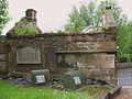 Watch House, New Monkland Church - geograph.org.uk - 1602708.jpg 640 × 480 ; 108 kio
-
 Watch House, New Monkland Church - geograph.org.uk - 1951526.jpg 1 017 × 1 000 ; 246 kio
-
 Which Direction - geograph.org.uk - 1304311.jpg 640 × 480 ; 71 kio
-
 Wind turbine - geograph.org.uk - 3485725.jpg 640 × 480 ; 66 kio
-
 Wind turbine near Braidenhill Farm - geograph.org.uk - 2803778.jpg 480 × 640 ; 68 kio
-
 Wind Turbines - geograph.org.uk - 3485063.jpg 640 × 480 ; 45 kio
-
 Windmill and Muddy Field - geograph.org.uk - 3803824.jpg 640 × 480 ; 29 kio
-
 Woodhead Crescent, Glenmavis - geograph.org.uk - 3237883.jpg 640 × 481 ; 70 kio
-
 Yetts Hole Road at Braidenhill - geograph.org.uk - 2122589.jpg 600 × 800 ; 93 kio


_-_geograph.org.uk_-_1729070.jpg)


_-_geograph.org.uk_-_1951553.jpg)


