Category:Glentham
Aller à la navigation
Aller à la recherche
English: Glentham is a village and civil parish in the West Lindsey district of Lincolnshire, England. It includes the small hamlet of Caenby. According to the 2001 census it had a population of 341. It is on the A631 2 miles east of Caenby Corner and the A15.
localité britannique du comté anglais de Lincolnshire  | |||||
| Téléverser des médias | |||||
| Nature de l’élément | |||||
|---|---|---|---|---|---|
| Lieu | West Lindsey, Lincolnshire, Midlands de l'Est, Angleterre | ||||
| Réputé identique à | Glentham (page en doublon, paroisse civile) | ||||
 | |||||
Sous-catégories
Cette catégorie comprend 4 sous-catégories, dont les 4 ci-dessous.
Média dans la catégorie « Glentham »
Cette catégorie comprend 170 fichiers, dont les 170 ci-dessous.
-
 A631 approaching Brickyard Cottages - geograph.org.uk - 4568867.jpg 640 × 251 ; 42 kio
-
 A631 at Glentham village boundary - geograph.org.uk - 5677186.jpg 640 × 480 ; 45 kio
-
 A631 east entering Glentham - geograph.org.uk - 3003781.jpg 640 × 485 ; 79 kio
-
 A631 entering Glentham - geograph.org.uk - 4325407.jpg 640 × 446 ; 51 kio
-
 A631 facing east - geograph.org.uk - 3516317.jpg 2 256 × 1 504 ; 2,28 Mio
-
 A631 heading east - geograph.org.uk - 2987775.jpg 640 × 480 ; 75 kio
-
 A631 heading east - geograph.org.uk - 3111871.jpg 640 × 480 ; 46 kio
-
 A631 heading east - geograph.org.uk - 3111875.jpg 640 × 480 ; 47 kio
-
 A631 nears Caenby Corner - geograph.org.uk - 5677193.jpg 640 × 480 ; 49 kio
-
 A631 passing Main Road Farm - geograph.org.uk - 4568861.jpg 640 × 271 ; 50 kio
-
 A631 through Glentham - geograph.org.uk - 4325366.jpg 640 × 564 ; 54 kio
-
 A631 towards Gainsborough - geograph.org.uk - 3111838.jpg 640 × 480 ; 88 kio
-
 A631 towards Gainsborough - geograph.org.uk - 3111851.jpg 640 × 480 ; 69 kio
-
 A631 towards Glentham - geograph.org.uk - 3033874.jpg 2 256 × 1 504 ; 890 kio
-
 A631 west from Main Road Farm - geograph.org.uk - 4325401.jpg 640 × 362 ; 47 kio
-
 Approaching Caenby Corner - geograph.org.uk - 4569005.jpg 640 × 293 ; 49 kio
-
 Barff Lane - geograph.org.uk - 3032048.jpg 2 256 × 1 504 ; 1,48 Mio
-
 Barff Lane heading east - geograph.org.uk - 3111827.jpg 640 × 480 ; 117 kio
-
 Barff Lane towards Glentham - geograph.org.uk - 5786708.jpg 1 600 × 1 065 ; 568 kio
-
 Barff Lane towards Glentham - geograph.org.uk - 5786718.jpg 1 600 × 1 135 ; 737 kio
-
 Barff Lane, Glentham - geograph.org.uk - 2286332.jpg 1 024 × 768 ; 216 kio
-
 Barff Lane, Glentham - geograph.org.uk - 2286528.jpg 1 024 × 768 ; 240 kio
-
 Barff Meadow, new houses in Glentham - geograph.org.uk - 4457095.jpg 640 × 427 ; 49 kio
-
 Behind the hedge, Newel Hill - geograph.org.uk - 3006018.jpg 1 024 × 768 ; 197 kio
-
 Bend and track off A631 at Newel Well - geograph.org.uk - 4645806.jpg 1 024 × 715 ; 160 kio
-
 Bend at Barff Farm entrance - geograph.org.uk - 4568878.jpg 640 × 308 ; 41 kio
-
 Bend in road east of Slates Farm - geograph.org.uk - 3003789.jpg 640 × 535 ; 68 kio
-
 Bend on A631 east through Bishopbridge - geograph.org.uk - 3003803.jpg 640 × 449 ; 67 kio
-
 Bishop Norton and Atterby, aerial 2015 - geograph.org.uk - 4420174.jpg 640 × 394 ; 55 kio
-
 Bishop Norton Road towards Glentham - geograph.org.uk - 3111820.jpg 640 × 480 ; 45 kio
-
 Bishop Norton Road, Glentham - geograph.org.uk - 2286555.jpg 1 024 × 768 ; 141 kio
-
 Bishop Norton Road, Glentham - geograph.org.uk - 3111832.jpg 640 × 480 ; 105 kio
-
 Bishopbridge - geograph.org.uk - 138887.jpg 640 × 480 ; 158 kio
-
 BP garage at Caenby Corner - geograph.org.uk - 6231825.jpg 1 888 × 1 232 ; 1,17 Mio
-
 Bracken's Wood - geograph.org.uk - 124133.jpg 640 × 427 ; 109 kio
-
 Brickyard Cottages - geograph.org.uk - 3111873.jpg 640 × 480 ; 46 kio
-
 Bungalow on Church Close, Glentham - geograph.org.uk - 5852540.jpg 1 600 × 1 065 ; 675 kio
-
 Caenby Corner auction ground - geograph.org.uk - 2248312.jpg 640 × 427 ; 82 kio
-
 Caravans near Caenby Corner - geograph.org.uk - 2248303.jpg 640 × 427 ; 73 kio
-
 Cherry Tree Farm - geograph.org.uk - 2333449.jpg 640 × 427 ; 90 kio
-
 Cottage and access at Glentham - geograph.org.uk - 2286324.jpg 1 024 × 768 ; 209 kio
-
 Cottages, Barff Lane - geograph.org.uk - 3111828.jpg 640 × 480 ; 69 kio
-
 Crop field off the A631 - geograph.org.uk - 3111869.jpg 640 × 480 ; 92 kio
-
 Crop field off the A631 - geograph.org.uk - 3111874.jpg 640 × 480 ; 87 kio
-
 Crop field, Glentham Grange - geograph.org.uk - 3111894.jpg 640 × 480 ; 79 kio
-
 Crop field, Highfield Farm - geograph.org.uk - 3111848.jpg 640 × 513 ; 68 kio
-
 Cross Lane - geograph.org.uk - 4645808.jpg 1 024 × 743 ; 103 kio
-
 Cross Lane - geograph.org.uk - 6344617.jpg 1 024 × 768 ; 198 kio
-
 Cross Lane Bridge over Seggimoor Beck - geograph.org.uk - 4261824.jpg 640 × 427 ; 78 kio
-
 Cross Lane heading north - geograph.org.uk - 3111896.jpg 640 × 480 ; 53 kio
-
 Cross Lane near Glentham Grange - geograph.org.uk - 4645812.jpg 1 024 × 669 ; 121 kio
-
 Crown Inn Glentham on A631 - geograph.org.uk - 2459847.jpg 640 × 480 ; 74 kio
-
 Cut Mark, Glentham, Seggimoor Bridge - geograph.org.uk - 5187611.jpg 960 × 1 280 ; 501 kio
-
 Cut Mark, Glentham, St Peter's Church - geograph.org.uk - 5187574.jpg 960 × 1 280 ; 410 kio
-
 Cut Mark, Glentham, St Peter's Church - geograph.org.uk - 5187577.jpg 1 280 × 960 ; 591 kio
-
 Drain, taken from the path along the River Ancholme - geograph.org.uk - 5652112.jpg 1 600 × 1 064 ; 665 kio
-
 Farm track (footpath) off Bishop Norton Road - geograph.org.uk - 3111817.jpg 640 × 480 ; 83 kio
-
 Farm track (footpath), Mill Hill - geograph.org.uk - 3111840.jpg 640 × 480 ; 77 kio
-
 Farm track at Newel Well Hill - geograph.org.uk - 3006015.jpg 1 024 × 768 ; 162 kio
-
 Farm track junction near Newel Well Hill - geograph.org.uk - 3003786.jpg 640 × 448 ; 47 kio
-
 Farm track near Bishop Norton - geograph.org.uk - 3033882.jpg 2 256 × 1 504 ; 904 kio
-
 Farm track off Barff Lane - geograph.org.uk - 5786716.jpg 1 600 × 1 065 ; 616 kio
-
 Farmland at Bishop Bridge - geograph.org.uk - 5652056.jpg 1 600 × 1 064 ; 728 kio
-
 Farmland off Barff Lane - geograph.org.uk - 3111821.jpg 640 × 480 ; 60 kio
-
 Farmland, Mill Hill - geograph.org.uk - 3111837.jpg 640 × 480 ; 53 kio
-
 Field Near New River Ancholme - geograph.org.uk - 1104722.jpg 640 × 480 ; 67 kio
-
 Fields and Scarecrow - geograph.org.uk - 1104744.jpg 640 × 480 ; 58 kio
-
 Fields south of Bishopbridge - geograph.org.uk - 6344556.jpg 1 024 × 768 ; 120 kio
-
 Ford at Glentham - geograph.org.uk - 2105184.jpg 3 872 × 2 592 ; 2,38 Mio
-
 Former gateway opposite the church in Glentham - geograph.org.uk - 4457090.jpg 640 × 427 ; 102 kio
-
 Garage at entrance to Glentham - geograph.org.uk - 4568887.jpg 640 × 305 ; 52 kio
-
 Glebe Farm from A631 east - geograph.org.uk - 3003799.jpg 640 × 460 ; 46 kio
-
 Glendower Guest House, High Street, Glentham - geograph.org.uk - 5852573.jpg 1 600 × 1 287 ; 577 kio
-
 Glentham Pietà - geograph.org.uk - 3482006.jpg 427 × 640 ; 87 kio
-
 Glentham Post Office - geograph.org.uk - 67917.jpg 640 × 480 ; 118 kio
-
 Glentham Road looking towards Bishop Norton - geograph.org.uk - 2286800.jpg 1 024 × 768 ; 152 kio
-
 Glentham Village Hall - geograph.org.uk - 3111833.jpg 640 × 480 ; 91 kio
-
 Glentham, bench mark S6421 - geograph.org.uk - 2234369.jpg 480 × 640 ; 134 kio
-

-
 Glentham, Seggimoor Bridge - geograph.org.uk - 5187614.jpg 1 280 × 960 ; 666 kio
-
 Graveyard at St Peter's Church, Glentham - geograph.org.uk - 5852544.jpg 1 600 × 1 065 ; 879 kio
-
 Harvested crop field near Glentham - geograph.org.uk - 3111816.jpg 640 × 480 ; 84 kio
-
 Hedgerow beside the A631 - geograph.org.uk - 3111849.jpg 640 × 480 ; 102 kio
-
 Hedgerow beside the A631 - geograph.org.uk - 3111850.jpg 640 × 480 ; 113 kio
-
 High Street - geograph.org.uk - 2333452.jpg 427 × 640 ; 102 kio
-
 House at Bishopbridge - geograph.org.uk - 1104634.jpg 640 × 480 ; 99 kio
-
 Impending storm - geograph.org.uk - 2286773.jpg 1 024 × 768 ; 197 kio
-
 Junction with A631 Glentham - geograph.org.uk - 3498436.jpg 1 024 × 768 ; 123 kio
-
 Long, straight Road to Waddingham - geograph.org.uk - 4261819.jpg 640 × 427 ; 29 kio
-
 Looking towards Bracken's Wood - geograph.org.uk - 2286338.jpg 1 024 × 768 ; 144 kio
-
 Memorial brass, Ss Peter ^ Paul church, Glentham - geograph.org.uk - 4952376.jpg 3 704 × 2 207 ; 6,51 Mio
-
 Middlefield Lane, Glentham (2) - geograph.org.uk - 2286539.jpg 1 024 × 768 ; 251 kio
-
 Middlefield Lane, Glentham - geograph.org.uk - 2286535.jpg 1 024 × 768 ; 244 kio
-

-
 New Covert from Ancholme - geograph.org.uk - 1104624.jpg 640 × 480 ; 80 kio
-
 New River Ancholme, Bishopbridge - geograph.org.uk - 3111884.jpg 640 × 480 ; 105 kio
-
 Newell Well Hill - geograph.org.uk - 2248322.jpg 640 × 427 ; 121 kio
-
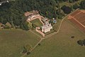 Norton Place, aerial 2013 - geograph.org.uk - 3641938.jpg 640 × 427 ; 65 kio
-
 Oil seed rape crop alongside the A631 - geograph.org.uk - 3498443.jpg 1 024 × 768 ; 116 kio
-
 On the A631 - geograph.org.uk - 6344621.jpg 1 024 × 768 ; 219 kio
-
 Open fields north of the A631 - geograph.org.uk - 326953.jpg 640 × 480 ; 74 kio
-
 Outbuildings on the bend in Middlefield Lane, Glentham - geograph.org.uk - 2286548.jpg 1 024 × 768 ; 225 kio
-
 Pallets and Pipes - geograph.org.uk - 2286335.jpg 1 024 × 768 ; 152 kio
-
 Path along the River Ancholme - geograph.org.uk - 5650444.jpg 1 600 × 1 064 ; 826 kio
-
 Path along the River Ancholme - geograph.org.uk - 5652094.jpg 1 600 × 1 064 ; 567 kio
-
 Path along the River Ancholme - geograph.org.uk - 5652098.jpg 1 600 × 1 064 ; 481 kio
-
 Path along the River Ancholme - geograph.org.uk - 5652117.jpg 1 600 × 1 064 ; 617 kio
-
 Path along the River Ancholme - geograph.org.uk - 5652119.jpg 1 600 × 1 064 ; 567 kio
-
 Picture postcard scene in Glentham - geograph.org.uk - 4457091.jpg 640 × 427 ; 92 kio
-

-

-
 Ploughed field, Bishopbridge - geograph.org.uk - 3111878.jpg 640 × 480 ; 69 kio
-
 Public footpath to Bishop Norton - geograph.org.uk - 3849166.jpg 1 200 × 798 ; 304 kio
-

-
 River Ancholme - geograph.org.uk - 124145.jpg 640 × 427 ; 115 kio
-
 River Ancholme - geograph.org.uk - 6344566.jpg 1 024 × 768 ; 143 kio
-
 River Ancholme at Bishopbridge - geograph.org.uk - 6344561.jpg 1 024 × 768 ; 194 kio
-
 River Ancholme from Bishop Bridge - geograph.org.uk - 5651948.jpg 1 600 × 1 064 ; 578 kio
-
 Road to Glentham Cliff Farmhouse - geograph.org.uk - 3033861.jpg 2 256 × 1 504 ; 894 kio
-
 Roadside Scene - geograph.org.uk - 1104648.jpg 640 × 467 ; 76 kio
-
 Roadway to Highfield Farm - geograph.org.uk - 3006024.jpg 1 024 × 768 ; 170 kio
-
 Scaremonger - geograph.org.uk - 1104716.jpg 640 × 480 ; 87 kio
-
 Seggimoor Beck - geograph.org.uk - 2717062.jpg 1 024 × 768 ; 323 kio
-
 Seggimoor Beck - geograph.org.uk - 2784788.jpg 682 × 1 024 ; 357 kio
-
 Seggimoor Beck - geograph.org.uk - 6344613.jpg 1 024 × 768 ; 314 kio
-
 Seggimoor Farm - geograph.org.uk - 3111830.jpg 640 × 480 ; 61 kio
-
 Sign for Highfield Cliff farm off the A631 - geograph.org.uk - 4645807.jpg 1 024 × 768 ; 106 kio
-
 Slates Farm - geograph.org.uk - 3006032.jpg 1 024 × 768 ; 136 kio
-
 St Peter's Church, Glentham - geograph.org.uk - 5852515.jpg 1 600 × 1 065 ; 750 kio
-
 St Peter's Church, Glentham - geograph.org.uk - 5852520.jpg 1 600 × 1 065 ; 532 kio
-
 St Peter's Church, Glentham - geograph.org.uk - 5852523.jpg 1 065 × 1 600 ; 452 kio
-
 St Peter's Church, Glentham - geograph.org.uk - 5852528.jpg 1 065 × 1 600 ; 387 kio
-
 St Peter's Church, Glentham - geograph.org.uk - 5852533.jpg 1 042 × 1 600 ; 671 kio
-
 St Peter's Church, Glentham - geograph.org.uk - 5852537.jpg 1 065 × 1 600 ; 449 kio
-
 Start of track to Highfield Farm - geograph.org.uk - 4568997.jpg 640 × 267 ; 41 kio
-
 Swan roost next to the New River Ancholme - geograph.org.uk - 4243568.jpg 640 × 427 ; 71 kio
-
 The A631 High Street, Glentham - geograph.org.uk - 5852583.jpg 1 600 × 1 065 ; 525 kio
-
 The Bell, Bishop Bridge - geograph.org.uk - 5651962.jpg 1 600 × 1 064 ; 671 kio
-
 The Crown Inn, Glentham - geograph.org.uk - 3111858.jpg 640 × 480 ; 56 kio
-
 The Crown Inn, Glenton - geograph.org.uk - 3849185.jpg 1 200 × 798 ; 302 kio
-
 The Crown Inn, High Street, Glentham - geograph.org.uk - 5852581.jpg 1 600 × 1 120 ; 541 kio
-
 The Glendower and the Crown Inn at Glentham - geograph.org.uk - 4568910.jpg 640 × 319 ; 46 kio
-
 Tower builder - geograph.org.uk - 2339083.jpg 427 × 640 ; 87 kio
-
 Track to Barff Farm - geograph.org.uk - 3111822.jpg 640 × 480 ; 86 kio
-
 Track to Barff Farm, near Glentham - geograph.org.uk - 2784777.jpg 682 × 1 024 ; 328 kio
-
 Track to Glentham Cliff - geograph.org.uk - 2286782.jpg 1 024 × 768 ; 114 kio
-
 Track to Halfmoon Plantation - geograph.org.uk - 3028056.jpg 2 256 × 1 504 ; 988 kio
-
 Track to Highland Farm - geograph.org.uk - 3028077.jpg 2 256 × 1 504 ; 803 kio
-
 Track to Slates Farm - geograph.org.uk - 3033841.jpg 2 256 × 1 504 ; 1 022 kio
-
 Track towards Norton park - geograph.org.uk - 2248323.jpg 640 × 427 ; 104 kio
-

-
 View to New Covert at Bishopbridge - geograph.org.uk - 6344548.jpg 1 024 × 768 ; 154 kio
-
 View towards Bishopbridge - geograph.org.uk - 2376998.jpg 1 024 × 768 ; 139 kio
-
 View towards Glebe Farm - geograph.org.uk - 2717067.jpg 1 024 × 768 ; 128 kio
-
 Village Hall, Glentham - geograph.org.uk - 5786726.jpg 1 600 × 1 065 ; 850 kio
-

-

-
 A631 at Bishop Bridge - geograph.org.uk - 783638.jpg 640 × 478 ; 77 kio
-
 Another Scarecrow - geograph.org.uk - 1104765.jpg 640 × 480 ; 75 kio
-
 Barff Lane - geograph.org.uk - 124135.jpg 640 × 427 ; 151 kio
-
 Glentham Grange Farm - geograph.org.uk - 327434.jpg 640 × 480 ; 67 kio
-
 Low Place - geograph.org.uk - 327433.jpg 640 × 480 ; 80 kio
-
 Mill Hill - geograph.org.uk - 194078.jpg 640 × 480 ; 88 kio
-
 Misty Morning Farmland - geograph.org.uk - 194079.jpg 640 × 480 ; 68 kio
-
 Moat Farm - geograph.org.uk - 326950.jpg 640 × 480 ; 72 kio
-
 Near Caenby - geograph.org.uk - 67913.jpg 640 × 480 ; 148 kio
-
 Near Glentham - geograph.org.uk - 67920.jpg 640 × 480 ; 123 kio
-
 Over pasture to Cherry Tree Farm - geograph.org.uk - 339438.jpg 640 × 480 ; 56 kio
-
 Passing Comet - geograph.org.uk - 194081.jpg 640 × 480 ; 91 kio
-
 The Crown Inn, Glentham - geograph.org.uk - 68025.jpg 640 × 480 ; 118 kio


_off_Bishop_Norton_Road_-_geograph.org.uk_-_3111817.jpg)
,_Mill_Hill_-_geograph.org.uk_-_3111840.jpg)


_-_geograph.org.uk_-_2286539.jpg)


