Category:Godshill, Hampshire
Aller à la navigation
Aller à la recherche
village britannique (Hampshire)  | |||||
| Téléverser des médias | |||||
| Nature de l’élément | |||||
|---|---|---|---|---|---|
| Se trouve dans l'aire protégée | |||||
| Lieu | New Forest, Hampshire, Angleterre du Sud-Est, Angleterre | ||||
 | |||||
Sous-catégories
Cette catégorie comprend 11 sous-catégories, dont les 11 ci-dessous.
B
- Black Gutter Bottom (19 F)
C
- Cockley Plain (10 F)
D
- Deadman Hill, New Forest (23 F)
F
- Frankenbury Camp (3 F)
G
- Godshill Chapel, Hampshire (9 F)
- Godshill Ford (3 F)
I
- Islands Thorns Inclosure (47 F)
L
- Leaden Hall, New Forest (8 F)
P
- Pitts Wood Inclosure (31 F)
S
Média dans la catégorie « Godshill, Hampshire »
Cette catégorie comprend 322 fichiers, dont les 200 ci-dessous.
(page précédente) (page suivante)-

-

-
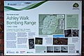
 (10a) A tour of the WWII Ashley Walk Bombing Range - chalk dump - geograph.org.uk - 4477943.jpg 3 000 × 2 000 ; 6,1 Mio
-

-

-

-

-

-

-

-

-

-
-
-

-
-

-
-

-
 (9a) A tour of the WWII Ashley Walk Bombing Range - Ship Target - geograph.org.uk - 4477913.jpg 3 000 × 2 000 ; 7,23 Mio
-
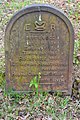
 12 Grave of Ernest Westlake.jpg 3 454 × 5 967 ; 9,48 Mio
-
 17 animal casualties so far in 2006 - geograph.org.uk - 223415.jpg 640 × 480 ; 82 kio
-
 A dry ford north of Godshill - geograph.org.uk - 2876864.jpg 3 536 × 2 545 ; 1,87 Mio
-
-

-
-
 Abbots Well, Frogham - geograph.org.uk - 1169218.jpg 640 × 480 ; 204 kio
-
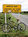 Animals on road - geograph.org.uk - 2042074.jpg 480 × 640 ; 120 kio
-
-
 Ashley Cross, New Forest - geograph.org.uk - 478230.jpg 640 × 480 ; 76 kio
-
 Ashley Walk Car Park - geograph.org.uk - 4148725.jpg 1 024 × 768 ; 164 kio
-
 Ashley Walk site of Wall Target no 2 - geograph.org.uk - 2612860.jpg 1 280 × 960 ; 186 kio
-
 Ashley Walk, and the 'Snake Track', New Forest - geograph.org.uk - 2411085.jpg 1 024 × 768 ; 172 kio
-
 Ashley, forestry crossroads - geograph.org.uk - 4097335.jpg 1 024 × 768 ; 190 kio
-
 Ashley, forestry track - geograph.org.uk - 4097410.jpg 1 024 × 768 ; 167 kio
-
 Avon floodplain near Burgate - geograph.org.uk - 5045954.jpg 3 072 × 2 048 ; 1,25 Mio
-
 Avon floodplain near Burgate - geograph.org.uk - 5045961.jpg 2 085 × 1 239 ; 806 kio
-
 B3078 enters Godshill - geograph.org.uk - 2876852.jpg 3 425 × 2 575 ; 1,6 Mio
-
 B3080 at Golden Cross - geograph.org.uk - 2976610.jpg 3 648 × 2 499 ; 1,64 Mio
-
 B3080 crosses Rushy Flat - geograph.org.uk - 2976617.jpg 3 648 × 2 670 ; 1 Mio
-
 B3080 passing Burnt Ground Wood - geograph.org.uk - 2973456.jpg 640 × 480 ; 57 kio
-
 B3080 road - geograph.org.uk - 3573616.jpg 3 648 × 2 736 ; 4,01 Mio
-
 B3080 southbound - geograph.org.uk - 4450441.jpg 640 × 474 ; 73 kio
-
 Beehives near Coopers Hill - geograph.org.uk - 2777069.jpg 1 600 × 1 200 ; 608 kio
-
 Benchmark on the culvert - geograph.org.uk - 2774699.jpg 800 × 600 ; 304 kio
-
 Bend in B3078 near Deadman Hill - geograph.org.uk - 2973466.jpg 640 × 480 ; 51 kio
-
 Beside Godshill Inclosure - geograph.org.uk - 5821314.jpg 1 600 × 1 200 ; 677 kio
-
 Black Gutter - geograph.org.uk - 4149237.jpg 1 024 × 768 ; 228 kio
-
 Bluebells in Amberwood Inclosure - geograph.org.uk - 1976360.jpg 1 600 × 1 200 ; 1,28 Mio
-
-
 Bramshaw Telegraph, forestry road - geograph.org.uk - 4063815.jpg 1 024 × 768 ; 133 kio
-
 Bramshaw Telegraph, gateway - geograph.org.uk - 4063808.jpg 1 024 × 768 ; 187 kio
-
 Bramshaw, Black Gutter - geograph.org.uk - 4217905.jpg 1 024 × 768 ; 215 kio
-
 Bramshaw, concrete remains - geograph.org.uk - 4217893.jpg 1 024 × 768 ; 221 kio
-
 Bramshaw, heathland - geograph.org.uk - 4217862.jpg 1 024 × 768 ; 183 kio
-
 Bramshaw, pond - geograph.org.uk - 4217879.jpg 1 024 × 721 ; 119 kio
-
 Bramshaw, track - geograph.org.uk - 4217847.jpg 1 024 × 768 ; 186 kio
-
 Bramshaw, track junction - geograph.org.uk - 4217834.jpg 1 024 × 768 ; 178 kio
-
 Bridge over an Avon stream - geograph.org.uk - 1524926.jpg 640 × 426 ; 185 kio
-
 Burgate, Avon Valley Path - geograph.org.uk - 2484190.jpg 1 024 × 768 ; 241 kio
-
 Burgate, bales - geograph.org.uk - 2484144.jpg 1 024 × 768 ; 178 kio
-
 Burgate, footpath - geograph.org.uk - 2484124.jpg 1 024 × 768 ; 296 kio
-
 Burgate, horse grazing - geograph.org.uk - 2484197.jpg 1 024 × 768 ; 185 kio
-
 Burgate, national park boundary - geograph.org.uk - 2484114.jpg 1 024 × 768 ; 249 kio
-
 Burgate, ponies - geograph.org.uk - 2484139.jpg 1 024 × 768 ; 180 kio
-
 Burgate, sluice - geograph.org.uk - 2484156.jpg 1 024 × 748 ; 229 kio
-
 Burgate, stile - geograph.org.uk - 2484132.jpg 1 024 × 768 ; 333 kio
-
-
 Cattle watering point off the Avon - geograph.org.uk - 1524896.jpg 640 × 426 ; 184 kio
-
 Channel, Avon floodplain - geograph.org.uk - 5045977.jpg 2 031 × 2 947 ; 960 kio
-
 Channel, Avon floodplain - geograph.org.uk - 5046034.jpg 2 048 × 3 072 ; 1,45 Mio
-
 Cockley Bushes - geograph.org.uk - 4148894.jpg 1 024 × 768 ; 156 kio
-
 Cockley Hill - geograph.org.uk - 4148906.jpg 1 024 × 768 ; 178 kio
-
 Cockley Hill, horse rider - geograph.org.uk - 4148885.jpg 1 024 × 768 ; 133 kio
-
 Cockley, forestry road - geograph.org.uk - 4148873.jpg 1 024 × 768 ; 154 kio
-
 Concrete arrow on Deadmans Hill - geograph.org.uk - 2892271.jpg 4 288 × 3 216 ; 2,11 Mio
-
 Converging roads - geograph.org.uk - 5822401.jpg 1 600 × 1 200 ; 524 kio
-
 Cottage by Burnt Ground Wood - geograph.org.uk - 5822409.jpg 1 600 × 1 200 ; 592 kio
-
 Cottage off B3080 - geograph.org.uk - 4451951.jpg 640 × 480 ; 64 kio
-
 Cows and cyclists on Deadman Hill - geograph.org.uk - 3423831.jpg 640 × 363 ; 36 kio
-
 Cricket Ground - geograph.org.uk - 3573648.jpg 3 648 × 2 736 ; 3,67 Mio
-
 Culvert and hatches - geograph.org.uk - 2774682.jpg 800 × 600 ; 254 kio
-
 Cunninger Bottom - geograph.org.uk - 4150031.jpg 1 024 × 768 ; 170 kio
-
 Cunninger Bottom - geograph.org.uk - 5822577.jpg 1 600 × 1 200 ; 624 kio
-
 Cunninger Bottom from Deadman Hill - geograph.org.uk - 2315827.jpg 640 × 480 ; 66 kio
-
 Cunninger Bottom from Deadman Hill - geograph.org.uk - 2538901.jpg 427 × 640 ; 151 kio
-
 Cunninger Bottom, brook - geograph.org.uk - 4150089.jpg 1 024 × 768 ; 216 kio
-
 Cunninger Bottom, crab-apple tree - geograph.org.uk - 4150072.jpg 1 024 × 768 ; 228 kio
-
 Cunninger Bottom, stream bed - geograph.org.uk - 4150045.jpg 1 024 × 768 ; 170 kio
-
 Cunninger Bottom, track - geograph.org.uk - 4150060.jpg 1 024 × 768 ; 189 kio
-
 Cunninger Bottom, track junction - geograph.org.uk - 4150077.jpg 1 024 × 768 ; 152 kio
-
 Deadman Bottom - geograph.org.uk - 4149476.jpg 1 024 × 768 ; 166 kio
-
 Deadman Corner, New Forest - geograph.org.uk - 910101.jpg 640 × 480 ; 102 kio
-
 Deadman Hill - geograph.org.uk - 2042079.jpg 640 × 480 ; 72 kio
-
 Deadman Hill - geograph.org.uk - 4149247.jpg 1 024 × 768 ; 147 kio
-
 Deadman Hill, B3078 - geograph.org.uk - 4149392.jpg 1 024 × 768 ; 127 kio
-
 Deadman Hill, ditch - geograph.org.uk - 4149466.jpg 1 024 × 768 ; 182 kio
-
 Deadman Hill, former gravel pits - geograph.org.uk - 4149261.jpg 1 024 × 768 ; 221 kio
-
 Deadman Hill, gateway - geograph.org.uk - 4149272.jpg 1 024 × 768 ; 154 kio
-
 Deadman Hill, heathland - geograph.org.uk - 4149472.jpg 1 024 × 768 ; 220 kio
-
 Decorated garage - geograph.org.uk - 655921.jpg 640 × 476 ; 103 kio
-

-
 Ditch End, brook - geograph.org.uk - 4097098.jpg 1 024 × 768 ; 218 kio
-
 Ditch End, cattle grazing - geograph.org.uk - 4096997.jpg 1 024 × 768 ; 156 kio
-
 Ditch End, country lane - geograph.org.uk - 4097031.jpg 1 024 × 768 ; 292 kio
-
 Ditch End, forestry track - geograph.org.uk - 4097088.jpg 1 024 × 768 ; 225 kio
-
 Ditch End, heathland - geograph.org.uk - 4097110.jpg 1 024 × 768 ; 192 kio
-
 Ditch End, ponies - geograph.org.uk - 4097012.jpg 1 024 × 768 ; 145 kio
-
 Ditch End, track - geograph.org.uk - 4097079.jpg 1 024 × 768 ; 283 kio
-
 Ditchend Bottom - geograph.org.uk - 2213287.jpg 2 112 × 2 816 ; 2,12 Mio
-
 Ditchend Bottom - geograph.org.uk - 6247230.jpg 4 000 × 3 000 ; 4,13 Mio
-
 Ditchend Bottom from Godshill Ridge - geograph.org.uk - 2440285.jpg 640 × 427 ; 115 kio
-
 Ditchend Bottom seen from Burnt Balls - geograph.org.uk - 2353180.jpg 640 × 427 ; 117 kio
-
 Ditchend Brook crosses the New Forest boundary - geograph.org.uk - 2353155.jpg 640 × 427 ; 172 kio
-
 Donkey near Rushy Flat - geograph.org.uk - 3622134.jpg 427 × 640 ; 114 kio
-
 Donkey near Rushy Flat - geograph.org.uk - 3622135.jpg 640 × 427 ; 87 kio
-
 Donkeys near Rushy Flat - geograph.org.uk - 3628668.jpg 640 × 427 ; 91 kio
-
 Emerging from Turf Hill Inclosure - geograph.org.uk - 2519726.jpg 640 × 427 ; 152 kio
-
 Entrance to Pitts Wood Inclosure - geograph.org.uk - 3466738.jpg 640 × 427 ; 127 kio
-
 Entrance to Sandy Balls holiday site - geograph.org.uk - 3423805.jpg 640 × 409 ; 69 kio
-
 Fallow bucks - geograph.org.uk - 655897.jpg 640 × 460 ; 94 kio
-
 Feel the power - geograph.org.uk - 2042112.jpg 640 × 480 ; 92 kio
-
 Footbridge over Ditchend Brook, south of Godshill - geograph.org.uk - 385862.jpg 640 × 480 ; 110 kio
-
 Footpath near Godshill - geograph.org.uk - 2251733.jpg 640 × 480 ; 130 kio
-
 Forest track, near Eyeworth - geograph.org.uk - 2225446.jpg 640 × 480 ; 151 kio
-
 Furry cow, Millersford Bottom, New Forest - geograph.org.uk - 277070.jpg 480 × 640 ; 106 kio
-
 Godshill Cricket Car Park - geograph.org.uk - 4148652.jpg 1 024 × 768 ; 192 kio
-
 Godshill Cricket Pitch - geograph.org.uk - 5821295.jpg 1 600 × 1 200 ; 523 kio
-
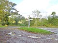 Godshill Cross - geograph.org.uk - 4210976.jpg 1 024 × 754 ; 208 kio
-
 Godshill Ford - geograph.org.uk - 5114943.jpg 1 440 × 960 ; 2,43 Mio
-
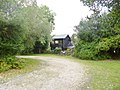 Godshill Pottery - geograph.org.uk - 4148730.jpg 1 024 × 768 ; 246 kio
-
 Godshill Pottery, east of Godshill, New Forest - geograph.org.uk - 27271.jpg 640 × 480 ; 446 kio
-
 Godshill Ridge - geograph.org.uk - 4148719.jpg 1 024 × 768 ; 172 kio
-
 Godshill village cricket pitch, New Forest - geograph.org.uk - 27269.jpg 640 × 302 ; 48 kio
-
 Godshill, bracken - geograph.org.uk - 4148771.jpg 1 024 × 768 ; 172 kio
-
 Godshill, bridge - geograph.org.uk - 4148857.jpg 1 024 × 758 ; 152 kio
-
 Godshill, Brook Cottage - geograph.org.uk - 2484235.jpg 1 024 × 768 ; 360 kio
-
 Godshill, cricket pitch - geograph.org.uk - 4148667.jpg 1 024 × 768 ; 123 kio
-
 Godshill, Croft Cottage - geograph.org.uk - 4210912.jpg 1 024 × 768 ; 166 kio
-
 Godshill, disused glasshouses - geograph.org.uk - 2484210.jpg 1 024 × 768 ; 315 kio
-
 Godshill, entrance - geograph.org.uk - 4210988.jpg 1 024 × 768 ; 217 kio
-
 Godshill, Folds Farm - geograph.org.uk - 2484202.jpg 1 024 × 768 ; 153 kio
-
 Godshill, footbridge - geograph.org.uk - 4150172.jpg 1 024 × 768 ; 255 kio
-
 Godshill, footpath - geograph.org.uk - 2484243.jpg 1 024 × 768 ; 264 kio
-
 Godshill, footpath junction - geograph.org.uk - 2484220.jpg 1 024 × 768 ; 301 kio
-
 Godshill, Forest Cottage Farmhouse - geograph.org.uk - 4096422.jpg 1 024 × 768 ; 208 kio
-
 Godshill, gate - geograph.org.uk - 4148715.jpg 1 024 × 768 ; 238 kio
-
 Godshill, gate - geograph.org.uk - 4211025.jpg 1 024 × 768 ; 242 kio
-
 Godshill, gorse - geograph.org.uk - 4148759.jpg 1 024 × 768 ; 132 kio
-
 Godshill, Hart Hill - geograph.org.uk - 4096438.jpg 1 024 × 768 ; 257 kio
-
 Godshill, heathland - geograph.org.uk - 4148703.jpg 1 024 × 768 ; 199 kio
-
 Godshill, humid heathland - geograph.org.uk - 4148846.jpg 1 024 × 776 ; 262 kio
-
 Godshill, Lampton Lodge - geograph.org.uk - 4210874.jpg 1 024 × 768 ; 191 kio
-
 Godshill, lawn - geograph.org.uk - 4096413.jpg 1 024 × 768 ; 181 kio
-
 Godshill, Picks Barn - geograph.org.uk - 4096431.jpg 1 024 × 768 ; 170 kio
-
 Godshill, ponies - geograph.org.uk - 4096399.jpg 1 024 × 768 ; 255 kio
-
 Godshill, postbox No. SP6 322 - geograph.org.uk - 1444376.jpg 640 × 480 ; 107 kio
-

-
 Godshill, St. Giles' - geograph.org.uk - 4210866.jpg 1 024 × 737 ; 142 kio
-
 Godshill, stile - geograph.org.uk - 2484248.jpg 1 024 × 768 ; 326 kio
-
 Godshill, stiles and footbridge - geograph.org.uk - 2484228.jpg 1 024 × 768 ; 298 kio
-
 Godshill, streambed - geograph.org.uk - 4148782.jpg 1 024 × 768 ; 212 kio
-
 Godshill, track - geograph.org.uk - 4148679.jpg 1 024 × 768 ; 149 kio
-
 Godshill, track junction - geograph.org.uk - 4148695.jpg 1 024 × 768 ; 142 kio
-
 Godshill, woodland - geograph.org.uk - 2484257.jpg 1 024 × 768 ; 306 kio
-
 Good Friday Hill - geograph.org.uk - 484642.jpg 640 × 480 ; 187 kio
-
 Good Friday Hill - geograph.org.uk - 488309.jpg 640 × 480 ; 131 kio
-
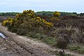
 Gorse near Millersford Plantation - geograph.org.uk - 2818655.jpg 640 × 480 ; 71 kio
-

-
 Gorse-covered tumuli - geograph.org.uk - 3466698.jpg 640 × 427 ; 88 kio
-
 Grass field by the Avon Valley Path - geograph.org.uk - 5046160.jpg 1 920 × 1 280 ; 802 kio
-
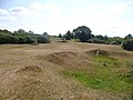
 Group of Small Bowl Barrows North of The Butts (geograph 7064980).jpg 1 600 × 900 ; 423 kio
-
 Hale, B3080 - geograph.org.uk - 2082312.jpg 1 024 × 758 ; 121 kio
-
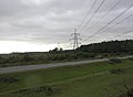 Hale, power lines - geograph.org.uk - 2082326.jpg 640 × 467 ; 43 kio
-
 Hamptworth, B3080 - geograph.org.uk - 2082248.jpg 768 × 1 024 ; 101 kio
-
 Hamptworth, cattle - geograph.org.uk - 2082285.jpg 1 024 × 768 ; 184 kio
-
 Hamptworth, county boundary - geograph.org.uk - 2082273.jpg 1 024 × 768 ; 180 kio
-
 Hamptworth, forest boundary - geograph.org.uk - 2082223.jpg 1 024 × 768 ; 277 kio
-
 Hamptworth, guinea fowl - geograph.org.uk - 2082233.jpg 1 024 × 768 ; 270 kio
-
 Hamptworth, ponies - geograph.org.uk - 2082296.jpg 1 024 × 768 ; 154 kio
-
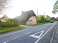
 Hamptworth, thatched cottage - geograph.org.uk - 2082265.jpg 640 × 480 ; 64 kio
-

-
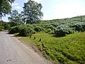
 Heathland, Turf Hill - geograph.org.uk - 2819115.jpg 800 × 600 ; 201 kio
-
 Hope Cottage after light snowfall - geograph.org.uk - 2799663.jpg 640 × 482 ; 81 kio
-
 Into Pitts Wood Inclosure - geograph.org.uk - 6247866.jpg 4 000 × 3 000 ; 4,98 Mio
-
 Junction of B3078 and B3080 - geograph.org.uk - 2976638.jpg 3 648 × 2 663 ; 1,11 Mio
-
 Junction of footpaths by Arniss Farm - geograph.org.uk - 655874.jpg 640 × 480 ; 106 kio
-
 Killed Trees, 2 - geograph.org.uk - 3820401.jpg 2 816 × 2 112 ; 2,73 Mio
-
 Lane leading from Godshill Green to Newgrounds - geograph.org.uk - 2251730.jpg 640 × 480 ; 110 kio
-
 Lane past Forest Brook Farm - geograph.org.uk - 2251724.jpg 640 × 480 ; 139 kio
-
 Lay-by on Rushy Flat - geograph.org.uk - 3574040.jpg 1 024 × 768 ; 88 kio
-
 Leaden Hall, bombing target - geograph.org.uk - 4149216.jpg 1 024 × 768 ; 176 kio
-
 Leaden Hall, heathland - geograph.org.uk - 4149093.jpg 1 024 × 768 ; 225 kio
-
 Leaden Hall, ponies - geograph.org.uk - 4149100.jpg 1 024 × 768 ; 126 kio
-
 Leaden Hall, ponies - geograph.org.uk - 4149218.jpg 1 024 × 768 ; 154 kio
-
 Leaden Hall, track - geograph.org.uk - 4149230.jpg 1 024 × 768 ; 202 kio
-
 Leaden Hall, track junction - geograph.org.uk - 4149226.jpg 1 024 × 768 ; 126 kio
-
 Little Cockley Plain - geograph.org.uk - 4148913.jpg 1 024 × 768 ; 221 kio
-
 Little Cockley Plain, forestry road - geograph.org.uk - 4149080.jpg 1 024 × 768 ; 173 kio
-
 Little Cockley Plain, track junction - geograph.org.uk - 4148922.jpg 1 024 × 768 ; 131 kio


_A_tour_of_the_WWII_Ashley_Walk_Bombing_Range_-_chalk_dump_-_geograph.org.uk_-_4477943.jpg)
_A_tour_of_the_WWII_Ashley_Walk_Bombing_Range_-_No._1_Wall_Target_-_geograph.org.uk_-_4477958.jpg)
_A_tour_of_the_WWII_Ashley_Walk_Bombing_Range_-_%22Bullseye%22_target_-_geograph.org.uk_-_4477973.jpg)
_A_tour_of_the_WWII_Ashley_Walk_Bombing_Range_-_large_cross_target_-_geograph.org.uk_-_4477999.jpg)
_A_tour_of_the_WWII_Ashley_Walk_Bombing_Range_-_No_2_Wall_Target_-_geograph.org.uk_-_4478010.jpg)
_A_tour_of_the_WWII_Ashley_Walk_Bombing_Range_-_No_3_Wall_Target_-_geograph.org.uk_-_4478039.jpg)
_A_tour_of_the_WWII_Ashley_Walk_Bombing_Range_-_%22Highball%22_bomb_ballast_-_geograph.org.uk_-_4478063.jpg)
_A_tour_of_the_WWII_Ashley_Walk_Bombing_Range_-_%22Highball%22_bomb_ballast_-_geograph.org.uk_-_4478073.jpg)
_A_tour_of_the_WWII_Ashley_Walk_Bombing_Range_-_site_of_North_Tower_-_geograph.org.uk_-_4478116.jpg)
_A_tour_of_the_WWII_Ashley_Walk_Bombing_Range_-_site_of_North_Tower_-_geograph.org.uk_-_4478140.jpg)
_A_tour_of_the_WWII_Ashley_Walk_Bombing_Range_-_Line_Target_(end)_-_geograph.org.uk_-_4477731.jpg)
_A_tour_of_the_WWII_Ashley_Walk_Bombing_Range_-_Line_Target_(end)_-_geograph.org.uk_-_4477741.jpg)
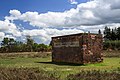
_A_tour_of_the_WWII_Ashley_Walk_Bombing_Range_-_Observation_Shelter_-_geograph.org.uk_-_4477841.jpg)
_A_tour_of_the_WWII_Ashley_Walk_Bombing_Range_-_Observation_Shelter_-_geograph.org.uk_-_4477856.jpg)
_A_tour_of_the_WWII_Ashley_Walk_Bombing_Range_-_Observation_Shelter_(detail)_-_geograph.org.uk_-_4477872.jpg)
_A_tour_of_the_WWII_Ashley_Walk_Bombing_Range_-_Observation_Shelter_(detail)_-_geograph.org.uk_-_4477882.jpg)
_A_tour_of_the_WWII_Ashley_Walk_Bombing_Range_-_C_%5E_D_Fragmentation_Target_-_geograph.org.uk_-_4477897.jpg)
_A_tour_of_the_WWII_Ashley_Walk_Bombing_Range_-_Ship_Target_-_geograph.org.uk_-_4477913.jpg)


_-_impact_distance_indicator_-_geograph.org.uk_-_4720718.jpg)
_-_North-South_airstrip_-_geograph.org.uk_-_6161293.jpg)
_-_Ship_Target_(detail)_-_geograph.org.uk_-_6161313.jpg)


.jpg)


