Category:Gottsfeld
Zur Navigation springen
Zur Suche springen
Ortsteil von Creußen | |||||
| Medium hochladen | |||||
| Ist ein(e) |
| ||||
|---|---|---|---|---|---|
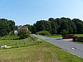
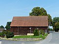
| Ort | Creußen, Landkreis Bayreuth, Oberfranken, Bayern, Deutschland | ||||
| Fläche |
| ||||
| Höhe über dem Meeresspiegel |
| ||||
 | |||||
Unterkategorien
Diese Kategorie enthält folgende Unterkategorie:
In Klammern die Anzahl der enthaltenen Kategorien (K), Seiten (S), Dateien (D)
S
- Schloss Gottsfeld (2 D)
Medien in der Kategorie „Gottsfeld“
Folgende 5 Dateien sind in dieser Kategorie, von 5 insgesamt.
-
 Gottsfeld Creußen 2017 xy1.jpg 4.000 × 3.000; 4,15 MB
-
 Gottsfeld Creußen 2017 xy2.jpg 4.000 × 3.000; 4 MB
-
 Gottsfeld Creußen 2017 xy3.jpg 4.000 × 3.000; 3,92 MB
-
 Gottsfeld Creußen 2017 xy4.jpg 4.000 × 3.000; 3,86 MB
-
 Gottsfeld Creußen 2017 xy5.jpg 4.000 × 3.000; 3,76 MB


