Category:Grampound
Aller à la navigation
Aller à la recherche
village britannique  | |||||
| Téléverser des médias | |||||
| Nature de l’élément |
| ||||
|---|---|---|---|---|---|
| Lieu | Grampound with Creed, Cornouailles, Angleterre du Sud-Ouest, Angleterre | ||||
| Altitude |
| ||||
| site officiel | |||||
 | |||||
English: Grampound is a village in Cornwall, in the United Kingdom, with 638 residents as of the 2001 census, and little growth in the last ten years. It lies on the A390 road, between Truro and St Austell, and also on the River Fal. Its name comes from the bridge over the river.
Sous-catégories
Cette catégorie comprend 2 sous-catégories, dont les 2 ci-dessous.
G
- Grampound Town Hall (3 F)
N
- St Nun's Church, Grampound (2 F)
Média dans la catégorie « Grampound »
Cette catégorie comprend 50 fichiers, dont les 50 ci-dessous.
-
 'Bonython Cottage', Grampound, Cornwall - geograph.org.uk - 2384840.jpg 1 600 × 1 200 ; 497 kio
-
 A bus climbs the A390 at Grampound - geograph.org.uk - 2384842.jpg 1 600 × 1 200 ; 387 kio
-
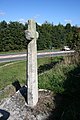 A Stone Cross - geograph.org.uk - 247891.jpg 427 × 640 ; 100 kio
-

-
 A390, Grampound - geograph.org.uk - 3414058.jpg 640 × 480 ; 78 kio
-
 A390, Grampound - geograph.org.uk - 3414062.jpg 640 × 457 ; 62 kio
-
 A390, Grampound - geograph.org.uk - 3414065.jpg 640 × 480 ; 50 kio
-
 Approaching Grampound church on A390 - geograph.org.uk - 4037843.jpg 640 × 462 ; 59 kio
-
 August in Grampound - geograph.org.uk - 959727.jpg 427 × 640 ; 59 kio
-
 Cottage, Grampound, Cornwall - geograph.org.uk - 2384846.jpg 1 600 × 1 200 ; 512 kio
-
 Dolphin Inn, Fore Street, Grampound, Cornwall - May 2022.jpg 4 032 × 3 024 ; 3,23 Mio
-
 Entering Grampound on A390 - geograph.org.uk - 4037845.jpg 640 × 404 ; 60 kio
-
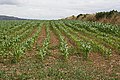 Field of Maize - geograph.org.uk - 198357.jpg 640 × 427 ; 135 kio
-
 Fly Tipping Behind the Hedge - geograph.org.uk - 200901.jpg 640 × 427 ; 137 kio
-
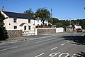
 Fore Street Grampound - geograph.org.uk - 1816580.jpg 640 × 480 ; 97 kio
-
 Garlenick Manor - geograph.org.uk - 560255.jpg 640 × 424 ; 69 kio
-
 Grampound - geograph.org.uk - 198301.jpg 640 × 427 ; 104 kio
-
 Grampound Church and Town Hall - geograph.org.uk - 200159.jpg 640 × 427 ; 85 kio
-
 Grampound Post Office - geograph.org.uk - 240693.jpg 640 × 469 ; 98 kio
-
 Grampound Village - geograph.org.uk - 200150.jpg 640 × 423 ; 101 kio
-
 Hewas Water - geograph.org.uk - 241742.jpg 640 × 426 ; 80 kio
-
 The Main Road between Truro and St Austell - geograph.org.uk - 200256.jpg 640 × 427 ; 109 kio
-
 The River Fal above the bridge at Grampound - geograph.org.uk - 1816583.jpg 480 × 640 ; 134 kio
-
 Trewithen House, Cornwall - geograph.org.uk - 349928.jpg 635 × 442 ; 113 kio
-
 Vercoe and Trevail, Grampound, Cornwall - May 2022.jpg 4 032 × 3 024 ; 3,83 Mio
-
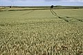 Wheat Prairie - geograph.org.uk - 198330.jpg 1 280 × 853 ; 959 kio
-
 A Bend in the Road - geograph.org.uk - 240702.jpg 640 × 427 ; 93 kio
-
 A house in Trewinnow-Meor - geograph.org.uk - 560323.jpg 640 × 480 ; 101 kio
-
 Barley Field and Woodland - geograph.org.uk - 198305.jpg 640 × 427 ; 116 kio
-
 Barn at Trevillick - geograph.org.uk - 227159.jpg 640 × 427 ; 95 kio
-
 Brassicas - geograph.org.uk - 240706.jpg 640 × 427 ; 111 kio
-
 Bridleway to Grampound - geograph.org.uk - 200245.jpg 640 × 427 ; 116 kio
-
 Bringing in the Bales - geograph.org.uk - 227128.jpg 640 × 427 ; 85 kio
-
 Building works at Trewarmenna - geograph.org.uk - 430891.jpg 640 × 480 ; 99 kio
-
 By the Fal Valley - geograph.org.uk - 226310.jpg 640 × 427 ; 78 kio
-
 Byway to Golden Mill - geograph.org.uk - 430881.jpg 640 × 480 ; 156 kio
-
 Lane by Barteliver - geograph.org.uk - 200233.jpg 427 × 640 ; 124 kio
-
 Lane to Nantellan - geograph.org.uk - 226319.jpg 640 × 427 ; 109 kio
-
 Looking towards Nantellan - geograph.org.uk - 227141.jpg 640 × 427 ; 95 kio
-
 Lush Grassland - geograph.org.uk - 241749.jpg 640 × 425 ; 107 kio
-
 Maize Crop and Woodland - geograph.org.uk - 227170.jpg 640 × 427 ; 107 kio
-
 Narrow Lane with High Hedges - geograph.org.uk - 200225.jpg 640 × 427 ; 138 kio
-
 Old Barn near Trevillick - geograph.org.uk - 227151.jpg 640 × 427 ; 113 kio
-
 Outside Grampound - geograph.org.uk - 226860.jpg 640 × 427 ; 74 kio
-
 Pasture Land - geograph.org.uk - 240697.jpg 640 × 427 ; 87 kio
-
 Tregongeeves Lane - geograph.org.uk - 113362.jpg 640 × 480 ; 106 kio
-
 Trencreek Farm - geograph.org.uk - 105848.jpg 640 × 480 ; 243 kio
-
 Two Grain Fields and a Shallow Valley - geograph.org.uk - 200261.jpg 640 × 427 ; 115 kio
-
 Valley near Trecaine - geograph.org.uk - 240713.jpg 640 × 427 ; 112 kio
-
 Wheatfield behind a modern gate - geograph.org.uk - 198315.jpg 640 × 490 ; 145 kio


