Category:Grant County, New Mexico
Zur Navigation springen
Zur Suche springen
Counties of New Mexico: Bernalillo · Catron · Chaves · Cibola · Colfax · Curry · De Baca · Doña Ana · Eddy · Grant · Guadalupe · Harding · Hidalgo · Lea · Lincoln · Los Alamos · Luna · McKinley · Mora · Otero · Quay · Rio Arriba · Roosevelt · San Juan · San Miguel · Sandoval · Santa Fe · Sierra · Socorro · Taos · Torrance · Union · Valencia
County im US-Bundesstaat New Mexico   | |||||
| Medium hochladen | |||||
| Ist ein(e) | |||||
|---|---|---|---|---|---|
| Benannt nach | |||||
| Ort | New Mexico | ||||
| Hauptstadt | |||||
| Datum der Gründung, Erstellung, Entstehung, Erbauung |
| ||||
| Einwohnerzahl |
| ||||
| Fläche |
| ||||
| offizielle Website | |||||
 | |||||
Unterkategorien
Es werden 17 von insgesamt 17 Unterkategorien in dieser Kategorie angezeigt:
In Klammern die Anzahl der enthaltenen Kategorien (K), Seiten (S), Dateien (D)
Medien in der Kategorie „Grant County, New Mexico“
Folgende 63 Dateien sind in dieser Kategorie, von 63 insgesamt.
-

-
 Chenopodium capitatum var. parvicapitatum - Flickr - aspidoscelis (1).jpg 3.600 × 2.400; 2,46 MB
-
 East of Blue Creek - Flickr - aspidoscelis (2).jpg 3.600 × 2.400; 4,47 MB
-
 East side of the Coyote Hills - Flickr - aspidoscelis.jpg 3.600 × 2.400; 4,42 MB
-
 East-northeast of the Brockman Hills - Flickr - aspidoscelis.jpg 3.600 × 2.400; 3,68 MB
-
 Endangered amphibians and reptiles of seven southwestern New Mexico counties (IA endangeredamphib6029belf).pdf 633 × 831, 124 Seiten; 31,36 MB
-
 Holbrookia maculata - Flickr - aspidoscelis.jpg 3.600 × 2.400; 2,6 MB
-

-
-
-
 Meadow Creek - Flickr - aspidoscelis (1).jpg 3.600 × 2.400; 4,48 MB
-
 Meadow Creek - Flickr - aspidoscelis (2).jpg 3.600 × 2.400; 4,72 MB
-
 Meadow Creek - Flickr - aspidoscelis.jpg 3.600 × 2.400; 4,98 MB
-
 Mogollon Mountains viewed from Aldo Leopold Vista.jpg 1.080 × 614; 548 KB
-
 Muhlenbergia sinuosa - Flickr - aspidoscelis.jpg 3.600 × 2.400; 2,49 MB
-
 Near Antelope Draw - Flickr - aspidoscelis (1).jpg 3.600 × 2.400; 3,54 MB
-
 Near Antelope Draw - Flickr - aspidoscelis.jpg 3.600 × 2.400; 3,7 MB
-
 Near Arrastra Gulch - Flickr - aspidoscelis.jpg 3.600 × 2.400; 4,69 MB
-
 Near Bessie Rhoads Mountain - Flickr - aspidoscelis (1).jpg 3.600 × 2.400; 3,98 MB
-
 Near Bessie Rhoads Mountain - Flickr - aspidoscelis (2).jpg 3.600 × 2.400; 3,78 MB
-
 Near Bessie Rhoads Mountain - Flickr - aspidoscelis.jpg 3.600 × 2.400; 4,2 MB
-
 Near Bill Evans Lake - Flickr - aspidoscelis.jpg 3.600 × 2.400; 4,35 MB
-
 Near Burro Cienaga - Flickr - aspidoscelis (1).jpg 3.600 × 2.400; 4 MB
-
 Near Burro Cienaga - Flickr - aspidoscelis.jpg 3.600 × 2.400; 4,06 MB
-
 Near Burro Cienega - Flickr - aspidoscelis.jpg 3.600 × 2.400; 4,01 MB
-
 Near Cactus Flat - Flickr - aspidoscelis.jpg 3.600 × 2.400; 4,17 MB
-
 Near Caprock Mountain - Flickr - aspidoscelis (1).jpg 3.600 × 2.400; 4,62 MB
-
 Near Caprock Mountain - Flickr - aspidoscelis (2).jpg 3.600 × 2.400; 4,56 MB
-
 Near Caprock Mountain - Flickr - aspidoscelis.jpg 3.600 × 2.400; 4,47 MB
-
 Near China Draw - Flickr - aspidoscelis (1).jpg 3.600 × 2.400; 3,66 MB
-
 Near China Draw - Flickr - aspidoscelis.jpg 3.600 × 2.400; 4,21 MB
-
 Near Corral Canyon - Flickr - aspidoscelis.jpg 3.600 × 2.400; 4,54 MB
-
 Near Flat Canyon - Flickr - aspidoscelis (1).jpg 3.600 × 2.400; 4,17 MB
-
 Near Flat Canyon - Flickr - aspidoscelis (2).jpg 3.600 × 2.400; 4,42 MB
-
 Near Flat Canyon - Flickr - aspidoscelis (3).jpg 3.600 × 2.400; 3,79 MB
-
 Near Flat Canyon - Flickr - aspidoscelis (4).jpg 3.600 × 2.400; 3,71 MB
-
 Near Flat Canyon - Flickr - aspidoscelis (6).jpg 3.600 × 2.400; 3,58 MB
-
 Near Flat Canyon - Flickr - aspidoscelis.jpg 3.600 × 2.400; 3,83 MB
-
 Near Flat Hill - Flickr - aspidoscelis.jpg 3.600 × 2.400; 4,73 MB
-
 Near the Coyote Hills - Flickr - aspidoscelis.jpg 3.600 × 2.400; 3,9 MB
-
 North-northeast of Soldiers Farewell Hill - Flickr - aspidoscelis.jpg 3.600 × 2.400; 4,41 MB
-
 North-northwest of Bill Evans Lake - Flickr - aspidoscelis.jpg 3.600 × 2.400; 4,15 MB
-
 Pleasant Days at Faywood Hot Springs.jpg 2.960 × 4.032; 6,09 MB
-
 Psoralidium tenuiflorum - Flickr - aspidoscelis (2).jpg 3.600 × 2.400; 2,8 MB
-
 Psoralidium tenuiflorum - Flickr - aspidoscelis (3).jpg 3.600 × 2.400; 3,71 MB
-
 Psoralidium tenuiflorum - Flickr - aspidoscelis.jpg 3.600 × 2.400; 2,95 MB
-
 Rabb Park Trail - Flickr - aspidoscelis (4).jpg 3.600 × 2.400; 4,42 MB
-
-
 Satureja vulgare - Flickr - aspidoscelis (1).jpg 1.800 × 1.200; 551 KB
-
 Satureja vulgare - Flickr - aspidoscelis (2).jpg 1.800 × 1.200; 348 KB
-
 Satureja vulgare - Flickr - aspidoscelis (3).jpg 1.800 × 1.200; 329 KB
-
 Satureja vulgare - Flickr - aspidoscelis.jpg 1.800 × 1.200; 774 KB
-
 Schizachyrium scoparium - Flickr - aspidoscelis (2).jpg 1.800 × 1.200; 799 KB
-
 Schizachyrium scoparium - Flickr - aspidoscelis (3).jpg 3.600 × 2.400; 2,21 MB
-
 Schizachyrium scoparium - Flickr - aspidoscelis (4).jpg 3.600 × 2.400; 1,97 MB
-
 Schizachyrium scoparium - Flickr - aspidoscelis (5).jpg 3.600 × 2.400; 1,76 MB
-
 Silver Creek Canyon - Flickr - aspidoscelis (4).jpg 3.600 × 2.400; 3,8 MB
-
 Southwest of Cliff - Flickr - aspidoscelis.jpg 3.600 × 2.400; 3,97 MB
-
 The Gila Mimbres Community Radio building in Silver City, New Mexico on 21 February 2023.jpg 5.933 × 3.955; 9,64 MB
-

-

-
 USA Grant County, New Mexico age pyramid.svg 520 × 600; 7 KB
-
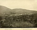
 View from the south (7167507853).jpg 2.592 × 1.936; 1,96 MB

.jpg)
.jpg)


.jpg)
.jpg)


.jpg)


.jpg)
.jpg)


.jpg)


.jpg)
.jpg)

.jpg)


.jpg)
.jpg)
.jpg)
.jpg)
.jpg)


.jpg)
.jpg)

.jpg)
_(14579773239).jpg)
.jpg)
.jpg)
.jpg)

.jpg)
.jpg)
.jpg)
.jpg)
.jpg)


_(14596023137).jpg)
_(14780234892).jpg)

.jpg)