Category:Grappenhall and Thelwall
Aller à la navigation
Aller à la recherche
paroisse civile  | |||||
| Téléverser des médias | |||||
| Nature de l’élément | |||||
|---|---|---|---|---|---|
| Nommé(e) en référence à | |||||
| Lieu | Warrington, Cheshire, Angleterre du Nord-Ouest, Angleterre | ||||
| Date de fondation ou de création |
| ||||
 | |||||
Sous-catégories
Cette catégorie comprend 3 sous-catégories, dont les 3 ci-dessous.
G
T
Média dans la catégorie « Grappenhall and Thelwall »
Cette catégorie comprend 121 fichiers, dont les 121 ci-dessous.
-
 "The Big End's Gone" Latchford Locks - geograph.org.uk - 5048252.jpg 4 146 × 2 764 ; 3,63 Mio
-
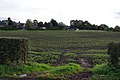 A new crop near Clay Bank Farm - geograph.org.uk - 3702515.jpg 3 872 × 2 592 ; 4,41 Mio
-
 A shadow of its former self - geograph.org.uk - 109021.jpg 640 × 426 ; 132 kio
-
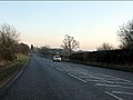
 A56-A50 intersection, Grappenhall - geograph.org.uk - 2779412.jpg 640 × 480 ; 65 kio
-
 B5356 Grappenhall Lane looking west - geograph.org.uk - 6278201.jpg 1 024 × 767 ; 157 kio
-
 Bellhouse Lane, Grappenhall Bridge - geograph.org.uk - 3060747.jpg 640 × 480 ; 639 kio
-
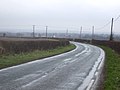
 Bend on Stockport Road, Thelwall - geograph.org.uk - 3354345.jpg 640 × 480 ; 86 kio
-
 Bradshaw Lane - geograph.org.uk - 6364802.jpg 1 024 × 683 ; 270 kio
-
 Bradshaw Lane - geograph.org.uk - 6364803.jpg 1 024 × 683 ; 265 kio
-
 Bradshaw Primary School - geograph.org.uk - 6364801.jpg 1 024 × 683 ; 314 kio
-
 Bridge over B5157 Warrington - geograph.org.uk - 1887707.jpg 4 224 × 3 168 ; 2,17 Mio
-
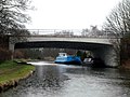
 Bridgewater Canal, Grappenhall Bridge No 17 - geograph.org.uk - 4415956.jpg 3 768 × 2 628 ; 4,58 Mio
-
 Bridgewater Canal, Knutsford Road Bridge No 18 - geograph.org.uk - 4415959.jpg 4 320 × 3 240 ; 5,95 Mio
-
 Bridgewater Canal, Stanny Lunt Bridge No 16 - geograph.org.uk - 4415953.jpg 4 320 × 3 240 ; 6,35 Mio
-
 British Legion - geograph.org.uk - 6364785.jpg 1 024 × 683 ; 246 kio
-
 Broad Lane - geograph.org.uk - 3363915.jpg 640 × 480 ; 52 kio
-
 Canalside trees, east of Thelwall Ferry - geograph.org.uk - 3424860.jpg 1 024 × 614 ; 123 kio
-
 Cartridge Lane - geograph.org.uk - 3363932.jpg 1 200 × 900 ; 273 kio
-
 Cartridge Lane - geograph.org.uk - 4816318.jpg 4 592 × 3 056 ; 5,52 Mio
-
 Chester Road (A56) - geograph.org.uk - 2779408.jpg 640 × 480 ; 52 kio
-
-
 Chester Road at Stanny Lunt Bridge - geograph.org.uk - 2779402.jpg 640 × 480 ; 70 kio
-
 Cliff Lane (A50) - geograph.org.uk - 3363935.jpg 640 × 480 ; 61 kio
-
 Cliff Lane Bridge - geograph.org.uk - 2524879.jpg 640 × 405 ; 59 kio
-
 Clifflane Farm - geograph.org.uk - 4816302.jpg 4 548 × 2 534 ; 7,24 Mio
-
 Cruden's Offices - geograph.org.uk - 2786809.jpg 1 200 × 900 ; 858 kio
-
 Customs Notice, Latchford Locks - geograph.org.uk - 5048259.jpg 640 × 546 ; 108 kio
-
 Deans Wharf, Thelwall - geograph.org.uk - 3315244.jpg 4 000 × 2 248 ; 1,51 Mio
-
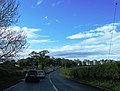
 Entering Grappenhall on the A50 - geograph.org.uk - 3354314.jpg 640 × 480 ; 62 kio
-
 Entering Thelwall on Stockport Road - geograph.org.uk - 3354330.jpg 640 × 480 ; 124 kio
-
 Farmland near Reddish Hall - geograph.org.uk - 3363914.jpg 640 × 480 ; 53 kio
-
 Farmland off Cartridge Lane - geograph.org.uk - 3363930.jpg 1 024 × 643 ; 73 kio
-
 Farmland off Grappenhall Lane - geograph.org.uk - 3363912.jpg 640 × 480 ; 56 kio
-
 Field entrance off Stockport Road, Thelwall - geograph.org.uk - 3354347.jpg 1 024 × 768 ; 144 kio
-
 Footpath off Weaste Lane - geograph.org.uk - 4308774.jpg 2 500 × 1 700 ; 4,97 Mio
-
 Footpath over Pickering's Bridge - geograph.org.uk - 3354336.jpg 640 × 480 ; 141 kio
-
 Footpath to Weaste Lane Farm - geograph.org.uk - 2786814.jpg 1 200 × 900 ; 964 kio
-
 Gates closing, Latchford Locks - geograph.org.uk - 3425008.jpg 1 024 × 768 ; 113 kio
-
 Grappenhall Ridge - geograph.org.uk - 2786788.jpg 1 200 × 900 ; 719 kio
-
 Halfacre Lane Aqueduct - geograph.org.uk - 4298162.jpg 2 560 × 1 920 ; 3,32 Mio
-
 Heron by the Bridgewater Canal - geograph.org.uk - 3702556.jpg 3 872 × 2 592 ; 4,6 Mio
-
 Inlet to Bridgewater Canal - geograph.org.uk - 5833341.jpg 2 784 × 1 568 ; 2,17 Mio
-
 Knutsford Road (A50) - geograph.org.uk - 3521684.jpg 640 × 481 ; 490 kio
-
 Knutsford Road (A50) leaving Grappenhall - geograph.org.uk - 2779420.jpg 640 × 480 ; 54 kio
-
 Knutsford Road (A50), Grappenhall - geograph.org.uk - 3354325.jpg 640 × 480 ; 53 kio
-
 Knutsford Road A50 - geograph.org.uk - 3985801.jpg 640 × 404 ; 57 kio
-
 Knutsford Road Bridge over Bridgewater Canal - geograph.org.uk - 2003679.jpg 640 × 480 ; 103 kio
-
 Knutsford Road looking east - geograph.org.uk - 3396901.jpg 640 × 480 ; 53 kio
-
 Knutsford Road, A50 - geograph.org.uk - 3985798.jpg 640 × 486 ; 71 kio
-
 Knutsford Road-Chester Road junction - geograph.org.uk - 3396907.jpg 640 × 480 ; 49 kio
-
 Lane off Thelwall New Road, Thelwall - geograph.org.uk - 4674351.jpg 1 024 × 768 ; 284 kio
-
 Latchford Locks - geograph.org.uk - 2614131.jpg 1 024 × 766 ; 121 kio
-
 Latchford Locks and Viaduct - geograph.org.uk - 4952834.jpg 640 × 481 ; 379 kio
-
 Latchford Locks from the South Bank... - geograph.org.uk - 3461582.jpg 4 752 × 3 168 ; 5,49 Mio
-

-

-
 Latchford Railway Viaduct (Disused) - geograph.org.uk - 4952858.jpg 640 × 481 ; 377 kio
-
 Latchford Viaduct - geograph.org.uk - 6364816.jpg 1 024 × 683 ; 292 kio
-
 Latchford Viaduct - geograph.org.uk - 6364818.jpg 1 024 × 683 ; 325 kio
-

-
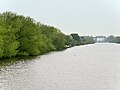
 Manchester Ship Canal - geograph.org.uk - 6365274.jpg 1 024 × 683 ; 217 kio
-
 Manchester Ship Canal at Thelwall - geograph.org.uk - 4952810.jpg 640 × 481 ; 372 kio
-
 Manchester Ship Canal near Thelwall - geograph.org.uk - 4952743.jpg 640 × 480 ; 336 kio
-
 Manchester Ship Canal near Thelwall Ferry - geograph.org.uk - 4786337.jpg 1 600 × 1 064 ; 322 kio
-

-
 Manchester Ship Canal, Latchford Locks - geograph.org.uk - 4952831.jpg 640 × 481 ; 389 kio
-
 Manchester Ship Canal, Thelwall - geograph.org.uk - 4952806.jpg 640 × 481 ; 393 kio
-
 Manchester Ship Canal, Thelwall Ferry - geograph.org.uk - 4952786.jpg 640 × 481 ; 432 kio
-
 Martham Close - geograph.org.uk - 3354311.jpg 640 × 480 ; 51 kio
-
 Metal milepost - geograph.org.uk - 4307865.jpg 2 500 × 1 647 ; 5,14 Mio
-
 MSC Vixen Moored at Latchford - geograph.org.uk - 4952843.jpg 640 × 481 ; 553 kio
-
 Mysterious Tower^ - geograph.org.uk - 2786779.jpg 1 200 × 900 ; 716 kio
-
 New homes on Thelwall Lane (2) - geograph.org.uk - 3425003.jpg 1 024 × 768 ; 136 kio
-
 Path from Thelwall Old Post Office to the Manchester Ship Canal - geograph.org.uk - 6113199.jpg 1 600 × 1 200 ; 862 kio
-
 Penny Ferry at Thelwall - geograph.org.uk - 6113224.jpg 1 200 × 1 600 ; 322 kio
-
 Pickering Crescent, Thelwall - geograph.org.uk - 4298155.jpg 2 784 × 1 568 ; 2,17 Mio
-
 Pickering's Bridge, Bridgewater Canal - geograph.org.uk - 2057523.jpg 1 280 × 856 ; 269 kio
-
 Pipeline into Thelwall Eye - geograph.org.uk - 3424841.jpg 1 024 × 768 ; 160 kio
-
 Pumping Station, Thelwall Eye - geograph.org.uk - 2535336.jpg 640 × 468 ; 33 kio
-
 Reflected in the Canal - geograph.org.uk - 4298175.jpg 2 784 × 1 568 ; 2,19 Mio
-
 Roundabout on the B5356 - geograph.org.uk - 2786790.jpg 1 200 × 900 ; 767 kio
-
 Shirley Drive, Grappenhall - geograph.org.uk - 3354317.jpg 640 × 456 ; 57 kio
-
 Sodden bus stop, Thelwall New Road, Thelwall - geograph.org.uk - 4674342.jpg 1 024 × 768 ; 276 kio
-
 South end of Ferry Lane, Thelwall - geograph.org.uk - 4674347.jpg 1 024 × 768 ; 209 kio
-
 Stanny Lunt Bridge - geograph.org.uk - 2524872.jpg 640 × 377 ; 64 kio
-
 Stanton Road, Thelwall - geograph.org.uk - 3354334.jpg 640 × 480 ; 51 kio
-
 Stanton Road, Thelwall - geograph.org.uk - 3396920.jpg 640 × 480 ; 48 kio
-

-
-
 Stubble, Thelwall - geograph.org.uk - 6364777.jpg 1 024 × 683 ; 339 kio
-
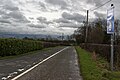
 The A50 in open countryside - geograph.org.uk - 2779445.jpg 640 × 480 ; 61 kio
-
 The Manchester Ship Canal from the Thelwall Viaduct - geograph.org.uk - 5724468.jpg 6 000 × 4 000 ; 5,69 Mio
-
 The Old Post Office, Bell Lane, Thelwall - geograph.org.uk - 6113161.jpg 1 600 × 1 200 ; 767 kio
-
 The pond at Cheshire Dogs Home - geograph.org.uk - 4816289.jpg 4 592 × 3 056 ; 7,83 Mio
-
 The track to Yew Tree Farm - geograph.org.uk - 4816537.jpg 4 572 × 2 292 ; 5,51 Mio
-
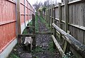
 The Trans Pennine Trail leaves the railway - geograph.org.uk - 6364799.jpg 1 024 × 683 ; 362 kio
-

-
 The Transpennine Trail - geograph.org.uk - 4164425.jpg 4 317 × 2 873 ; 7,24 Mio
-
 Thelwall - B5157 Looking East - geograph.org.uk - 1337557.jpg 640 × 480 ; 215 kio
-
 Thelwall - Public Open Space - geograph.org.uk - 1337553.jpg 640 × 480 ; 220 kio
-
 Thelwall - Weaste Lane At Halfacre Lane Junction - geograph.org.uk - 1337548.jpg 640 × 480 ; 184 kio
-
 Thelwall Ferry - geograph.org.uk - 4307832.jpg 2 500 × 1 666 ; 4,55 Mio
-
 Thelwall Ferry - geograph.org.uk - 4307837.jpg 1 594 × 2 500 ; 3,56 Mio
-
 Thelwall Ferry - geograph.org.uk - 4751624.jpg 1 024 × 690 ; 191 kio
-
 Thelwall New Road - geograph.org.uk - 6113179.jpg 1 600 × 1 200 ; 703 kio
-
 Thelwall New Road, Thelwall (1) - geograph.org.uk - 4674337.jpg 1 024 × 768 ; 105 kio
-
 Thelwall New Road, Thelwall (2) - geograph.org.uk - 4674353.jpg 1 024 × 768 ; 222 kio
-
 Thelwall Old Hall, Ferry Lane - geograph.org.uk - 6113227.jpg 1 600 × 1 200 ; 582 kio
-
 Thelwall to Bridgewater Canal road - geograph.org.uk - 6364771.jpg 1 024 × 683 ; 399 kio
-
 Thelwall to Bridgewater Canal road - geograph.org.uk - 6364779.jpg 1 024 × 683 ; 369 kio
-
 Trans Pennine Trail - Thelwall - geograph.org.uk - 1887690.jpg 3 168 × 4 224 ; 2,13 Mio
-
 Trans Pennine Trail, Grappenhall - geograph.org.uk - 6364796.jpg 1 024 × 683 ; 358 kio
-
 Trans Pennine Trail, Grappenhall - geograph.org.uk - 6366325.jpg 1 024 × 683 ; 373 kio
-
 Trans Pennine Trail, Thelwall - geograph.org.uk - 6364762.jpg 1 024 × 683 ; 382 kio
-
 Trans-Pennine Trail at Lymm, Cheshire - geograph.org.uk - 4428263.jpg 5 472 × 3 648 ; 2,54 Mio
-
 Tree with memorials, Latchford Locks - geograph.org.uk - 3424992.jpg 1 024 × 768 ; 138 kio
-
 Weaste Lane near Highfields - geograph.org.uk - 4811179.jpg 640 × 480 ; 57 kio
-
 Weight Restriction, Grappenhall Bridge - geograph.org.uk - 3060749.jpg 480 × 640 ; 725 kio
-
 White Clover - Trifolium repens - geograph.org.uk - 1166921.jpg 640 × 480 ; 103 kio
-
 WWII Cheshire, RNAS Stretton, VHF Homing beacon - geograph.org.uk - 6205580.jpg 1 024 × 683 ; 1,02 Mio
-
 Yew Tree Farm - geograph.org.uk - 2786783.jpg 1 200 × 900 ; 693 kio


_-_geograph.org.uk_-_2779408.jpg)
_curving_alongside_the_Bridgewater_Canal_-_geograph.org.uk_-_2779399.jpg)

_-_geograph.org.uk_-_3363935.jpg)


_-_geograph.org.uk_-_3521684.jpg)
_leaving_Grappenhall_-_geograph.org.uk_-_2779420.jpg)
,_Grappenhall_-_geograph.org.uk_-_3354325.jpg)


_-_geograph.org.uk_-_4952858.jpg)


_-_geograph.org.uk_-_3425003.jpg)


,_looking_east_at_Stanton_Road_-_geograph.org.uk_-_2779415.jpg)
,_looking_west_at_Stanton_Road_-_geograph.org.uk_-_2779418.jpg)


_-_geograph.org.uk_-_4674337.jpg)
_-_geograph.org.uk_-_4674353.jpg)


