Category:Great Carlton
Aller à la navigation
Aller à la recherche
localité britannique du comté anglais de Lincolnshire  | |||||
| Téléverser des médias | |||||
| Nature de l’élément | |||||
|---|---|---|---|---|---|
| Lieu | East Lindsey, Lincolnshire, Midlands de l'Est, Angleterre | ||||
| Réputé identique à | Great Carlton (page en doublon, paroisse civile) | ||||
 | |||||
Sous-catégories
Cette catégorie comprend 3 sous-catégories, dont les 3 ci-dessous.
Média dans la catégorie « Great Carlton »
Cette catégorie comprend 201 fichiers, dont les 200 ci-dessous.
(page précédente) (page suivante)-

-

-

-

-
 Alpaca at Great Carlton - geograph.org.uk - 1015593.jpg 639 × 479 ; 106 kio
-
 Alpaca Country, Chapel Lane, Great Carlton - geograph.org.uk - 3530493.jpg 640 × 427 ; 50 kio
-
 Approach to Great Carlton - geograph.org.uk - 2515459.jpg 1 280 × 960 ; 393 kio
-
 Avenue of young trees - geograph.org.uk - 3168706.jpg 640 × 427 ; 111 kio
-
 Bank alongside Long Eau - geograph.org.uk - 2507443.jpg 640 × 480 ; 68 kio
-

-

-
 Bridge over the Long Eau by Manor Farm - geograph.org.uk - 3168764.jpg 640 × 427 ; 87 kio
-
 Bridge over Two Mile Bank Drain - geograph.org.uk - 3835944.jpg 640 × 427 ; 80 kio
-
 Bumpy road to Three Bridges - geograph.org.uk - 3835955.jpg 640 × 427 ; 35 kio
-
 Bunch of trees next to The Cut (Drain) - geograph.org.uk - 3835947.jpg 640 × 427 ; 47 kio
-
 Bus stop and shelter on Main Road, Great Carlton - geograph.org.uk - 4667949.jpg 640 × 480 ; 107 kio
-
 Carlton Grange, aerial 2014 - geograph.org.uk - 3965810.jpg 640 × 427 ; 47 kio
-

-
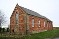 Carlton Methodist Church - geograph.org.uk - 108032.jpg 640 × 427 ; 106 kio
-
 Carlton Methodist Church - geograph.org.uk - 2517247.jpg 1 600 × 1 200 ; 527 kio
-
-
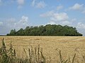 Castle Plat Plantation - geograph.org.uk - 4656426.jpg 640 × 480 ; 73 kio
-

-
 Chapel Lane and the Carltons, aerial 2015 - geograph.org.uk - 4358098.jpg 640 × 427 ; 68 kio
-
 Construction work at Gayton Windfarm - geograph.org.uk - 4611360.jpg 640 × 427 ; 41 kio
-
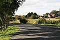
 Corner of Glebe road - geograph.org.uk - 1960720.jpg 640 × 480 ; 91 kio
-

-
 Crop field beside Engine Drain - geograph.org.uk - 4407106.jpg 640 × 480 ; 81 kio
-
-
 Dowsey Fen - geograph.org.uk - 4176855.jpg 1 024 × 698 ; 226 kio
-
 Dowsey Fen and the bank of the Long Eau - geograph.org.uk - 3834351.jpg 640 × 427 ; 42 kio
-
 Drain beside Sturdy Hill - geograph.org.uk - 4667959.jpg 640 × 480 ; 91 kio
-

-
 Drain off Sturdy Hill - geograph.org.uk - 4667969.jpg 640 × 480 ; 95 kio
-

-
 Eastfield Farm corner - geograph.org.uk - 3278911.jpg 640 × 427 ; 101 kio
-
 Eastfield Farm, Great Carlton - geograph.org.uk - 3278930.jpg 640 × 427 ; 150 kio
-
 Engine Drain - geograph.org.uk - 4407108.jpg 640 × 480 ; 69 kio
-
 Entering Great Carlton - geograph.org.uk - 3056051.jpg 1 024 × 768 ; 194 kio
-
 Entering Great Carlton - geograph.org.uk - 4667995.jpg 640 × 480 ; 104 kio
-

-
-
 Farm track at Walk Farm - geograph.org.uk - 3689698.jpg 2 256 × 1 453 ; 804 kio
-
 Farm track off Sturdy Hill - geograph.org.uk - 4667970.jpg 640 × 480 ; 72 kio
-
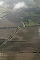
 Farmland near Two Mile Drain - geograph.org.uk - 1010227.jpg 640 × 457 ; 147 kio
-
 Farmland off Thacker Bank - geograph.org.uk - 4407114.jpg 640 × 480 ; 70 kio
-
 Farmland south west of Great Carlton - geograph.org.uk - 4668003.jpg 640 × 480 ; 57 kio
-

-
-

-

-
-
-
 Fenland east of Manby - geograph.org.uk - 2981587.jpg 640 × 427 ; 40 kio
-
 Field and Wyggeston Farm - geograph.org.uk - 3056061.jpg 1 024 × 768 ; 217 kio
-
 Field towards Walk Farm - geograph.org.uk - 4656419.jpg 640 × 480 ; 62 kio
-
 Flat farmland near the Long Eau - geograph.org.uk - 4667984.jpg 640 × 480 ; 79 kio
-
 Flat farmland off Sturdy Hill - geograph.org.uk - 4656424.jpg 640 × 480 ; 47 kio
-
 Flat farmland, Great Carlton - geograph.org.uk - 4667955.jpg 640 × 480 ; 70 kio
-
 Flood bank of the Long Eau - geograph.org.uk - 4667981.jpg 640 × 480 ; 75 kio
-

-

-
-
 Footbridge over Long Eau - geograph.org.uk - 4407112.jpg 640 × 480 ; 50 kio
-
 Footbridge to Manor Farm - geograph.org.uk - 4176936.jpg 1 024 × 683 ; 337 kio
-
 Footpath at Great Carlton - geograph.org.uk - 3056054.jpg 1 024 × 768 ; 160 kio
-
 Footpath from Sturdy Hill to Great Carlton - geograph.org.uk - 3834175.jpg 640 × 427 ; 58 kio
-

-
 Former Manby airfield, aerial 2017 - geograph.org.uk - 5594465.jpg 800 × 533 ; 72 kio
-
 Gayton Engine at Theddlethorpe All Saints - geograph.org.uk - 1502478.jpg 640 × 480 ; 78 kio
-
-
 Gayton le Marsh, aerial 2015 (1) - geograph.org.uk - 4358264.jpg 452 × 640 ; 59 kio
-

-

-

-

-

-
 Gayton Windfarm, more traffic disruption - geograph.org.uk - 4614818.jpg 640 × 427 ; 64 kio
-
 Gayton Windfarm, piling (aerial 2015) - geograph.org.uk - 4346494.jpg 640 × 427 ; 53 kio
-
-
 Great Carlton - geograph.org.uk - 3448491.jpg 640 × 427 ; 70 kio
-
 Great Carlton beacon - geograph.org.uk - 4179700.jpg 1 024 × 694 ; 210 kio
-
 Great carlton beacon - geograph.org.uk - 4861706.jpg 640 × 427 ; 46 kio
-
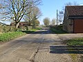
 Great Carlton crossroads - geograph.org.uk - 1960730.jpg 640 × 480 ; 61 kio
-
 Great Carlton crossroads - geograph.org.uk - 3278600.jpg 640 × 427 ; 65 kio
-
 Great Carlton to Castle Carlton, aerial 2015 - geograph.org.uk - 4303416.jpg 640 × 372 ; 41 kio
-
 Great Carlton to the sea, aerial 2015 - geograph.org.uk - 4303549.jpg 640 × 369 ; 39 kio
-
 Great Carlton Village Hall - geograph.org.uk - 464632.jpg 640 × 480 ; 86 kio
-
 Great Carlton Village Hall - geograph.org.uk - 4656405.jpg 640 × 480 ; 91 kio
-
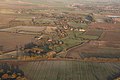
 Great Carlton, aerial 2010 - geograph.org.uk - 4314267.jpg 800 × 533 ; 119 kio
-
 Great Carlton, aerial 2015 - geograph.org.uk - 4303013.jpg 800 × 533 ; 70 kio
-
 Great Carlton, long barn - geograph.org.uk - 3278605.jpg 640 × 427 ; 79 kio
-

-
 Great Eau SW of Theddlethorpe, aerial 2015 - geograph.org.uk - 4684043.jpg 427 × 640 ; 50 kio
-
 Hall Farm House - geograph.org.uk - 4176744.jpg 1 024 × 683 ; 272 kio
-
 Heading north east from Great Carlton - geograph.org.uk - 4667953.jpg 640 × 480 ; 51 kio
-
 Heading north east on Sturdy Hill - geograph.org.uk - 4667963.jpg 640 × 480 ; 65 kio
-
 Hedge-lined lane near to Rose Cottage - geograph.org.uk - 6080939.jpg 3 910 × 2 933 ; 2,01 Mio
-
 Hedge-lined New lane heading towards Great Carlton - geograph.org.uk - 6080945.jpg 3 394 × 2 545 ; 2,06 Mio
-
 Homefield Alpacas, Great Carlton - geograph.org.uk - 3278936.jpg 640 × 427 ; 98 kio
-
 Homefield Alpacas, Great Carlton - geograph.org.uk - 3278957.jpg 2 496 × 1 664 ; 1,32 Mio
-
 Honeysuckle Cottage, Great Carlton - geograph.org.uk - 2517253.jpg 1 600 × 1 200 ; 726 kio
-

-
-
 Kenwood farmland - geograph.org.uk - 4071241.jpg 1 024 × 768 ; 171 kio
-
 Land Drain - geograph.org.uk - 4176865.jpg 683 × 1 024 ; 340 kio
-
 Land Drain off Sturdy Hill - geograph.org.uk - 2517242.jpg 3 648 × 2 736 ; 6,5 Mio
-
 Little Carlton to Great Carlton, aerial 2018 - geograph.org.uk - 5682472.jpg 800 × 533 ; 83 kio
-
 Little Carlton, aerial 2016 - geograph.org.uk - 4862386.jpg 640 × 427 ; 53 kio
-
 Long Eau - geograph.org.uk - 4176923.jpg 1 024 × 683 ; 252 kio
-
 Long Eau - geograph.org.uk - 4176928.jpg 1 024 × 683 ; 324 kio
-
 Long Eau - geograph.org.uk - 4176942.jpg 1 024 × 683 ; 290 kio
-
 Long Eau - geograph.org.uk - 4656421.jpg 640 × 480 ; 91 kio
-
 Long Eau east of Great Carlton, aerial 2016 - geograph.org.uk - 4824704.jpg 427 × 640 ; 50 kio
-
 Long Eau floodbank - geograph.org.uk - 4314536.jpg 1 024 × 768 ; 152 kio
-

-
 Long Eau looking east - geograph.org.uk - 2507451.jpg 640 × 480 ; 52 kio
-
 Long Eau near Manor Farm - geograph.org.uk - 3728914.jpg 1 024 × 681 ; 335 kio
-
 Long Eau on Dowsey Fen - geograph.org.uk - 3835954.jpg 640 × 427 ; 70 kio
-

-

-
 Looking south along Sturdy Hill (road) - geograph.org.uk - 2899036.jpg 800 × 600 ; 177 kio
-
 Looking south down Old Eau - geograph.org.uk - 2899026.jpg 800 × 600 ; 131 kio
-
 Lordship Road in Great Carlton - geograph.org.uk - 6080952.jpg 4 000 × 3 000 ; 4,43 Mio
-

-

-

-
-
 Main Road, Great Carlton - geograph.org.uk - 4667951.jpg 640 × 480 ; 66 kio
-
 Manby, aerial 2017 - geograph.org.uk - 5594481.jpg 800 × 533 ; 96 kio
-
-
 Minor road towards the A157 - geograph.org.uk - 4668000.jpg 640 × 480 ; 40 kio
-
 Minor road towards the A157 - geograph.org.uk - 4669440.jpg 640 × 480 ; 84 kio
-
 Minor road towards the A157 - geograph.org.uk - 4669444.jpg 640 × 480 ; 73 kio
-
 Modern pipe bridge over Two Mile Bank Drain - geograph.org.uk - 3835950.jpg 640 × 427 ; 40 kio
-
 New Gayton Engine Drain - geograph.org.uk - 3835946.jpg 640 × 427 ; 59 kio
-
-
 Old Church Institute, Great Carlton - geograph.org.uk - 3576210.jpg 640 × 427 ; 83 kio
-
 Old Eau at Great Carlton, aerial 2015 - geograph.org.uk - 4303522.jpg 640 × 427 ; 43 kio
-
 Old Forge, Great Carlton - geograph.org.uk - 3278616.jpg 640 × 427 ; 95 kio
-
 Ordnance Survey Cut Mark - geograph.org.uk - 6088415.jpg 3 735 × 2 802 ; 2,58 Mio
-
 Overgrown Drain off Thacker Bank - geograph.org.uk - 3689719.jpg 2 148 × 1 344 ; 2,98 Mio
-

-
 Pumping station near Gayton Engine - geograph.org.uk - 3168152.jpg 640 × 427 ; 48 kio
-

-
 Right of way through the wood - geograph.org.uk - 5745548.jpg 900 × 1 600 ; 625 kio
-
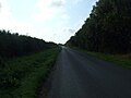
 Road to Theddlethorpe - geograph.org.uk - 2507447.jpg 640 × 480 ; 72 kio
-
 Rose cottage on Sturdy Hill (road) - geograph.org.uk - 2899039.jpg 800 × 600 ; 96 kio
-
 Say No to Gayton Wind Farm - geograph.org.uk - 3168170.jpg 640 × 427 ; 73 kio
-
 Sheep on the bank of the Long Eau - geograph.org.uk - 4407109.jpg 640 × 438 ; 51 kio
-
 Small bridge and tree, near Thacker Bank - geograph.org.uk - 3688367.jpg 2 256 × 1 504 ; 2,11 Mio
-
 Straight road from Great Carlton - geograph.org.uk - 1960748.jpg 640 × 487 ; 63 kio
-
 Stubble field and hedgerow - geograph.org.uk - 4667967.jpg 640 × 480 ; 66 kio
-
 Stubble field off Sturdy Hill - geograph.org.uk - 4656409.jpg 640 × 480 ; 71 kio
-
 Stubble field with bales - geograph.org.uk - 4656413.jpg 640 × 480 ; 67 kio
-
 Sturdy Hill - geograph.org.uk - 4176782.jpg 1 024 × 683 ; 286 kio
-
 Sturdy Hill - geograph.org.uk - 4667961.jpg 640 × 480 ; 67 kio
-
 Sturdy Hill footpath - geograph.org.uk - 1055052.jpg 640 × 427 ; 70 kio
-
 Sturdy Hill footpath - geograph.org.uk - 4176795.jpg 1 024 × 683 ; 226 kio
-
 Swan Roost on the wind turbine site - geograph.org.uk - 3835956.jpg 640 × 427 ; 44 kio
-
 T junction at Three Bridges - geograph.org.uk - 2507427.jpg 640 × 480 ; 105 kio
-
 Temporary Dam - geograph.org.uk - 2468027.jpg 1 024 × 768 ; 164 kio
-
 Thacker Bank - geograph.org.uk - 4176890.jpg 1 024 × 683 ; 153 kio
-
 Thacker Bank - geograph.org.uk - 4407110.jpg 640 × 480 ; 80 kio
-
 Thacker Bank - geograph.org.uk - 4407115.jpg 640 × 480 ; 69 kio
-
 Thacker Bank - geograph.org.uk - 4667978.jpg 640 × 480 ; 48 kio
-
 Thacker Bank - geograph.org.uk - 4667987.jpg 640 × 480 ; 63 kio
-
 Thacker Bank alongside Long Eau - geograph.org.uk - 2507440.jpg 640 × 443 ; 59 kio
-
 Thacker Bank and Lordship Farm - geograph.org.uk - 3056246.jpg 1 024 × 768 ; 123 kio
-

-
 The footbridge over Long Eau - geograph.org.uk - 3728913.jpg 1 024 × 681 ; 412 kio
-
 The Great Eau after the rains - geograph.org.uk - 481868.jpg 640 × 427 ; 81 kio
-

-
 The road to Three Bridges - geograph.org.uk - 3835958.jpg 640 × 427 ; 64 kio
-
 The village sign at the top of Glebe Road Great Carlton - geograph.org.uk - 6251478.jpg 4 608 × 3 072 ; 3,73 Mio
-
 Theddlethorpe All Saints, aerial 2015 - geograph.org.uk - 4303016.jpg 1 024 × 668 ; 105 kio
-
 Three Bridge Lane - geograph.org.uk - 4176932.jpg 1 024 × 683 ; 201 kio
-

-

-
 Track to Draytons - geograph.org.uk - 3056068.jpg 1 024 × 768 ; 144 kio
-
 Two Mile Bank Drain - geograph.org.uk - 1010206.jpg 457 × 640 ; 143 kio
-
 Two Mile Bank Drain - geograph.org.uk - 1010276.jpg 640 × 457 ; 149 kio
-
 Two Mile Bank Drain - geograph.org.uk - 481908.jpg 640 × 427 ; 118 kio
-
 View along the old Salt Road (Two Mile Bank) - geograph.org.uk - 3530620.jpg 640 × 427 ; 69 kio
-
 View from the Hallington Road above Withcall - geograph.org.uk - 3433002.jpg 640 × 328 ; 23 kio
-

-
 View towards Gayton Engine - geograph.org.uk - 2468045.jpg 1 024 × 768 ; 149 kio
-
 View towards Rose Cottage - geograph.org.uk - 3056057.jpg 1 024 × 707 ; 180 kio
-
 Walk Farm - geograph.org.uk - 4667972.jpg 640 × 480 ; 46 kio
-

-
 War memorial at Great Carlton - geograph.org.uk - 6251475.jpg 4 608 × 3 072 ; 6,15 Mio
-

-

-

-
 Wesleyan Chapel, Great Carlton - geograph.org.uk - 3278615.jpg 640 × 427 ; 75 kio
-
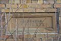 Wesleyan Chapel, Great Carlton, date stone - geograph.org.uk - 3278617.jpg 640 × 427 ; 85 kio
-
 Wild oats by the path to Great Carlton - geograph.org.uk - 3539349.jpg 640 × 427 ; 75 kio
-
-
-
 Woodland beside Thacker Bank - geograph.org.uk - 4667993.jpg 640 × 480 ; 79 kio


_-_geograph.org.uk_-_4303424.jpg)


_aerial_2017_-_geograph.org.uk_-_5266045.jpg)


_-_geograph.org.uk_-_3835947.jpg)


,_remains_of_tofts_and_crofts_(aerial_2018)_-_geograph.org.uk_-_5704161.jpg)


_-_geograph.org.uk_-_4913949.jpg)


_-_geograph.org.uk_-_3834335.jpg)

_-_geograph.org.uk_-_4676551.jpg)
_-_geograph.org.uk_-_4777593.jpg)
_-_geograph.org.uk_-_4777595.jpg)
_-_geograph.org.uk_-_5683933.jpg)


_-_geograph.org.uk_-_5706498.jpg)


_-_geograph.org.uk_-_4440526.jpg)
_-_geograph.org.uk_-_4358264.jpg)


_-_geograph.org.uk_-_4346494.jpg)


_-_geograph.org.uk_-_3834319.jpg)
_-_geograph.org.uk_-_2899036.jpg)


_-_geograph.org.uk_-_5703909.jpg)
_-_geograph.org.uk_-_5703918.jpg)
,_the_arrival_-_geograph.org.uk_-_5703926.jpg)
,_the_arrival_-_geograph.org.uk_-_5703941.jpg)


_-_geograph.org.uk_-_2899039.jpg)


_-_geograph.org.uk_-_3530620.jpg)


_-_geograph.org.uk_-_4440514.jpg)
