Category:Great Coxwell
Aller à la navigation
Aller à la recherche
Article Wikipédia principal : Great Coxwell.
localité britannique du comté anglais d'Oxfordshire  | |||||
| Téléverser des médias | |||||
| Nature de l’élément | |||||
|---|---|---|---|---|---|
| Lieu | Vale of White Horse, Oxfordshire, Angleterre du Sud-Est, Angleterre | ||||
| site officiel | |||||
 | |||||

Sous-catégories
Cette catégorie comprend 8 sous-catégories, dont les 8 ci-dessous.
B
C
- Court House, Great Coxwell (4 F)
D
- Danes Cottage, Great Coxwell (2 F)
- Danes House, Great Coxwell (4 F)
G
K
- Great Coxwell K6 kiosk (3 F)
Média dans la catégorie « Great Coxwell »
Cette catégorie comprend 138 fichiers, dont les 138 ci-dessous.
-
 A field by the Great Barn - geograph.org.uk - 2022834.jpg 1 500 × 1 000 ; 212 kio
-
 A path through the beech trees on Badbury Hill - geograph.org.uk - 5761595.jpg 2 700 × 2 025 ; 976 kio
-
 A path through the beech trees on Badbury Hill - geograph.org.uk - 5761597.jpg 2 700 × 2 025 ; 899 kio
-
 A path through the beech trees on Badbury Hill - geograph.org.uk - 5761604.jpg 2 700 × 2 025 ; 912 kio
-
 A rolling obstruction - geograph.org.uk - 4235480.jpg 640 × 480 ; 169 kio
-
 A stile to the footpath - geograph.org.uk - 2022853.jpg 1 000 × 1 500 ; 198 kio
-
 A track down into Badbury Wood - geograph.org.uk - 5761599.jpg 2 700 × 2 025 ; 1,14 Mio
-
 A420 south-west of Faringdon - geograph.org.uk - 893919.jpg 640 × 480 ; 94 kio
-
 A420 south-west of Faringdon - geograph.org.uk - 893921.jpg 640 × 480 ; 130 kio
-
 Across the road - geograph.org.uk - 4235174.jpg 640 × 480 ; 169 kio
-
 Badbury Camp (1) - geograph.org.uk - 4235163.jpg 640 × 480 ; 162 kio
-
 Badbury Camp (2) - geograph.org.uk - 4235167.jpg 640 × 480 ; 158 kio
-
 Badbury Clump - geograph.org.uk - 5761600.jpg 2 700 × 2 025 ; 735 kio
-
 Badbury Hill - geograph.org.uk - 6246539.jpg 4 000 × 3 000 ; 4,72 Mio
-
 Badbury Hill Cottage, Faringdon - geograph.org.uk - 3938013.jpg 640 × 480 ; 170 kio
-
 Badbury Hill House - geograph.org.uk - 4757306.jpg 640 × 480 ; 76 kio
-

-
 Bend in the A420 - geograph.org.uk - 4199292.jpg 1 500 × 999 ; 121 kio
-
 Blackberries by the B4019 - geograph.org.uk - 2022863.jpg 1 500 × 1 000 ; 124 kio
-

-
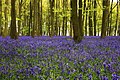
 Bluebells, Badbury Clump - geograph.org.uk - 2380318.jpg 640 × 427 ; 235 kio
-
 Bluebells, Badbury Clump - geograph.org.uk - 3985059.jpg 1 024 × 682 ; 1,01 Mio
-
 Box Tree Cottage, Great Coxwell - geograph.org.uk - 307446.jpg 640 × 480 ; 100 kio
-
 Bridleway, near Faringdon golf course - geograph.org.uk - 893911.jpg 640 × 480 ; 170 kio
-
 Bury Hill Cottage, Great Coxwell - geograph.org.uk - 4192098.jpg 640 × 480 ; 104 kio
-
 Bury Hill Cottage, rat-trap bond at Great Coxwell - geograph.org.uk - 6415065.jpg 1 600 × 1 243 ; 490 kio
-
 By-passed stiles - geograph.org.uk - 4235438.jpg 640 × 480 ; 160 kio
-
 GreatCoxwell ChapelHouse SW.jpg 1 280 × 1 280 ; 842 kio
-
 Chapel House, Great Coxwell.jpg 4 052 × 3 070 ; 1,61 Mio
-
 Entrance to Gipsy Lane - geograph.org.uk - 6203940.jpg 3 880 × 3 000 ; 4,16 Mio
-
 Faringdon Folly, Faringdon - geograph.org.uk - 3941584.jpg 640 × 480 ; 81 kio
-
 Faringdon golf course, south of Faringdon - geograph.org.uk - 893879.jpg 640 × 480 ; 166 kio
-
 Farm building by the Great Barn - geograph.org.uk - 2022805.jpg 1 500 × 1 000 ; 285 kio
-
 Farmland at Great Coxwell - geograph.org.uk - 5119566.jpg 1 024 × 768 ; 283 kio
-
 Field by Badbury Clump - geograph.org.uk - 6147508.jpg 2 700 × 2 025 ; 486 kio
-
 Field edge path - geograph.org.uk - 4235432.jpg 640 × 480 ; 165 kio
-
 Field on Badbury Hill - geograph.org.uk - 6147506.jpg 2 700 × 2 025 ; 365 kio
-
 Footbridge south of Oak Wood - geograph.org.uk - 2789303.jpg 2 848 × 2 136 ; 2,14 Mio
-
 Footpath down Badbury Hill - geograph.org.uk - 4192246.jpg 640 × 480 ; 191 kio
-
 Footpath entrance to Badbury Wood - geograph.org.uk - 3985099.jpg 1 024 × 683 ; 1,01 Mio
-
 Footpath in Badbury Forest - geograph.org.uk - 6147490.jpg 2 700 × 2 025 ; 706 kio
-
 Footpath in Coxwell Wood - geograph.org.uk - 6147500.jpg 2 700 × 2 025 ; 747 kio
-
 Footpath in Coxwell Wood - geograph.org.uk - 6147502.jpg 2 025 × 2 700 ; 795 kio
-
 Footpath leaves the road - geograph.org.uk - 4235390.jpg 640 × 480 ; 160 kio
-
 Footpath past Rowleaze Wood - geograph.org.uk - 2789296.jpg 2 848 × 2 136 ; 1,81 Mio
-
 Footpath signs beside the B4019 - geograph.org.uk - 1651910.jpg 480 × 640 ; 108 kio
-
 Footpath south of Oak Wood - geograph.org.uk - 2789310.jpg 2 848 × 2 136 ; 1,89 Mio
-
 Footpath through Coxwell Wood - geograph.org.uk - 6147491.jpg 2 025 × 2 700 ; 862 kio
-
 Footpath through Coxwell Wood - geograph.org.uk - 6147494.jpg 2 025 × 2 700 ; 715 kio
-
 Footpath through Coxwell Wood - geograph.org.uk - 6147495.jpg 2 700 × 2 025 ; 600 kio
-
 Footpath through Coxwell Wood - geograph.org.uk - 6147496.jpg 2 025 × 2 700 ; 653 kio
-
 Footpath to Coleshill (1) - geograph.org.uk - 4236060.jpg 640 × 480 ; 163 kio
-
 Footpath to Coleshill (2) - geograph.org.uk - 4236061.jpg 640 × 480 ; 171 kio
-
 Footpath to Faringdon - geograph.org.uk - 6147498.jpg 2 700 × 2 025 ; 625 kio
-
 Footpath to Faringdon - geograph.org.uk - 6147504.jpg 2 700 × 2 025 ; 485 kio
-
 Footpath to Great Coxwell - geograph.org.uk - 1651892.jpg 640 × 480 ; 64 kio
-
 Footpath west of Great Coxwell, Oxfordshire - geograph.org.uk - 2960961.jpg 640 × 480 ; 128 kio
-
 Footpaths through Coxwell Wood - geograph.org.uk - 6147493.jpg 2 700 × 2 025 ; 747 kio
-
 Beeches and bluebells, Badbury Hill - geograph.org.uk - 1777343.jpg 1 600 × 1 066 ; 693 kio
-
 Bluebell woods, Badbury Hill - geograph.org.uk - 1777345.jpg 1 600 × 1 066 ; 764 kio
-
 Great Coxwell war memorial - geograph.org.uk - 5120507.jpg 600 × 800 ; 167 kio
-
 Great Coxwell, the Holloway Road - geograph.org.uk - 5949792.jpg 1 024 × 776 ; 173 kio
-
 Great Coxwell, view from the churchyard - geograph.org.uk - 5959679.jpg 769 × 1 024 ; 182 kio
-
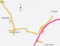 Great-coxwell.png 908 × 698 ; 556 kio
-
 GreatCoxwell Chowle milestone.jpg 768 × 1 024 ; 759 kio
-
 Greens' Farmhouse, Great Coxwell.jpg 4 000 × 3 000 ; 5,01 Mio
-
 Harvesting on Badbury Hill - geograph.org.uk - 4192229.jpg 640 × 480 ; 125 kio
-
 Harvesting on Badbury Hill - geograph.org.uk - 4192778.jpg 640 × 480 ; 124 kio
-
 GreatCoxwell HollowayHouse outbuilding.jpg 1 280 × 695 ; 512 kio
-
 Holloway House - geograph.org.uk - 4235281.jpg 640 × 480 ; 167 kio
-
 Holloway, Great Coxwell.jpg 4 000 × 3 000 ; 913 kio
-
-
 In the wood - geograph.org.uk - 4235124.jpg 640 × 480 ; 160 kio
-
 Into the wood - geograph.org.uk - 4233794.jpg 640 × 480 ; 159 kio
-
 Manor Cottage (geograph 4235330).jpg 640 × 480 ; 171 kio
-
 Names on Great Coxwell war memorial - geograph.org.uk - 5120508.jpg 800 × 600 ; 196 kio
-
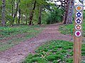
 National Trust sign by Badbury Wood - geograph.org.uk - 5761598.jpg 2 700 × 2 016 ; 594 kio
-
-
 Old Milestone by the A420, south west of Faringdon (geograph 5622215).jpg 890 × 1 040 ; 102 kio
-
 Old outbuilding at Court House Farm - geograph.org.uk - 1093168.jpg 640 × 383 ; 78 kio
-
 Old road direction sign, Great Coxwell - geograph.org.uk - 3377209.jpg 640 × 378 ; 79 kio
-
 Once a school - geograph.org.uk - 4235368.jpg 640 × 480 ; 174 kio
-
 Ordnance Survey Cut Mark - geograph.org.uk - 4690338.jpg 4 000 × 3 000 ; 4,4 Mio
-
 Panoramic view inside Badbury Clump, near Faringdon - geograph.org.uk - 3941502.jpg 4 850 × 1 018 ; 2,69 Mio
-
 Parish Reading Room - geograph.org.uk - 4235359.jpg 640 × 480 ; 165 kio
-
 Path crosses track - geograph.org.uk - 4235045.jpg 640 × 480 ; 163 kio
-
 Path entering Great Coxwell - geograph.org.uk - 4757299.jpg 640 × 480 ; 89 kio
-
 Path to Oldfield Farm - geograph.org.uk - 4757309.jpg 640 × 480 ; 87 kio
-
 Pear Tree Cottage (geograph 4235382).jpg 640 × 480 ; 163 kio
-
 Pear Tree Cottage, Great Coxwell.jpg 4 000 × 3 000 ; 4,23 Mio
-
 Place for dogs - geograph.org.uk - 4235187.jpg 640 × 480 ; 170 kio
-
 Please use the stile - geograph.org.uk - 4235054.jpg 640 × 480 ; 157 kio
-
 Plough Barn (derelict) - geograph.org.uk - 6194501.jpg 4 000 × 3 000 ; 4,67 Mio
-
 Public bridleway to Great Coxwell - geograph.org.uk - 6194507.jpg 4 000 × 3 000 ; 4,77 Mio
-
 Public footpath from Great Coxwell - geograph.org.uk - 6194832.jpg 4 000 × 3 000 ; 4,64 Mio
-
 Puddleduck Lane, Great Coxwell - geograph.org.uk - 5949738.jpg 1 024 × 798 ; 190 kio
-
-
 Repairs to thatch, the Holloway Road, Great Coxwell - geograph.org.uk - 6194833.jpg 4 000 × 3 000 ; 4,65 Mio
-
 Road junction north of Great Coxwell - geograph.org.uk - 3244089.jpg 1 600 × 760 ; 273 kio
-
 Rosemary Cottage - geograph.org.uk - 4235292.jpg 640 × 480 ; 172 kio
-
 Rowleaze Farm Cottages - geograph.org.uk - 2789165.jpg 2 848 × 2 136 ; 1,72 Mio
-
 Rubber ducks - geograph.org.uk - 5167046.jpg 1 024 × 768 ; 312 kio
-
 Solitary tree at bend in A420 - geograph.org.uk - 5527535.jpg 1 600 × 1 200 ; 707 kio
-

-
 Steps to the hayloft - geograph.org.uk - 2022810.jpg 1 500 × 1 000 ; 216 kio
-
 Straw stack - geograph.org.uk - 4233777.jpg 640 × 480 ; 164 kio
-
 The A420, Little Coxwell - geograph.org.uk - 6307201.jpg 1 848 × 1 162 ; 1,2 Mio
-
 The A420, Little Coxwell - geograph.org.uk - 6311291.jpg 1 920 × 1 280 ; 1,17 Mio
-
 The B4019 to Faringdon - geograph.org.uk - 2022861.jpg 1 500 × 1 000 ; 182 kio
-
 The Great Barn, Great Coxwell - geograph.org.uk - 6194837.jpg 4 000 × 3 000 ; 4,83 Mio
-
 The Old School, Great Coxwell - geograph.org.uk - 2298166.jpg 2 816 × 2 112 ; 1,88 Mio
-
 The pond by the Great Barn - geograph.org.uk - 2022821.jpg 640 × 427 ; 80 kio
-
 The Ranch, Oakfield, Great Coxwell Road - geograph.org.uk - 6194187.jpg 4 000 × 3 000 ; 4,67 Mio
-
 The road into Great Coxwell - geograph.org.uk - 2021642.jpg 1 500 × 1 000 ; 256 kio
-

-
 Three ways to go (1) - geograph.org.uk - 4235071.jpg 640 × 480 ; 162 kio
-
 Three ways to go (2) - geograph.org.uk - 4235077.jpg 640 × 480 ; 157 kio
-
 Three ways to go (3) - geograph.org.uk - 4235080.jpg 640 × 480 ; 157 kio
-
 Through the green tunnel - geograph.org.uk - 4235396.jpg 480 × 640 ; 146 kio
-
 Through the kissing gate - geograph.org.uk - 4235199.jpg 640 × 480 ; 167 kio
-
 TJ's Cafe, Little Coxwell - geograph.org.uk - 6306857.jpg 1 920 × 1 280 ; 1,15 Mio
-
 Towards Great Coxwell - geograph.org.uk - 4235178.jpg 640 × 480 ; 169 kio
-
 Towards the hill - geograph.org.uk - 4235092.jpg 640 × 480 ; 162 kio
-
 Towards the wood - geograph.org.uk - 4233782.jpg 640 × 480 ; 165 kio
-
 Trees, Badbury Clump, near Faringdon - geograph.org.uk - 3942118.jpg 640 × 480 ; 184 kio
-

-

-
 Wall to Danes House, Great Coxwell.jpg 4 103 × 3 138 ; 2,18 Mio
-
 Walnut Cottage, Great Coxwell - geograph.org.uk - 4192004.jpg 640 × 480 ; 121 kio
-
 War Memorial, Great Coxwell - geograph.org.uk - 4235364.jpg 640 × 480 ; 165 kio
-
 Water supply - geograph.org.uk - 4235194.jpg 640 × 480 ; 155 kio
-
 Cottages Great Coxwell Geograph-2298175-by-Gareth-James.jpg 2 816 × 2 112 ; 1,76 Mio
-
 Wayside, Great Coxwell.jpg 4 000 × 3 000 ; 1,21 Mio
-
 Wet and muddy field - geograph.org.uk - 1651754.jpg 640 × 480 ; 70 kio
-
 Wire-walking, Badbury Clump, near Faringdon - geograph.org.uk - 3941511.jpg 640 × 362 ; 118 kio
-
 Wood House, near Faringdon - geograph.org.uk - 2787339.jpg 2 848 × 2 136 ; 1,65 Mio
-
 Woodland path, Badbury Hill - geograph.org.uk - 4192238.jpg 640 × 480 ; 210 kio
-
 Bridleway north of Badbury Hill House - geograph.org.uk - 307438.jpg 640 × 480 ; 125 kio


_-_geograph.org.uk_-_4235163.jpg)
_-_geograph.org.uk_-_4235167.jpg)


_-_geograph.org.uk_-_4236060.jpg)
_-_geograph.org.uk_-_4236061.jpg)


.jpg)


.jpg)


.jpg)


_-_geograph.org.uk_-_6194501.jpg)


_-_geograph.org.uk_-_4235071.jpg)
_-_geograph.org.uk_-_4235077.jpg)
_-_geograph.org.uk_-_4235080.jpg)


