Category:Great Doddington
Aller à la navigation
Aller à la recherche
English: *The village's official website
village britannique  | |||||
| Téléverser des médias | |||||
| Nature de l’élément | |||||
|---|---|---|---|---|---|
| Lieu | North Northamptonshire, Northamptonshire, Midlands de l'Est, Angleterre | ||||
| Réputé identique à | Great Doddington (page en doublon, paroisse civile) | ||||
 | |||||
Sous-catégories
Cette catégorie comprend seulement la sous-catégorie ci-dessous.
Média dans la catégorie « Great Doddington »
Cette catégorie comprend 59 fichiers, dont les 59 ci-dessous.
-
 A Corner of Summer Leys Nature Reserve - geograph.org.uk - 130475.jpg 480 × 640 ; 78 kio
-
 A45 (north) from Earls Barton Road - geograph.org.uk - 5114916.jpg 640 × 481 ; 450 kio
-
 A45 (south) from Earls Barton Road - geograph.org.uk - 5114919.jpg 640 × 481 ; 438 kio
-
 Bridge Over the A45 - geograph.org.uk - 5114923.jpg 640 × 481 ; 498 kio
-
 Bridleway towards the River Nene - geograph.org.uk - 6002954.jpg 1 024 × 768 ; 183 kio
-
 Churchyard Cross - geograph.org.uk - 5674840.jpg 2 616 × 3 488 ; 1,66 Mio
-
 Churchyard Cross, The Church of St Nicholas - geograph.org.uk - 5113999.jpg 547 × 640 ; 658 kio
-
 Doctors Lane - geograph.org.uk - 3419482.jpg 478 × 640 ; 63 kio
-
 Doddington Lock, River Nene, from Hardwater Road - geograph.org.uk - 4132848.jpg 1 064 × 1 600 ; 369 kio
-
 Former ROC Bunker - geograph.org.uk - 1573275.jpg 640 × 480 ; 154 kio
-
 Gravel lake near the Nene - geograph.org.uk - 6136184.jpg 1 600 × 1 066 ; 352 kio
-
 Grazing steer by the Nene Way - geograph.org.uk - 3169738.jpg 2 560 × 1 920 ; 997 kio
-
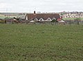
 Great Doddington - geograph.org.uk - 3169721.jpg 2 560 × 1 920 ; 957 kio
-
 Great Doddington - geograph.org.uk - 3169765.jpg 2 560 × 1 920 ; 1 Mio
-
 Great Doddington, The Church of St Nicholas - geograph.org.uk - 5114011.jpg 480 × 640 ; 587 kio
-
 Hardwater Mill - geograph.org.uk - 3169531.jpg 2 560 × 1 920 ; 1 010 kio
-
 Hardwater Mill - geograph.org.uk - 3169548.jpg 2 560 × 1 920 ; 1,06 Mio
-
 Hardwater Mill, on the River Nene - geograph.org.uk - 4132822.jpg 1 600 × 1 064 ; 386 kio
-
 Hardwater Road crosses the River Nene - geograph.org.uk - 5100784.jpg 640 × 480 ; 39 kio
-
 Hardwater Road, bridges over channels of the River Nene - geograph.org.uk - 4132862.jpg 1 600 × 1 064 ; 401 kio
-
 HardwaterMill.JPG 4 272 × 2 848 ; 5,09 Mio
-
 Landscape just south of Great Doddington - geograph.org.uk - 3169756.jpg 2 560 × 1 920 ; 1,01 Mio
-
 Looking towards Hardwater Mill - geograph.org.uk - 3169524.jpg 2 560 × 1 920 ; 1,02 Mio
-
 Nene Valley towards Woolaston Mill - geograph.org.uk - 3169774.jpg 2 560 × 1 920 ; 941 kio
-
 No score - geograph.org.uk - 1573200.jpg 640 × 480 ; 91 kio
-
 Outside The Stag in Great Doddington - geograph.org.uk - 6002953.jpg 1 024 × 768 ; 175 kio
-
 Path through the woods - geograph.org.uk - 6136186.jpg 1 600 × 1 066 ; 751 kio
-
 Platelayers hut - geograph.org.uk - 1183657.jpg 640 × 479 ; 75 kio
-
 Post Box on The Ridge - geograph.org.uk - 72710.jpg 640 × 480 ; 137 kio
-
 Redundant water tower - geograph.org.uk - 1573285.jpg 480 × 640 ; 121 kio
-
 River Nene at Great Doddington - geograph.org.uk - 5988690.jpg 3 264 × 2 448 ; 1,28 Mio
-
 River Nene downstream of Hardwater Road - geograph.org.uk - 4132835.jpg 1 600 × 1 064 ; 311 kio
-
 River Nene flowing nicely - geograph.org.uk - 6002955.jpg 1 024 × 768 ; 197 kio
-
 River Nene, navigation channel from the foot of Doddington Lock - geograph.org.uk - 4132845.jpg 1 064 × 1 600 ; 229 kio
-
 River Nene, navigation channel from the foot of Doddington Lock - geograph.org.uk - 4132860.jpg 1 600 × 1 064 ; 283 kio
-
 Road bridge by Hardwater Mill - geograph.org.uk - 3169551.jpg 2 560 × 1 920 ; 1,02 Mio
-
 St Nicholas' Church, Great Doddington - geograph.org.uk - 5114009.jpg 480 × 640 ; 524 kio
-
 Tall trees at the end of the lake - geograph.org.uk - 6136178.jpg 1 600 × 1 066 ; 481 kio
-
 The A45, Wellingborough - geograph.org.uk - 6203164.jpg 1 892 × 1 236 ; 1,15 Mio
-
 The Church of St Nicholas, Great Doddington - geograph.org.uk - 5113987.jpg 640 × 481 ; 636 kio
-
 The River Nene - geograph.org.uk - 6136810.jpg 1 600 × 1 066 ; 353 kio
-
 Trees along the edge of the lake - geograph.org.uk - 6136173.jpg 1 600 × 1 066 ; 413 kio
-
 Water meadows in the Nene valley, from Hardwater Road - geograph.org.uk - 4132827.jpg 1 600 × 1 064 ; 309 kio
-
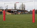 Wellingborough RFC - geograph.org.uk - 1573188.jpg 640 × 480 ; 75 kio
-
 Wellingborough RFC - geograph.org.uk - 1573293.jpg 640 × 480 ; 90 kio
-
 Wellingborough Rugby Club - geograph.org.uk - 5114911.jpg 640 × 427 ; 404 kio
-
 Willow tree near Hardwater Mill - geograph.org.uk - 3169534.jpg 2 560 × 1 920 ; 1 003 kio
-
 Woodland by the water - geograph.org.uk - 6136182.jpg 1 600 × 1 066 ; 322 kio
-
 Cringle Farm - geograph.org.uk - 146914.jpg 640 × 480 ; 81 kio
-
 Cringle Farm Cottages - geograph.org.uk - 146910.jpg 640 × 467 ; 83 kio
-
 Gaol - geograph.org.uk - 27288.jpg 640 × 480 ; 139 kio
-
 Lambs and faded Dye - geograph.org.uk - 146924.jpg 640 × 480 ; 87 kio
-

-
 Meadow - geograph.org.uk - 58996.jpg 640 × 480 ; 129 kio
-
 Recycling Centre - geograph.org.uk - 130496.jpg 640 × 480 ; 86 kio
-
 Stone Bridge - geograph.org.uk - 146931.jpg 640 × 480 ; 131 kio
-
 Swans at Rest - geograph.org.uk - 146919.jpg 640 × 480 ; 88 kio
-

-
 The Nene Valley - geograph.org.uk - 72707.jpg 640 × 480 ; 130 kio

_from_Earls_Barton_Road_-_geograph.org.uk_-_5114916.jpg)
_from_Earls_Barton_Road_-_geograph.org.uk_-_5114919.jpg)


