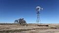
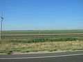
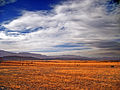
Category:Great Plains
Jump to navigation
Jump to search
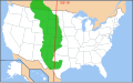
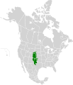
English: The Great Plains of North America, located in the central United States and southern Canada. A landform, region, and ecoregion of the Temperate grasslands, savannas and shrublands Biome.
broad expanse of flat land west of the Mississippi River and east of the Rocky Mountains  Вялікія раўніны ў штаце Небраска, ЗША  | |||||
| Վերբեռնել մեդիա նիշք | |||||
| Հասկացության մասնավոր դեպք | |||||
|---|---|---|---|---|---|
| Մասն է | |||||
| Կոչվել է ի պատիվ | |||||
| Վայր | |||||
| Partially coincident with |
| ||||
 | |||||
Ենթակատեգորիաներ
Ստորև բերված է այս կատեգորիայի 22 ենթակատեգորիա՝ 22-ից։
- Plains of Montana (62 F)
- Plains of North Dakota (6 F)
- Plains of South Dakota (13 F)
B
- Birds of the plains (5 F)
C
- Cheyenne Bottoms (6 F)
- Coteau des Prairies (7 F)
- Coteau du Missouri (7 F)
D
F
H
I
L
M
P
Q
- Querecho Plains (12 F)
R
- Rio Grande Embayment (1 F)
S
- Samuel Seymour (7 F)
T
«Great Plains» կատեգորիայի մեդիան
Ստորև բերված է այս կատեգորիայի 115 նիշք՝ 115-ից։
-
 Map of Great Plains.svg 959 × 593; 301 ԿԲ
-
 Map of Great Plains2.jpg 960 × 591; 48 ԿԲ
-
 US Great Plains Map.svg 959 × 593; 87 ԿԲ
-
 Central and Southern Mixed Grasslands map.svg 1712 × 1992; 344 ԿԲ
-
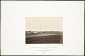
 "View of Mitchell, Nebraska." - NARA - 294455.jpg 3000 × 2315; 959 ԿԲ
-
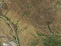
 A satellite image illustrating the Great Plains.jpg 1600 × 1200; 1,37 ՄԲ
-
 Abandoned gas station west of North Platte, Nebraska.jpg 582 × 440; 92 ԿԲ
-
 Arealy kulturowe Am Pn.jpg 388 × 459; 71 ԿԲ
-

-
 Bierstadt Albert Nebraska Wasatch Mountains.jpg 1000 × 692; 144 ԿԲ
-
 Bierstadt Albert The Buffalo Trail.jpg 1920 × 1080; 493 ԿԲ
-
 Bierstadt Albert The Plains Near Fort Laramie.jpg 901 × 556; 236 ԿԲ
-
 Bierstadt Albert Western Kansas.jpg 1890 × 1275; 512 ԿԲ
-
 Albert Biertadt - A Western Landscape (1860-70).jpg 2124 × 1546; 518 ԿԲ
-
 Albert Bierstadt - Sunset on the Plains (c. 1887).jpg 1800 × 1319; 2,27 ՄԲ
-
 Albert Bierstadt - Sunset on the Plains.jpg 1280 × 946; 433 ԿԲ
-
 Bison at Niobrara Valley Preserve.jpg 2048 × 1536; 691 ԿԲ
-
 Bison bison 2003 map.svg 1712 × 1992; 415 ԿԲ
-
 Boy holding reins for a team of two horses - NARA - 285502.jpg 3000 × 2123; 2,11 ՄԲ
-
 Brontosaurus tracks.jpg 3000 × 4000; 3,7 ՄԲ
-
 Buffalo Herd grazing South Dakota.jpg 780 × 551; 139 ԿԲ
-
 Canada Prairie provinces map.png 262 × 212; 4 ԿԲ
-
 Canada Prairie provinces map.svg 1304 × 1263; 94 ԿԲ
-
 Cattle grazing on the Central Plains Experimental Range.jpg 520 × 320; 89 ԿԲ
-
 Clark County, Kansas.jpg 2272 × 1704; 1,43 ՄԲ
-
 Climates of the Great Plains - NARA - 84786400.jpg 7552 × 17 175; 13,08 ՄԲ
-
 Colorado Great Plains P5310698.JPG 3072 × 2304; 1,18 ՄԲ
-
 Colorado High Plains.JPG 3264 × 2448; 3,1 ՄԲ
-
 Corn Fields, Iowa Farm 7-13 (15277889101).jpg 2450 × 1401; 2,11 ՄԲ
-
 Curry County Eastern New Mexico 2010.jpg 4080 × 2271; 1,75 ՄԲ
-

-

-
 Dry Arkansas River.jpg 2272 × 1704; 1,19 ՄԲ
-
 DSCN5051 greatplainswestofkearney e.jpg 600 × 323; 35 ԿԲ
-
 Early Indian treaty territories, North Dakota - an overview map.png 1279 × 830; 418 ԿԲ
-
 Early Indian treaty territories, North Dakota. Map 1 (1851-1891).png 1440 × 845; 2,85 ՄԲ
-
 Early Indian treaty territories, North Dakota. Map and overview.png 1278 × 1675; 2,99 ՄԲ
-

-
 Albert Bierstadt - Evening on the Prairie.jpg 2000 × 1325; 823 ԿԲ
-
 Fence along the Montana–Alberta border - 19940726.jpg 2280 × 1628; 630 ԿԲ
-
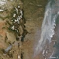
 Fires in the Great Plains (MODIS 2015-04-21).jpg 1800 × 2400; 1,09 ՄԲ
-
 Flickr - Nicholas T - Skewed.jpg 2816 × 2112; 3,34 ՄԲ
-
 Flickr - Nicholas T - Windswept.jpg 2816 × 2112; 4,26 ՄԲ
-
 FLOWERS AMID THE PRAIRIE GRASSES ON THE CROW INDIAN RESERVATION - NARA - 549229.jpg 2003 × 3000; 1009 ԿԲ
-
-
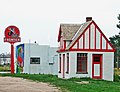 Frontier Station, Paxton, NE 713 (16487498820).jpg 2450 × 1885; 1,06 ՄԲ
-
 Great Plain, Hungary covered in snow.jpg 4624 × 3472; 5,31 ՄԲ
-
 Great Plains from United 793 (6305381350).jpg 1600 × 1200; 247 ԿԲ
-
 Great Plains map.png 946 × 618; 74 ԿԲ
-
 Great Plains P5310707.JPG 3072 × 2304; 1,12 ՄԲ
-
 Great plains storm - Great Sand Dunes National Park.jpg 6262 × 4175; 9,51 ՄԲ
-
 Great Plains Tornado Outbreak, 1999 (50700830227).jpg 1186 × 1020; 280 ԿԲ
-
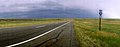
 Great Plains, Nebraska, U.S. 1.jpg 740 × 492; 239 ԿԲ
-
 Indian territories, North Dakota. Map 2 (1875-1889).png 1431 × 852; 2,61 ՄԲ
-
 Indian territories, North Dakota. Map 3 (1880-1892).png 1437 × 847; 2,64 ՄԲ
-
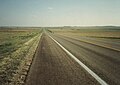
 Interstate 70 in Colorado Flats.jpg 2272 × 1704; 1,01 ՄԲ
-
ISS pass over Southern California to Hudson Bay.ogv 21 վ, 640 × 425; 2,87 ՄԲ
-
 Johnson 1920 HighPlains.jpg 4169 × 3172; 6,37 ՄԲ
-
 Kane Prairie.jpg 1750 × 1048; 672 ԿԲ
-

-
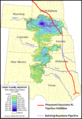 Keystone XL - Ogallala Aquifer.png 781 × 1137; 625 ԿԲ
-
 Major Project - DPLA - 12a444cc7e8e179fb1ded754448fefa6.jpg 1039 × 790; 130 ԿԲ
-
 Map of the grassland ecoregions of the United States.jpg 2826 × 1759; 1,97 ՄԲ
-
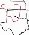
 Map-USA-Great Plains01.png 677 × 1355; 118 ԿԲ
-
 Mixed grass prairie Fort Smith Montana.jpg 640 × 480; 40 ԿԲ
-
 Northern Mixed Grasslands.svg 1712 × 1992; 341 ԿԲ
-

-

-

-
-

-
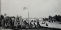
 Oregon Trail reenactment - NARA - 286052.jpg 3000 × 2402; 1,04 ՄԲ
-
 Oregon Trail reenactment - NARA - 286052.tif 3000 × 2402; 6,87 ՄԲ
-
 Albert Bierstadt - Study for The Last of the Buffalo.jpg 3308 × 2240; 838 ԿԲ
-
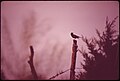 PART OF RURAL NEBRASKA'S VARIED BIRD LIFE - NARA - 547318.jpg 3000 × 2023; 595 ԿԲ
-
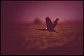 PART OF RURAL NEBRASKA'S VARIED BIRD POPULATION - NARA - 547322.jpg 3000 × 2018; 663 ԿԲ
-
 Plains Indian tipi, North America. Wellcome V0038483.jpg 3070 × 2314; 2,54 ՄԲ
-
 Prairie-and-Plains.png 640 × 675; 182 ԿԲ
-
 Rain clouds at Sand Creek Massacre Site.jpg 3072 × 2304; 541 ԿԲ
-

-
 Ranch lands and prairie near Little Bighorn Battlefield National Monument 06-73.jpg 2973 × 1982; 3,67 ՄԲ
-
 Regina Soreson and friends in drag.jpg 640 × 426; 291 ԿԲ
-
-
 Samuel Seymour, Pawnee Indian Council, October 1819.png 926 × 544; 1,01 ՄԲ
-
 Sand Creek 2.jpg 4892 × 1156; 2,26 ՄԲ
-
 Satellite image illustrating the Great Plains.jpg 1600 × 1200; 1,37 ՄԲ
-
 Short Grass plains of Sand Creek Massacre Site.jpg 3072 × 2304; 1,08 ՄԲ
-
 Snow across the Great Plains (MODIS 2015-12-10).jpg 5600 × 7200; 8,12 ՄԲ
-
 Snow in the eastern Rocky Mountains and Great Plains (MODIS 2016-12-20).jpg 5089 × 4161; 3,18 ՄԲ
-
 South Dakota plains.jpg 881 × 621; 117 ԿԲ
-
 Southern Great Plains in Oklahoma IMG 6980.JPG 4608 × 3456; 2,96 ՄԲ
-
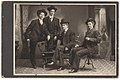
 Southern Plains villagers.jpg 1226 × 1494; 304 ԿԲ
-
 Spring Greening on the Great Plains (MODIS 2024-05-26).jpg 1706 × 1302; 494 ԿԲ
-
 Sunrise on Country Cemetery 7-13 (15383014192).jpg 2450 × 1711; 1,52 ՄԲ
-
 Sunset at Sand Creek Massacre National Historic Site.jpg 3072 × 2304; 1,05 ՄԲ
-

-
 The Hide Hunters, 1872 (11951970726).jpg 1000 × 711; 671 ԿԲ
-
 The Holdup, 1869 (11951971476).jpg 1000 × 711; 680 ԿԲ
-
 Title- The End, 1883 (11951577234).jpg 1000 × 701; 705 ԿԲ
-
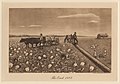
 Title- The Herd, 1860 (11951138715).jpg 1000 × 711; 630 ԿԲ
-
 Tracking Fires Over the Great Plains (NESDIS 2021-04-05 giffiresksok).gif 973 × 547; 13,53 ՄԲ
-
 Trees at Sand Creek Massacre Site.jpg 3072 × 2304; 1006 ԿԲ
-
 US-KS - North America - Road Trip - Great Plains (4892281226).jpg 4288 × 2848; 10,46 ՄԲ
-
 View on the plains, Kansas, 585 miles west of St. Louis, Mo.jpg 1024 × 509; 102 ԿԲ
-
 Wallow fire satphoto, June 7, 2011.jpg 720 × 720; 222 ԿԲ
-
 White Thistle in flower P5310704.JPG 3072 × 2304; 1,73 ՄԲ
-
 Wikivoyage US regions - The Great Plains states.jpg 572 × 371; 107 ԿԲ
-
 WY Redds Great plains.jpg 2100 × 1575; 2,54 ՄԲ
-
 Wyoming 1997 16.jpg 1048 × 710; 141 ԿԲ
-
 Wyoming, panorámicas (1997) 04.jpg 5420 × 2071; 6,03 ՄԲ
-
 Wyoming, panorámicas (1997) 05.jpg 5186 × 2046; 6,33 ՄԲ
-
 Nebraska Sand Hills Mixed Grasslands map.svg 1712 × 1992; 339 ԿԲ
-
 Northern short grasslands map.svg 1712 × 1992; 346 ԿԲ
-
 Western Short Grasslands map.svg 1712 × 1992; 348 ԿԲ
-
 Yellow Composite - Thistle P5310702.JPG 2304 × 3072; 1,31 ՄԲ


.jpg)
.jpg)


.jpg)


.png)

_(20576215843).jpg)


.jpg)


.jpg)

.jpg)


.jpg)
.png)
.png)


.jpg)


.jpg)
.jpg)
_(cropped).jpg)
.jpg)
.jpg)


.jpg)
.jpg)


.jpg)
.jpg)


.jpg)
.jpg)
.jpg)
.jpg)

.jpg)


._1843-44._The_return_of_a_sacred_arrow_of_the_Cheyenne.png)
,_Ingo_Schr%C3%B6der,_1986.gif)
.gif)
_04.jpg)
_05.jpg)