Category:Great Salt Lake
Przejdź do nawigacji
Przejdź do wyszukiwania
jezioro w Stanach Zjednoczonych  | |||||
| Prześlij plik multimedialny | |||||
| Jest to |
| ||||
|---|---|---|---|---|---|
| Miejsce | Utah, Stany Zjednoczone | ||||
| Szerokość |
| ||||
| Długość |
| ||||
| Powierzchnia |
| ||||
| Wysokość nad poziomem morza |
| ||||
| Zasilające |
| ||||
| Państwo zlewiska | |||||
 | |||||
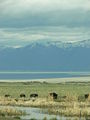
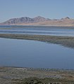
English: Great Salt Lake — in the Great Basin region of Utah.
Podkategorie
Poniżej wyświetlono 20 spośród wszystkich 20 podkategorii tej kategorii.
*
- Maps of the Great Salt Lake (9 plików)
A
- Antelope Island Causeway (7 plików)
B
- Bear River Bay (6 plików)
- Black Rock (22 pliki)
F
G
- Garfield beach, Utah (9 plików)
- Great Salt Lake gallery (27 plików)
- Great Salt Lake State Park (8 plików)
L
M
- Minerals of Great Salt Lake (6 plików)
S
- Satellite pictures of Great Salt Lake (114 plików)
- Spiral Jetty (1 strona, 24 pliki)
W
Pliki w kategorii „Great Salt Lake”
Poniżej wyświetlono 181 spośród wszystkich 181 plików w tej kategorii.
-
 02162008 Interstate80NWUtah.JPG 3872 × 2592; 6,84 MB
-
 1215-foot tall Garfield Smelter Stack, UT.jpg 4313 × 2817; 7,04 MB
-
 170 MSS P 24 B2 F4.jpg 1303 × 844; 193 KB
-
 1890s detail, Saltair, Gt. Salt Lake, North Front, C.R. Savage. (cropped).jpg 2371 × 1666; 507 KB
-
 2012.10.02.091900 Great Salt Lake Magna Utah.jpg 1920 × 1280; 850 KB
-
 2012.10.02.091923 Great Salt Lake Magna Utah.jpg 1920 × 1280; 1,05 MB
-

-

-

-
-

-

-
 2021 Great Salt Lake 01.jpg 6000 × 4000; 4,15 MB
-
 2021 Great Salt Lake 02.jpg 6000 × 4000; 4,09 MB
-
 2021 Great Salt Lake 03.jpg 6000 × 4000; 4,85 MB
-
 2021 Great Salt Lake 04.jpg 6000 × 4000; 4,16 MB
-
 2021 Great Salt Lake 05.jpg 6000 × 4000; 3,43 MB
-
 2021 Great Salt Lake 06.jpg 5813 × 3816; 4,85 MB
-
 393 MSS P 24 B3 F5.jpg 2594 × 1665; 565 KB
-
 4874j USA - Utah - Grand Lac Salé.jpg 1024 × 819; 498 KB
-

-
 A glimpse of Great Salt Lake, Utah (1891) (14762359201).jpg 2485 × 1665; 2,03 MB
-
 A glimpse of Great Salt Lake, Utah (1891) (14765527665).jpg 1982 × 2970; 1,5 MB
-
 Antelope Island (239445189).jpg 800 × 534; 107 KB
-
 Antelope Island (6856251090).jpg 1600 × 919; 196 KB
-
 Antelope Island Aurora and Moon.jpg 4032 × 3024; 8,09 MB
-
 Antelope Island Aurora.jpg 4032 × 3024; 6,36 MB
-
 Approaching the the dry Spiral Jetty on June 18th, 2018.jpg 4607 × 3061; 6,47 MB
-
 AS09-22-3439 (22008600816).jpg 4400 × 4600; 1,08 MB
-
-
 Birds - "G" - DPLA - fa4f9bd5c830300b800aad46650d6eda.jpg 4789 × 3883; 2,33 MB
-
 Box Elder County, UT, USA - panoramio.jpg 3648 × 2736; 1,69 MB
-
 Boxeldercounty.png 1024 × 633; 144 KB
-
 Bridger Bay Antelope Island Utah.jpg 3024 × 4032; 4,26 MB
-
 Bridger Bay science Antelope Island Utah.jpg 3024 × 4032; 3,09 MB
-
 Dangerous dust ESA24385047.jpg 1920 × 1080; 1,45 MB
-
 Duchesnerivermap.png 720 × 586; 300 KB
-
 EAST SHORE - NARA - 544773.jpg 3000 × 2043; 1,05 MB
-
 Eastern edge of the Great Salt Lake, Utah LCCN2011635789.tif 3425 × 2739; 53,7 MB
-
 EASTERN SHORE - NARA - 544778.jpg 3000 × 2033; 840 KB
-
 EASTERN SHORE - NARA - 544782.jpg 3000 × 2041; 1,26 MB
-
 EB9 Wyoming, Idaho, Montana, & Dakota.jpg 5597 × 3860; 4,7 MB
-
 Farmington Bay, Antelope Island and the Great Salt Lake.jpg 4288 × 2848; 9,07 MB
-
 Fig 23 Rise and Fall of Gt Salt Lake.jpg 400 × 130; 12 KB
-
 Flowers at the Great Salt Lake.jpg 4032 × 3024; 2,12 MB
-

-
 Gran Lago Salado 01.JPG 3456 × 5184; 5,03 MB
-
 Gran Lago Salado 02.JPG 5184 × 3456; 5,04 MB
-
 Gran Lago Salado 03.jpg 5184 × 3218; 12,7 MB
-
 Gran Lago Salado 04.JPG 5184 × 3456; 5,74 MB
-
 Gran Lago Salado 05.JPG 5184 × 3456; 4,86 MB
-
 Gran Lago Salado 06.JPG 5184 × 3456; 5,51 MB
-
 Gran Lago Salado 07.JPG 5184 × 3456; 5,29 MB
-
 Gran Lago Salado Isla Antilope.jpg 800 × 599; 67 KB
-
 Great Salt Lake (432109506).jpg 1147 × 768; 237 KB
-
 Great Salt Lake (432109590).jpg 768 × 1147; 230 KB
-
 Great Salt Lake (432109615).jpg 768 × 1147; 209 KB
-
 Great Salt Lake (432109634).jpg 1147 × 768; 255 KB
-
 Great Salt Lake (432109670).jpg 1147 × 768; 225 KB
-
 Great Salt Lake (5077174974).jpg 720 × 576; 170 KB
-
 Great Salt Lake (7002365445).jpg 1600 × 879; 216 KB
-
 Great Salt Lake (Antelope Island Causeway).JPG 2816 × 2112; 1,12 MB
-
 Great Salt Lake (Antelope Island.JPG 2816 × 2112; 1,04 MB
-
 Great Salt Lake (June 2008).jpg 1920 × 1277; 907 KB
-
 Great Salt Lake - panoramio - Frans-Banja Mulder.jpg 858 × 643; 652 KB
-
 Great Salt Lake - panoramio.jpg 858 × 643; 474 KB
-
 Great Salt Lake - Richard F. Burton.tif 980 × 677; 1,92 MB
-
 Great Salt Lake 2.jpg 480 × 640; 114 KB
-
 Great Salt Lake and Interstate 80 from plane.jpg 4272 × 2848; 3,5 MB
-
 Great Salt Lake Beach - panoramio.jpg 672 × 504; 334 KB
-
 Great Salt Lake Causeway Map 2016.jpg 2500 × 569; 322 KB
-
 Great Salt Lake crystals.jpg 3000 × 4000; 3,72 MB
-
 Great salt lake drainage map.jpg 1060 × 1227; 1,13 MB
-

-
 Great Salt Lake from Sunset Beach.jpg 2580 × 1932; 877 KB
-
 Great Salt Lake from University of Utah (6856250606).jpg 1600 × 743; 311 KB
-
 Great Salt Lake print.jpg 1024 × 709; 204 KB
-
 Great Salt Lake Reflection - panoramio.jpg 1944 × 2592; 818 KB
-
 Great Salt Lake Reflection.jpg 975 × 463; 42 KB
-
 Great Salt Lake Scenes 1 - October 2018 (43713546780).jpg 2400 × 1600; 1,36 MB
-
 Great Salt Lake Scenes 2 - October 2018 (44805380354).jpg 2400 × 1600; 1,77 MB
-
 Great Salt Lake Scenes 3 - October 2018 (43713547300).jpg 1600 × 2400; 1,95 MB
-
 Great Salt Lake Scenes 4 - October 2018 (44805380874).jpg 1600 × 2400; 1,56 MB
-
 Great Salt Lake Sunset (432109519).jpg 1147 × 768; 103 KB
-
 Great Salt Lake Sunset.jpg 4608 × 3072; 5,29 MB
-
 Great Salt Lake Ufer.jpg 2197 × 1476; 521 KB
-
 Great Salt Lake UT1.jpg 3886 × 2120; 6,4 MB
-
 Great Salt Lake Utah 6132960267 o.jpg 2400 × 1600; 3 MB
-
 Great Salt Lake Utah USA - 50603.jpg 3264 × 2448; 1,87 MB
-
 Great Salt Lake Utah USA 2005.jpg 3264 × 2448; 1,93 MB
-
 Great Salt Lake Utah USA3.jpg 3264 × 2448; 2,2 MB
-
 Great Salt Lake Utah.jpg 3264 × 2448; 1,22 MB
-
 Great Salt Lake view (Jan. 2006).jpg 1099 × 1149; 669 KB
-
 Great Salt Lake Wasatch2.jpg 2235 × 1489; 380 KB
-
 Great Salt Lake, UT - panoramio.jpg 2736 × 2736; 1,47 MB
-
 Great Salt Lake, Utah (NYPL Hades-118918-55069).tif 5033 × 4121; 59,35 MB
-
 Great Salt Lake, Utah USA (2006).jpg 1536 × 2048; 2,05 MB
-
 Great Salt Lake.jpg 640 × 480; 62 KB
-
 Great salt lake.svg 741 × 427; 687 KB
-
 Great Salt Lake10.jpg 800 × 533; 63 KB
-
 Great salt outline.gif 21 × 22; 1003 bajtów
-
 Großer Salzsee.jpg 3648 × 2736; 2,88 MB
-
 GSL Antelope Island.jpg 7421 × 1990; 3,26 MB
-
 GSLview.JPG 2448 × 3264; 3,2 MB
-
 Interface (8452629).jpg 1528 × 1927; 1,19 MB
-
 ISS007-E-13499 - View of Utah.jpg 3032 × 2064; 699 KB
-
 Jordan River (Utah) Watershed.jpg 1024 × 1024; 254 KB
-
 Jurvetson - A River Runs Through It (by).jpg 3000 × 3514; 3,27 MB
-
 Lake levels 4856.jpg 6000 × 4000; 7,6 MB
-
 Lake Tuz 2.jpg 4608 × 2592; 3,59 MB
-
 Magna smelter UT1.jpg 3820 × 2168; 6,33 MB
-
 Mapa Gran Lago Salado.jpg 509 × 599; 74 KB
-
 Marina - panoramio (7).jpg 3488 × 2616; 3,23 MB
-

-
 Microbialite.jpg 3024 × 4032; 2,43 MB
-

-
-

-
 Nerr0940 - Flickr - NOAA Photo Library.jpg 3000 × 1989; 3,35 MB
-
 North at Great Salt Lake & Antelope Island, Mar 16.jpg 2592 × 1944; 2,32 MB
-
 North Tooele Park and Ride lot, Mar 16.jpg 2592 × 1944; 2,35 MB
-
 Northwest at I-80 & SR-202 interchange, Mar 16.jpg 2592 × 1944; 2,4 MB
-
 Northwest at western I-80 & SR-201 interchange, Mar 16.jpg 2592 × 1944; 2,37 MB
-
 OquirrhFlugzeug.jpg 800 × 600; 122 KB
-
 Panorama of the Great Salt Lake Desert.jpg 2696 × 400; 102 KB
-
 People at Sunset (6032228153).jpg 4752 × 3168; 479 KB
-
 Plate 33 Comparative Map of Great Salt Lake.jpg 1338 × 1973; 406 KB
-
-
 Reworked tar Rozel Point Utah.JPG 2048 × 1536; 1,13 MB
-
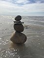 Rock cairn.jpg 2448 × 3264; 1,4 MB
-
 Rozel Bay, Utah.jpg 4000 × 3000; 2,49 MB
-
 Salt Lake - panoramio.jpg 2160 × 1440; 184 KB
-
 Salt Lake Buoy - Flickr - michaelrighi.jpg 2086 × 1620; 827 KB
-
 Salt Lake City Map.jpg 549 × 781; 82 KB
-
 Salt Lake City Trinity (3655628459).jpg 2225 × 3348; 3,86 MB
-
 Salt Lake Sandbars - panoramio - photophat (1).jpg 2781 × 871; 960 KB
-
 Salt Lake Sandbars - panoramio - photophat.jpg 1859 × 2121; 1,64 MB
-

-
 Saltair Pavilion Entrance.jpg 2799 × 2055; 1,08 MB
-
 Saltair Pavilion UT1.jpg 3575 × 2383; 5,57 MB
-
 SaltLake.jpg 971 × 894; 266 KB
-
 SaltLakeBoats.jpg 1516 × 1072; 325 KB
-
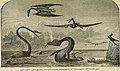
 SaltLakeFlyBirds.jpg 1156 × 918; 258 KB
-
 SaltLakeRipples.jpg 1143 × 985; 210 KB
-

-

-
 Spiral Jetty USU.jpg 1600 × 1200; 554 KB
-
 Stromatolites Great Salt Lake.jpg 12 872 × 5692; 37,65 MB
-
 SUN REFLECTION - NARA - 544774.jpg 3000 × 2042; 670 KB
-
 Sunset on the Great Salt Lake.png 1334 × 750; 995 KB
-
 Tar seep raised edges ripple marks.JPG 2048 × 1536; 1,17 MB
-

-
 The Great Salt Lake at dusk.jpg 2048 × 1536; 789 KB
-
 The Great Salt Lake of Utah.jpg 1156 × 800; 342 KB
-
 The Great Salt Lake, Antelope Island.jpg 5947 × 3721; 2,33 MB
-
 The Great Salt Lake.jpg 6048 × 4032; 4,05 MB
-
 The Great Salt Lake.png 750 × 1334; 939 KB
-
-

-
-
 Timpanogos Valley BHoU-p13.png 2870 × 4082; 225 KB
-
 Train to Promontory Landfill.jpg 1458 × 996; 303 KB
-
 Unspecified-8.jpg 768 × 768; 97 KB
-
 UTA bus stop, North Tooele Park and Ride lot, Mar 16.jpg 2592 × 1944; 2,41 MB
-
 Utah regional geology.PNG 472 × 613; 64 KB
-
 UTAH-GREAT SALT LAKE - NARA - 544768.jpg 3000 × 2027; 1,07 MB
-
 View from Antelope Island.jpg 6048 × 4032; 2,22 MB
-
 Viewing Robert Smithson's Spiral Jetty on June 18th, 2018.jpg 3770 × 2690; 4,1 MB
-
 Walking Robert Smithson's Spiral Jetty on June 18th, 2018.jpg 4616 × 3067; 5,81 MB
-
 WCNF Wilderness Map.jpg 700 × 513; 91 KB
-
 Wendover Cut-off construction.png 3615 × 2408; 185 KB
-
 White-faced Ibis Great Salt Lake 1 cropped.jpg 664 × 798; 74 KB
-
 White-faced Ibis Great Salt Lake 1.jpg 683 × 1024; 437 KB
-
 Willard3.jpg 869 × 578; 80 KB
-
 Windward East Bay.jpg 7298 × 3182; 6,65 MB
-
 Black Rock in the Great Salt Lake, by Savage, C. R. (Charles Roscoe), 1832-1909.jpg 2666 × 1358; 1,19 MB
-
 Black Rock in the Great Salt Lake, by Savage, C. R. (Charles Roscoe), 1832-1909.png 2666 × 1358; 4,02 MB
-

-

-
 Shores of Salt Lake, by Savage, C. R. (Charles Roscoe), 1832-1909.jpg 2681 × 1371; 1,39 MB
-
 Shores of Salt Lake, by Savage, C. R. (Charles Roscoe), 1832-1909.png 2681 × 1371; 4,6 MB


.jpg)


_(14757668761).jpg)
_(14762359201).jpg)
_(14765527665).jpg)
.jpg)
.jpg)


.jpg)


.jpg)


.jpg)
.jpg)
.jpg)
.jpg)
.jpg)
.jpg)
.jpg)
.JPG)

.jpg)


_(16453305837).jpg)

.jpg)


.jpg)
.jpg)
.jpg)
.jpg)
.jpg)


.jpg)


.jpg)


.jpg)

_Watershed.jpg)
.jpg)


.jpg)
.jpg)


.jpg)

_(14591971357).jpg)


.jpg)


.jpg)


_(14784293805).jpg)


,_1832-1909.jpg)
,_1832-1909.png)
_Mountains_in_the_distance,_by_Savage,_C._R._(Charles_Roscoe),_1832-1909.jpg)
_Mountains_in_the_distance,_by_Savage,_C._R._(Charles_Roscoe),_1832-1909.png)
,_1832-1909.jpg)
,_1832-1909.png)
.jpg)
Kategorie:
- Lakes of Utah
- Salt lakes of the United States
- Endorheic lakes
- Great Basin region of Utah
- Lakes of the United States by name
- Bodies of water in Box Elder County, Utah
- Bodies of water in Davis County, Utah
- Bodies of water in Salt Lake County, Utah
- Bodies of water in Tooele County, Utah
- Salt Lake Valley
- Salt domes in Utah
- Drying lakes
- Great Basin Shrub Steppe Ecoregion
- Meromictic lakes