Category:Great Waltham
Aller à la navigation
Aller à la recherche
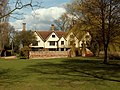
Great Waltham is a village in Essex, England, and in the civil parish of Great Waltham. At the northeast of the village is 'Langley's', an early 18th-century house with deer park.

localité britannique du comté anglais de l'Essex  | |||||
| Téléverser des médias | |||||
| Nature de l’élément | |||||
|---|---|---|---|---|---|
| Lieu | cité de Chelmsford, Essex, Angleterre de l'Est, Angleterre | ||||
 | |||||
Sous-catégories
Cette catégorie comprend 16 sous-catégories, dont les 16 ci-dessous.
- Littley Green (14 F)
B
- The Beehive, Great Waltham (3 F)
- Bollingtons (3 F)
- Broad's Green, Essex (1 F)
F
- Fitzjohn's Farmhouse (1 F)
G
- Great Waltham Roll of Honour (1 F)
- Great Waltham War Memorial (1 F)
H
- Hartford End Mill (1 F)
L
- Langleys, Great Waltham (18 F)
M
- Minnow End (1 F)
P
Média dans la catégorie « Great Waltham »
Cette catégorie comprend 123 fichiers, dont les 123 ci-dessous.
-
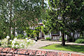
 'Badynghams', 'Bollingtons' or 'The Guildhall', Great Waltham - geograph.org.uk - 5947141.jpg 3 776 × 2 520 ; 3,37 Mio
-
 Church of Ss Mary & Lawrence - churchyard east cottage rose.JPG 3 648 × 5 472 ; 11,84 Mio
-
 Chelmsford Road and South Street junction, Great Waltham, Essex, England.JPG 5 472 × 3 648 ; 12,19 Mio
-
 Chelmsford Road white house, Great Waltham, Essex, England.JPG 5 472 × 3 648 ; 15,69 Mio
-
 Church of Ss Mary & Lawrence - churchyard east cottage from west.JPG 5 472 × 3 648 ; 11,96 Mio
-
 Chelmsford Road beige house, Great Waltham, Essex, England.JPG 3 648 × 4 494 ; 11,55 Mio
-
 A Bridleway by Fanner's Green - geograph.org.uk - 765370.jpg 640 × 480 ; 114 kio
-
 A flowering climbing shrub in Great Waltham, Essex, England.JPG 3 395 × 5 173 ; 9,52 Mio
-
 A flowering rose and trellis in Great Waltham, Essex, England.JPG 3 648 × 5 472 ; 14,95 Mio
-
 A house and red rose in Great Waltham, Essex, England 01.JPG 5 472 × 3 648 ; 12,67 Mio
-
 A house and red rose in Great Waltham, Essex, England 02.JPG 5 472 × 3 648 ; 10,88 Mio
-
 A house and white rose in Great Waltham, Essex, England 01.JPG 5 472 × 3 648 ; 14,5 Mio
-
 A house and white rose in Great Waltham, Essex, England 02.JPG 5 472 × 3 648 ; 15,58 Mio
-
 A lane with no name^ - geograph.org.uk - 3358586.jpg 640 × 480 ; 137 kio
-
 A red rose in Great Waltham, Essex, England 01.JPG 5 472 × 3 648 ; 6,41 Mio
-
 A rose bush in Great Waltham, Essex, England.JPG 3 648 × 5 472 ; 10,57 Mio
-
 A rose bush with cut logs in Great Waltham, Essex, England 01.JPG 5 208 × 3 648 ; 10,37 Mio
-
 A white rose in Great Waltham, Essex, England 02.JPG 5 472 × 3 648 ; 8,06 Mio
-
 A white rose in Great Waltham, Essex, England 03.JPG 2 695 × 4 848 ; 4,6 Mio
-
 Absol Bridge - geograph.org.uk - 2592200.jpg 640 × 480 ; 169 kio
-
 Along Chelmsford Road from South Street, Great Waltham, Essex, England 02.JPG 5 391 × 3 524 ; 14,65 Mio
-
 B1008 bridge over Hyde Hall Lane - geograph.org.uk - 3362156.jpg 640 × 480 ; 155 kio
-
 B1417 crosses the River Chelmer - geograph.org.uk - 2603465.jpg 640 × 428 ; 94 kio
-
 Black Chapel Lane meets the B1008 - geograph.org.uk - 2592199.jpg 640 × 480 ; 110 kio
-
 Blackchapel, chapel and priest's house - geograph.org.uk - 4622519.jpg 1 024 × 757 ; 202 kio
-
 Blackchapel, Gothick window - geograph.org.uk - 4622450.jpg 766 × 1 024 ; 209 kio
-
 Blackchapel, North End (1) - geograph.org.uk - 4622225.jpg 1 024 × 773 ; 160 kio
-
 Blackchapel, North End (2) - geograph.org.uk - 4622442.jpg 1 024 × 783 ; 152 kio
-
 Bridleway to Fanner's Green - geograph.org.uk - 4517384.jpg 1 600 × 1 064 ; 643 kio
-
 Chelmsford Road, Great Waltham, Essex, England - Pargeting.JPG 3 648 × 4 944 ; 13,91 Mio
-
 Church of Ss Mary & Lawrence - churchyard east cottage front.JPG 5 328 × 3 436 ; 13,3 Mio
-
 Cottages at Broad's Green - geograph.org.uk - 3421025.jpg 4 608 × 3 456 ; 3,27 Mio
-
 Country between Great Waltham and Howe Street - geograph.org.uk - 5942931.jpg 5 184 × 3 456 ; 7,18 Mio
-
 Cows at Great Waltham village, Essex, England 01.JPG 5 472 × 3 648 ; 12,82 Mio
-
 Cows at Great Waltham village, Essex, England 02.JPG 4 116 × 3 064 ; 11,29 Mio
-
 Cows at Great Waltham village, Essex, England 03.JPG 3 776 × 3 648 ; 9,98 Mio
-
 Cows at Great Waltham village, Essex, England 04.JPG 4 560 × 3 648 ; 11,35 Mio
-
 Cows at Great Waltham village, Essex, England 05.JPG 4 184 × 3 648 ; 10,85 Mio
-
 Cows at Great Waltham village, Essex, England 06.JPG 3 582 × 2 995 ; 8,27 Mio
-
 Cows at Great Waltham village, Essex, England 07.jpg 3 930 × 3 153 ; 7,23 Mio
-
 Cows at Great Waltham village, Essex, England 08.JPG 4 739 × 3 544 ; 9,9 Mio
-
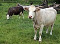 Cows at Great Waltham village, Essex, England 09.JPG 4 684 × 3 431 ; 8,29 Mio
-
 Driveway leading away from Langleys House, Great Waltham - geograph.org.uk - 4647159.jpg 1 024 × 768 ; 213 kio
-
 Dunmow Lane - geograph.org.uk - 3420927.jpg 4 608 × 3 456 ; 3,43 Mio
-
 Dunmow Lane - geograph.org.uk - 3420957.jpg 4 608 × 3 456 ; 3,57 Mio
-
 Dunmow Lane - geograph.org.uk - 5189319.jpg 640 × 428 ; 249 kio
-
 Entering Broads Green - geograph.org.uk - 2602788.jpg 640 × 428 ; 95 kio
-
 Essex Way above Walthambury Brook - geograph.org.uk - 5941639.jpg 5 184 × 3 456 ; 7,63 Mio
-
 Essex Way between Pleshey and Great Waltham - geograph.org.uk - 5942525.jpg 5 184 × 3 456 ; 5,52 Mio
-
 Essex Way heading North East towards Great and Little Leighs - geograph.org.uk - 5943397.jpg 5 184 × 3 456 ; 5,51 Mio
-
 Essex Way heading North East towards the B1008 - geograph.org.uk - 5943398.jpg 5 184 × 3 456 ; 5,68 Mio
-
 Farm track near Hyde Hall - geograph.org.uk - 3358549.jpg 640 × 480 ; 124 kio
-
 Field and hedgerow near Old Shaw's Farm - geograph.org.uk - 6315665.jpg 1 024 × 768 ; 313 kio
-
 Field of Oil-seed Rape - geograph.org.uk - 5189314.jpg 640 × 428 ; 179 kio
-
 Field south of Old Shaw's Farm - geograph.org.uk - 6315517.jpg 1 024 × 768 ; 288 kio
-
 Flooded Gravel Pit near Broads Green - geograph.org.uk - 3421013.jpg 4 608 × 3 456 ; 3,29 Mio
-
 Footpath to Beadle's Hall - geograph.org.uk - 4517373.jpg 1 600 × 1 064 ; 423 kio
-
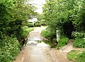 Ford in Bury Lane, Great Waltham - geograph.org.uk - 427904.jpg 640 × 472 ; 124 kio
-
 Ford on Bury Lane - geograph.org.uk - 2602919.jpg 640 × 480 ; 161 kio
-
 Ford on Bury Lane, Great Waltham - geograph.org.uk - 5947098.jpg 3 776 × 2 520 ; 3,29 Mio
-
 Graveyard tree, Great Waltham, Essex, England.JPG 3 648 × 5 472 ; 11,5 Mio
-
 Great Waltham (geograph 3420871).jpg 4 608 × 3 456 ; 3,27 Mio
-
 Great Waltham (geograph 4206433).jpg 4 320 × 3 240 ; 4,61 Mio
-
 Great Waltham - geograph.org.uk - 4611793.jpg 4 234 × 3 122 ; 4,46 Mio
-
 Great Waltham Ford - geograph.org.uk - 3415640.jpg 3 872 × 2 592 ; 2,34 Mio
-
 Great Waltham old fire station (geograph 1910197).jpg 640 × 427 ; 227 kio
-
 Great Waltham, Essex, England - Village hall 01.JPG 5 472 × 3 648 ; 15,85 Mio
-
 Great Waltham, Essex, England - Village hall 02.JPG 5 248 × 3 648 ; 17,76 Mio
-
 Hartford End Brewery - geograph.org.uk - 1052045.jpg 640 × 405 ; 52 kio
-
 Harvested field near liberty Hall - geograph.org.uk - 4611896.jpg 4 258 × 3 156 ; 5,05 Mio
-
 Hedgerow and Fields, Spring - geograph.org.uk - 3420980.jpg 4 608 × 3 456 ; 3,44 Mio
-
 House, Littley Green - geograph.org.uk - 6315503.jpg 1 024 × 768 ; 315 kio
-
 Houses on Bury Road, Great Waltham (geograph 2604761).jpg 640 × 480 ; 104 kio
-
 Houses on Hyde Hall Lane - geograph.org.uk - 6315694.jpg 1 024 × 768 ; 406 kio
-
 Hyde Hall Lane - geograph.org.uk - 6315692.jpg 1 024 × 768 ; 500 kio
-
 Hyde Hall, Essex - geograph.org.uk - 153785.jpg 640 × 480 ; 95 kio
-
 Hyde Hall, near Chatham Green - geograph.org.uk - 4611887.jpg 4 320 × 3 240 ; 5,47 Mio
-
 Lane past High House - geograph.org.uk - 2603326.jpg 640 × 428 ; 124 kio
-
 Langleys (1) - geograph.org.uk - 5942734.jpg 5 184 × 3 456 ; 5,53 Mio
-
 Langleys (2) - geograph.org.uk - 5942793.jpg 5 184 × 3 456 ; 5,03 Mio
-
 Main Road, Great Waltham (geograph 2602855).jpg 640 × 428 ; 78 kio
-
 Mashbury Road near Bards Hall - geograph.org.uk - 4517360.jpg 1 600 × 1 064 ; 753 kio
-
 Oil-seed Rape by Dunmow Lane - geograph.org.uk - 5189312.jpg 640 × 428 ; 183 kio
-
 On the Essex Way nearing Great Waltham, Essex - geograph.org.uk - 4647152.jpg 1 024 × 768 ; 198 kio
-
 Part of the A130, Great Waltham by-pass - geograph.org.uk - 788603.jpg 640 × 480 ; 54 kio
-
 Pleshey Road at Bury Lane junction - geograph.org.uk - 2602888.jpg 640 × 428 ; 95 kio
-
 Ploughed Field beside Bury Lane - geograph.org.uk - 5942539.jpg 5 184 × 3 456 ; 7,65 Mio
-
 Priest's house, Black Chapel - geograph.org.uk - 2604688.jpg 640 × 480 ; 101 kio
-
 Rebuilt house, Luck's Lane - geograph.org.uk - 4349701.jpg 640 × 640 ; 131 kio
-
 Reservoir at Waltham Bury, Great Waltham - geograph.org.uk - 427892.jpg 640 × 490 ; 63 kio
-
 Reservoir near Walthambury Farm - geograph.org.uk - 5947079.jpg 3 776 × 2 520 ; 3,06 Mio
-
 River Chelmer above Absol Bridge - geograph.org.uk - 2592201.jpg 640 × 480 ; 138 kio
-
 River Chelmer below Absol Bridge - geograph.org.uk - 2592202.jpg 640 × 480 ; 169 kio
-
 Road closed - geograph.org.uk - 4611826.jpg 4 222 × 3 104 ; 5,24 Mio
-
 Road Junction near Howe Street - geograph.org.uk - 3420911.jpg 4 608 × 3 456 ; 3,39 Mio
-

-
 Small Reservoir off Bury Lane - geograph.org.uk - 5942533.jpg 5 184 × 3 456 ; 6,35 Mio
-
 St Mary and St Laurence, Great Waltham - geograph.org.uk - 4611810.jpg 4 320 × 3 240 ; 4,47 Mio
-
 St. Mary and St. Laurence Church, Great Waltham - geograph.org.uk - 5942824.jpg 5 184 × 3 456 ; 5,85 Mio
-
 Stables to the north-east of Langleys (geograph 5947159).jpg 3 776 × 2 520 ; 3,07 Mio
-
 Thatched cottage, Ford End - geograph.org.uk - 2603362.jpg 640 × 428 ; 87 kio
-
 The Beehive, Great Waltham - geograph.org.uk - 5947102.jpg 3 776 × 2 520 ; 3,26 Mio
-
 The Essex Way 52 - geograph.org.uk - 1903034.jpg 640 × 426 ; 99 kio
-
 The Essex Way 55 - geograph.org.uk - 1903103.jpg 640 × 426 ; 94 kio
-
 The Essex Way 58, Poppies - geograph.org.uk - 1903895.jpg 640 × 426 ; 117 kio
-
 The Essex Way crossing Chatham Hall Lane - geograph.org.uk - 5947177.jpg 3 776 × 2 520 ; 3,07 Mio
-
 The Essex Way leaving the Langleys Estate - geograph.org.uk - 5947170.jpg 3 776 × 2 520 ; 4,21 Mio
-
 The Guildhall, Great Waltham - geograph.org.uk - 5942920.jpg 5 184 × 3 456 ; 6,61 Mio
-
 The Old Vicarage (geograph 3397420).jpg 800 × 534 ; 145 kio
-
 The River Chelmer by Langleys House, Great Waltham - geograph.org.uk - 4647164.jpg 1 024 × 768 ; 279 kio
-
 The Stables at Langleys - geograph.org.uk - 5942805.jpg 5 184 × 3 456 ; 6,78 Mio
-
 The Walnut Tree, Broads Green - geograph.org.uk - 2602811.jpg 640 × 480 ; 97 kio
-
 Tomb in the churchyard of St Mary and St Laurence - geograph.org.uk - 4611805.jpg 4 320 × 3 240 ; 4,77 Mio
-
 Triangulation pillar S3869 - geograph.org.uk - 3362144.jpg 640 × 480 ; 136 kio
-
 Truck on B1008 - geograph.org.uk - 3358509.jpg 640 × 480 ; 111 kio
-
 View across the Chelmer valley - geograph.org.uk - 2592331.jpg 640 × 480 ; 93 kio
-
 View along lane towards Old Shaw's Farm - geograph.org.uk - 6315525.jpg 1 024 × 768 ; 473 kio
-

-
 View towards Mabb's Farm - geograph.org.uk - 6315512.jpg 1 024 × 768 ; 284 kio
-
 Walkers on Pleshey Road, 1982 - geograph.org.uk - 2460545.jpg 640 × 428 ; 92 kio
-
 Walthambury Brook - geograph.org.uk - 3420849.jpg 4 608 × 3 456 ; 3,49 Mio
-
 Walthambury Brook - geograph.org.uk - 3420863.jpg 4 608 × 3 456 ; 3,41 Mio
-
 Walthambury Brook - geograph.org.uk - 3420997.jpg 3 456 × 4 608 ; 3,54 Mio


_-_geograph.org.uk_-_4622225.jpg)
_-_geograph.org.uk_-_4622442.jpg)


.jpg)
.jpg)


.jpg)


.jpg)


_-_geograph.org.uk_-_5942734.jpg)
_-_geograph.org.uk_-_5942793.jpg)
.jpg)


.jpg)


.jpg)


