Category:Greatham, County Durham
Aller à la navigation
Aller à la recherche
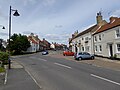
English: Greatham is a village and civil parish in the borough of Hartlepool and the ceremonial county of County Durham, England. It is situated to the south of central Hartlepool.
village britannique | |||||
| Téléverser des médias | |||||
| Nature de l’élément | |||||
|---|---|---|---|---|---|
| Lieu | Hartlepool, Durham, Angleterre du Nord-Est, Angleterre | ||||
 | |||||
Sous-catégories
Cette catégorie comprend 5 sous-catégories, dont les 5 ci-dessous.
G
- Greatham Creek (20 F)
- Greatham railway station (3 F)
- Greatham War Memorial (2 F)
H
- Hospital of God (8 F)
Média dans la catégorie « Greatham, County Durham »
Cette catégorie comprend 93 fichiers, dont les 93 ci-dessous.
-
 A689 southwest of Claxton Bridge - geograph.org.uk - 2640313.jpg 640 × 480 ; 111 kio
-
 Access road for farm near Greatham Village - geograph.org.uk - 1729640.jpg 2 048 × 1 536 ; 694 kio
-
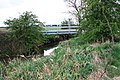 Bridge over Claxton Beck - geograph.org.uk - 1834577.jpg 3 088 × 2 056 ; 4,39 Mio
-
 Car park near Claxton Bridge - geograph.org.uk - 1832749.jpg 3 072 × 2 304 ; 1,47 Mio
-
 Cart Bridge over Greatham Beck - geograph.org.uk - 1737484.jpg 2 048 × 1 536 ; 1,29 Mio
-
 Cemetery entrance Greatham Village - geograph.org.uk - 1578384.jpg 640 × 480 ; 132 kio
-
 Chestnut Row Greatham Village - geograph.org.uk - 1578376.jpg 640 × 474 ; 69 kio
-
 Claxton Beck flowing over the weir - geograph.org.uk - 1834548.jpg 3 088 × 2 056 ; 4,09 Mio
-
 Claxton Beck near Greatham Creek - geograph.org.uk - 1834453.jpg 3 088 × 2 056 ; 2,9 Mio
-
 Claxton Beck near the river tunnel - geograph.org.uk - 1834525.jpg 3 088 × 2 056 ; 2,65 Mio
-
 Claxton Beck river tunnel - geograph.org.uk - 1834478.jpg 3 088 × 2 056 ; 3,75 Mio
-
 Cloff Bridge - geograph.org.uk - 5026089.jpg 640 × 480 ; 344 kio
-
 Cottages, Greatham - geograph.org.uk - 3819723.jpg 640 × 430 ; 40 kio
-
 Crop field near Greatham - geograph.org.uk - 3819873.jpg 640 × 447 ; 75 kio
-
 Dip in A689 crossing Claxton Bridge - geograph.org.uk - 3655042.jpg 3 648 × 2 736 ; 2,46 Mio
-
 Entering Greatham - geograph.org.uk - 3817911.jpg 640 × 480 ; 58 kio
-

-
 Farmland and hedgerow - geograph.org.uk - 3819961.jpg 640 × 480 ; 96 kio
-
 Farmland, West Meadows - geograph.org.uk - 3817908.jpg 640 × 480 ; 50 kio
-
 Field House Farm - geograph.org.uk - 3817907.jpg 640 × 480 ; 69 kio
-
 Fields north of the railway - geograph.org.uk - 3207073.jpg 4 608 × 3 456 ; 4,97 Mio
-
 Footbridge over Greatham Beck - geograph.org.uk - 1737499.jpg 2 048 × 1 536 ; 954 kio
-
 Footpath beside the East Coast Railway - geograph.org.uk - 3819738.jpg 640 × 480 ; 94 kio
-
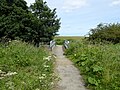
 Footpath off Stockton Road - geograph.org.uk - 3819955.jpg 640 × 480 ; 138 kio
-
 Footpath stile at Marsh House Farm - geograph.org.uk - 1729609.jpg 2 048 × 1 536 ; 985 kio
-
 Grazing beside the East Coast Railway - geograph.org.uk - 3819739.jpg 640 × 480 ; 79 kio
-
 Grazing near Field House Farm - geograph.org.uk - 3817903.jpg 640 × 447 ; 66 kio
-
 Greatham - geograph.org.uk - 3825111.jpg 640 × 480 ; 384 kio
-
 Greatham Beck sluice and footbridge - geograph.org.uk - 1576427.jpg 640 × 480 ; 85 kio
-
 Greatham Creek - geograph.org.uk - 2820650.jpg 640 × 480 ; 58 kio
-
 Greatham Creek - geograph.org.uk - 2820657.jpg 640 × 480 ; 60 kio
-
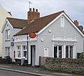
 Greatham Post Office - geograph.org.uk - 3819722.jpg 640 × 480 ; 56 kio
-
 Greatham Signal Box - geograph.org.uk - 3819744.jpg 535 × 640 ; 93 kio
-
 Greatham signal box.jpg 4 160 × 2 655 ; 2,67 Mio
-
 Greatham Tank Farm - geograph.org.uk - 1376885.jpg 640 × 405 ; 31 kio
-
 Greatham Village Community Centre - geograph.org.uk - 1578398.jpg 640 × 480 ; 74 kio
-
 Greatham Village Community Centre - geograph.org.uk - 3819868.jpg 640 × 480 ; 67 kio
-
 Greatham Village Post Office - geograph.org.uk - 1575160.jpg 640 × 582 ; 76 kio
-
 Greatham village, Hartlepool, County Durham.jpg 4 160 × 3 120 ; 2,48 Mio
-
 Greatham, Hartlepool, County Durham.jpg 4 094 × 2 658 ; 3,27 Mio
-
 Greatham, Hartlepool, UK.jpg 4 061 × 2 170 ; 1,13 Mio
-
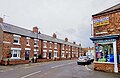
 High Street - geograph.org.uk - 3819952.jpg 640 × 480 ; 53 kio
-
 Horses and feeder at Field House Farm - geograph.org.uk - 5026102.jpg 640 × 480 ; 268 kio
-
 Hub 2, The Innovation Centre - geograph.org.uk - 2728583.jpg 640 × 480 ; 52 kio
-
 Inside the 42" Rolling Mill - geograph.org.uk - 859349.jpg 640 × 426 ; 83 kio
-
 Inside the 84" Rolling Mill - geograph.org.uk - 859366.jpg 640 × 426 ; 71 kio
-
 Junction on A689, Hartlepool - geograph.org.uk - 279238.jpg 640 × 480 ; 61 kio
-
 Level crossing on Marsh House Lane - geograph.org.uk - 3207029.jpg 4 608 × 3 456 ; 4,42 Mio
-
 Level crossing on Marsh House Lane - geograph.org.uk - 3819748.jpg 640 × 462 ; 49 kio
-
 Looking across to Cowpen Marsh - geograph.org.uk - 832090.jpg 640 × 480 ; 101 kio
-
 Looking across towards petrochemical works - geograph.org.uk - 832076.jpg 640 × 480 ; 95 kio
-
 Looking out towards the estuary - geograph.org.uk - 832081.jpg 640 × 480 ; 82 kio
-
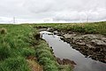
 Looking towards Greatham Creek - geograph.org.uk - 832065.jpg 640 × 480 ; 66 kio
-
 Looking west along the railway - geograph.org.uk - 3207040.jpg 4 608 × 3 456 ; 5,09 Mio
-
 Marsh House Lane - geograph.org.uk - 2820642.jpg 640 × 480 ; 53 kio
-
 Mitsubishi Colt 2011.jpg 2 335 × 1 939 ; 970 kio
-
 Mown field near Greatham - geograph.org.uk - 5026111.jpg 480 × 640 ; 292 kio
-
 National Cycle Network route 14 near Greatham - geograph.org.uk - 5026106.jpg 640 × 480 ; 281 kio
-
 National Cycle route 14 - geograph.org.uk - 3817905.jpg 640 × 480 ; 88 kio
-
 National Cycle route 14 - geograph.org.uk - 3817909.jpg 640 × 480 ; 95 kio
-
 Ordnance Survey Cut Mark - geograph.org.uk - 5909827.jpg 1 024 × 883 ; 318 kio
-
 Ordnance Survey Flush Bracket (S0271) - geograph.org.uk - 5909829.jpg 736 × 1 024 ; 288 kio
-
 Path leading to the Country Park - geograph.org.uk - 3207099.jpg 4 608 × 3 456 ; 5,37 Mio
-
 Pillbox near Greatham - geograph.org.uk - 3819875.jpg 640 × 515 ; 89 kio
-
 Play area Greatham Village - geograph.org.uk - 1578390.jpg 640 × 480 ; 75 kio
-
 Railway bridge near Greatham Creek - geograph.org.uk - 1834439.jpg 3 088 × 2 056 ; 3,84 Mio
-
 Railway junction on the East Coast Railway - geograph.org.uk - 3819733.jpg 640 × 480 ; 61 kio
-
 Road junction at Sapper's Corner - geograph.org.uk - 1832819.jpg 3 072 × 2 304 ; 1,41 Mio
-
 Road junction near Claxton Farm - geograph.org.uk - 1832761.jpg 3 072 × 2 304 ; 1,46 Mio
-
 Road to nowhere - geograph.org.uk - 832055.jpg 640 × 480 ; 67 kio
-
 St John the Baptist church, Greatham - geograph.org.uk - 6431368.jpg 2 048 × 1 152 ; 686 kio
-
 Station Road, Greatham - geograph.org.uk - 3819724.jpg 640 × 480 ; 86 kio
-
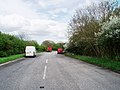
 Stockton Road (A689) - geograph.org.uk - 3819957.jpg 640 × 480 ; 105 kio
-
 Stockton Road (A689) - geograph.org.uk - 3819963.jpg 640 × 480 ; 70 kio
-
 The Bull ^ Dog pub, Greatham - geograph.org.uk - 3819720.jpg 640 × 480 ; 64 kio
-
 The East Coast Railway - geograph.org.uk - 3819743.jpg 480 × 640 ; 100 kio
-
 The Green, Greatham - geograph.org.uk - 4300844.jpg 1 600 × 1 200 ; 320 kio
-
 The Hope ^ Anchor pub, Greatham - geograph.org.uk - 3817912.jpg 640 × 480 ; 61 kio
-
 The signal box at Greatham.jpg 4 160 × 3 120 ; 3,4 Mio
-
 The Smiths Arms in Greatham - geograph.org.uk - 1832808.jpg 3 072 × 2 304 ; 1,46 Mio
-
 The village of Greatham - geograph.org.uk - 5026169.jpg 640 × 480 ; 223 kio
-
 Thorn Tree Lane (track) - geograph.org.uk - 3819728.jpg 640 × 480 ; 59 kio
-
 Thorn Tree Lane - geograph.org.uk - 3819729.jpg 640 × 480 ; 38 kio
-
 Thorn Tree Lane Bridge Greatham Village - geograph.org.uk - 1575855.jpg 640 × 480 ; 89 kio
-
 Tidal sluice gate - geograph.org.uk - 3207057.jpg 4 608 × 3 456 ; 5,22 Mio
-
 Utilities Shed, 84" Plate Mill - geograph.org.uk - 859377.jpg 640 × 426 ; 66 kio
-
 View from the hill in the Country Park - geograph.org.uk - 3207513.jpg 4 608 × 3 456 ; 4,91 Mio
-
 West Meadows - geograph.org.uk - 2008149.jpg 640 × 480 ; 217 kio
-
 West Meadows - geograph.org.uk - 2008164.jpg 640 × 480 ; 223 kio
-
 West Meadows - geograph.org.uk - 215224.jpg 640 × 479 ; 46 kio
-
 Wheat field and pylons - geograph.org.uk - 5026095.jpg 640 × 480 ; 301 kio
-
 Greatham - geograph.org.uk - 215230.jpg 640 × 479 ; 41 kio
-
 Public Footpath Near Greatham Creek - geograph.org.uk - 83395.jpg 640 × 480 ; 65 kio


_-_geograph.org.uk_-_5909829.jpg)


_-_geograph.org.uk_-_3819957.jpg)
_-_geograph.org.uk_-_3819963.jpg)


_-_geograph.org.uk_-_3819728.jpg)


