Category:Greysouthen
Vai alla navigazione
Vai alla ricerca
English: Greysouthen (Pronounced: "Grey-soon") is a small village and civil parish between the towns of Workington and Cockermouth, which are in Cumbria, in the North West of England.
a village located in Allerdale, United Kingdom  | |||||
| Carica un file multimediale | |||||
| Istanza di | |||||
|---|---|---|---|---|---|
| Luogo | Allerdale, Cumbria, Nord Ovest dell'Inghilterra, Inghilterra | ||||
 | |||||
File nella categoria "Greysouthen"
Questa categoria contiene 34 file, indicati di seguito, su un totale di 34.
-
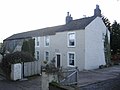 Asby Moor Farmhouse. - geograph.org.uk - 84577.jpg 640 × 480; 69 KB
-
 Curl Beck, looking downstream - geograph.org.uk - 5320374.jpg 2 592 × 1 944; 2,41 MB
-
 Entering Bridgefoot - geograph.org.uk - 4249353.jpg 2 048 × 1 536; 1,83 MB
-
 Entrance into grass field - geograph.org.uk - 4249342.jpg 2 048 × 1 536; 1,38 MB
-
 Fields above the River Derwent - geograph.org.uk - 5320349.jpg 2 592 × 1 944; 937 KB
-
 Former Wesleyan Methodist Chapel, Greysouthen - geograph.org.uk - 4248162.jpg 2 034 × 1 515; 585 KB
-
 Grassland east of Bridgefoot - geograph.org.uk - 4249348.jpg 2 048 × 1 536; 1,19 MB
-
 Grassland on the edge of Greysouthen - geograph.org.uk - 4249344.jpg 2 048 × 1 536; 965 KB
-
 Grassland south of Broughton Cross - geograph.org.uk - 4248142.jpg 2 048 × 1 536; 1,08 MB
-
 Harper's Lane, Greysouthen - geograph.org.uk - 4249340.jpg 1 536 × 2 048; 1,14 MB
-
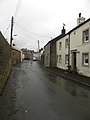
 In Greysouthen village - geograph.org.uk - 5320353.jpg 2 592 × 1 944; 1,61 MB
-
 In Greysouthen village - geograph.org.uk - 5320357.jpg 2 592 × 1 944; 1,62 MB
-
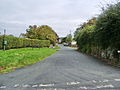
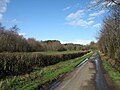 Lane to Greysouthen - geograph.org.uk - 5320361.jpg 2 592 × 1 944; 1,76 MB
-
 Lane to Greysouthen - geograph.org.uk - 5320384.jpg 2 592 × 1 944; 1,99 MB
-
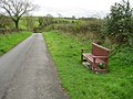 Lanty's Seat On the Overend Road - geograph.org.uk - 2639620.jpg 1 024 × 768; 258 KB
-
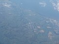 Lillyhall Industrial Estate from the air - geograph.org.uk - 3139330.jpg 3 264 × 2 448; 2,76 MB
-
 Lillyhall Industrial Estate, Cumbria - geograph.org.uk - 3139344.jpg 3 264 × 2 448; 2,76 MB
-
 Lonning from Town Head Farm - geograph.org.uk - 2639503.jpg 1 024 × 768; 231 KB
-
 Main Street, Greysouthen - geograph.org.uk - 4248146.jpg 1 536 × 2 048; 1,01 MB
-
 Main Street, Greysouthen - geograph.org.uk - 4249336.jpg 2 048 × 1 536; 1,11 MB
-
 Overend Road, Greysouthen - geograph.org.uk - 554089.jpg 640 × 480; 183 KB
-
 Phone box in Greysouthen - geograph.org.uk - 4248156.jpg 2 048 × 1 536; 938 KB
-
 Post box, Greysouthen - geograph.org.uk - 4249338.jpg 1 536 × 2 048; 1,33 MB
-
 Private Entrance to Tarn Bank - geograph.org.uk - 79421.jpg 640 × 480; 110 KB
-
 Road junction between Greysouthen and Bridgefoot - geograph.org.uk - 4249346.jpg 2 048 × 1 536; 1,02 MB
-
 Road junction east of Bridgefoot - geograph.org.uk - 4249350.jpg 2 048 × 1 536; 870 KB
-
 Road junction in Greysouthen - geograph.org.uk - 4249328.jpg 2 048 × 1 536; 1,19 MB
-
 Road junction west of Greysouthen - geograph.org.uk - 4249341.jpg 2 048 × 1 536; 1,05 MB
-
 Road sign in Greysouthen - geograph.org.uk - 4249331.jpg 1 536 × 2 048; 1,4 MB
-
 Start of Footpath to Brigham - geograph.org.uk - 2639630.jpg 1 024 × 768; 334 KB
-
 The lane from Dean to Greysouthen - geograph.org.uk - 5320396.jpg 2 592 × 1 944; 1,36 MB
-
 The Old Punchbowl Pub in Greysouthen.jpg 1 024 × 768; 193 KB
-
 The road to Bridgefoot - geograph.org.uk - 5320343.jpg 2 592 × 1 944; 1,16 MB
-
 Went Meadows, Greysouthen - geograph.org.uk - 554087.jpg 640 × 480; 213 KB


