Category:Grimentz
Vai alla navigazione
Vai alla ricerca
Località del comune di Anniviers   | |||||
| Carica un file multimediale | |||||
| Istanza di |
| ||||
|---|---|---|---|---|---|
| Luogo | Anniviers, distretto di Sierre, Vallese, Svizzera | ||||
| Designazione del patrimonio | |||||
| Superficie |
| ||||
| Altezza sul mare |
| ||||
| Sostituito da |
| ||||
| sito web ufficiale | |||||
 | |||||
Sottocategorie
Questa categoria contiene le 7 sottocategorie indicate di seguito, su un totale di 7.
File nella categoria "Grimentz"
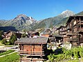
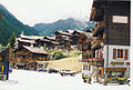
Questa categoria contiene 93 file, indicati di seguito, su un totale di 93.
-
 Bendola - septembre 2022.jpg 5 284 × 3 963; 17,34 MB
-
 Bendola.jpg 6 240 × 4 160; 21,65 MB
-
 Bewolkte gletsjer boven Lac de Moiry.JPG 5 027 × 3 452; 11,68 MB
-
 Blick auf Grimentz.JPG 3 072 × 2 304; 4,91 MB
-
 Chandolin (Switzerland, November 2020) - 94 (50898934256).jpg 4 896 × 3 672; 12,9 MB
-
 Chandolin (Switzerland, November 2020) - 95 (50898221708).jpg 4 896 × 3 672; 17,16 MB
-
 Chandolin (Switzerland, November 2020) - 96 (50898222128).jpg 4 896 × 3 672; 13,65 MB
-
 CHE Grimentz Flag.svg 600 × 600; 7 KB
-
 ETH-BIB-Grimentz, Blumen-Gasse von Südwest-Dia 247-13867.tif 2 942 × 3 439; 29,08 MB
-
 ETH-BIB-Grimentz, Hauptgasse von Nordost-Dia 247-13861.tif 2 947 × 3 405; 28,84 MB
-
 ETH-BIB-Grimentz, Hauptgasse von Südwest-Dia 247-13862.tif 3 684 × 2 838; 29,99 MB
-
 ETH-BIB-Grimentz, Kupfer-Hütte von Nordost-Dia 247-13865.tif 3 634 × 2 744; 9,6 MB
-
 ETH-BIB-Grimentz, von Süden-Dia 247-13864.tif 3 616 × 2 753; 28,58 MB
-
 ETH-BIB-Grimentz-LBS H1-029057.tif 6 530 × 4 612; 86,21 MB
-
 ETH-BIB-Grimentz-LBS H1-029111.tif 6 710 × 4 794; 92,08 MB
-
 ETH-BIB-Grimentz-LBS H1-029112.tif 6 665 × 4 783; 91,25 MB
-
 ETH-BIB-Grimentz-LBS H1-029113.tif 6 674 × 4 758; 90,89 MB
-
 ETH-BIB-Grimentz-LBS H1-029114.tif 6 667 × 4 729; 90,24 MB
-
 Europese lariks (Larix decidua) langs het voetpad tussen Grimentz en Vercorin 02.jpg 5 184 × 3 224; 14,9 MB
-
 Europese lariks (Larix decidua) langs het voetpad tussen Grimentz en Vercorin.jpg 5 184 × 3 456; 18,12 MB
-
 Europese larix (Larix decidua) langs het voetpad tussen Grimentz en Vercorin 01.JPG 2 259 × 2 624; 5,13 MB
-
 Europese larix (Larix decidua) langs het voetpad tussen Grimentz en Vercorin 02.JPG 5 184 × 3 030; 11,24 MB
-
 Europese larix (Larix decidua) langs het voetpad tussen Grimentz en Vercorin 03.JPG 5 184 × 3 456; 14,01 MB
-
 Europese larix (Larix decidua) langs het voetpad tussen Grimentz en Vercorin 04.JPG 5 184 × 3 456; 13,46 MB
-
 Europese larix (Larix decidua) langs het voetpad tussen Grimentz en Vercorin 05.JPG 5 184 × 3 456; 12,52 MB
-
 Europese larix (Larix decidua) langs het voetpad tussen Grimentz en Vercorin 06.JPG 5 059 × 3 385; 12,25 MB
-
 Europese larix (Larix decidua) langs het voetpad tussen Grimentz en Vercorin 07.JPG 5 184 × 3 456; 12,79 MB
-
 Flag of Grimentz.gif 216 × 216; 3 KB
-
 CHE Grimentz COA.svg 500 × 600; 2 KB
-
 Grimentz - août 2022.jpg 5 474 × 3 079; 13,03 MB
-
 Grimentz - septembre 2022.jpg 6 240 × 4 160; 18,72 MB
-
 Grimentz - Tourism in Valais.jpg 5 616 × 3 744; 16,85 MB
-
 Grimentz - Valais (1).jpg 2 676 × 3 879; 2,14 MB
-
 Grimentz 20090716 170306.jpg 2 784 × 1 568; 1,1 MB
-
 Grimentz houses.jpg 1 414 × 1 060; 422 KB
-
 Grimentz Marinda.jpg 2 048 × 1 536; 2,06 MB
-
 Grimentz ruelle.jpg 1 920 × 2 560; 2,83 MB
-
 Grimentz VS (cropped).jpg 3 752 × 536; 2,71 MB
-
 Grimentz VS.jpg 4 000 × 2 250; 12,21 MB
-
 Grimentz's bakery, on summer - panoramio.jpg 3 672 × 4 896; 6,55 MB
-
 Grimentz-Eglise.jpg 1 200 × 800; 1,18 MB
-
 Grimentz-Expansion immobilière.jpg 3 648 × 2 736; 3,23 MB
-
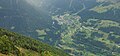
 Grimentz-Moiry.jpg 1 200 × 800; 888 KB
-
 Grimentz-Pierre.jpg 1 200 × 800; 1,54 MB
-
 Grimentz-Raccard (1).jpg 3 648 × 2 736; 4,67 MB
-
 Grimentz-Raccard (2).jpg 3 648 × 2 736; 3,02 MB
-
 Grimentz-Rue.jpg 800 × 1 200; 1,01 MB
-
 Grimentz-Village.jpg 800 × 1 200; 1,4 MB
-
 Grimentz-VS.jpg 1 200 × 800; 1,27 MB
-
 Grimentz-Vue au crépuscule (1).jpg 3 648 × 2 736; 2,13 MB
-
 Grimentz-Vue au crépuscule (2).jpg 3 648 × 2 736; 2,02 MB
-
 Grimentz-Vue au crépuscule (3).jpg 3 648 × 2 736; 2,22 MB
-
 Grimentz.jpg 2 608 × 1 952; 3,56 MB
-
 Grimentz.png 200 × 212; 5 KB
-
 Grimentz01.jpg 776 × 1 114; 257 KB
-
 Grimentz02.jpg 1 161 × 784; 393 KB
-
 Grimentz201910231131.jpg 2 136 × 3 216; 3,47 MB
-
 Grimentz201910231133.jpg 2 136 × 3 216; 2,93 MB
-
 Grimentz201910231144.jpg 3 216 × 2 136; 2,39 MB
-
 Grimentz201910231150.jpg 3 216 × 2 136; 3,41 MB
-
 Grimentz201910231326.jpg 2 136 × 3 216; 3,7 MB
-
 Hochebene von Lona.JPG 3 072 × 2 304; 4,47 MB
-
 Hôtel Weisshorn, (2337m). Zicht op Grimentz (1570 m) in het Walliser Val d'Anniviers 01.JPG 5 184 × 3 456; 18,65 MB
-
 Hôtel Weisshorn, (2337m). Zicht op Grimentz (1570 m) in het Walliser Val d'Anniviers 02.JPG 5 184 × 3 456; 16,48 MB
-
 L'ancienne chapelle de Grimentz.jpg 4 080 × 3 060; 3,22 MB
-
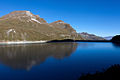
 Lac de Châteaupré.jpg 7 712 × 4 352; 13,22 MB
-
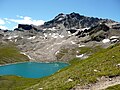 Lac de Lona.JPG 3 072 × 2 304; 4,95 MB
-
 Lac de Moiry (2250 m). Pad richting Grimentz 01.JPG 4 339 × 3 148; 10,33 MB
-
 Lac de Moiry (2250 m). Pad richting Grimentz 02.JPG 5 184 × 3 456; 12,92 MB
-
 Lac de Moiry's sight toward "Pointe de Lona" on summer - panoramio.jpg 4 896 × 2 754; 6,36 MB
-
 Lac de Moiry, (2250 m) Grimentz, Zwitserland 01.JPG 5 184 × 3 456; 13,56 MB
-
 Lac de Moiry, (2250 m) Grimentz, Zwitserland 02.JPG 5 184 × 3 456; 15,53 MB
-
 Le Mayen a Grimentz par msum - panoramio.jpg 1 600 × 1 200; 598 KB
-
 Locatie, voetpad tussen Grimentz en Vercorin 010.JPG 5 184 × 3 456; 14,36 MB
-
 Locatie, voetpad tussen Grimentz en Vercorin 011.JPG 2 589 × 3 452; 8,59 MB
-
 Locatie, voetpad tussen Grimentz en Vercorin 08.JPG 5 184 × 3 456; 17,27 MB
-
 Locatie, voetpad tussen Grimentz en Vercorin 09.JPG 2 246 × 1 129; 2,11 MB
-
 Moiry20220716104813.jpg 4 032 × 3 024; 6,87 MB
-
 Raccard in Grimentz.jpg 2 048 × 1 536; 650 KB
-
 Sasseneire's ridge's sight to Sasseneire - panoramio.jpg 3 000 × 4 000; 5,34 MB
-
 Sasseneire's sight to "Grand Cornier glacier" - panoramio.jpg 4 000 × 3 000; 4,82 MB
-
 Sasseneire's sight to "La Dent Blanche" - panoramio.jpg 4 000 × 3 000; 5,09 MB
-
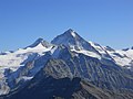
 Sasseneire's sight to "Weisshorn" - panoramio.jpg 4 000 × 3 000; 4,72 MB
-

-
 Sorbus aucuparia in Grimentz.jpg 5 026 × 3 769; 11,2 MB
-
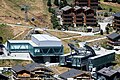 Téléphérique et télécabine de Grimentz.jpg 6 240 × 4 160; 23,26 MB
-
-

-
 VSGrimentz1.jpg 3 003 × 2 101; 1,31 MB
-
 VSGrimentz2.jpg 2 148 × 3 300; 1,19 MB
-
 VSGrimentz3.jpg 3 087 × 2 124; 1,11 MB
-
 Wolkensluiers tussen de bergen boven Lac de Moiry 01.JPG 5 184 × 3 456; 10,02 MB
-
 Wolkensluiers tussen de bergen boven Lac de Moiry 02.JPG 5 184 × 3 456; 10,94 MB


_-_94_(50898934256).jpg)
_-_95_(50898221708).jpg)
_-_96_(50898222128).jpg)

_langs_het_voetpad_tussen_Grimentz_en_Vercorin_02.jpg)
_langs_het_voetpad_tussen_Grimentz_en_Vercorin.jpg)
_langs_het_voetpad_tussen_Grimentz_en_Vercorin_01.JPG)
_langs_het_voetpad_tussen_Grimentz_en_Vercorin_02.JPG)
_langs_het_voetpad_tussen_Grimentz_en_Vercorin_03.JPG)
_langs_het_voetpad_tussen_Grimentz_en_Vercorin_04.JPG)
_langs_het_voetpad_tussen_Grimentz_en_Vercorin_05.JPG)
_langs_het_voetpad_tussen_Grimentz_en_Vercorin_06.JPG)
_langs_het_voetpad_tussen_Grimentz_en_Vercorin_07.JPG)


.jpg)


.jpg)
.jpg)


.jpg)
.jpg)
.jpg)


._Zicht_op_Grimentz_(1570_m)_in_het_Walliser_Val_d%27Anniviers_01.JPG)
._Zicht_op_Grimentz_(1570_m)_in_het_Walliser_Val_d%27Anniviers_02.JPG)


._Pad_richting_Grimentz_01.JPG)
._Pad_richting_Grimentz_02.JPG)

_Grimentz,_Zwitserland_01.JPG)
_Grimentz,_Zwitserland_02.JPG)


._Zicht_op_Grimentz_(1570_m)_in_het_Walliser_Val_d%27Anniviers_01.jpg)
._Zicht_op_Grimentz_(1570_m)_in_het_Walliser_Val_d%27Anniviers_02.jpg)


.jpg)