Category:Grimsay
Zur Navigation springen
Zur Suche springen
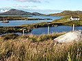
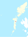
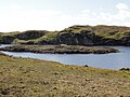
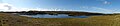
tidal island in the Outer Hebrides of Scotland, northeast of Benbecula   | |||||
| Medium hochladen | |||||
| Ist ein(e) | |||||
|---|---|---|---|---|---|
| Ist Teil von | |||||
| Ort | Äußere Hebriden, Schottland | ||||
| Liegt am oder im Gewässer |
| ||||
| Einwohnerzahl |
| ||||
| Fläche |
| ||||
| Höhe über dem Meeresspiegel |
| ||||
| Verschieden von | |||||
 | |||||

Unterkategorien
Diese Kategorie enthält folgende Unterkategorie:
In Klammern die Anzahl der enthaltenen Kategorien (K), Seiten (S), Dateien (D)
B
- Bàgh Mòr (2 D)
Medien in der Kategorie „Grimsay“
Folgende 110 Dateien sind in dieser Kategorie, von 110 insgesamt.
-
 Bagh Mor - geograph.org.uk - 1548225.jpg 640 × 480; 123 KB
-
 Baghmor.jpg 640 × 431; 260 KB
-
 Boathouse - geograph.org.uk - 1341473.jpg 640 × 361; 211 KB
-
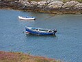
 Boats at Kallin - geograph.org.uk - 858044.jpg 640 × 300; 50 KB
-
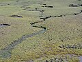
 Bog, Grimsay - geograph.org.uk - 3221781.jpg 640 × 360; 197 KB
-
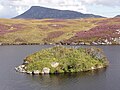
 Bàgh Mòr, Grimsay-Griomasaigh - geograph.org.uk - 855889.jpg 640 × 480; 62 KB
-
 Bàgh Sgotbheinn - geograph.org.uk - 1341486.jpg 546 × 640; 348 KB
-
 Ceallan Harbour - geograph.org.uk - 1435474.jpg 640 × 427; 179 KB
-
 Ceallan Harbour Griomasaigh - geograph.org.uk - 1523378.jpg 640 × 426; 269 KB
-
 Croft Buildings - geograph.org.uk - 448475.jpg 640 × 480; 82 KB
-
 Field, Ceannaraigh - geograph.org.uk - 3221760.jpg 640 × 360; 218 KB
-
 Free Church of Scotland on Grimsay - geograph.org.uk - 1202137.jpg 640 × 480; 63 KB
-
 Grimsay from Eaval - geograph.org.uk - 857225.jpg 640 × 491; 82 KB
-
 Grimsay Landscape Ruabhal.jpg 640 × 359; 42 KB
-
 Grimsay OH.svg 1.083 × 1.424; 2,36 MB
-
 Grimsay Road, Grimsay Island - geograph.org.uk - 526504.jpg 640 × 482; 81 KB
-
 Grimsay South East Benbecula OH.svg 1.083 × 1.424; 2,36 MB
-
Grimsay wheelhouse.ogv 1 min 45 s, 960 × 540; 49,68 MB
-
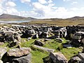
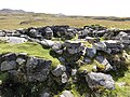
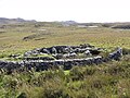
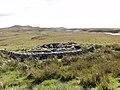
 Grimsaywheelhouse.jpg 640 × 480; 118 KB
-
 Harbour at Ceallan - geograph.org.uk - 1341466.jpg 640 × 480; 306 KB
-
 Inlet, Ceannaraigh - geograph.org.uk - 3221765.jpg 640 × 360; 218 KB
-
 Kallin Harbour - geograph.org.uk - 2707818.jpg 3.872 × 2.592; 2,24 MB
-
 Kallin Harbour - geograph.org.uk - 3221775.jpg 640 × 360; 216 KB
-
 Kallin harbour from the sea - geograph.org.uk - 2069730.jpg 4.000 × 3.000; 2,37 MB
-
 Kallin Harbour, Grimsay - geograph.org.uk - 6491040.jpg 1.799 × 1.199; 414 KB
-
 Kallin, postbox № HS6 25 - geograph.org.uk - 3112914.jpg 640 × 480; 57 KB
-
 Loch Hornaraigh - geograph.org.uk - 1437297.jpg 640 × 480; 171 KB
-
 Loch, Rubha Dubh - geograph.org.uk - 3221754.jpg 640 × 360; 257 KB
-
 Lochan on Griomasagh - geograph.org.uk - 1341431.jpg 480 × 640; 252 KB
-
 Millions of scallop shells - geograph.org.uk - 1438086.jpg 640 × 480; 227 KB
-
 Near Kallin - geograph.org.uk - 3221772.jpg 640 × 360; 212 KB
-
 North Uist Fae003.jpg 3.648 × 2.736; 3,98 MB
-
 North Uist Fae004.jpg 3.648 × 2.736; 4,22 MB
-
 North Uist Fae005.jpg 3.648 × 2.736; 4,21 MB
-
 North Uist Fae006.jpg 4.912 × 1.080; 2,41 MB
-
 North Uist Fae007.jpg 3.648 × 2.736; 4,25 MB
-
 North Uist Fae008.jpg 3.648 × 2.736; 4,3 MB
-
 North Uist Fae009.jpg 3.648 × 2.736; 4,25 MB
-
 North Uist Fae010.jpg 3.648 × 2.736; 4,17 MB
-
 North Uist Fae011.jpg 3.648 × 2.736; 4,34 MB
-
 North Uist Fae012.jpg 3.648 × 2.736; 4,26 MB
-
 North Uist Fae013.jpg 3.648 × 2.736; 4,3 MB
-
 North Uist Fae014.jpg 3.648 × 2.736; 4,27 MB
-
 North Uist Fae015.jpg 3.648 × 2.736; 4,37 MB
-
 North Uist Fae016.jpg 3.648 × 2.736; 4,18 MB
-
 North Uist Fae017.jpg 3.648 × 2.736; 4,23 MB
-
 North Uist Fae018.jpg 3.648 × 2.736; 4,3 MB
-
 North Uist Fae019.jpg 3.648 × 2.736; 4,27 MB
-
 North Uist Fae020.jpg 3.648 × 2.736; 4,26 MB
-
 North Uist Fae021.jpg 2.736 × 3.648; 4,28 MB
-
 North Uist Fae022.jpg 3.648 × 2.736; 4,24 MB
-
 North Uist Fae023.jpg 3.648 × 2.736; 4,21 MB
-
 North Uist Fae024.jpg 3.648 × 2.736; 4,34 MB
-
 North Uist Fae025.jpg 3.424 × 1.920; 3,54 MB
-
 North Uist Fae026.jpg 3.424 × 1.920; 3,63 MB
-
 North Uist Fae027.jpg 3.648 × 2.736; 4,16 MB
-
 North Uist Fae028.jpg 3.648 × 2.736; 4,28 MB
-
 North Uist Fae029.jpg 3.648 × 2.736; 4,24 MB
-
 North Uist Fae030.jpg 3.648 × 2.736; 4,24 MB
-
 North Uist Fae031.jpg 3.648 × 2.736; 4,25 MB
-
 North Uist Fae032.jpg 3.648 × 2.736; 4,24 MB
-
 North Uist Fae033.jpg 3.648 × 2.736; 4,32 MB
-
 North Uist Fae034.jpg 3.648 × 2.736; 4,2 MB
-
 North Uist Fae035.jpg 3.648 × 2.736; 4,21 MB
-
 North Uist Fae036.jpg 3.648 × 2.736; 4,27 MB
-
 North Uist Fae037.jpg 3.648 × 2.736; 4,19 MB
-
 North Uist Fae038.jpg 3.648 × 2.736; 4,27 MB
-
 North Uist Fae039.jpg 3.648 × 2.736; 4,35 MB
-
 North Uist Fae040.jpg 4.912 × 1.080; 2,47 MB
-
 North Uist Fae041.jpg 3.648 × 2.736; 4,17 MB
-
 North Uist Fae042.jpg 3.648 × 2.736; 4,3 MB
-
 North Uist Fae043.jpg 3.648 × 2.736; 4,17 MB
-
 North Uist Fae044.jpg 3.648 × 2.736; 4,34 MB
-
 North Uist Fae045.jpg 3.648 × 2.736; 4,37 MB
-
 North Uist Fae046.jpg 3.648 × 2.736; 4,12 MB
-
 North Uist Fae047.jpg 4.912 × 1.080; 2,36 MB
-
 North Uist Fae048.jpg 3.648 × 2.736; 4,32 MB
-
 North Uist Fae049.jpg 3.648 × 2.736; 4,14 MB
-
 North Uist Fae050.jpg 3.648 × 2.736; 3,31 MB
-
 North Uist Fae051.jpg 3.648 × 2.736; 4,31 MB
-
 North Uist Fae052.jpg 3.648 × 2.736; 4,33 MB
-
 North Uist Fae055.jpg 2.736 × 3.648; 3,57 MB
-
 North Uist Fae056.jpg 3.648 × 2.736; 4,33 MB
-
 North Uist Fae057.jpg 3.648 × 2.736; 4,27 MB
-
 North Uist Fae058.jpg 3.648 × 2.736; 4,2 MB
-
 North Uist Fae059.jpg 3.648 × 2.736; 4,19 MB
-
 North Uist Fae060.jpg 3.648 × 2.736; 4,16 MB
-
 North Uist Fae061.jpg 3.648 × 2.736; 4,26 MB
-
 North Uist Fae062.jpg 3.648 × 2.736; 4,27 MB
-
 North Uist Fae063.jpg 3.648 × 2.736; 3,89 MB
-
 North Uist Fae064.jpg 3.648 × 2.736; 4,18 MB
-
 North Uist Fae065.jpg 3.648 × 2.736; 4,1 MB
-
 North Uist Fae066.jpg 3.648 × 2.736; 4,06 MB
-
 North Uist Fae067.jpg 3.648 × 2.736; 4,32 MB
-
 North Uist Fae068.jpg 3.648 × 2.736; 4,35 MB
-
 North Uist Fae069.jpg 3.648 × 2.736; 4,19 MB
-
 North Uist Fae070.jpg 3.648 × 2.736; 3,72 MB
-
 North Uist Fae071.jpg 3.648 × 2.736; 4,32 MB
-
 Post Box on Grimsay - geograph.org.uk - 855867.jpg 640 × 417; 60 KB
-
 Private road and cattle grid near Kallin - geograph.org.uk - 1523368.jpg 640 × 426; 259 KB
-
 Road on Grimsay - geograph.org.uk - 3221734.jpg 640 × 360; 217 KB
-
 Road sign, Grimsay - geograph.org.uk - 855861.jpg 640 × 480; 80 KB
-
 Small harbour at Bagh Mor, Griomasaigh - geograph.org.uk - 1523376.jpg 640 × 426; 271 KB
-
 The boat shed - geograph.org.uk - 2045171.jpg 1.635 × 2.178; 626 KB
-
 The Stelimar at Kallin harbour - geograph.org.uk - 2045210.jpg 2.176 × 2.305; 882 KB
-
 Tidal flats and salt marsh on Grimsay - geograph.org.uk - 2043740.jpg 3.221 × 2.145; 1,23 MB
-
 Tidal Flats on South Uist - panoramio.jpg 4.320 × 3.240; 2,91 MB
-
 UK Grimsay.PNG 648 × 584; 19 KB
-
 Vallastrome - geograph.org.uk - 2045184.jpg 2.978 × 1.632; 942 KB
-
 Àird nan Srùban - geograph.org.uk - 3221642.jpg 640 × 360; 222 KB


