Category:Grube (Potsdam)
Vai alla navigazione
Vai alla ricerca
quartiere della città tedesca di Potsdam  | |||||
| Carica un file multimediale | |||||
| Istanza di |
| ||||
|---|---|---|---|---|---|
| Luogo |
| ||||
| Popolazione |
| ||||
| Superficie |
| ||||
| Altezza sul mare |
| ||||
 | |||||
Sottocategorie
Questa categoria contiene un'unica sottocategoria, indicata di seguito.
D
- Dorfkirche Grube (Potsdam) (8 F)
File nella categoria "Grube (Potsdam)"
Questa categoria contiene 18 file, indicati di seguito, su un totale di 18.
-
 BfBornimGrubeEG.jpg 4 896 × 3 672; 7,75 MB
-
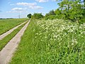 Golm - Feldweg Nach Grube (Footpath to Grube) - geo.hlipp.de - 36895.jpg 640 × 480; 123 KB
-
 Grube - Gruene Oase (Green Oasis) - geo.hlipp.de - 36889.jpg 640 × 480; 151 KB
-

-
 Grube - Nattwerder Weg - geo.hlipp.de - 36888.jpg 640 × 480; 110 KB
-
 Grube - Oelfelder (Oilfields) - geo.hlipp.de - 36892.jpg 640 × 480; 123 KB
-
 Grube - Potsdamer Strasse - geo.hlipp.de - 36883.jpg 640 × 480; 132 KB
-
 Grube - Rapsfeld ("Oil Field") - geo.hlipp.de - 36890.jpg 640 × 480; 115 KB
-
 Grube - Wublitzbruecke (Wublitz Bridge) - geo.hlipp.de - 36885.jpg 640 × 480; 112 KB
-
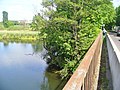
 Grube - Wublitzufer (Wublitz River Bank) - geo.hlipp.de - 36882.jpg 640 × 480; 67 KB
-
 Grube am Bahnhof nr 1.jpg 4 000 × 3 000; 4,6 MB
-
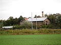 Grube Gebäude 1.jpg 4 000 × 3 000; 4,33 MB
-
 Grube Gebäude 2.jpg 4 000 × 3 000; 4,64 MB
-
 Grube Kuhtränke 1.jpg 4 896 × 3 264; 8,05 MB
-
 Grube Kuhtränke 2.jpg 4 896 × 3 264; 8,14 MB
-
 Grube Potsdam Urmesstischblatt 3543-1839.png 1 665 × 1 253; 6,16 MB
-
 Landschaft Grube 1.jpg 4 000 × 3 000; 4,52 MB
-
 Potsdam-Grube - Neue Dorfstrasse - geo.hlipp.de - 36887.jpg 480 × 640; 103 KB

_-_geo.hlipp.de_-_36895.jpg)
_-_geo.hlipp.de_-_36889.jpg)
_-_geo.hlipp.de_-_36891.jpg)

_-_geo.hlipp.de_-_36892.jpg)

_-_geo.hlipp.de_-_36890.jpg)
_-_geo.hlipp.de_-_36885.jpg)
_-_geo.hlipp.de_-_36882.jpg)


