Category:Gruinard Island
Aller à la navigation
Aller à la recherche
île britannique située sur la côte occidentale de l'Écosse  | |||||
| Téléverser des médias | |||||
| Nature de l’élément | |||||
|---|---|---|---|---|---|
| Partie de | |||||
| Lieu | Highland, Hautes-Terres écossaises, Écosse | ||||
| Baigné par | |||||
| Largeur |
| ||||
| Longueur |
| ||||
| Population |
| ||||
| Superficie |
| ||||
 | |||||
Média dans la catégorie « Gruinard Island »
Cette catégorie comprend 26 fichiers, dont les 26 ci-dessous.
-
 A carpet of bluebells on Gruinard Island. - geograph.org.uk - 1305517.jpg 640 × 480 ; 159 kio
-
 A View Of Gruinard Island - geograph.org.uk - 4026053.jpg 2 560 × 1 920 ; 2,63 Mio
-
 A View Towards Sròn a' Mhoil - geograph.org.uk - 4026049.jpg 2 560 × 1 920 ; 2,54 Mio
-
 Admiralty Chart No 2500 Approaches to Loch Broom and to Little Loch Broom, Published 1911.jpg 16 035 × 10 822 ; 63,83 Mio
-
 Admiralty Chart No 2500 Lochs Broom, Published 1857.jpg 10 192 × 6 584 ; 26,71 Mio
-
 An Eilid, Gruinard Island - geograph.org.uk - 4026042.jpg 2 560 × 1 920 ; 2,78 Mio
-
 Coast below Tòrr Mòr - geograph.org.uk - 836655.jpg 640 × 480 ; 95 kio
-
 Creag Mhor. - geograph.org.uk - 1255331.jpg 640 × 480 ; 148 kio
-
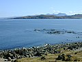 Gruinard Bay - geograph.org.uk - 638370.jpg 800 × 600 ; 201 kio
-
 Gruinard Island - 1981 - geograph.org.uk - 2252447.jpg 2 272 × 1 514 ; 455 kio
-
 Gruinard Island - Aird nan Caorach - geograph.org.uk - 3872409.jpg 640 × 462 ; 86 kio
-
 Gruinard Island - east coast - geograph.org.uk - 3872414.jpg 640 × 468 ; 76 kio
-
 Gruinard Island - geograph.org.uk - 2269452.jpg 640 × 424 ; 24 kio
-
 Gruinard Island - south-west coast - geograph.org.uk - 3872404.jpg 640 × 434 ; 86 kio
-
 Gruinard Island - south-west coast - geograph.org.uk - 3872406.jpg 640 × 370 ; 107 kio
-
 Gruinard Island - Stirk Rock - geograph.org.uk - 3872395.jpg 640 × 480 ; 73 kio
-
 Gruinard Island - west coast - geograph.org.uk - 3872399.jpg 640 × 384 ; 104 kio
-
 Gruinard Island from near Laide - geograph.org.uk - 213533.jpg 640 × 480 ; 139 kio
-
 Gruinard Island from the north - geograph.org.uk - 3872393.jpg 640 × 505 ; 83 kio
-
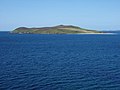
 Gruinard Island.jpg 3 005 × 1 929 ; 1,09 Mio
-
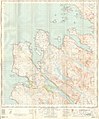 Ordnance Survey One-Inch Sheet 19 Gairloch, Published 1958.jpg 8 238 × 9 933 ; 7,8 Mio
-
 South east from Rubha Beag - geograph.org.uk - 921095.jpg 640 × 346 ; 24 kio
-

-
 View towards Gruinard Island - geograph.org.uk - 836894.jpg 640 × 480 ; 52 kio
-
 Gruinard Island - geograph.org.uk - 94985.jpg 640 × 359 ; 48 kio
-
 Gruinard River - geograph.org.uk - 7309.jpg 406 × 622 ; 205 kio


