Category:Guestling
Aller à la navigation
Aller à la recherche
localité britannique  | |||||
| Téléverser des médias | |||||
| Nature de l’élément | |||||
|---|---|---|---|---|---|
| Lieu | Rother, East Sussex, Sussex de l'Est, Angleterre du Sud-Est, Angleterre | ||||
| Superficie |
| ||||
| Réputé identique à | Guestling (page en doublon, paroisse civile) | ||||
 | |||||
Sous-catégories
Cette catégorie comprend 5 sous-catégories, dont les 5 ci-dessous.
Média dans la catégorie « Guestling »
Cette catégorie comprend 338 fichiers, dont les 200 ci-dessous.
(page précédente) (page suivante)-
 1066 Country Walk below Lower Snailham - geograph.org.uk - 3448451.jpg 4 320 × 3 240 ; 6,17 Mio
-
 1066 Country Walk crosses the Marshlink Line - geograph.org.uk - 2515184.jpg 640 × 430 ; 146 kio
-
 1066 Country Walk follows Fourteen Acre Lane - geograph.org.uk - 2515202.jpg 640 × 430 ; 67 kio
-
 1066 Country Walk from Lower Snailham - geograph.org.uk - 2575202.jpg 640 × 430 ; 133 kio
-
 1066 Country Walk in the Brede Valley - geograph.org.uk - 2575138.jpg 640 × 430 ; 90 kio
-
 1066 Country Walk in the Brede Valley - geograph.org.uk - 2575147.jpg 640 × 430 ; 82 kio
-
 1066 Country Walk in the Brede Valley - geograph.org.uk - 2575166.jpg 640 × 430 ; 99 kio
-
 1066 Country Walk in the Brede Valley - geograph.org.uk - 2575169.jpg 640 × 430 ; 89 kio
-
 1066 Country Walk leaves Pett Rd, Friar's Hill - geograph.org.uk - 1854976.jpg 640 × 430 ; 207 kio
-
 1066 Country Walk on the Brede Level - geograph.org.uk - 3448423.jpg 4 320 × 3 240 ; 6,27 Mio
-
 1066 Country Walk sign, Fourteen Acre Lane - geograph.org.uk - 2515199.jpg 640 × 430 ; 101 kio
-
 1066 Country Walk sign, Lower Snailham - geograph.org.uk - 2575181.jpg 640 × 430 ; 93 kio
-
 1066 Country Walk sign, Pett Rd, Friar's Hill - geograph.org.uk - 1854963.jpg 640 × 430 ; 221 kio
-
 1066 Country Walk, Lower Lidham Hill Farm - geograph.org.uk - 2568692.jpg 640 × 430 ; 112 kio
-
 1066 Country Walk, Lower Snailham - geograph.org.uk - 2575186.jpg 640 × 430 ; 92 kio
-
 A259 - geograph.org.uk - 5831016.jpg 1 024 × 681 ; 260 kio
-
 A259 - geograph.org.uk - 5831027.jpg 1 024 × 681 ; 150 kio
-
 A259 - geograph.org.uk - 5831961.jpg 778 × 1 024 ; 298 kio
-
 A259 descends Bachelor's Bump - geograph.org.uk - 3003097.jpg 3 648 × 2 736 ; 1,97 Mio
-
 A259 east of Copshall Farm - geograph.org.uk - 3001565.jpg 3 648 × 2 634 ; 1,64 Mio
-
 A259 enters Guestling Thorn - geograph.org.uk - 3001558.jpg 3 438 × 2 524 ; 1,05 Mio
-
 A259 Guestling Green - geograph.org.uk - 3118529.jpg 4 320 × 3 240 ; 4,41 Mio
-
 A259 Guestling Green - geograph.org.uk - 3118530.jpg 4 320 × 3 240 ; 4,36 Mio
-
 A259 junction with Chapel Lane - geograph.org.uk - 3003086.jpg 3 574 × 2 668 ; 1,38 Mio
-
 A259 junction with Church Lane - geograph.org.uk - 3003077.jpg 3 648 × 2 681 ; 1,37 Mio
-
 A259 passes Buckswood School - geograph.org.uk - 3001582.jpg 3 605 × 2 681 ; 1,79 Mio
-
 A259 south of Lord's Wood - geograph.org.uk - 3003089.jpg 3 648 × 2 736 ; 2,31 Mio
-
 A259, Bachelor's Bump - geograph.org.uk - 3118527.jpg 4 320 × 3 240 ; 4,15 Mio
-
 A259, Batchelor's Bump - geograph.org.uk - 5831030.jpg 1 024 × 915 ; 233 kio
-
 A259, Guestling Green - geograph.org.uk - 5831025.jpg 574 × 1 024 ; 103 kio
-
 Approaching Lower Lidham Hill Farm - geograph.org.uk - 2568685.jpg 640 × 430 ; 102 kio
-
 Ashenden in the trees - geograph.org.uk - 2515197.jpg 640 × 430 ; 87 kio
-
 Austen Way, Ore - geograph.org.uk - 3017698.jpg 4 320 × 3 240 ; 4,25 Mio
-
 Barn at Copsall Farm, Guestling Thorn - geograph.org.uk - 5212067.jpg 2 227 × 1 012 ; 396 kio
-
 Barn Meadow - geograph.org.uk - 6230226.jpg 640 × 480 ; 78 kio
-
 Barn renovation, Lidham Hill Farm - geograph.org.uk - 4111165.jpg 640 × 480 ; 116 kio
-
 Barn skeleton and tractors, Stocks Farm - geograph.org.uk - 4111270.jpg 640 × 480 ; 148 kio
-
 Barn, Lower Snailham - geograph.org.uk - 2575183.jpg 640 × 430 ; 66 kio
-
 Brede Level - geograph.org.uk - 5422097.jpg 640 × 426 ; 55 kio
-
 Brede Levels - geograph.org.uk - 2697423.jpg 640 × 480 ; 74 kio
-
 Bridge on North Lane, Icklesham, East Sussex - geograph.org.uk - 947516.jpg 640 × 480 ; 134 kio
-
 Bridge over railway at Doleham - geograph.org.uk - 3793492.jpg 1 600 × 1 090 ; 561 kio
-
 Bulrushes by the 1066 Country Walk - geograph.org.uk - 2575171.jpg 640 × 430 ; 111 kio
-
 Burnt out cars by the Ivyhouse Industrial Estate - geograph.org.uk - 5321575.jpg 1 600 × 1 200 ; 812 kio
-
 Burnt out cars, Coghurst Wood - geograph.org.uk - 5187715.jpg 1 597 × 1 197 ; 786 kio
-
 Butcher's Lane - geograph.org.uk - 2918642.jpg 640 × 480 ; 99 kio
-
 Butcher's Lane enters Three Oaks - geograph.org.uk - 2710808.jpg 3 290 × 2 277 ; 1,28 Mio
-
 Butcher's Lane in the centre of Three Oaks - geograph.org.uk - 2710820.jpg 3 454 × 2 342 ; 1,88 Mio
-
 Butcher's Lane, Three Oak, East Sussex - geograph.org.uk - 2983017.jpg 1 600 × 980 ; 514 kio
-
 Butcher's Lane, Three Oaks - geograph.org.uk - 3018574.jpg 4 320 × 3 240 ; 4,62 Mio
-
 Butcher's Lane, Three Oaks - geograph.org.uk - 3018578.jpg 4 320 × 3 240 ; 4,47 Mio
-
 Butcher's Lane, Three Oaks - geograph.org.uk - 5136215.jpg 1 600 × 1 200 ; 440 kio
-
 By the Marshlink Line - geograph.org.uk - 5421810.jpg 640 × 426 ; 124 kio
-
 Cage for fen raft spiderlings - geograph.org.uk - 5250696.jpg 2 655 × 1 991 ; 1,68 Mio
-
 Cattle feeder, Lower Snailham - geograph.org.uk - 2575188.jpg 640 × 315 ; 50 kio
-
 Cattle in the Brede Valley - geograph.org.uk - 5251550.jpg 640 × 480 ; 100 kio
-
 Cattle, Lower Snailham - geograph.org.uk - 2575187.jpg 640 × 430 ; 66 kio
-
 Chapel Lane - geograph.org.uk - 5831026.jpg 1 024 × 681 ; 143 kio
-
 Chapel Lane, Friar's Hill - geograph.org.uk - 1854958.jpg 640 × 430 ; 183 kio
-
 Cheyney Shaw - geograph.org.uk - 2575173.jpg 640 × 430 ; 98 kio
-
 Cheyneys, Shellies Green - geograph.org.uk - 6227312.jpg 640 × 514 ; 103 kio
-
 Church Lane - geograph.org.uk - 6227310.jpg 480 × 640 ; 136 kio
-
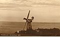
 Church Lane, Friar's Hill - geograph.org.uk - 1854931.jpg 640 × 430 ; 202 kio
-
 Coghurst Wood - geograph.org.uk - 5421799.jpg 640 × 426 ; 123 kio
-
 Coghurst Wood - geograph.org.uk - 5421804.jpg 640 × 426 ; 114 kio
-
 Concrete area, Guestling Wood - geograph.org.uk - 6395627.jpg 1 024 × 768 ; 586 kio
-
 Copshall Oast, Butchers Lane, Guestling Thorne - geograph.org.uk - 5067579.jpg 4 000 × 3 000 ; 3,28 Mio
-
-
 Cows on Brede Levels - geograph.org.uk - 2700554.jpg 640 × 427 ; 93 kio
-
 Cows on Brede Levels - geograph.org.uk - 2700557.jpg 640 × 480 ; 106 kio
-
 Crossing Paths, Guestling Wood - geograph.org.uk - 6227323.jpg 640 × 543 ; 141 kio
-
 Crossroads - geograph.org.uk - 889953.jpg 640 × 424 ; 59 kio
-
 Crossroads, Friar's Hill - geograph.org.uk - 1854939.jpg 640 × 430 ; 160 kio
-
 Cutting Coghurst Wood - geograph.org.uk - 5421837.jpg 640 × 426 ; 123 kio
-
 Cutting north of The Ore Tunnel - geograph.org.uk - 5421795.jpg 640 × 426 ; 135 kio
-
 Cutting north of The Ore Tunnel - geograph.org.uk - 5421796.jpg 640 × 426 ; 124 kio
-
 Cutting, Coghurst Wood - geograph.org.uk - 5421805.jpg 640 × 426 ; 112 kio
-
 Derelict farm buildings - geograph.org.uk - 5211998.jpg 1 581 × 732 ; 455 kio
-
 Derelict woodland by the Ivyhouse Industrial Estate - geograph.org.uk - 5321566.jpg 1 543 × 1 157 ; 834 kio
-
 Digger by Fourteen Acre Lane - geograph.org.uk - 2700561.jpg 640 × 480 ; 60 kio
-

-
 Disused yard and workshop at Doleham - geograph.org.uk - 5305482.jpg 4 199 × 2 634 ; 3,79 Mio
-
 Ditch in the Brede Valley - geograph.org.uk - 2575140.jpg 640 × 430 ; 81 kio
-
 Ditch in the Brede Valley - geograph.org.uk - 2575146.jpg 640 × 430 ; 91 kio
-
 Ditch in the Brede Valley - geograph.org.uk - 2575164.jpg 640 × 430 ; 92 kio
-
 Doleham Ditch valley - geograph.org.uk - 2513168.jpg 640 × 430 ; 70 kio
-
 Doleham Ditch valley - geograph.org.uk - 2513169.jpg 640 × 430 ; 69 kio
-
 Doleham Ditch Valley - geograph.org.uk - 2515181.jpg 640 × 430 ; 52 kio
-
 Doleham Farm - geograph.org.uk - 2699220.jpg 480 × 640 ; 69 kio
-
 Doleham Farm, Dolham Lane, Westfield - geograph.org.uk - 2691342.jpg 640 × 480 ; 113 kio
-
 Doleham Hill - geograph.org.uk - 2515207.jpg 640 × 430 ; 52 kio
-
 Doleham Lane near Three Oaks - geograph.org.uk - 3793480.jpg 1 600 × 1 389 ; 601 kio
-
 Doleham Railway Station - geograph.org.uk - 3793473.jpg 1 600 × 1 058 ; 596 kio
-
 Doleham railway station, Sussex - geograph.org.uk - 5133439.jpg 1 600 × 1 200 ; 632 kio
-
 Doleham station - geograph.org.uk - 3315357.jpg 640 × 480 ; 178 kio
-
 Doleham Valley grazing marshes - geograph.org.uk - 5267235.jpg 1 415 × 426 ; 189 kio
-
 Duck pond - geograph.org.uk - 4109498.jpg 640 × 480 ; 158 kio
-
 Eight Acre Lane - geograph.org.uk - 5067570.jpg 4 000 × 3 000 ; 4,71 Mio
-
 Eight Acre Lane - geograph.org.uk - 5421817.jpg 640 × 426 ; 124 kio
-
 Eight Acre Lane - geograph.org.uk - 889972.jpg 640 × 424 ; 92 kio
-
 Eight Acre Lane, Three Oaks - geograph.org.uk - 3793518.jpg 1 600 × 1 069 ; 373 kio
-
 Eighteen Pounder Farm - geograph.org.uk - 5067587.jpg 4 000 × 3 000 ; 3,8 Mio
-
 Entering Guestling Green, A259 - geograph.org.uk - 5831023.jpg 1 024 × 681 ; 231 kio
-
 Entering Guestling Thorn, A259 - geograph.org.uk - 5830996.jpg 1 024 × 751 ; 157 kio
-
 Entrance to a telephone exchange, Pett Rd - geograph.org.uk - 1854952.jpg 640 × 430 ; 194 kio
-
 Entrance to Coghurst Holiday Village - geograph.org.uk - 889944.jpg 640 × 424 ; 102 kio
-
 Entrance to field and Footpath, Three Oaks - geograph.org.uk - 889996.jpg 640 × 424 ; 112 kio
-
 Entrance to Icklesham, A259 - geograph.org.uk - 2751084.jpg 640 × 480 ; 86 kio
-
 Entrance to Ivyhouse nursery and 1066 Paintball, Hastings - geograph.org.uk - 2831326.jpg 1 600 × 1 522 ; 476 kio
-
 Entrance to Lower Lidham Hill Farm - geograph.org.uk - 1307792.jpg 640 × 424 ; 95 kio
-

-

-
 Entrance to Snaleham Place, Chapel Lane - geograph.org.uk - 1362884.jpg 640 × 424 ; 106 kio
-
 Entrance to Three Oaks - geograph.org.uk - 2751071.jpg 640 × 480 ; 91 kio
-
 Evening farmland, Guestling - geograph.org.uk - 4112480.jpg 640 × 480 ; 99 kio
-
 Farm building, Lower Lidham Hill Farm - geograph.org.uk - 2568688.jpg 640 × 454 ; 99 kio
-
 Field by Doleham Hill and North Lane - geograph.org.uk - 5067584.jpg 4 000 × 3 000 ; 3,72 Mio
-
 Field near Three Oaks - geograph.org.uk - 889982.jpg 640 × 424 ; 75 kio
-
 Field of Broad Beans, Near Old Coghurst Farm - geograph.org.uk - 889954.jpg 640 × 424 ; 78 kio
-
 Field off Fourteen Acre Lane - geograph.org.uk - 890014.jpg 640 × 424 ; 65 kio
-
 Fields near Guestling Thorne - geograph.org.uk - 1307784.jpg 640 × 424 ; 58 kio
-
 Floodplain of the Doleham Ditch - geograph.org.uk - 2515179.jpg 640 × 430 ; 54 kio
-
 Footbridge on Brede Level - geograph.org.uk - 4111238.jpg 640 × 480 ; 122 kio
-
 Footbridge, 1066 Country Walk - geograph.org.uk - 2568697.jpg 640 × 430 ; 133 kio
-
 Footbridge, 1066 Country Walk - geograph.org.uk - 2575139.jpg 640 × 430 ; 113 kio
-
 Footbridge, 1066 Country Walk - geograph.org.uk - 2575144.jpg 640 × 430 ; 87 kio
-
 Footpath Guestling 2 turns a corner - geograph.org.uk - 4109481.jpg 640 × 480 ; 130 kio
-
 Footpath Guestling 4 crosses the railway - geograph.org.uk - 4111096.jpg 640 × 480 ; 193 kio
-
 Footpath Guestling 5a goes under the railway - geograph.org.uk - 4111118.jpg 640 × 480 ; 147 kio
-
 Footpath Guestling 6a - geograph.org.uk - 4112391.jpg 640 × 480 ; 119 kio
-
 Footpath heading NW from Guestling - geograph.org.uk - 155576.jpg 480 × 640 ; 99 kio
-
 Footpath off North Lane - geograph.org.uk - 2568662.jpg 640 × 430 ; 53 kio
-
 Footpath towards Guestling church - geograph.org.uk - 4112458.jpg 640 × 480 ; 79 kio
-
 Fourteen Acre Lane - geograph.org.uk - 2515200.jpg 640 × 430 ; 90 kio
-
 Fourteen Acre Lane - geograph.org.uk - 2515201.jpg 640 × 430 ; 82 kio
-
 Fourteen Acre Lane, near Three Oaks - geograph.org.uk - 5136202.jpg 1 600 × 1 200 ; 597 kio
-
 Fourteen Acre Lane, Three Oaks - geograph.org.uk - 3018585.jpg 4 320 × 3 240 ; 4,78 Mio
-
 Friar's Bank, Friar's Hill - geograph.org.uk - 1854970.jpg 640 × 430 ; 132 kio
-
 Gate, 1066 Country Walk - geograph.org.uk - 2575192.jpg 640 × 430 ; 106 kio
-
 Glebe Wood - geograph.org.uk - 6227307.jpg 640 × 480 ; 158 kio
-
 Grove Shaw - geograph.org.uk - 4112353.jpg 640 × 480 ; 203 kio
-
 Guestling church - geograph.org.uk - 4109585.jpg 640 × 480 ; 84 kio
-
 Guestling Church - geograph.org.uk - 5831013.jpg 1 024 × 681 ; 108 kio
-
 Guestling church from Guestling Wood - geograph.org.uk - 5292601.jpg 2 816 × 2 112 ; 2,82 Mio
-
 Guestling Sign - geograph.org.uk - 2717104.jpg 800 × 600 ; 163 kio
-
 Guestling Thorn - geograph.org.uk - 5831008.jpg 1 024 × 701 ; 201 kio
-
 Guestling wood - geograph.org.uk - 1316945.jpg 640 × 424 ; 143 kio
-
 Guestling Wood - geograph.org.uk - 6227320.jpg 640 × 480 ; 146 kio
-
 Guestling.jpg 1 529 × 947 ; 285 kio
-
 Hastings and St. Leonards sign, A259 Rye Road - geograph.org.uk - 3153854.jpg 480 × 640 ; 190 kio
-
 Hastings and St. Leonards sign, A259 Rye Road - geograph.org.uk - 3154109.jpg 640 × 480 ; 135 kio
-
 Hastings Van Centre, Guestling Green - geograph.org.uk - 4319265.jpg 1 024 × 513 ; 97 kio
-
 Heather beside the A259 at Broomham - geograph.org.uk - 5389647.jpg 2 272 × 1 704 ; 1,03 Mio
-
 Hedgerow blossom - geograph.org.uk - 2568694.jpg 640 × 430 ; 70 kio
-
 Historic house - geograph.org.uk - 4415520.jpg 2 400 × 1 208 ; 1,32 Mio
-
 Hornbeam stub in Guestling Wood - geograph.org.uk - 5292645.jpg 1 375 × 1 157 ; 974 kio
-
 Horse and blossom by the 1066 Country Walk - geograph.org.uk - 2568695.jpg 640 × 430 ; 85 kio
-
 Horses at Lower Lidham Hill Farm - geograph.org.uk - 3448102.jpg 4 320 × 3 240 ; 5,13 Mio
-
 Horses below Lower Lidham Hill Farm - geograph.org.uk - 4111226.jpg 640 × 480 ; 106 kio
-
 Horses by the 1066 Country Walk - geograph.org.uk - 2575134.jpg 640 × 430 ; 94 kio
-
 House in Ivyhouse Lane near Hastings - geograph.org.uk - 2831351.jpg 1 600 × 1 178 ; 407 kio
-
 Houses on Doleham Lane - geograph.org.uk - 2691330.jpg 7 399 × 2 895 ; 7,77 Mio
-
 Houses, Guestling Green - geograph.org.uk - 3354163.jpg 640 × 480 ; 112 kio
-
 In Guestling Wood - geograph.org.uk - 3024803.jpg 640 × 480 ; 218 kio
-
 In Guestling Wood - geograph.org.uk - 3232483.jpg 640 × 480 ; 194 kio
-
 In the Brede Valley - geograph.org.uk - 2575148.jpg 640 × 430 ; 73 kio
-
 In the Brede Valley - geograph.org.uk - 2575154.jpg 640 × 430 ; 80 kio
-
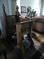
 Inside St Laurence, Guestling (a) - geograph.org.uk - 6208754.jpg 640 × 480 ; 36 kio
-
 Inside St Laurence, Guestling (b) - geograph.org.uk - 6208756.jpg 640 × 480 ; 76 kio
-
 Inside St Laurence, Guestling (c) - geograph.org.uk - 6208757.jpg 480 × 640 ; 42 kio
-
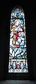
 Inside St Laurence, Guestling (d) - geograph.org.uk - 6208758.jpg 640 × 480 ; 65 kio
-
 Inside St Laurence, Guestling (e) - geograph.org.uk - 6208759.jpg 519 × 640 ; 53 kio
-
 Inside St Laurence, Guestling (f) - geograph.org.uk - 6208770.jpg 274 × 640 ; 41 kio
-
 Ivyhouse Lane near Hastings (2) - geograph.org.uk - 2831385.jpg 1 600 × 1 137 ; 713 kio
-
 Ivyhouse Lane near Hastings - geograph.org.uk - 2831365.jpg 1 600 × 1 188 ; 626 kio
-
 Ivyhouse Lane near Three Oaks - geograph.org.uk - 2983020.jpg 1 600 × 1 200 ; 386 kio
-
 Ivyhouse Lane, Hastings, East Sussex - geograph.org.uk - 949390.jpg 640 × 480 ; 111 kio
-

-
 Junction of Fourteen Acre Lane and Butcher's Lane - geograph.org.uk - 3018581.jpg 4 320 × 3 240 ; 4,75 Mio
-

-

-
 Junction of Rosemary Lane and Pett Rd - geograph.org.uk - 1853729.jpg 640 × 430 ; 175 kio
-
 Kitchen Wood - geograph.org.uk - 5831005.jpg 1 024 × 681 ; 132 kio
-
 Lake at Coghurst Hall Holiday Park - geograph.org.uk - 2830384.jpg 640 × 480 ; 93 kio
-
 Land off Watermill Lane - geograph.org.uk - 1316953.jpg 640 × 424 ; 69 kio
-
 Lavender Cottage, Pett Rd, Friar's Hill - geograph.org.uk - 1854969.jpg 640 × 430 ; 145 kio
-

-
 Lidham Cottage - geograph.org.uk - 2568691.jpg 640 × 430 ; 85 kio
-
 Lidham Hill Farm - geograph.org.uk - 2515210.jpg 640 × 430 ; 94 kio
-
 Lidham Hill Farm - geograph.org.uk - 2568649.jpg 640 × 430 ; 57 kio
-
 Lidham Hill Farm - geograph.org.uk - 2568657.jpg 640 × 430 ; 58 kio
-
 Lidham Hill Farm - geograph.org.uk - 5067582.jpg 7 064 × 2 941 ; 4,1 Mio
-
 Looking across the Doleham Valley - geograph.org.uk - 2515195.jpg 640 × 430 ; 75 kio
-
 Looking south down Rosemary Lane - geograph.org.uk - 1853731.jpg 640 × 430 ; 180 kio
-
 Lower Lidham Hall Farm - geograph.org.uk - 5067590.jpg 5 307 × 2 917 ; 3,58 Mio
-
 Lower Lidham Hill Farmhouse - geograph.org.uk - 2568687.jpg 640 × 430 ; 126 kio
-
 Lower Snailham - geograph.org.uk - 1163476.jpg 640 × 480 ; 106 kio
-
 Lower Snailham - geograph.org.uk - 2575175.jpg 640 × 430 ; 75 kio
-
 Lower Snailham - geograph.org.uk - 2575176.jpg 640 × 430 ; 116 kio
-
 Lower Snailham - geograph.org.uk - 2575178.jpg 640 × 430 ; 127 kio


_-_geograph.org.uk_-_6208754.jpg)
_-_geograph.org.uk_-_6208756.jpg)
_-_geograph.org.uk_-_6208757.jpg)
_-_geograph.org.uk_-_6208758.jpg)
_-_geograph.org.uk_-_6208759.jpg)
_-_geograph.org.uk_-_6208770.jpg)
_-_geograph.org.uk_-_2831385.jpg)


