Category:Gulf of Saros
Vai alla navigazione
Vai alla ricerca
bay in Turkey  | |||||
| Carica un file multimediale | |||||
| Istanza di | |||||
|---|---|---|---|---|---|
| Parte di | |||||
| Luogo | provincia di Çanakkale, Turchia | ||||
| Designazione del patrimonio | |||||
 | |||||
Sottocategorie
Questa categoria contiene le 3 sottocategorie indicate di seguito, su un totale di 3.
G
M
File nella categoria "Gulf of Saros"
Questa categoria contiene 11 file, indicati di seguito, su un totale di 11.
-
 1942 German military map - Türkei - Sheet Çanakkale.jpg 18 644 × 14 121; 45,34 MB
-
 Admiralty Chart No 1004 Western part of Sea of Marmara, Published 1887.jpg 16 272 × 11 114; 79,48 MB
-
 Admiralty Chart No 1880 Plans on the West Coast of Turkey, Published 1957.jpg 8 235 × 11 230; 18,35 MB
-
 British War Ships off Boulair - ILN-1878-0504-0004.jpg 2 340 × 1 620; 1,56 MB
-
 Dardanelles and Gulf of Saros by Piri Reis.jpg 600 × 826; 176 KB
-
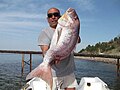 Dentex dentex Turkey.jpg 640 × 480; 44 KB
-
 Edirne Keşan Saros Körfezi.jpg 4 160 × 3 120; 2,19 MB
-
 Kalamar.jpg 1 200 × 1 600; 343 KB
-
 KÖMÜR KOYU SAROZ - panoramio.jpg 4 000 × 3 000; 4,83 MB
-
 Sarozun suyu - panoramio.jpg 1 200 × 1 600; 279 KB
-
 USS Lake Champlain CVS-39 with VMA-324 1957.jpg 3 050 × 2 396; 1,57 MB


