Category:Gunnersbury
Aller à la navigation
Aller à la recherche
établissement humain au Royaume-Uni .jpg) | |||||
| Téléverser des médias | |||||
| Nature de l’élément | |||||
|---|---|---|---|---|---|
| Lieu | Borough londonien de Hounslow, Grand Londres, Londres, Angleterre | ||||
 | |||||
English: Gunnersbury is a place in the London Borough of Hounslow, with its northern edge in the London Borough of Ealing, west London. It has an area of less than half a square kilometre and is within the west area of the Chiswick W4 postal district of London.
Sous-catégories
Cette catégorie comprend 7 sous-catégories, dont les 7 ci-dessous.
B
G
- Pubs in Gunnersbury (6 F)
Média dans la catégorie « Gunnersbury »
Cette catégorie comprend 55 fichiers, dont les 55 ci-dessous.
-
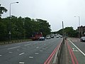
 A4 becomes the M4 - geograph.org.uk - 3522743.jpg 640 × 430 ; 48 kio
-
 Brooks Road - geograph.org.uk - 1846681.jpg 1 600 × 1 109 ; 531 kio
-
 Chiswick Park from the air - geograph.org.uk - 5074284.jpg 640 × 480 ; 208 kio
-
 Chiswick Park from the air - geograph.org.uk - 5074287.jpg 640 × 480 ; 217 kio
-
 Clarence Road, Chiswick - geograph.org.uk - 6326262.jpg 3 264 × 2 448 ; 2,94 Mio
-

-
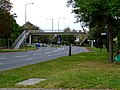 Footbridge over Gunnersbury Avenue - geograph.org.uk - 2645032.jpg 640 × 480 ; 158 kio
-
 Footbridge over Gunnersbury Avenue - geograph.org.uk - 2645085.jpg 640 × 480 ; 153 kio
-

-
 George V postbox, Wellesley Road, Chiswick, London - geograph.org.uk - 4211706.jpg 683 × 1 024 ; 229 kio
-
 Grange Road - geograph.org.uk - 2644876.jpg 640 × 480 ; 164 kio
-
 Grange Road - geograph.org.uk - 2644912.jpg 640 × 413 ; 166 kio
-
 Gunnersbury - Princes Avenue - geograph.org.uk - 5185506.jpg 4 608 × 3 456 ; 6,54 Mio
-
 Gunnersbury Avenue - geograph.org.uk - 2645087.jpg 640 × 480 ; 183 kio
-
 Gunnersbury Avenue, W3 - geograph.org.uk - 2445495.jpg 640 × 480 ; 120 kio
-
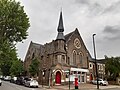 Gunnersbury Baptist Church.jpg 4 608 × 3 456 ; 3,77 Mio
-
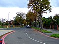
 Gunnersbury Drive - geograph.org.uk - 2625656.jpg 640 × 345 ; 79 kio
-
 Gunnersbury Drive - geograph.org.uk - 2629088.jpg 640 × 480 ; 159 kio
-
 Houses on North Circular Road - geograph.org.uk - 2626075.jpg 640 × 480 ; 173 kio
-
 Houses on North Circular Road - geograph.org.uk - 2626077.jpg 640 × 480 ; 169 kio
-
 Houses on Thorney Hedge Road, Gunnersbury - geograph.org.uk - 4775248.jpg 2 258 × 1 664 ; 1,39 Mio
-
 International School of London - geograph.org.uk - 2645026.jpg 640 × 480 ; 153 kio
-
 Kew and Gunnersbury from the air - geograph.org.uk - 2246855.jpg 640 × 350 ; 144 kio
-
 Manor Gardens, Gunnersbury - geograph.org.uk - 4173939.jpg 2 304 × 1 728 ; 875 kio
-
 Mansion building, Chiswick Village - geograph.org.uk - 3461500.jpg 640 × 430 ; 79 kio
-
 Mansion building, Regent St - geograph.org.uk - 3461497.jpg 640 × 430 ; 79 kio
-
 North Circular Road - geograph.org.uk - 2625624.jpg 640 × 423 ; 125 kio
-
 Office block on the corner of Thorney Hedge Road - geograph.org.uk - 4776192.jpg 2 304 × 1 728 ; 805 kio
-
 Offices on Thorney Hedge Road, Gunnersbury - geograph.org.uk - 4775249.jpg 2 304 × 1 728 ; 787 kio
-
 Offices on Thorney Hedge Road, Gunnersbury - geograph.org.uk - 4775250.jpg 2 228 × 1 620 ; 1,23 Mio
-
 Offices on Thorney Hedge Road, Gunnersbury - geograph.org.uk - 4776196.jpg 2 206 × 1 588 ; 1,28 Mio
-
 Park Avenue - geograph.org.uk - 2645078.jpg 640 × 480 ; 173 kio
-
 Park Place, Gunnersbury - geograph.org.uk - 5426068.jpg 2 304 × 1 728 ; 837 kio
-
 Pedestrian footbridge, Gunnersbury Avenue, W3 - geograph.org.uk - 2450226.jpg 3 504 × 2 336 ; 1,99 Mio
-
 Pope's Lane - geograph.org.uk - 4049196.jpg 640 × 430 ; 56 kio
-
 Popes Lane - geograph.org.uk - 2625642.jpg 640 × 480 ; 169 kio
-
 Popes Lane - geograph.org.uk - 2625645.jpg 640 × 480 ; 132 kio
-
 Popes Lane - geograph.org.uk - 2629032.jpg 640 × 358 ; 94 kio
-
 Power Road - geograph.org.uk - 2644964.jpg 640 × 372 ; 118 kio
-
 Power Road, Gunnersbury - geograph.org.uk - 5408933.jpg 3 210 × 2 374 ; 2,01 Mio
-
 Princes Avenue - geograph.org.uk - 4054337.jpg 640 × 430 ; 98 kio
-
 Princes Avenue - geograph.org.uk - 6565180.jpg 1 024 × 684 ; 201 kio
-
 Princes Avenue, W3 - geograph.org.uk - 1613982.jpg 640 × 480 ; 63 kio
-
 St Dunstan's Church - geograph.org.uk - 2645020.jpg 640 × 480 ; 178 kio
-
 Stile Hall Gardens, W4, west end - geograph.org.uk - 3914208.jpg 768 × 1 024 ; 163 kio
-
 Stonehill Road - geograph.org.uk - 1846646.jpg 1 600 × 1 067 ; 661 kio
-
 The Ridgeway, Gunnersbury - geograph.org.uk - 5408928.jpg 3 264 × 2 448 ; 3,25 Mio
-
 Wellesley Rd, Chiswick - geograph.org.uk - 4643537.jpg 3 264 × 2 448 ; 1,84 Mio
-
 Wellesley Road - geograph.org.uk - 1846623.jpg 1 600 × 1 009 ; 555 kio
-
 Wellesley Road - geograph.org.uk - 2644815.jpg 640 × 409 ; 110 kio
-
 Wellesley Road - geograph.org.uk - 2644851.jpg 640 × 410 ; 128 kio
-
 Wellesley Road - geograph.org.uk - 2644860.jpg 640 × 480 ; 167 kio
-
 Wellesley Road, Chiswick, London - geograph.org.uk - 4206871.jpg 1 024 × 669 ; 200 kio
-
 Wellesley Road, Chiswick, London - geograph.org.uk - 4210242.jpg 1 024 × 683 ; 222 kio
-
 Wellesley Road, W4 - geograph.org.uk - 2134503.jpg 1 249 × 804 ; 268 kio


,_Wellesley_Road,_Chiswick,_London_-_geograph.org.uk_-_4211711.jpg)


